STS073-725-49
| NASA Photo ID | STS073-725-49 |
| Focal Length | 250mm |
| Date taken | 1995.10.24 |
| Time taken | 16:55:56 GMT |

Cloud masks available for this image:
Spacecraft nadir point: 39.1° N, 104.4° W
Photo center point: 40.0° N, 105.0° W
Photo center point by machine learning:
Photo center point: 40.0° N, 105.0° W
Photo center point by machine learning:
Nadir to Photo Center: Northwest
Spacecraft Altitude: 145 nautical miles (269km)
Country or Geographic Name: | USA-COLORADO |
Features: | DENVER, AIRPORTS, AGRICULTURE |
| Features Found Using Machine Learning: | |
Cloud Cover Percentage: | 0 (no clouds present) |
Sun Elevation Angle: | 34° |
Sun Azimuth: | 148° |
Camera: | Hasselblad |
Focal Length: | 250mm |
Camera Tilt: | 24 degrees |
Format: | 5046: Kodak, natural color positive, Lumiere 100/5046, ASA 100, standard base |
Film Exposure: | Normal |
| Additional Information | |
| Width | Height | Annotated | Cropped | Purpose | Links |
|---|---|---|---|---|---|
| 5700 pixels | 5900 pixels | No | No | Download Image | |
| 500 pixels | 518 pixels | No | No | Download Image | |
| 640 pixels | 480 pixels | No | No | Download Image |
Download Packaged File
Download a Google Earth KML for this Image
View photo footprint information
Download a GeoTIFF for this photo
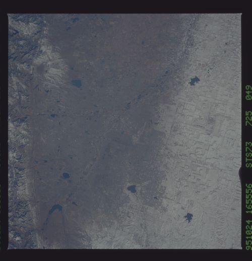
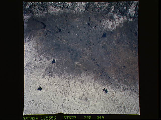
Image Caption: Denver and Colorado Springs, Colorado. A snow band can
clearly been seen running through the city of Denver, Colorado. Note
that the old Stapleton Airport is relatively clear of snow while the
new Denver International Airport (DIA) is not. It would be interesting
to monitor this site to see if DIA, because of it's location on the
high plains, will be closed more often due to bad weather than
Stapleton Airport would have been.
