STS073-722-51
| NASA Photo ID | STS073-722-51 |
| Focal Length | 250mm |
| Date taken | 1995.10.21 |
| Time taken | 09:36:03 GMT |
Resolutions offered for this image:
5275 x 5222 pixels 639 x 633 pixels 5700 x 5900 pixels 500 x 518 pixels 640 x 480 pixels 2606 x 2576 pixels
5275 x 5222 pixels 639 x 633 pixels 5700 x 5900 pixels 500 x 518 pixels 640 x 480 pixels 2606 x 2576 pixels


Cloud masks available for this image:
Spacecraft nadir point: 39.2° N, 27.8° E
Photo center point: 39.0° N, 26.0° E
Photo center point by machine learning:
Photo center point: 39.0° N, 26.0° E
Photo center point by machine learning:
Nadir to Photo Center: West
Spacecraft Altitude: 146 nautical miles (270km)
Camera: | Hasselblad |
Focal Length: | 250mm |
Camera Tilt: | 37 degrees |
Format: | 5046: Kodak, natural color positive, Lumiere 100/5046, ASA 100, standard base |
Film Exposure: | Normal |
| Additional Information | |
| Width | Height | Annotated | Cropped | Purpose | Links |
|---|---|---|---|---|---|
| 5275 pixels | 5222 pixels | No | No | Earth From Space collection | Download Image |
| 639 pixels | 633 pixels | No | No | Earth From Space collection | Download Image |
| 5700 pixels | 5900 pixels | No | No | Download Image | |
| 500 pixels | 518 pixels | No | No | Download Image | |
| 640 pixels | 480 pixels | No | No | Download Image | |
| 2606 pixels | 2576 pixels | No | No | Download Image |
Download Packaged File
Download a Google Earth KML for this Image
View photo footprint information
Download a GeoTIFF for this photo
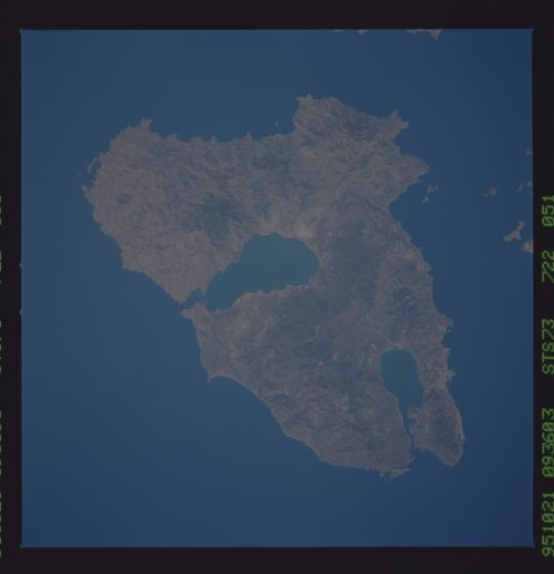
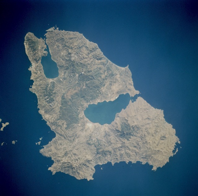
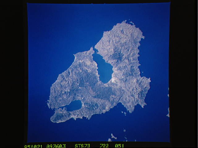
Image Caption: STS073-722-051 Lesbos Island, Greece September 1995
This low-oblique, north-looking photograph captures Lesbos (Lésvos), the largest of the Greek islands in the Aegean Sea. Lesbos, with a rather hilly terrain, extremely fertile soils, and a mild climate, covers 630 square miles (1630 square kilometers) off the northwest coast of Turkey. Vast olive groves, numerous vineyards, citrus trees, and wheat crops are scattered throughout the island. Other industries include fishing (sardines), oil refining, soap production, livestock raising, and marble quarrying. Mitilíni, the chief city, is located on the island's southeast coast (barely discernible in the photograph). Visible near the center of the photograph is the Gulf of Kallonís. Lesbos was the center of the Bronze Age and the cultural center of Greek civilization in the seventh century B.C.
This low-oblique, north-looking photograph captures Lesbos (Lésvos), the largest of the Greek islands in the Aegean Sea. Lesbos, with a rather hilly terrain, extremely fertile soils, and a mild climate, covers 630 square miles (1630 square kilometers) off the northwest coast of Turkey. Vast olive groves, numerous vineyards, citrus trees, and wheat crops are scattered throughout the island. Other industries include fishing (sardines), oil refining, soap production, livestock raising, and marble quarrying. Mitilíni, the chief city, is located on the island's southeast coast (barely discernible in the photograph). Visible near the center of the photograph is the Gulf of Kallonís. Lesbos was the center of the Bronze Age and the cultural center of Greek civilization in the seventh century B.C.
