STS073-716-83
| NASA Photo ID | STS073-716-83 |
| Focal Length | 250mm |
| Date taken | 1995.10.27 |
| Time taken | 15:15:17 GMT |
Resolutions offered for this image:
3904 x 3904 pixels 639 x 639 pixels 5700 x 5900 pixels 500 x 518 pixels 640 x 480 pixels 3399 x 3317 pixels
3904 x 3904 pixels 639 x 639 pixels 5700 x 5900 pixels 500 x 518 pixels 640 x 480 pixels 3399 x 3317 pixels


Cloud masks available for this image:
Spacecraft nadir point: 38.7° N, 96.1° W
Photo center point: 39.0° N, 96.5° W
Photo center point by machine learning:
Photo center point: 39.0° N, 96.5° W
Photo center point by machine learning:
Nadir to Photo Center: Northwest
Spacecraft Altitude: 143 nautical miles (265km)
Country or Geographic Name: | USA-KANSAS |
Features: | RIVERS, AGRICULTURE, RESERVOIRS |
| Features Found Using Machine Learning: | |
Cloud Cover Percentage: | 0 (no clouds present) |
Sun Elevation Angle: | 25° |
Sun Azimuth: | 133° |
Camera: | Hasselblad |
Focal Length: | 250mm |
Camera Tilt: | 12 degrees |
Format: | 5046: Kodak, natural color positive, Lumiere 100/5046, ASA 100, standard base |
Film Exposure: | Normal |
| Additional Information | |
| Width | Height | Annotated | Cropped | Purpose | Links |
|---|---|---|---|---|---|
| 3904 pixels | 3904 pixels | No | No | Earth From Space collection | Download Image |
| 639 pixels | 639 pixels | No | No | Earth From Space collection | Download Image |
| 5700 pixels | 5900 pixels | No | No | Download Image | |
| 500 pixels | 518 pixels | No | No | Download Image | |
| 640 pixels | 480 pixels | No | No | Download Image | |
| 3399 pixels | 3317 pixels | Download Image |
Download Packaged File
Download a Google Earth KML for this Image
View photo footprint information
Download a GeoTIFF for this photo
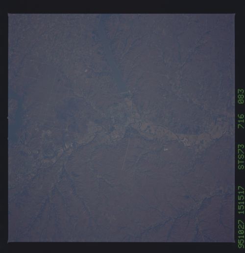
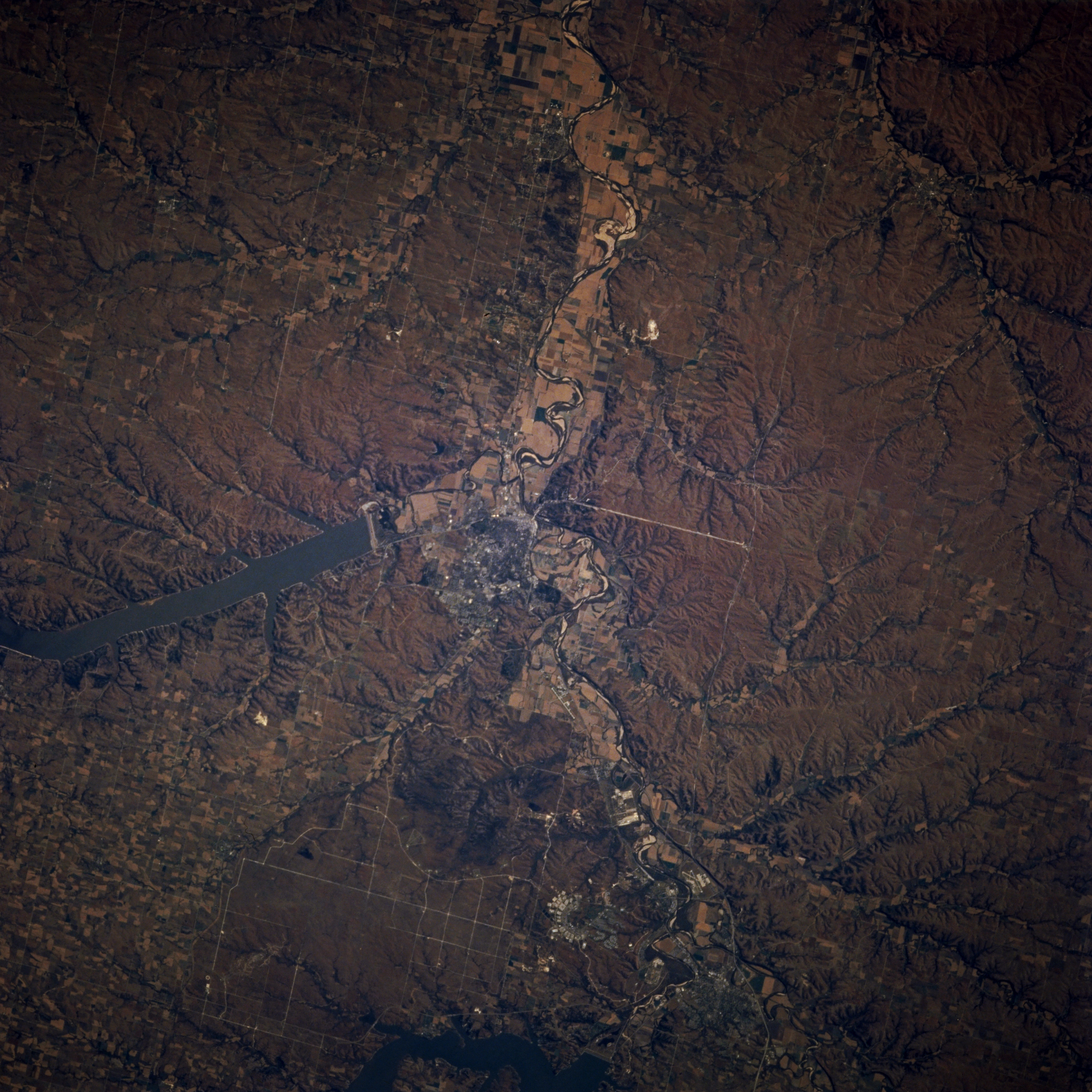
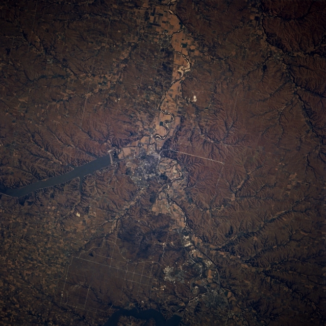
Image Caption: STS073-716-083 Kansas River Valley and Manhattan, Kansas, U.S.A. October 1995
The Kansas River Valley and Manhattan are apparent in this east-looking, low-oblique photograph. Manhattan (center of photograph) sits at the confluence of the south-flowing Big Blue River and the east-flowing Kansas River. A trade and processing center for this rich farm area, its industries also include dress pattern production, food processing, and truck farming. Much of the economy is dependent on Kansas State University and nearby Fort Riley Army Base. Visible are Tuttle Creek Reservoir north of Manhattan and the northern extension of the grass-covered, rolling terrain of the Flint Hills to the south.
The Kansas River Valley and Manhattan are apparent in this east-looking, low-oblique photograph. Manhattan (center of photograph) sits at the confluence of the south-flowing Big Blue River and the east-flowing Kansas River. A trade and processing center for this rich farm area, its industries also include dress pattern production, food processing, and truck farming. Much of the economy is dependent on Kansas State University and nearby Fort Riley Army Base. Visible are Tuttle Creek Reservoir north of Manhattan and the northern extension of the grass-covered, rolling terrain of the Flint Hills to the south.
