STS073-708-84
| NASA Photo ID | STS073-708-84 |
| Focal Length | 250mm |
| Date taken | 1995.10.26 |
| Time taken | 09:27:22 GMT |
Cloud masks available for this image:
Spacecraft nadir point: 31.0° N, 32.9° E
Photo center point: 31.0° N, 32.5° E
Photo center point by machine learning:
Photo center point: 31.0° N, 32.5° E
Photo center point by machine learning:
Nadir to Photo Center: West
Spacecraft Altitude: 145 nautical miles (269km)
Country or Geographic Name: | EGYPT |
Features: | SUEZ CANAL, PORT SAID |
| Features Found Using Machine Learning: | |
Cloud Cover Percentage: | 20 (11-25)% |
Sun Elevation Angle: | 47° |
Sun Azimuth: | 178° |
Camera: | Hasselblad |
Focal Length: | 250mm |
Camera Tilt: | 9 degrees |
Format: | 5046: Kodak, natural color positive, Lumiere 100/5046, ASA 100, standard base |
Film Exposure: | Normal |
| Additional Information | |
| Width | Height | Annotated | Cropped | Purpose | Links |
|---|---|---|---|---|---|
| 5700 pixels | 5900 pixels | No | No | Download Image | |
| 500 pixels | 518 pixels | No | No | Download Image | |
| 640 pixels | 480 pixels | No | No | Download Image |
Download Packaged File
Download a Google Earth KML for this Image
View photo footprint information
Download a GeoTIFF for this photo
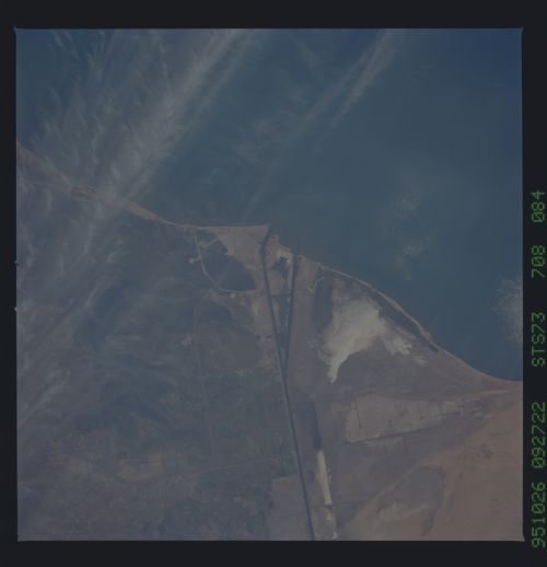
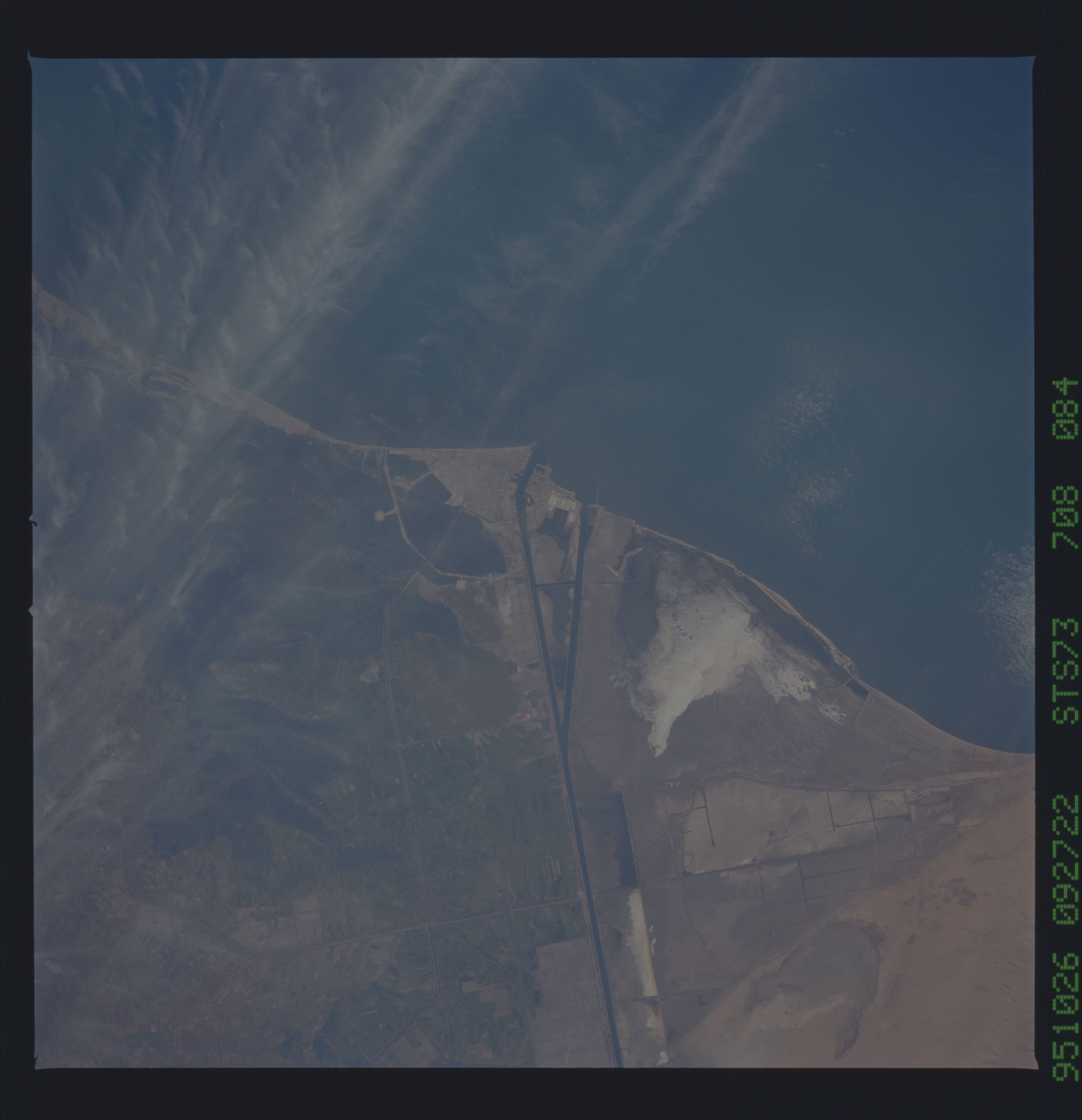
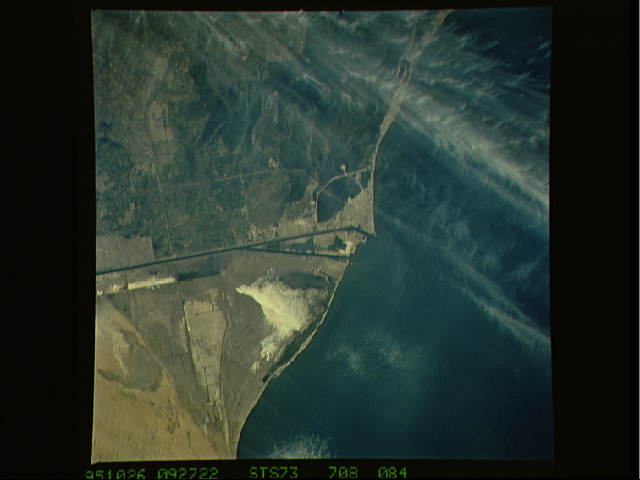
Image Caption: The City of Port Said and the Northern end of The Suez
Canal are shown in this 250mm view. The Suez Canal was built by the
French engineer Ferdinand de Lesseps from 1859 through 1869. It is 100
miles long and is the main route from the Middle East to Europe. It
was closed from the Six days War in 1867 and was reopened in 1975. It
was deepened and widened in 1980.
