STS073-708-23
| NASA Photo ID | STS073-708-23 |
| Focal Length | 250mm |
| Date taken | 1995.10.25 |
| Time taken | 18:31:03 GMT |
Resolutions offered for this image:
3904 x 3904 pixels 639 x 639 pixels 5700 x 5900 pixels 500 x 518 pixels 640 x 480 pixels
3904 x 3904 pixels 639 x 639 pixels 5700 x 5900 pixels 500 x 518 pixels 640 x 480 pixels


Cloud masks available for this image:
Spacecraft nadir point: 28.9° N, 93.4° W
Photo center point: 30.0° N, 94.0° W
Photo center point by machine learning:
Photo center point: 30.0° N, 94.0° W
Photo center point by machine learning:
Nadir to Photo Center: Northwest
Spacecraft Altitude: 145 nautical miles (269km)
Country or Geographic Name: | USA-TEXAS |
Features: | SABINE LAKE, SMOKE, CITY |
| Features Found Using Machine Learning: | |
Cloud Cover Percentage: | 10 (1-10)% |
Sun Elevation Angle: | 48° |
Sun Azimuth: | 192° |
Camera: | Hasselblad |
Focal Length: | 250mm |
Camera Tilt: | 27 degrees |
Format: | 5046: Kodak, natural color positive, Lumiere 100/5046, ASA 100, standard base |
Film Exposure: | Normal |
| Additional Information | |
| Width | Height | Annotated | Cropped | Purpose | Links |
|---|---|---|---|---|---|
| 3904 pixels | 3904 pixels | No | No | Earth From Space collection | Download Image |
| 639 pixels | 639 pixels | No | No | Earth From Space collection | Download Image |
| 5700 pixels | 5900 pixels | No | No | Download Image | |
| 500 pixels | 518 pixels | No | No | Download Image | |
| 640 pixels | 480 pixels | No | No | Download Image |
Download Packaged File
Download a Google Earth KML for this Image
View photo footprint information
Download a GeoTIFF for this photo
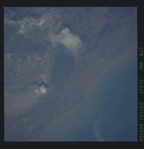
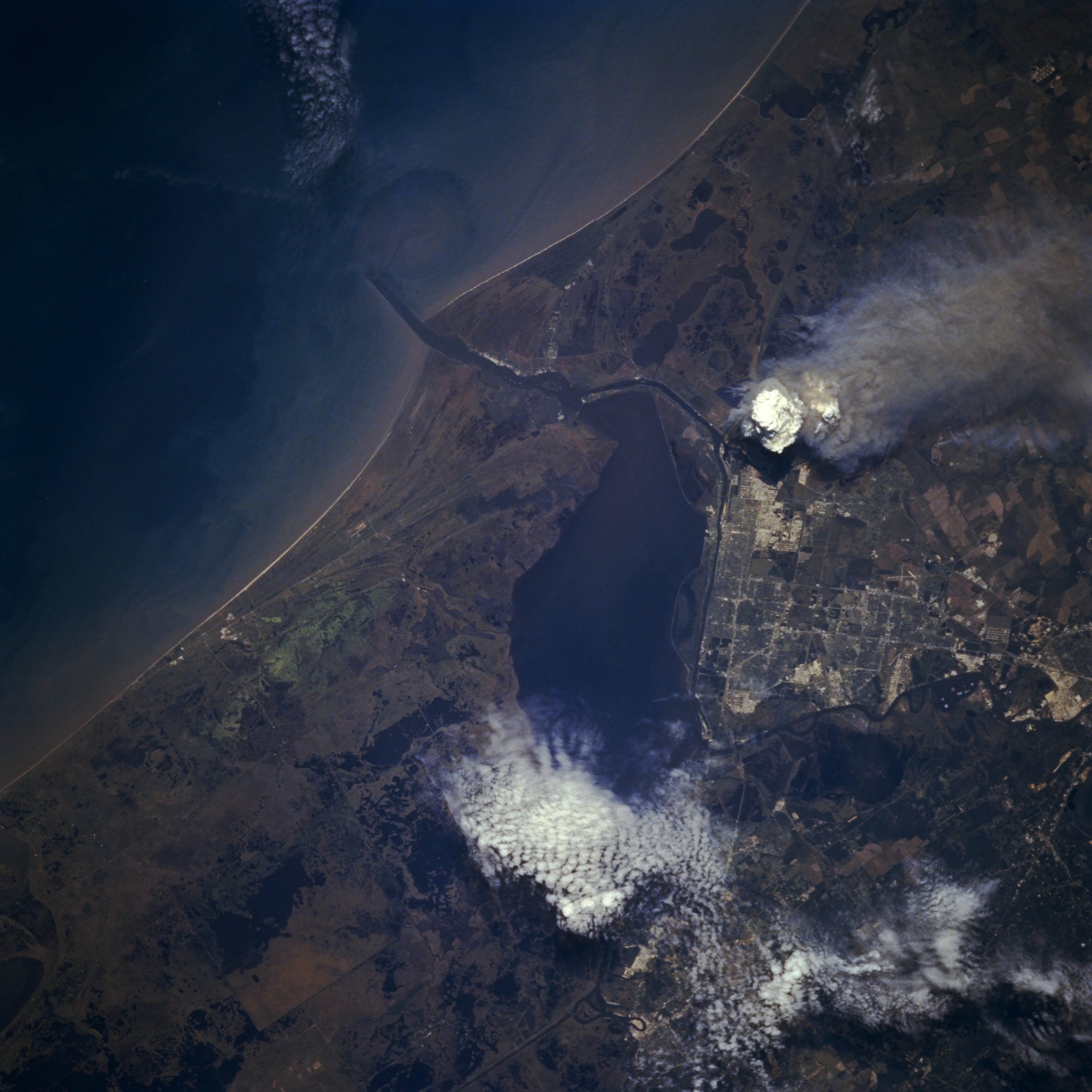
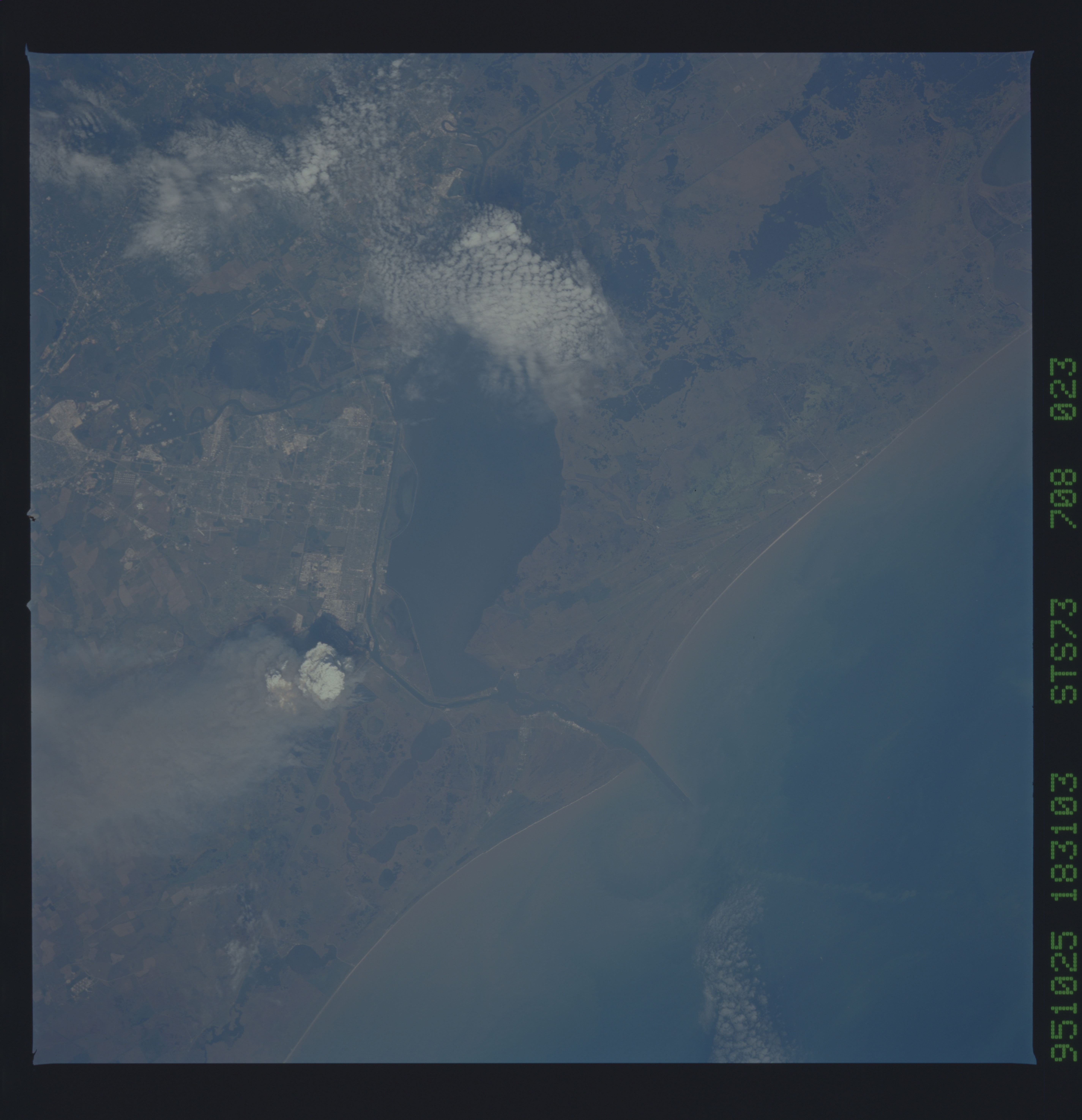
Image Caption: STS073-708-23 Port Arthur, Texas, U.S.A. October 1995
The grid street pattern designates the industrial city of Port Arthur along the northwest shore of Sabine Lake. Port Arthur's major industry is associated with refining petroleum products. The large white cloud and darker smoke in the general vicinity of the oil refineries suggest that a fire is in progress. Breakwaters reaching into the Gulf of Mexico help to modify the rate of coastal erosion around Sabine Pass and to reduce the amount of sediment in the ship channel that provides access to Sabine Lake. The east-to-west longshore current contains some sediment. The mottled landscape along the coast is very flat with extensive areas of swamps, lakes, and wetlands.
The grid street pattern designates the industrial city of Port Arthur along the northwest shore of Sabine Lake. Port Arthur's major industry is associated with refining petroleum products. The large white cloud and darker smoke in the general vicinity of the oil refineries suggest that a fire is in progress. Breakwaters reaching into the Gulf of Mexico help to modify the rate of coastal erosion around Sabine Pass and to reduce the amount of sediment in the ship channel that provides access to Sabine Lake. The east-to-west longshore current contains some sediment. The mottled landscape along the coast is very flat with extensive areas of swamps, lakes, and wetlands.
