STS073-706-6
| NASA Photo ID | STS073-706-6 |
| Focal Length | 250mm |
| Date taken | 1995.10.22 |
| Time taken | 18:40:06 GMT |
Resolutions offered for this image:
780 x 784 pixels 3872 x 3904 pixels 634 x 639 pixels 5700 x 5900 pixels 500 x 518 pixels 640 x 480 pixels
780 x 784 pixels 3872 x 3904 pixels 634 x 639 pixels 5700 x 5900 pixels 500 x 518 pixels 640 x 480 pixels


Cloud masks available for this image:
Spacecraft nadir point: 31.8° N, 79.6° W
Photo center point: 32.0° N, 81.0° W
Photo center point by machine learning:
Photo center point: 32.0° N, 81.0° W
Photo center point by machine learning:
Nadir to Photo Center: West
Spacecraft Altitude: 146 nautical miles (270km)
Camera: | Hasselblad |
Focal Length: | 250mm |
Camera Tilt: | 30 degrees |
Format: | 5046: Kodak, natural color positive, Lumiere 100/5046, ASA 100, standard base |
Film Exposure: | Normal |
| Additional Information | |
| Width | Height | Annotated | Cropped | Purpose | Links |
|---|---|---|---|---|---|
| 780 pixels | 784 pixels | No | No | Cities collection | Download Image |
| 3872 pixels | 3904 pixels | No | No | Earth From Space collection | Download Image |
| 634 pixels | 639 pixels | No | No | Earth From Space collection | Download Image |
| 5700 pixels | 5900 pixels | No | No | Download Image | |
| 500 pixels | 518 pixels | No | No | Download Image | |
| 640 pixels | 480 pixels | No | No | Download Image |
Download Packaged File
Download a Google Earth KML for this Image
View photo footprint information
Download a GeoTIFF for this photo
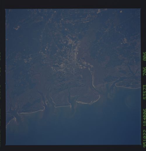
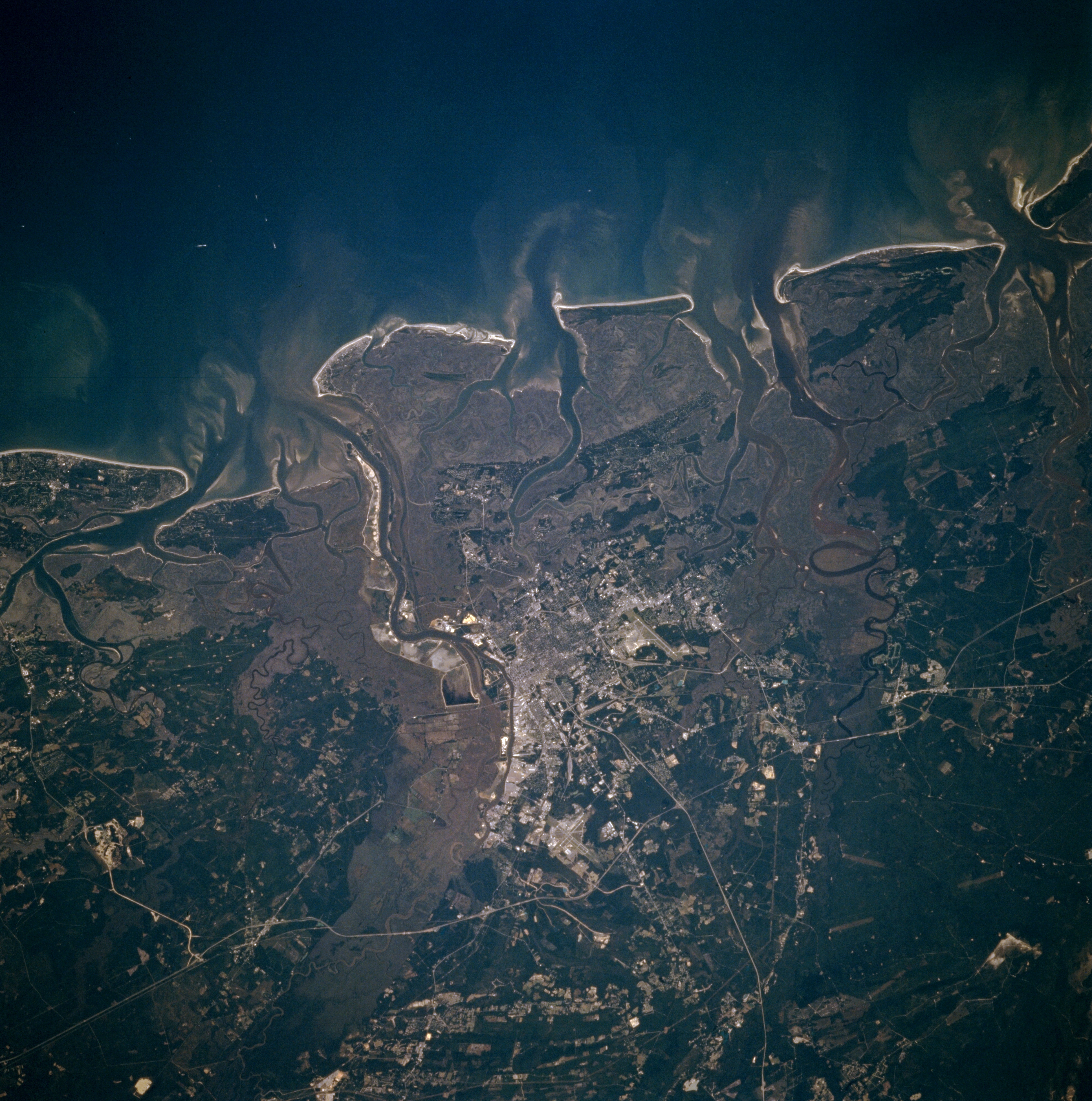
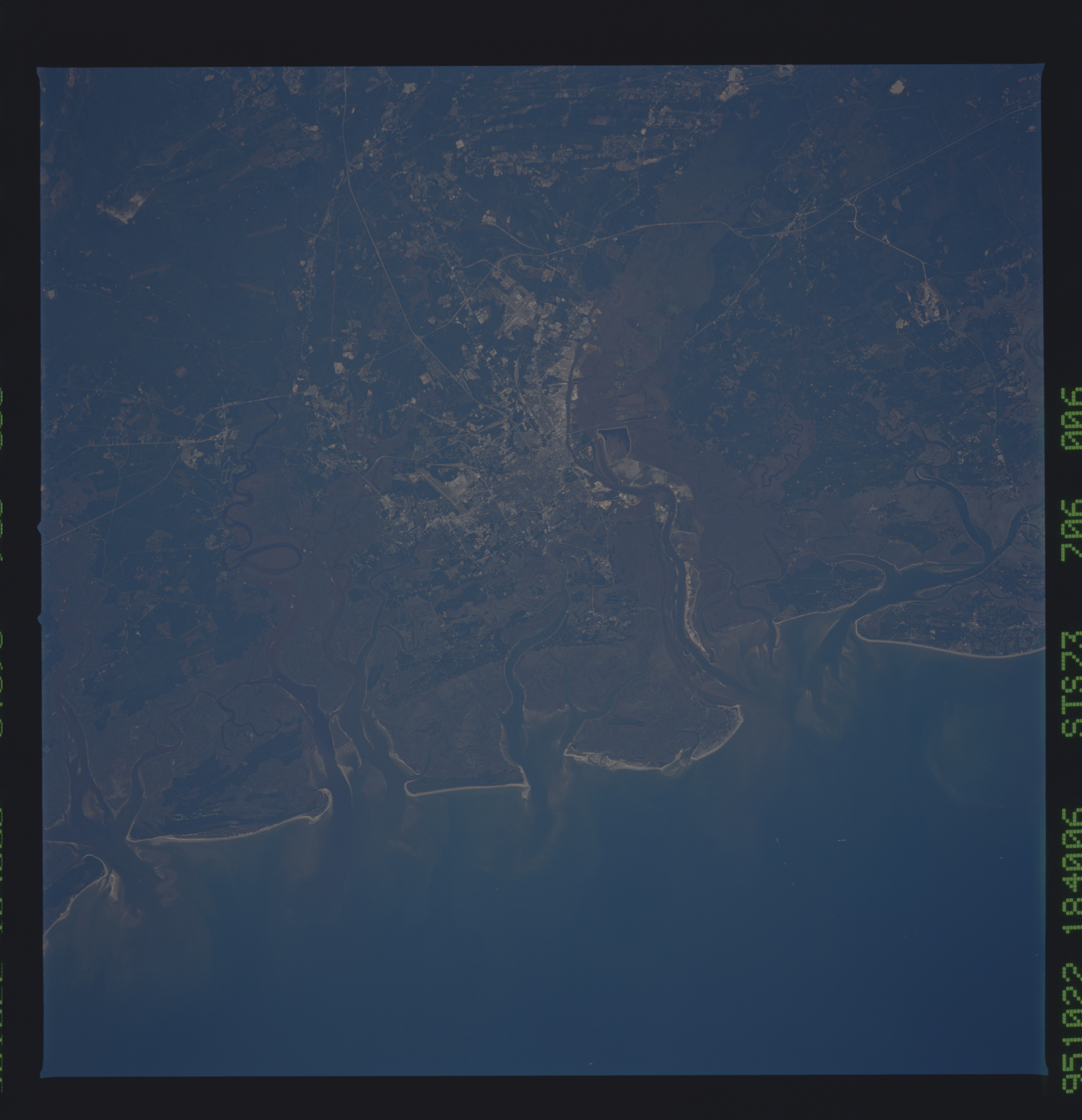
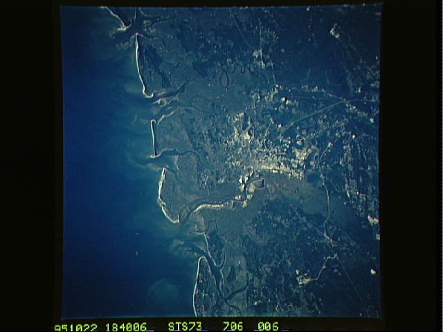
Image Caption: STS073-706-006 Savannah, Georgia, U.S.A. October 1995
Some of the street grid patterns of Savannah are visible in this northwest-looking photograph of the east Georgia coast. Discernible are the linear runway of Hunter Army Air Field to the south and the intersecting runways of Savannah International Airport to the northwest. Light, linear north-south-oriented Interstate Highway 95 passes west of Savannah, and Interstate Highway 16 is an eastern extension of a roadway that connects Atlanta and Savannah. Apparent are darker, more elevated, wooded terrain and a gray landscape along the coast and river channel depicting low lying, swampy, vegetated areas. Sediment plumes appear at the mouths of rivers and their estuaries. Highly reflective sandy beaches jut into the Atlantic Ocean. The Savannah River and its fairly broad floodplain form the boundary between this part of east Georgia and southern South Carolina.
Some of the street grid patterns of Savannah are visible in this northwest-looking photograph of the east Georgia coast. Discernible are the linear runway of Hunter Army Air Field to the south and the intersecting runways of Savannah International Airport to the northwest. Light, linear north-south-oriented Interstate Highway 95 passes west of Savannah, and Interstate Highway 16 is an eastern extension of a roadway that connects Atlanta and Savannah. Apparent are darker, more elevated, wooded terrain and a gray landscape along the coast and river channel depicting low lying, swampy, vegetated areas. Sediment plumes appear at the mouths of rivers and their estuaries. Highly reflective sandy beaches jut into the Atlantic Ocean. The Savannah River and its fairly broad floodplain form the boundary between this part of east Georgia and southern South Carolina.
