STS073-706-20
| NASA Photo ID | STS073-706-20 |
| Focal Length | 250mm |
| Date taken | 1995.10.22 |
| Time taken | 20:07:04 GMT |
Resolutions offered for this image:
727 x 720 pixels 3949 x 3949 pixels 639 x 639 pixels 5700 x 5900 pixels 500 x 518 pixels 640 x 480 pixels
727 x 720 pixels 3949 x 3949 pixels 639 x 639 pixels 5700 x 5900 pixels 500 x 518 pixels 640 x 480 pixels
Cloud masks available for this image:
Spacecraft nadir point: 35.8° N, 114.6° W
Photo center point: 36.0° N, 115.0° W
Photo center point by machine learning:
Photo center point: 36.0° N, 115.0° W
Photo center point by machine learning:
Nadir to Photo Center: Northwest
Spacecraft Altitude: 146 nautical miles (270km)
Camera: | Hasselblad |
Focal Length: | 250mm |
Camera Tilt: | 10 degrees |
Format: | 5046: Kodak, natural color positive, Lumiere 100/5046, ASA 100, standard base |
Film Exposure: | Normal |
| Additional Information | |
| Width | Height | Annotated | Cropped | Purpose | Links |
|---|---|---|---|---|---|
| 727 pixels | 720 pixels | No | No | Cities collection | Download Image |
| 3949 pixels | 3949 pixels | No | No | Earth From Space collection | Download Image |
| 639 pixels | 639 pixels | No | No | Earth From Space collection | Download Image |
| 5700 pixels | 5900 pixels | No | No | Download Image | |
| 500 pixels | 518 pixels | No | No | Download Image | |
| 640 pixels | 480 pixels | No | No | Download Image |
Download Packaged File
Download a Google Earth KML for this Image
View photo footprint information
Download a GeoTIFF for this photo
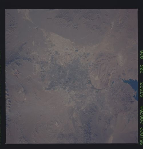
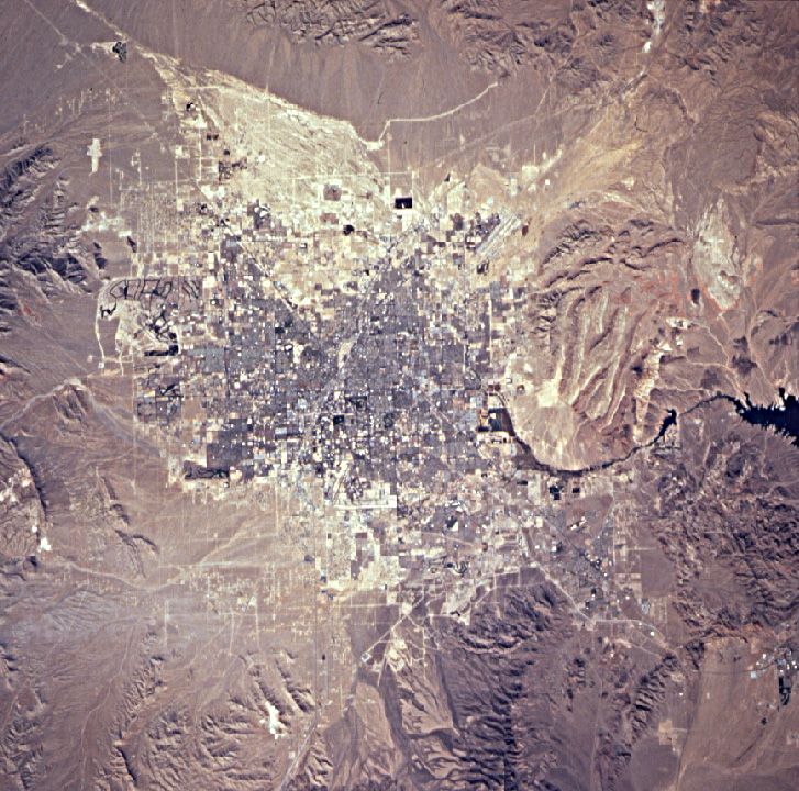
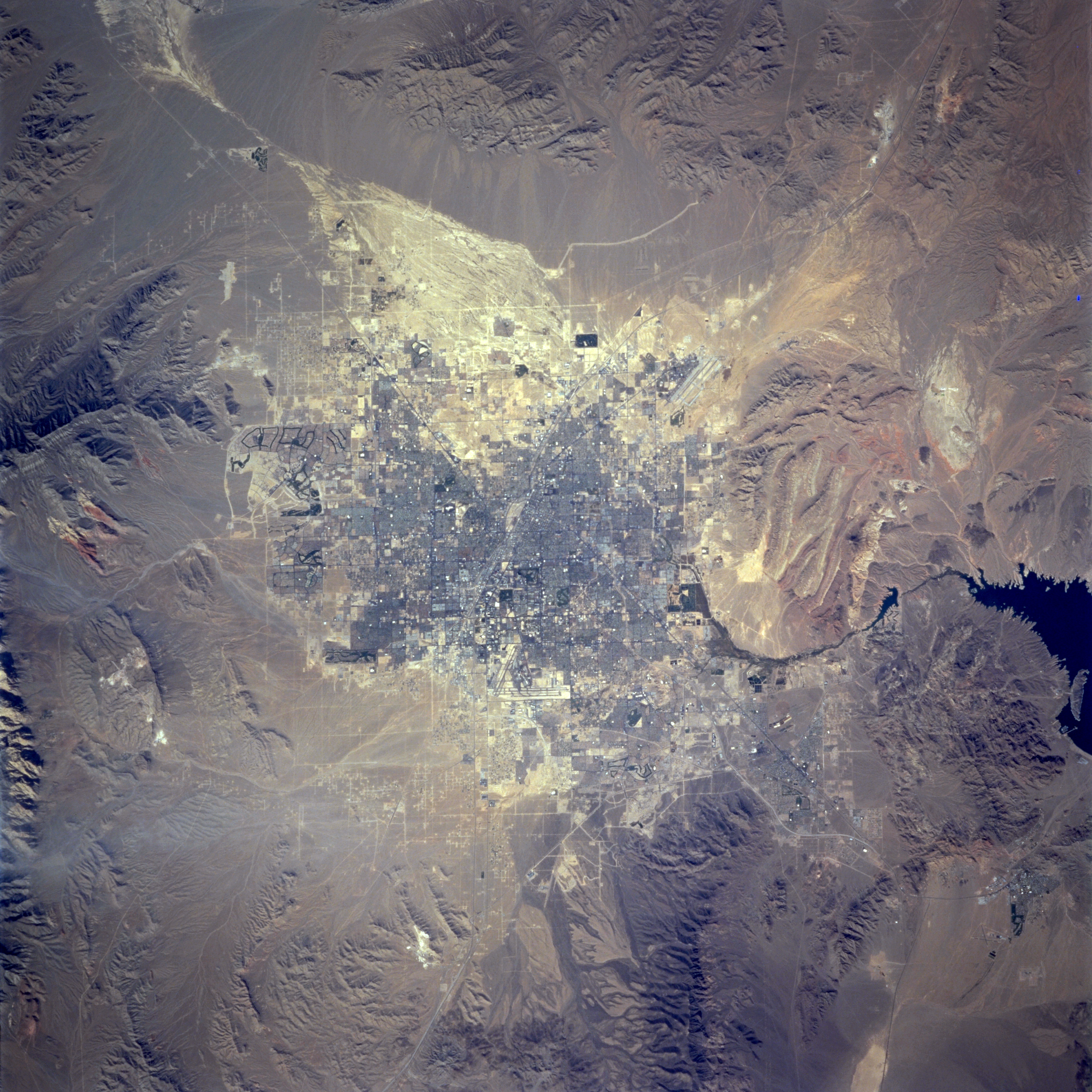
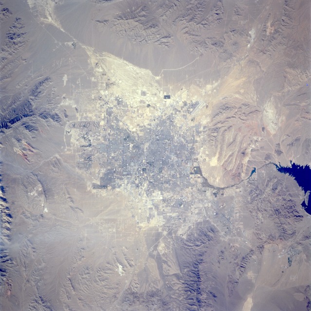
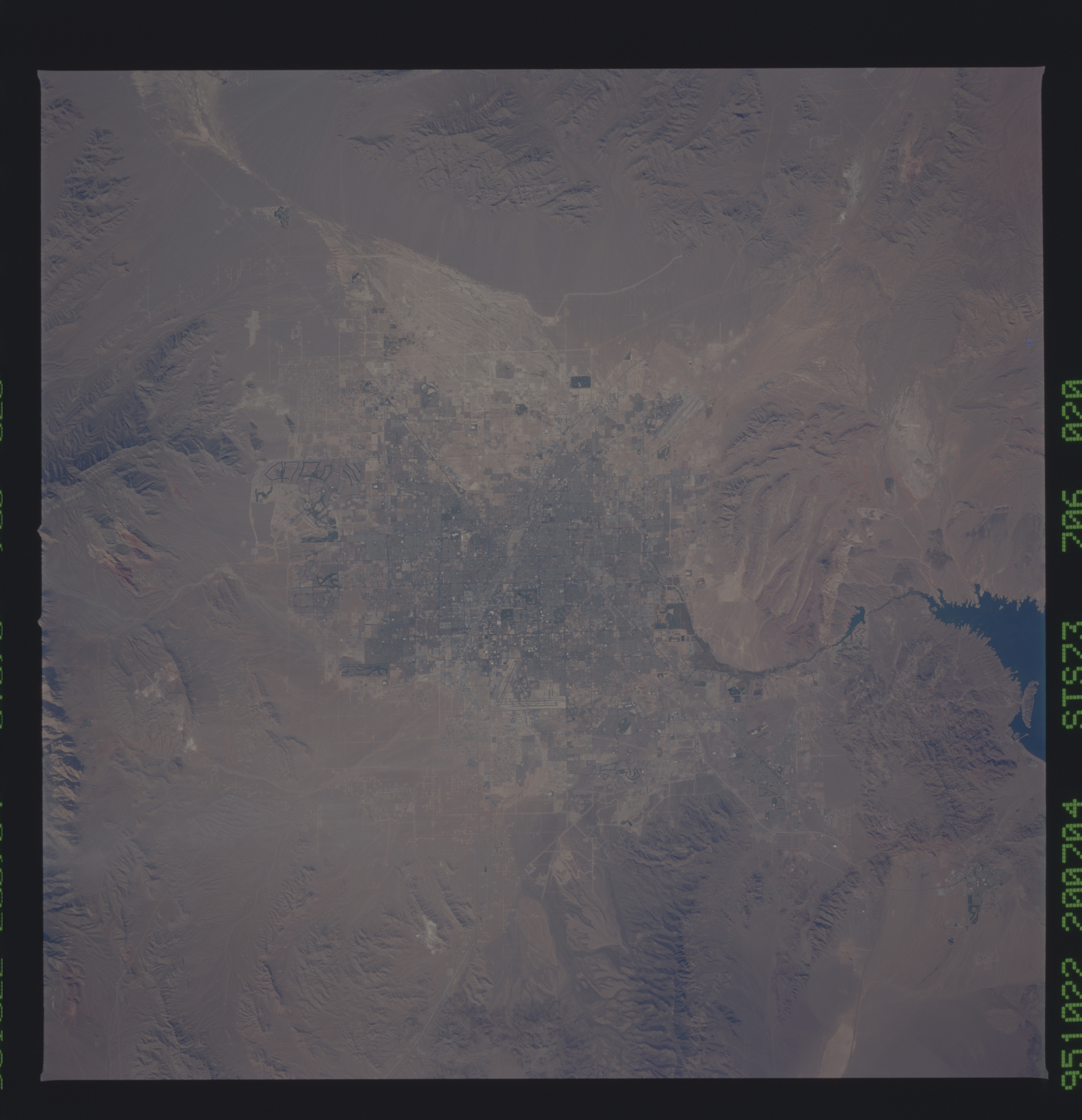
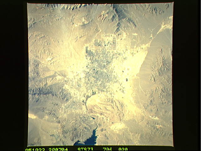
Image Caption: STS073-706-020 Las Vegas, Nevada, U.S.A. September 1995
Las Vegas, known worldwide for its gambling casinos and its numerous hotels and other recreational features, is seen in this spectacular, near-vertical-looking photograph. The city was built in a small depression within a larger basin that is surrounded by mountain ranges. Major drainage into this basin appears as a white area northwest of the city. During occasional heavy rainfall, downtown Las Vegas is prone to flash flooding; the Strip, where many of the gambling casinos and hotels are located, is especially vulnerable. Viewing clockwise east to west, several features are visible-the blue waters of Lake Mead, the runways of Las Vegas International Airport at the south end of the city, the red cliffs of Red Rock Canyon, and residential expansion west and northwest of the city. Las Vegas has grown rapidly in the last three decades as a result of increased tourism and the influx of population from California and other states.
Las Vegas, known worldwide for its gambling casinos and its numerous hotels and other recreational features, is seen in this spectacular, near-vertical-looking photograph. The city was built in a small depression within a larger basin that is surrounded by mountain ranges. Major drainage into this basin appears as a white area northwest of the city. During occasional heavy rainfall, downtown Las Vegas is prone to flash flooding; the Strip, where many of the gambling casinos and hotels are located, is especially vulnerable. Viewing clockwise east to west, several features are visible-the blue waters of Lake Mead, the runways of Las Vegas International Airport at the south end of the city, the red cliffs of Red Rock Canyon, and residential expansion west and northwest of the city. Las Vegas has grown rapidly in the last three decades as a result of increased tourism and the influx of population from California and other states.
