STS073-705-99
| NASA Photo ID | STS073-705-99 |
| Focal Length | 250mm |
| Date taken | 1995.10.25 |
| Time taken | 15:22:07 GMT |
Resolutions offered for this image:
3904 x 3904 pixels 639 x 639 pixels 5700 x 5900 pixels 500 x 518 pixels 640 x 480 pixels
3904 x 3904 pixels 639 x 639 pixels 5700 x 5900 pixels 500 x 518 pixels 640 x 480 pixels


Cloud masks available for this image:
Spacecraft nadir point: 39.1° N, 89.7° W
Photo center point: 39.0° N, 90.5° W
Photo center point by machine learning:
Photo center point: 39.0° N, 90.5° W
Photo center point by machine learning:
Nadir to Photo Center: West
Spacecraft Altitude: 144 nautical miles (267km)
Country or Geographic Name: | USA-MISSOURI |
Features: | MS & ILLINOIS RIVERS, AGR |
| Features Found Using Machine Learning: | |
Cloud Cover Percentage: | 0 (no clouds present) |
Sun Elevation Angle: | 29° |
Sun Azimuth: | 140° |
Camera: | Hasselblad |
Focal Length: | 250mm |
Camera Tilt: | 19 degrees |
Format: | 5046: Kodak, natural color positive, Lumiere 100/5046, ASA 100, standard base |
Film Exposure: | Normal |
| Additional Information | |
| Width | Height | Annotated | Cropped | Purpose | Links |
|---|---|---|---|---|---|
| 3904 pixels | 3904 pixels | No | No | Earth From Space collection | Download Image |
| 639 pixels | 639 pixels | No | No | Earth From Space collection | Download Image |
| 5700 pixels | 5900 pixels | No | No | Download Image | |
| 500 pixels | 518 pixels | No | No | Download Image | |
| 640 pixels | 480 pixels | No | No | Download Image |
Download Packaged File
Download a Google Earth KML for this Image
View photo footprint information
Download a GeoTIFF for this photo
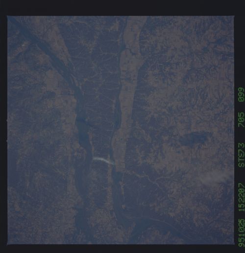
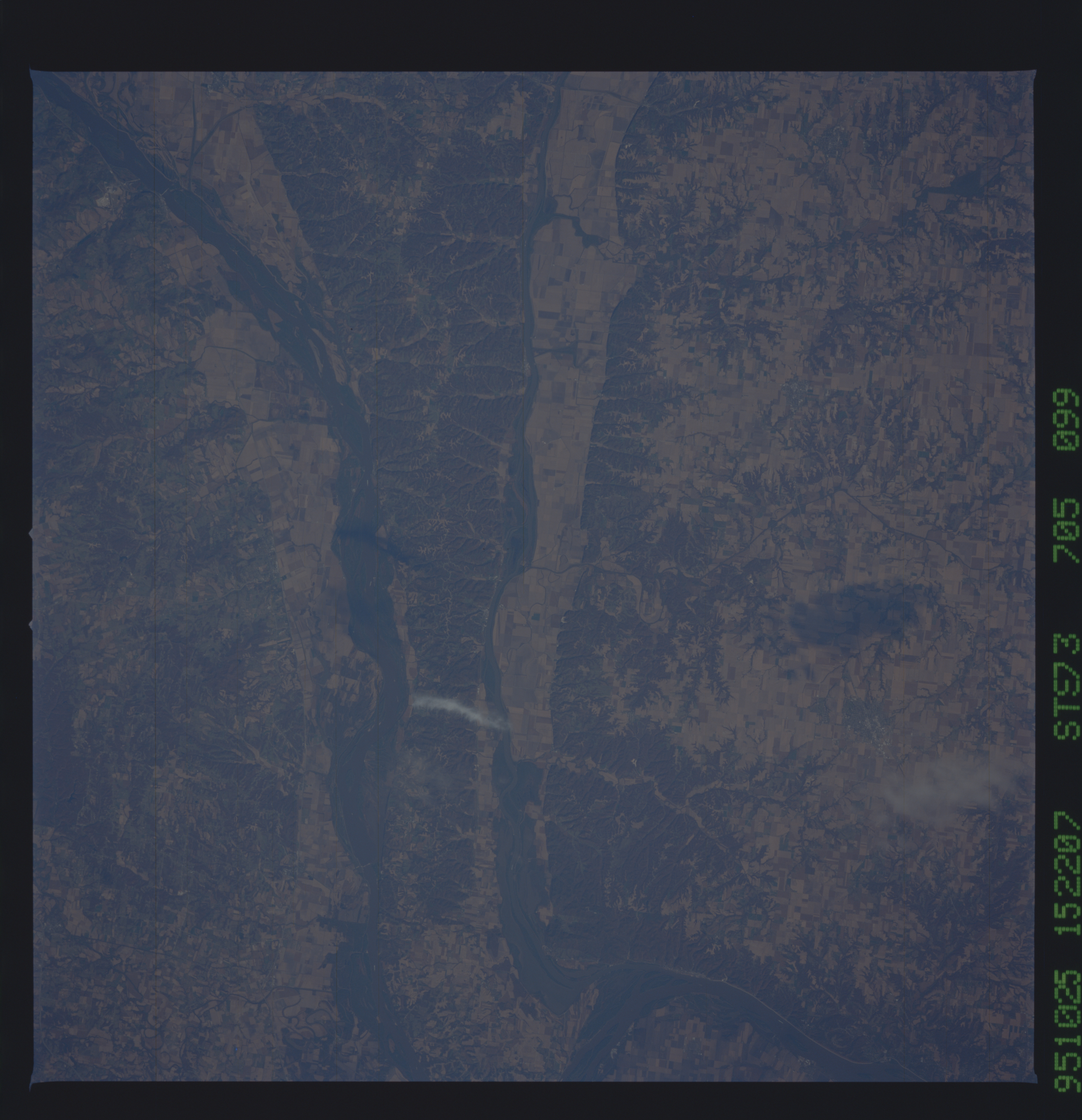
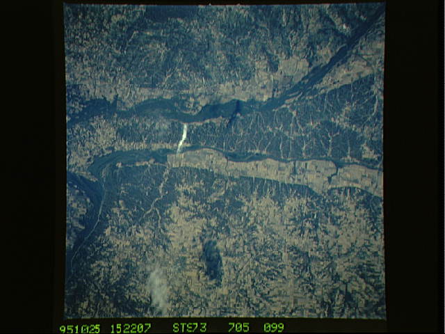
Image Caption: STS073-705-099 Mississippi and Illinois Rivers, Illinois, U.S.A. October 1995
The valleys of the Illinois River (center) and the Mississippi River (west of the Illinois River) are apparent in this near-vertical photograph. Agricultural field patterns dot both river valleys, depicting a recovery from the devastating floods of the spring and summer of 1993. More than 20 000 years ago, this part of the Illinois River was the main course of the Mississippi River. The continental glacier that covered most of Illinois to the east shifted the Mississippi River westward to its present course. North of the rivers' confluence is hilly, forested Pere Marquette State Park, the largest state park in Illinois.
The valleys of the Illinois River (center) and the Mississippi River (west of the Illinois River) are apparent in this near-vertical photograph. Agricultural field patterns dot both river valleys, depicting a recovery from the devastating floods of the spring and summer of 1993. More than 20 000 years ago, this part of the Illinois River was the main course of the Mississippi River. The continental glacier that covered most of Illinois to the east shifted the Mississippi River westward to its present course. North of the rivers' confluence is hilly, forested Pere Marquette State Park, the largest state park in Illinois.
