STS073-704-92
| NASA Photo ID | STS073-704-92 |
| Focal Length | 250mm |
| Date taken | 1995.10.22 |
| Time taken | 18:35:28 GMT |
Resolutions offered for this image:
3875 x 3861 pixels 640 x 637 pixels 5700 x 5900 pixels 500 x 518 pixels 640 x 480 pixels
3875 x 3861 pixels 640 x 637 pixels 5700 x 5900 pixels 500 x 518 pixels 640 x 480 pixels


Cloud masks available for this image:
Spacecraft nadir point: 37.5° N, 99.1° W
Photo center point:
Photo center point by machine learning:
Photo center point:
Photo center point by machine learning:
Nadir to Photo Center:
Spacecraft Altitude: 146 nautical miles (270km)
Country or Geographic Name: | USA-KANSAS |
Features: | RIVER, AGRICULTURE, ROADS |
| Features Found Using Machine Learning: | |
Cloud Cover Percentage: | 0 (no clouds present) |
Sun Elevation Angle: | 42° |
Sun Azimuth: | 185° |
Camera: | Hasselblad |
Focal Length: | 250mm |
Camera Tilt: | Low Oblique |
Format: | 5046: Kodak, natural color positive, Lumiere 100/5046, ASA 100, standard base |
Film Exposure: | Normal |
| Additional Information | |
| Width | Height | Annotated | Cropped | Purpose | Links |
|---|---|---|---|---|---|
| 3875 pixels | 3861 pixels | No | No | Earth From Space collection | Download Image |
| 640 pixels | 637 pixels | No | No | Earth From Space collection | Download Image |
| 5700 pixels | 5900 pixels | No | No | Download Image | |
| 500 pixels | 518 pixels | No | No | Download Image | |
| 640 pixels | 480 pixels | No | No | Download Image |
Download Packaged File
Download a Google Earth KML for this Image
View photo footprint information
Download a GeoTIFF for this photo
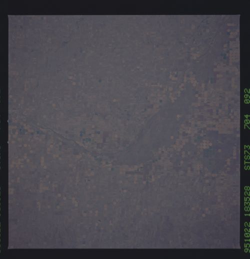
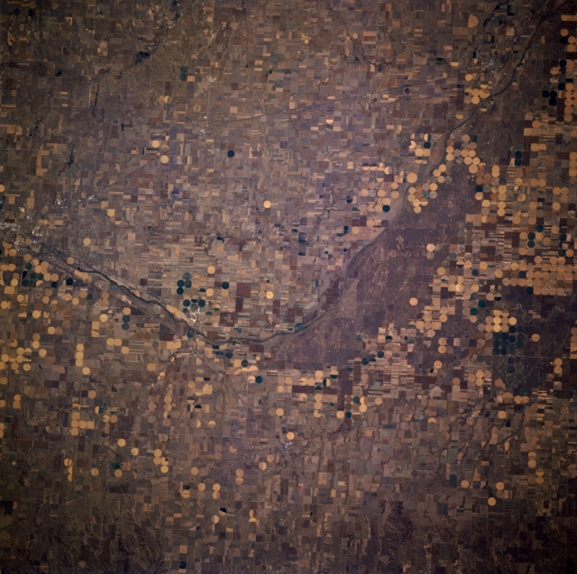
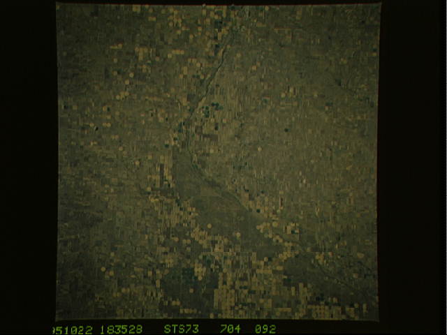
Image Caption: STS073-704-092 Arkansas River and Dodge City, Kansas, U.S.A. October 1995
The large, rectangular and center-pivot irrigated agricultural fields along the Arkansas River in western Kansas are featured in this north-looking, slightly low-oblique photograph. Dodge City, a distribution center in this wheat and livestock area, also produces agricultural implements and supplies. Laid out in 1872 near Fort Dodge (left center) on the old Santa Fe Trail, Dodge City soon flourished as the Santa Fe railhead and became a wild and rowdy cow town. Wyatt Earp and Bat Masterson were among its famous residents. The small city of Kinsley (barely discernible) lies northeast of Dodge City.
The large, rectangular and center-pivot irrigated agricultural fields along the Arkansas River in western Kansas are featured in this north-looking, slightly low-oblique photograph. Dodge City, a distribution center in this wheat and livestock area, also produces agricultural implements and supplies. Laid out in 1872 near Fort Dodge (left center) on the old Santa Fe Trail, Dodge City soon flourished as the Santa Fe railhead and became a wild and rowdy cow town. Wyatt Earp and Bat Masterson were among its famous residents. The small city of Kinsley (barely discernible) lies northeast of Dodge City.
