STS073-704-60
| NASA Photo ID | STS073-704-60 |
| Focal Length | 250mm |
| Date taken | 1995.10.22 |
| Time taken | 17:04:35 GMT |
Resolutions offered for this image:
3872 x 3869 pixels 639 x 639 pixels 5700 x 5900 pixels 500 x 518 pixels 640 x 480 pixels
3872 x 3869 pixels 639 x 639 pixels 5700 x 5900 pixels 500 x 518 pixels 640 x 480 pixels
Cloud masks available for this image:
Spacecraft nadir point: 38.3° N, 81.2° W
Photo center point: 38.5° N, 82.0° W
Photo center point by machine learning:
Photo center point: 38.5° N, 82.0° W
Photo center point by machine learning:
Nadir to Photo Center: West
Spacecraft Altitude: 146 nautical miles (270km)
Country or Geographic Name: | USA-WEST VIRGINIA |
Features: | OHIO & NEW RIVERS, AGR. |
| Features Found Using Machine Learning: | |
Cloud Cover Percentage: | 0 (no clouds present) |
Sun Elevation Angle: | 41° |
Sun Azimuth: | 178° |
Camera: | Hasselblad |
Focal Length: | 250mm |
Camera Tilt: | 19 degrees |
Format: | 5046: Kodak, natural color positive, Lumiere 100/5046, ASA 100, standard base |
Film Exposure: | Normal |
| Additional Information | |
| Width | Height | Annotated | Cropped | Purpose | Links |
|---|---|---|---|---|---|
| 3872 pixels | 3869 pixels | No | No | Earth From Space collection | Download Image |
| 639 pixels | 639 pixels | No | No | Earth From Space collection | Download Image |
| 5700 pixels | 5900 pixels | No | No | Download Image | |
| 500 pixels | 518 pixels | No | No | Download Image | |
| 640 pixels | 480 pixels | No | No | Download Image |
Download Packaged File
Download a Google Earth KML for this Image
View photo footprint information
Download a GeoTIFF for this photo
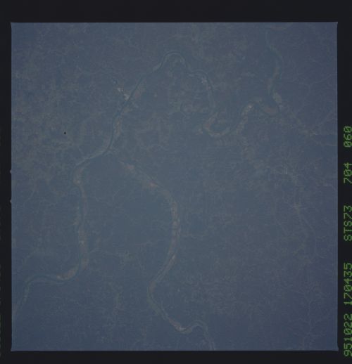
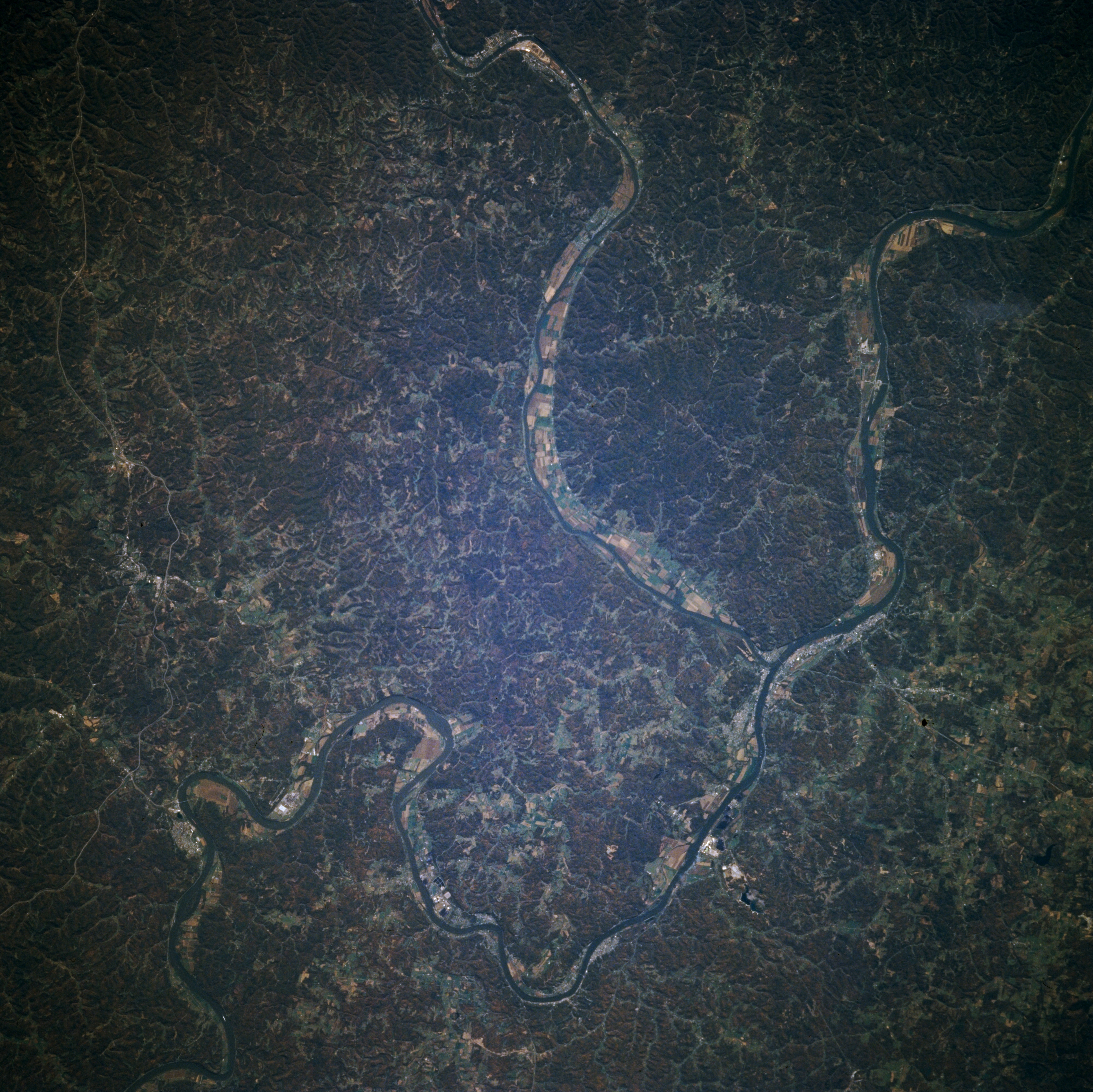
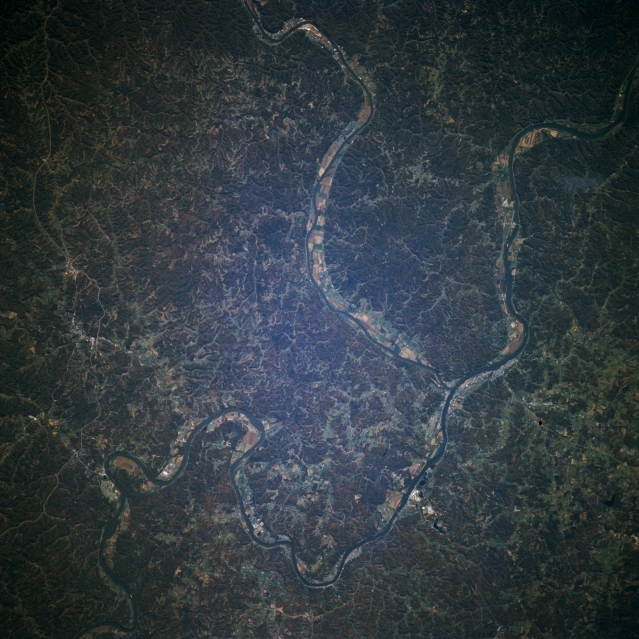
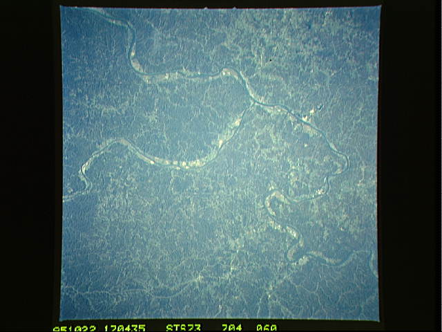
Image Caption: STS073-704-060 Ohio River, Appalachian Plateau, West Virginia, U.S.A. October 1995
The Appalachian Plateau can be seen in this south-looking very low oblique photograph. The Ohio River crosses the image from the lower left to the upper right. The Appalachian Plateau (or sometime referred to as the Allegheny Plateau) is a series of low-rounded hills with numerous eroded valleys. The plateau is covered with a wide variety of deciduous trees in full fall color at the time this image was acquired. Coal and other minerals are mined throughout the region. The Ohio River separates the state of Ohio to the north (bottom) from the state of West Virginia (top). The Kanawa River enters the scene near the top center of the image and enters the Ohio River just to the right of center of the image.
The Appalachian Plateau can be seen in this south-looking very low oblique photograph. The Ohio River crosses the image from the lower left to the upper right. The Appalachian Plateau (or sometime referred to as the Allegheny Plateau) is a series of low-rounded hills with numerous eroded valleys. The plateau is covered with a wide variety of deciduous trees in full fall color at the time this image was acquired. Coal and other minerals are mined throughout the region. The Ohio River separates the state of Ohio to the north (bottom) from the state of West Virginia (top). The Kanawa River enters the scene near the top center of the image and enters the Ohio River just to the right of center of the image.
