STS073-702-71
| NASA Photo ID | STS073-702-71 |
| Focal Length | 250mm |
| Date taken | 1995.10.27 |
| Time taken | 18:20:48 GMT |
Resolutions offered for this image:
3872 x 3840 pixels 639 x 634 pixels 5700 x 5900 pixels 500 x 518 pixels 640 x 480 pixels 3388 x 3373 pixels
3872 x 3840 pixels 639 x 634 pixels 5700 x 5900 pixels 500 x 518 pixels 640 x 480 pixels 3388 x 3373 pixels


Cloud masks available for this image:
Spacecraft nadir point: 32.2° N, 114.1° W
Photo center point: 32.5° N, 114.5° W
Photo center point by machine learning:
Photo center point: 32.5° N, 114.5° W
Photo center point by machine learning:
Nadir to Photo Center: Northwest
Spacecraft Altitude: 144 nautical miles (267km)
Country or Geographic Name: | USA-ARIZONA |
Features: | YUMA, COLORADO RIVER, AGR. |
| Features Found Using Machine Learning: | |
Cloud Cover Percentage: | 0 (no clouds present) |
Sun Elevation Angle: | 43° |
Sun Azimuth: | 160° |
Camera: | Hasselblad |
Focal Length: | 250mm |
Camera Tilt: | 12 degrees |
Format: | 5046: Kodak, natural color positive, Lumiere 100/5046, ASA 100, standard base |
Film Exposure: | Normal |
| Additional Information | |
| Width | Height | Annotated | Cropped | Purpose | Links |
|---|---|---|---|---|---|
| 3872 pixels | 3840 pixels | No | No | Earth From Space collection | Download Image |
| 639 pixels | 634 pixels | No | No | Earth From Space collection | Download Image |
| 5700 pixels | 5900 pixels | No | No | Download Image | |
| 500 pixels | 518 pixels | No | No | Download Image | |
| 640 pixels | 480 pixels | No | No | Download Image | |
| 3388 pixels | 3373 pixels | Download Image |
Download Packaged File
Download a Google Earth KML for this Image
View photo footprint information
Download a GeoTIFF for this photo
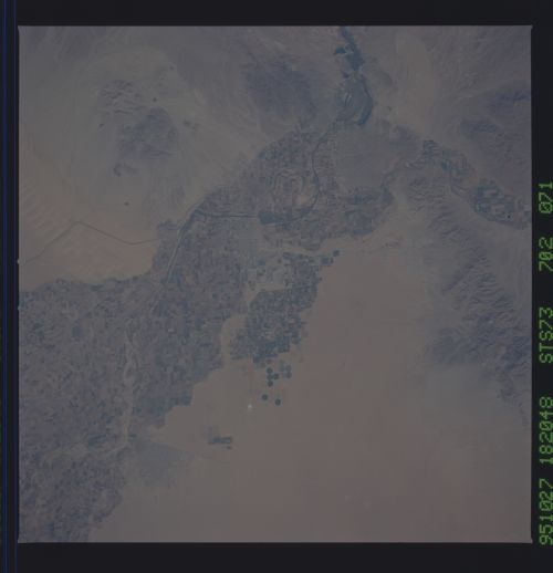
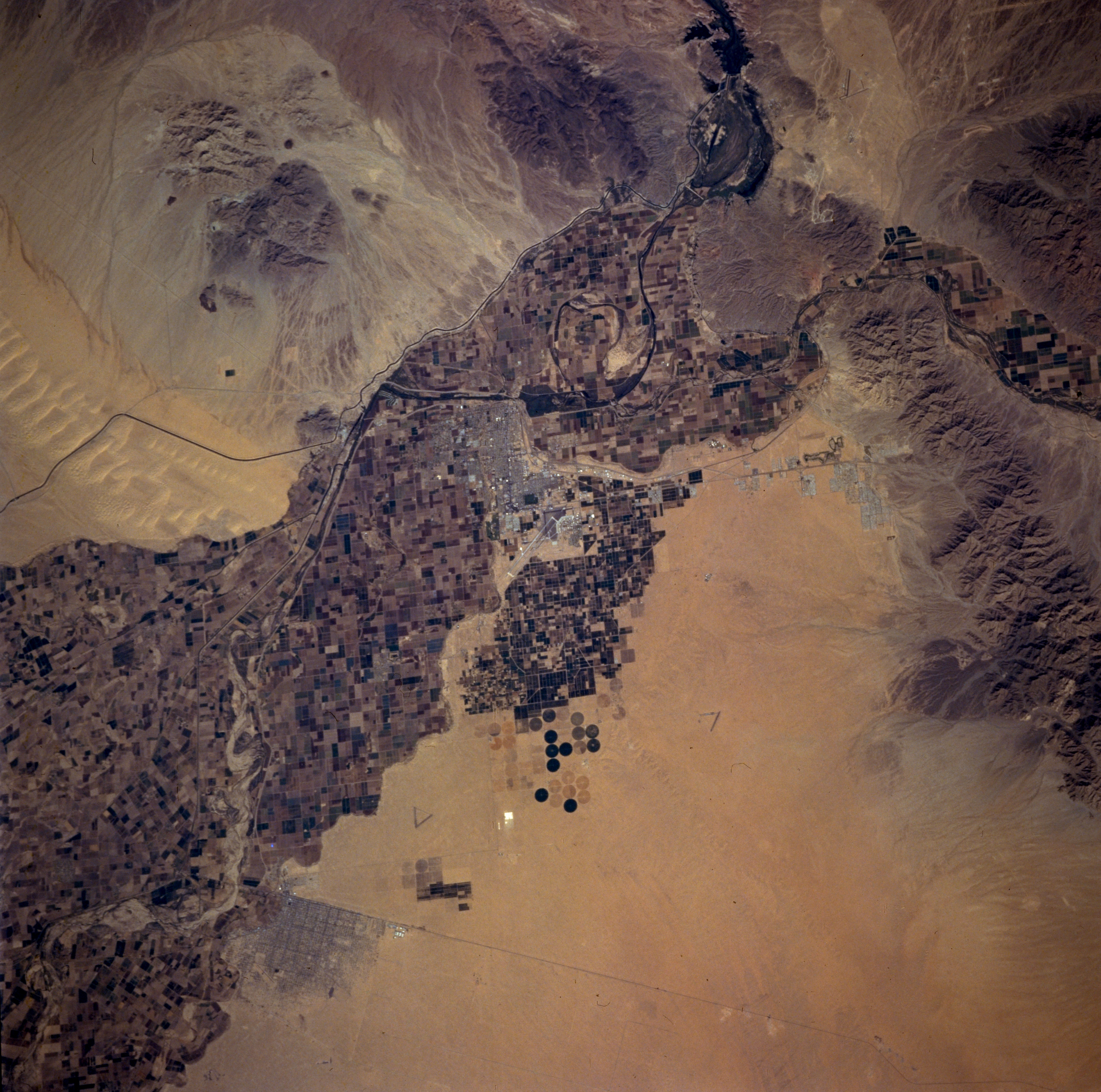
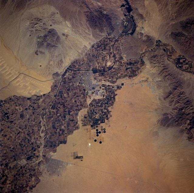
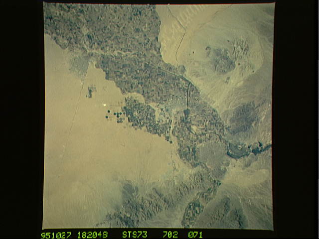
Image Caption: STS073-702-071 Yuma Area, Arizona, U.S.A. October 1995
Some street patterns of Yuma are visible near the center of this near-vertical photograph. The northeast-southwest-oriented runway of Yuma International Airport can be seen immediately southeast of the city. Farther east, the Gila Mountains obstruct the Gila River, forcing it to detour to the north before it merges with the Colorado River on the outskirts of Yuma. The All American Canal, which carries water from the Colorado River to parts of the Imperial Valley in southern California, appears as a dark line that crosses the southern end of the Sand Hills. Cultivated field patterns cover the landscape where adequate irrigation water is available, and a few circular field patterns south of Yuma indicate the use of center-pivot irrigation. The Mexican desert town of San Luis is visible near the lower left edge of the photograph, and the U.S.-Mexico border can be traced eastward through the desert.
Some street patterns of Yuma are visible near the center of this near-vertical photograph. The northeast-southwest-oriented runway of Yuma International Airport can be seen immediately southeast of the city. Farther east, the Gila Mountains obstruct the Gila River, forcing it to detour to the north before it merges with the Colorado River on the outskirts of Yuma. The All American Canal, which carries water from the Colorado River to parts of the Imperial Valley in southern California, appears as a dark line that crosses the southern end of the Sand Hills. Cultivated field patterns cover the landscape where adequate irrigation water is available, and a few circular field patterns south of Yuma indicate the use of center-pivot irrigation. The Mexican desert town of San Luis is visible near the lower left edge of the photograph, and the U.S.-Mexico border can be traced eastward through the desert.
