STS073-702-18
| NASA Photo ID | STS073-702-18 |
| Focal Length | 250mm |
| Date taken | 1995.10.27 |
| Time taken | 16:47:47 GMT |
Resolutions offered for this image:
3904 x 3840 pixels 639 x 629 pixels 5700 x 5900 pixels 500 x 518 pixels 640 x 480 pixels 1266 x 1270 pixels 426 x 426 pixels 426 x 426 pixels
3904 x 3840 pixels 639 x 629 pixels 5700 x 5900 pixels 500 x 518 pixels 640 x 480 pixels 1266 x 1270 pixels 426 x 426 pixels 426 x 426 pixels


Cloud masks available for this image:
Spacecraft nadir point: 36.6° N, 105.4° W
Photo center point: 38.0° N, 106.0° W
Photo center point by machine learning:
Photo center point: 38.0° N, 106.0° W
Photo center point by machine learning:
Nadir to Photo Center: North
Spacecraft Altitude: 143 nautical miles (265km)
Country or Geographic Name: | USA-COLORADO |
Features: | SAN LUIS VALLEY, PIVOT AG |
| Features Found Using Machine Learning: | |
Cloud Cover Percentage: | 0 (no clouds present) |
Sun Elevation Angle: | 34° |
Sun Azimuth: | 145° |
Camera: | Hasselblad |
Focal Length: | 250mm |
Camera Tilt: | 33 degrees |
Format: | 5046: Kodak, natural color positive, Lumiere 100/5046, ASA 100, standard base |
Film Exposure: | Normal |
| Additional Information | |
| Width | Height | Annotated | Cropped | Purpose | Links |
|---|---|---|---|---|---|
| 3904 pixels | 3840 pixels | No | No | Earth From Space collection | Download Image |
| 639 pixels | 629 pixels | No | No | Earth From Space collection | Download Image |
| 5700 pixels | 5900 pixels | No | No | Download Image | |
| 500 pixels | 518 pixels | No | No | Download Image | |
| 640 pixels | 480 pixels | No | No | Download Image | |
| 1266 pixels | 1270 pixels | No | No | Download Image | |
| 426 pixels | 426 pixels | No | No | Download Image | |
| 426 pixels | 426 pixels | Download Image |
Download Packaged File
Download a Google Earth KML for this Image
View photo footprint information
Download a GeoTIFF for this photo
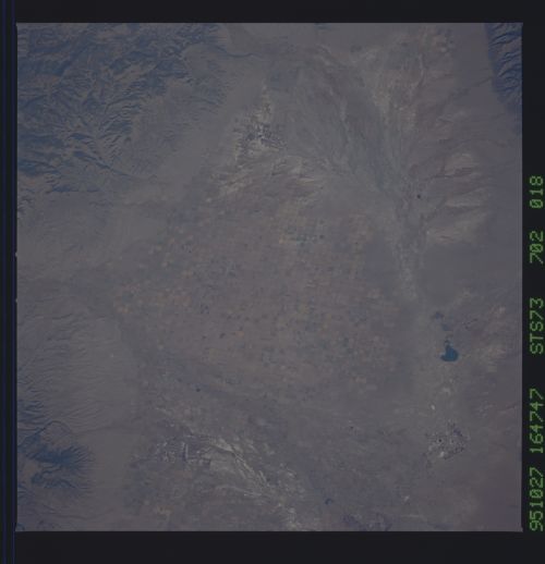
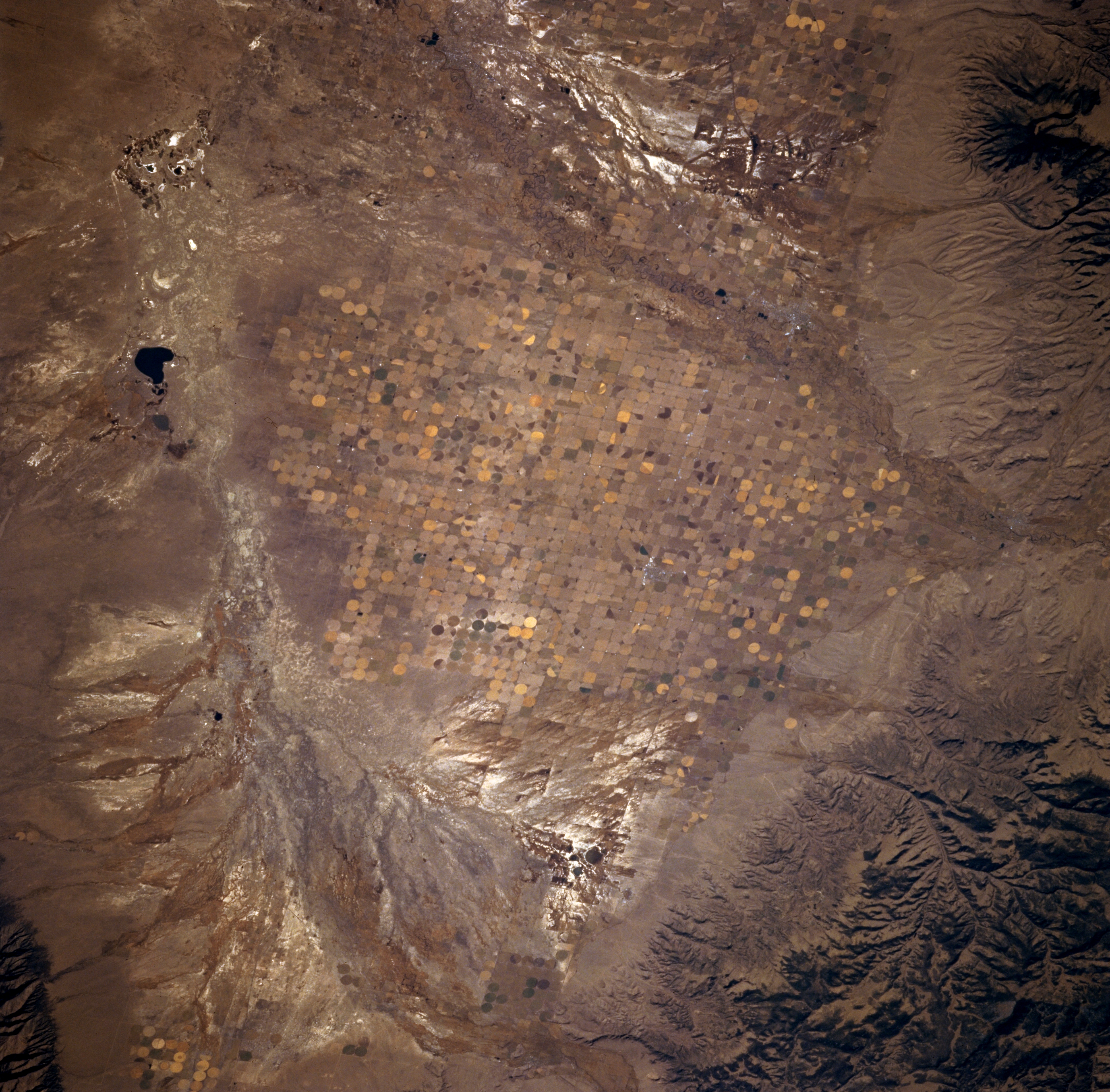
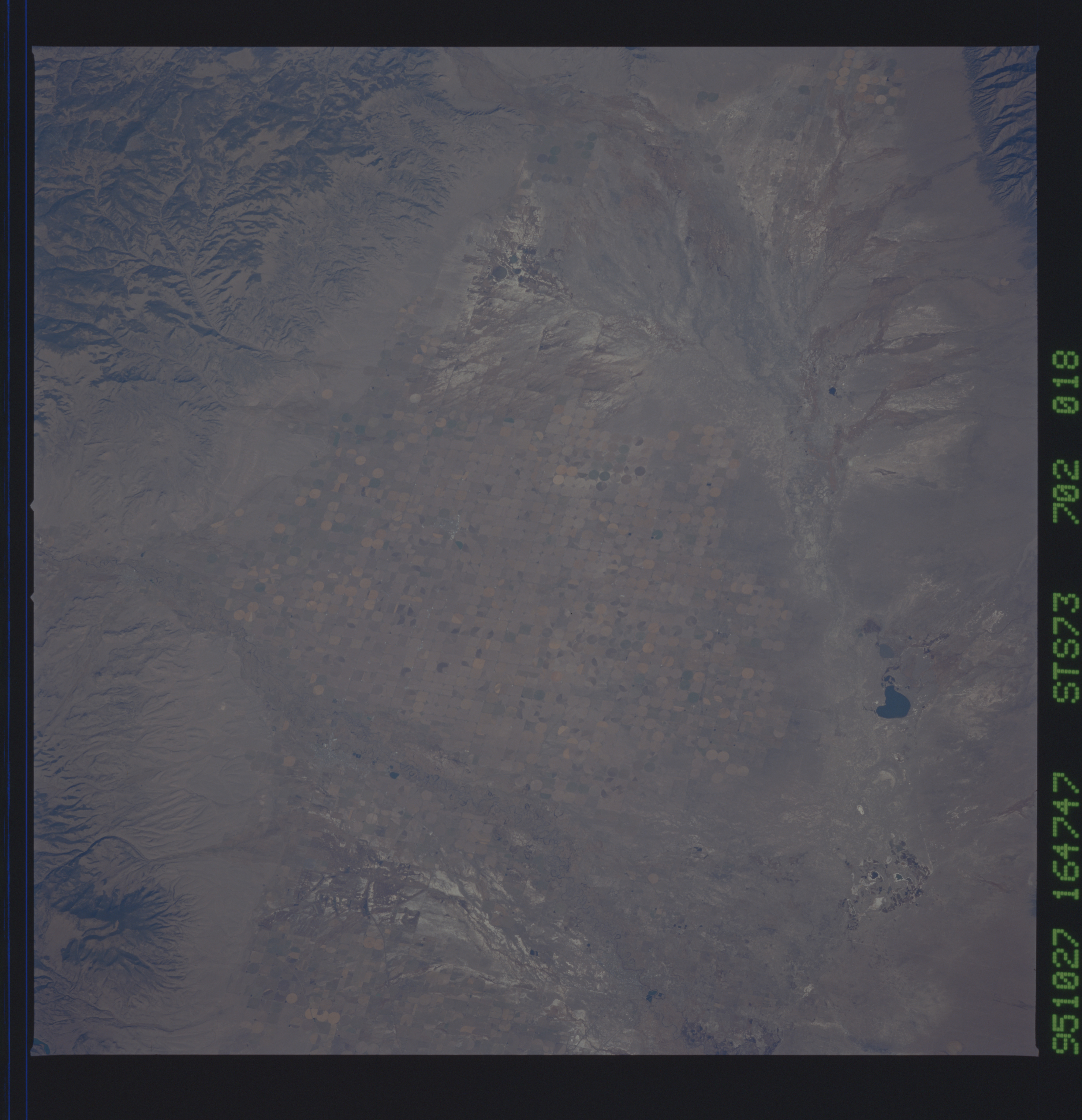
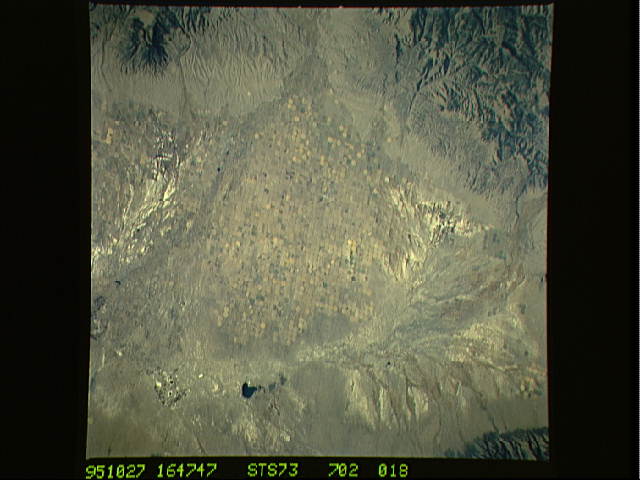
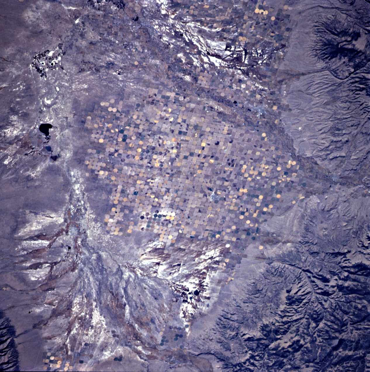
Image Caption: STS073-702-018 San Luis Valley, Colorado, U.S.A. October 1995
Streams that enter the northern half of the San Luis Valley of south-central Colorado, a relatively flat basin, rarely reach the Rio Grande. Despite the fact that the San Luis Valley is a true desert--receiving less than 8 inches of precipitation a year--much of the valley supports a vigorous agricultural industry because of irrigation water from deep artesian wells, some of which tap as many as five or six artesian aquifers. Visible are a large alluvial fan at the northern end of the valley that exhibits the classic pattern found in arid, flat landscapes; San Luis Creek; and San Luis Lake. A smaller, similarly colored drainage feature is also observed at the top center of the photograph. The two highly reflective areas north and south of the cultivated fields are probably the result of accumulations of salt deposited in the soils by the evaporation process.
Streams that enter the northern half of the San Luis Valley of south-central Colorado, a relatively flat basin, rarely reach the Rio Grande. Despite the fact that the San Luis Valley is a true desert--receiving less than 8 inches of precipitation a year--much of the valley supports a vigorous agricultural industry because of irrigation water from deep artesian wells, some of which tap as many as five or six artesian aquifers. Visible are a large alluvial fan at the northern end of the valley that exhibits the classic pattern found in arid, flat landscapes; San Luis Creek; and San Luis Lake. A smaller, similarly colored drainage feature is also observed at the top center of the photograph. The two highly reflective areas north and south of the cultivated fields are probably the result of accumulations of salt deposited in the soils by the evaporation process.
