STS073-702-17
| NASA Photo ID | STS073-702-17 |
| Focal Length | 250mm |
| Date taken | 1995.10.27 |
| Time taken | 16:47:44 GMT |
Resolutions offered for this image:
3936 x 3904 pixels 639 x 634 pixels 5700 x 5900 pixels 500 x 518 pixels 640 x 480 pixels
3936 x 3904 pixels 639 x 634 pixels 5700 x 5900 pixels 500 x 518 pixels 640 x 480 pixels


Cloud masks available for this image:
Spacecraft nadir point: 36.6° N, 105.6° W
Photo center point: 37.5° N, 106.5° W
Photo center point by machine learning:
Photo center point: 37.5° N, 106.5° W
Photo center point by machine learning:
Nadir to Photo Center: Northwest
Spacecraft Altitude: 143 nautical miles (265km)
Country or Geographic Name: | USA-COLORADO |
Features: | SAN LUIS VALLEY, PIVOT AG |
| Features Found Using Machine Learning: | |
Cloud Cover Percentage: | 0 (no clouds present) |
Sun Elevation Angle: | 33° |
Sun Azimuth: | 145° |
Camera: | Hasselblad |
Focal Length: | 250mm |
Camera Tilt: | 28 degrees |
Format: | 5046: Kodak, natural color positive, Lumiere 100/5046, ASA 100, standard base |
Film Exposure: | Normal |
| Additional Information | |
| Width | Height | Annotated | Cropped | Purpose | Links |
|---|---|---|---|---|---|
| 3936 pixels | 3904 pixels | No | No | Earth From Space collection | Download Image |
| 639 pixels | 634 pixels | No | No | Earth From Space collection | Download Image |
| 5700 pixels | 5900 pixels | No | No | Download Image | |
| 500 pixels | 518 pixels | No | No | Download Image | |
| 640 pixels | 480 pixels | No | No | Download Image |
Download Packaged File
Download a Google Earth KML for this Image
View photo footprint information
Download a GeoTIFF for this photo
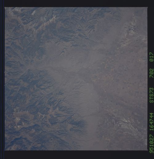
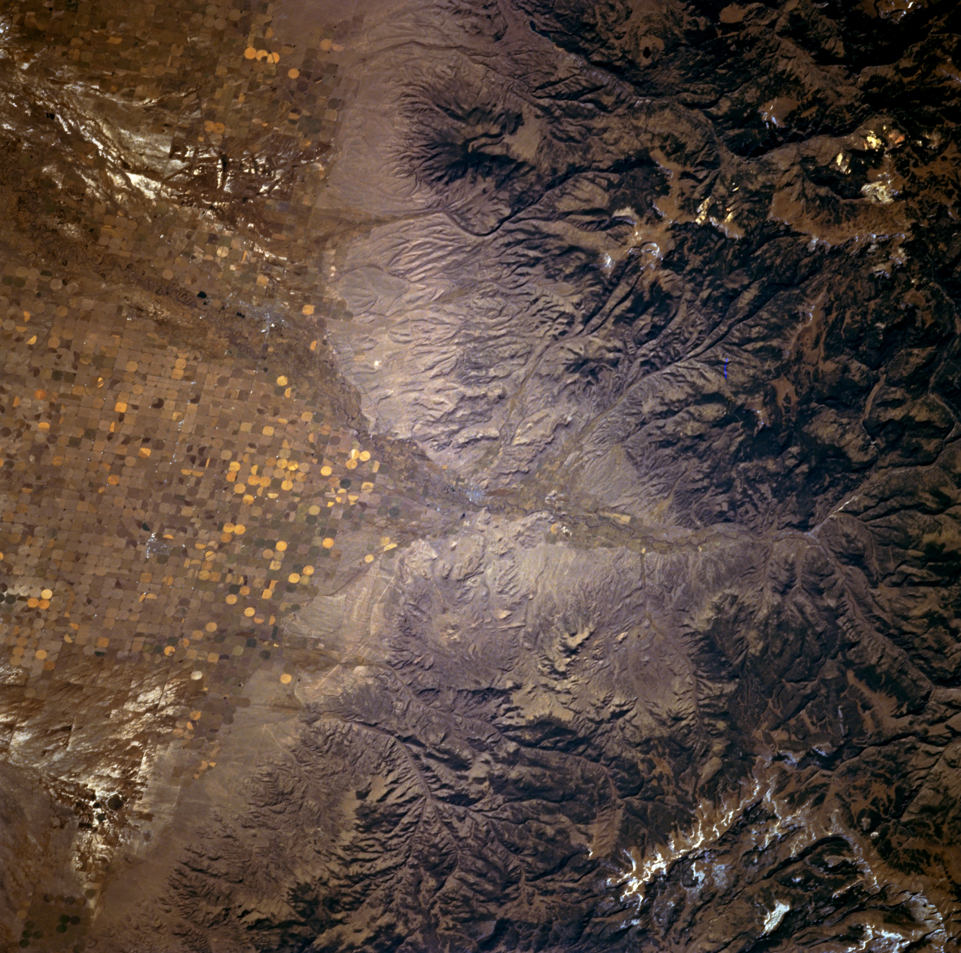
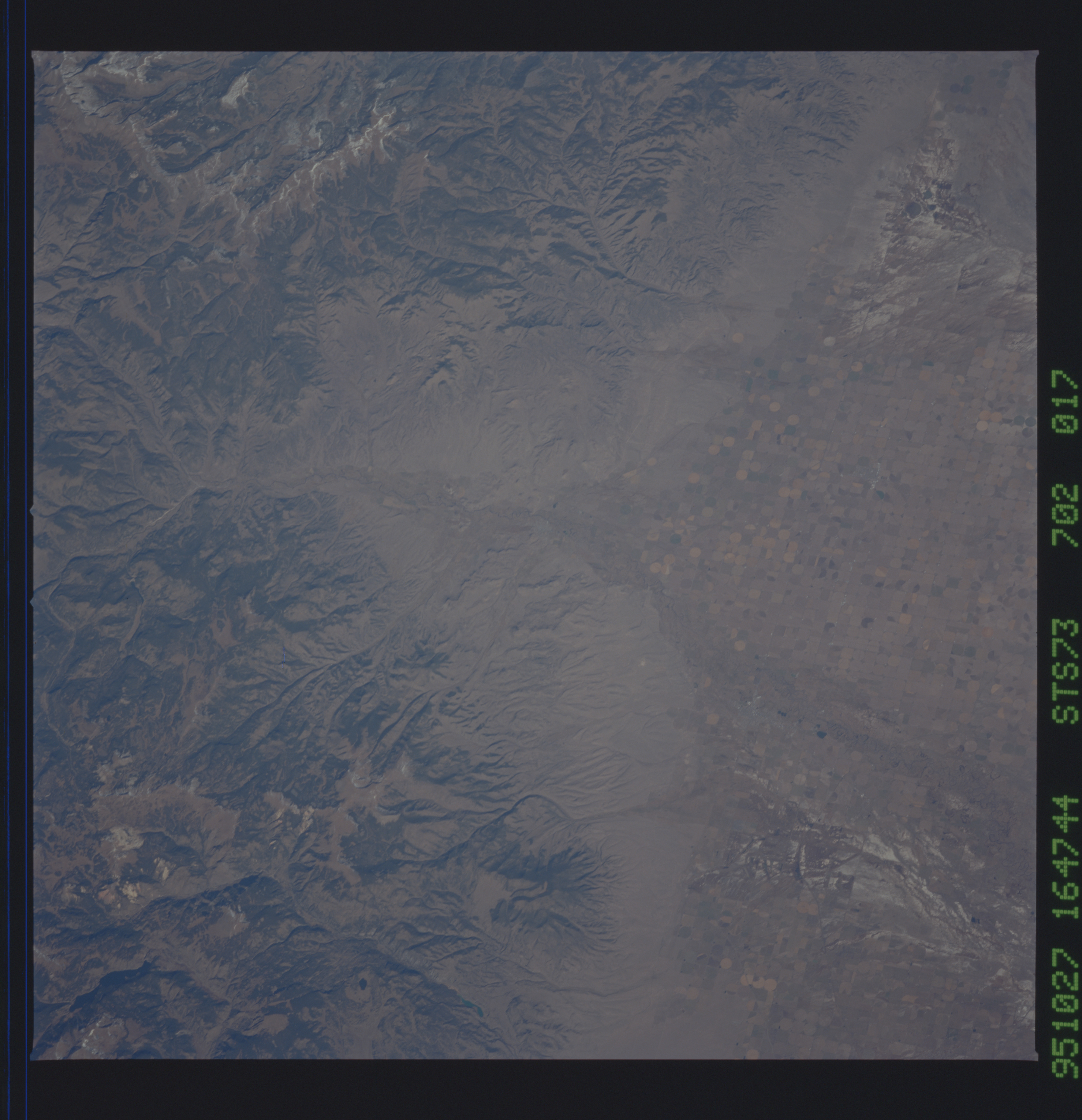
Image Caption: STS073-702-017 Rio Grande Headwaters, Colorado, U.S.A. October 1995
Apparent is the canyon eroded by the Rio Grande through the San Juan Mountains west of Del Norte (not discernible near center of the photograph) along the western edge of the San Luis Valley in south-central Colorado. Sediment deposits are visible along the eastern flank of the San Juan Mountains. The two highly reflective drainage patterns north and south of the river (upper and lower left corners) appear to be accumulations of salt from evaporation. Center-pivot irrigation provides a high level of agricultural activity in the San Luis Valley.
Apparent is the canyon eroded by the Rio Grande through the San Juan Mountains west of Del Norte (not discernible near center of the photograph) along the western edge of the San Luis Valley in south-central Colorado. Sediment deposits are visible along the eastern flank of the San Juan Mountains. The two highly reflective drainage patterns north and south of the river (upper and lower left corners) appear to be accumulations of salt from evaporation. Center-pivot irrigation provides a high level of agricultural activity in the San Luis Valley.
