STS072-733-44
| NASA Photo ID | STS072-733-44 |
| Focal Length | 250mm |
| Date taken | 1996.01.14 |
| Time taken | 11:48:18 GMT |
Resolutions offered for this image:
5700 x 5900 pixels 500 x 518 pixels 640 x 480 pixels 1800 x 1777 pixels
5700 x 5900 pixels 500 x 518 pixels 640 x 480 pixels 1800 x 1777 pixels
Cloud masks available for this image:
Spacecraft nadir point: 25.2° S, 20.8° E
Photo center point:
Photo center point by machine learning:
Photo center point:
Photo center point by machine learning:
Nadir to Photo Center:
Spacecraft Altitude: 165 nautical miles (306km)
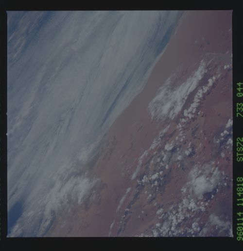
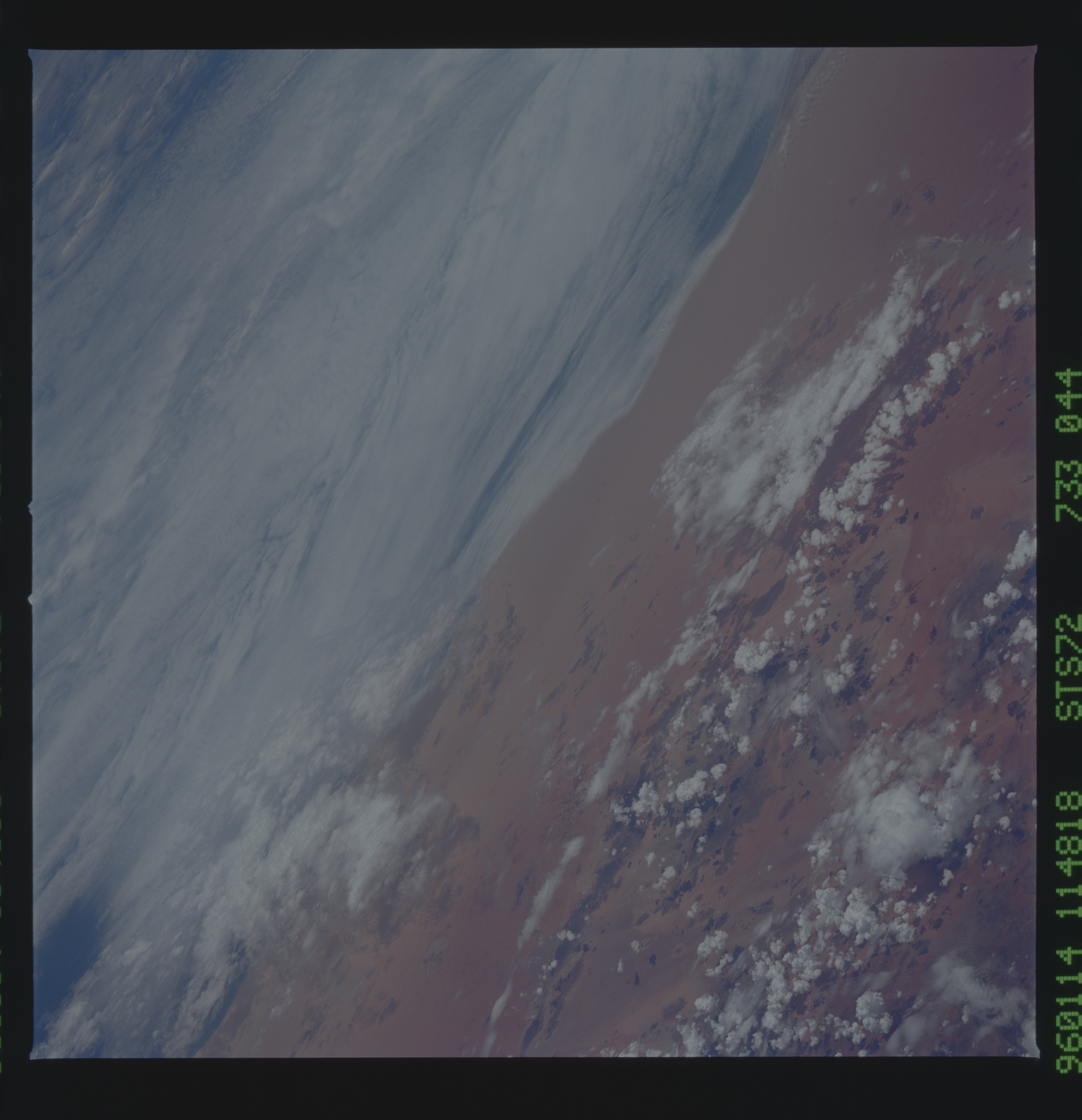
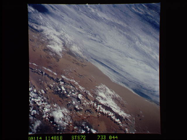
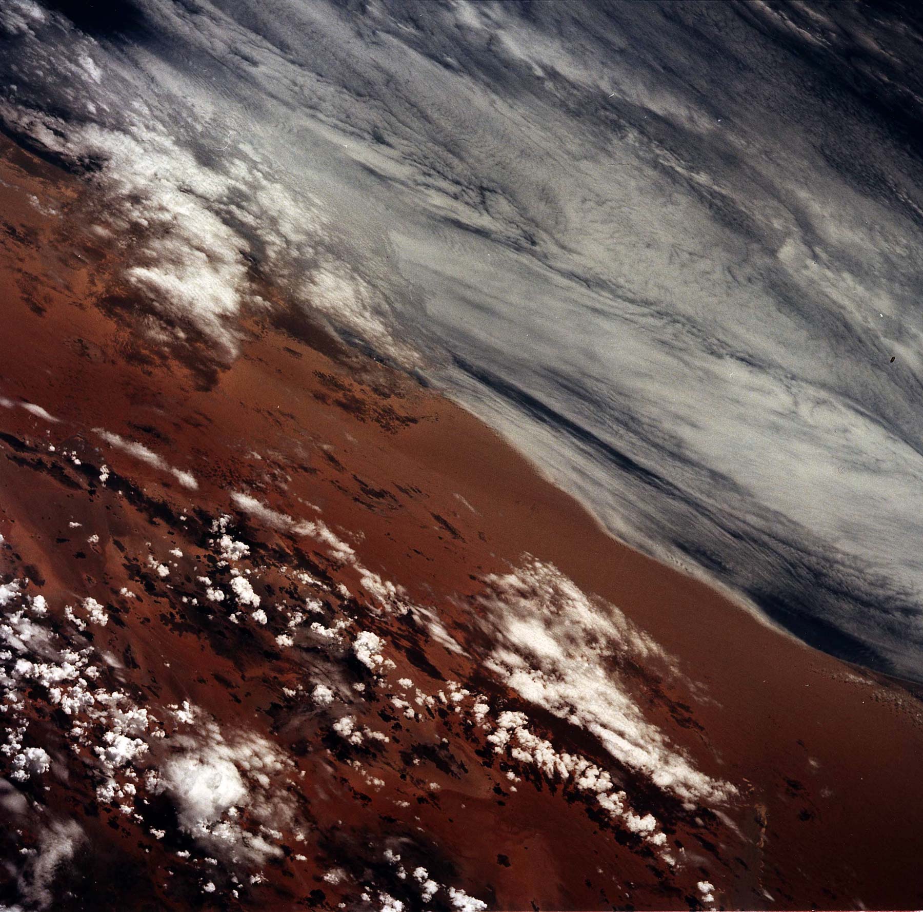
Country or Geographic Name: | NAMIBIA |
Features: | NAMIB DESERT, COAST, CL. |
| Features Found Using Machine Learning: | |
Cloud Cover Percentage: | 40 (26-50)% |
Sun Elevation Angle: | 75° |
Sun Azimuth: | 281° |
Camera: | Hasselblad |
Focal Length: | 250mm |
Camera Tilt: | Low Oblique |
Format: | 5046: Kodak, natural color positive, Lumiere 100/5046, ASA 100, standard base |
Film Exposure: | Normal |
| Additional Information | |
| Width | Height | Annotated | Cropped | Purpose | Links |
|---|---|---|---|---|---|
| 5700 pixels | 5900 pixels | No | No | Download Image | |
| 500 pixels | 518 pixels | No | No | Download Image | |
| 640 pixels | 480 pixels | No | No | Download Image | |
| 1800 pixels | 1777 pixels | No | No | Download Image |
Download Packaged File
Download a Google Earth KML for this Image
View photo footprint information
Download a GeoTIFF for this photo
Image Caption: Air/Sea Interaction off the coast
of the Namib Desert. Warmer, moist air takes the form of stratus
clouds and fog, as it moves over the colder, upwelled water of the
Benguela Current as it moves northward.
of the Namib Desert. Warmer, moist air takes the form of stratus
clouds and fog, as it moves over the colder, upwelled water of the
Benguela Current as it moves northward.
