STS071-745-65
| NASA Photo ID | STS071-745-65 |
| Focal Length | 100mm |
| Date taken | 1995.__.__ |
| Time taken | GMT |
Resolutions offered for this image:
3904 x 3872 pixels 639 x 634 pixels 5700 x 5900 pixels 500 x 518 pixels 640 x 480 pixels
3904 x 3872 pixels 639 x 634 pixels 5700 x 5900 pixels 500 x 518 pixels 640 x 480 pixels
Cloud masks available for this image:
Spacecraft nadir point:
Photo center point: 32.5° N, 97.0° W
Photo center point by machine learning:
Photo center point: 32.5° N, 97.0° W
Photo center point by machine learning:
Nadir to Photo Center:
Spacecraft Altitude: nautical miles (0km)
Country or Geographic Name: | USA-TEXAS |
Features: | DALLAS-FT. WORTH, PART. FRM |
| Features Found Using Machine Learning: | |
Cloud Cover Percentage: | 5 (1-10)% |
Sun Elevation Angle: | ° |
Sun Azimuth: | ° |
Camera: | Hasselblad |
Focal Length: | 100mm |
Camera Tilt: | Low Oblique |
Format: | VELVI: Fuji, natural color positive, Velvia 50, CS 135-36, ASA 32, standard base |
Film Exposure: | Normal |
| Additional Information | |
| Width | Height | Annotated | Cropped | Purpose | Links |
|---|---|---|---|---|---|
| 3904 pixels | 3872 pixels | No | No | Earth From Space collection | Download Image |
| 639 pixels | 634 pixels | No | No | Earth From Space collection | Download Image |
| 5700 pixels | 5900 pixels | No | No | Download Image | |
| 500 pixels | 518 pixels | No | No | Download Image | |
| 640 pixels | 480 pixels | No | No | Download Image |
Download Packaged File
Download a Google Earth KML for this Image
View photo footprint information
Download a GeoTIFF for this photo
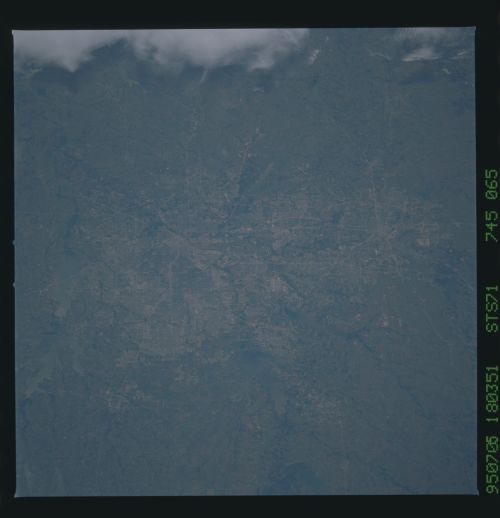
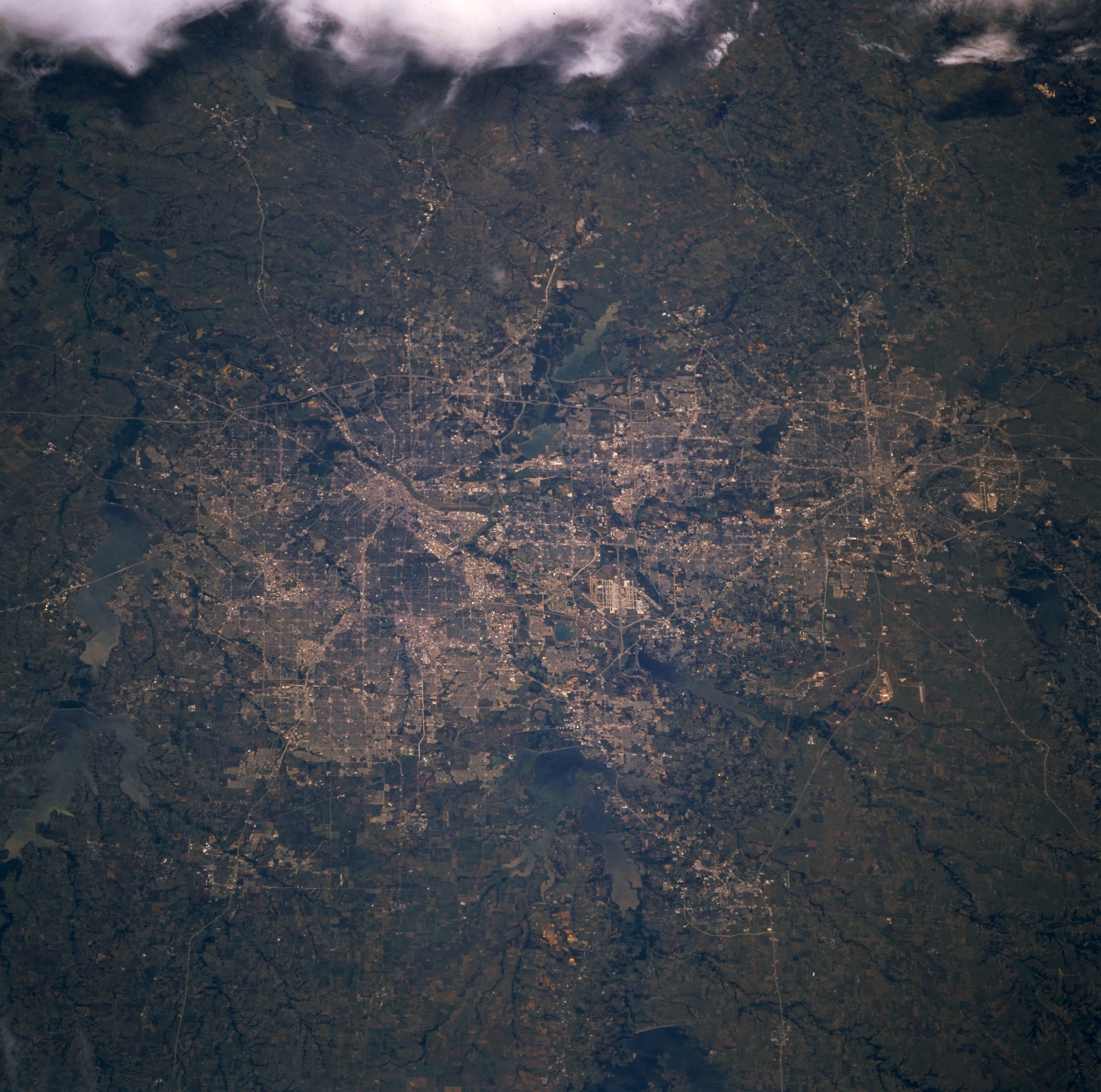
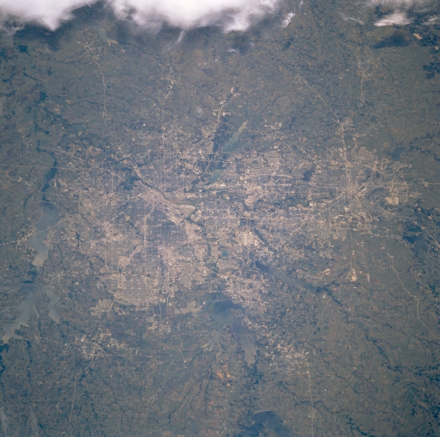
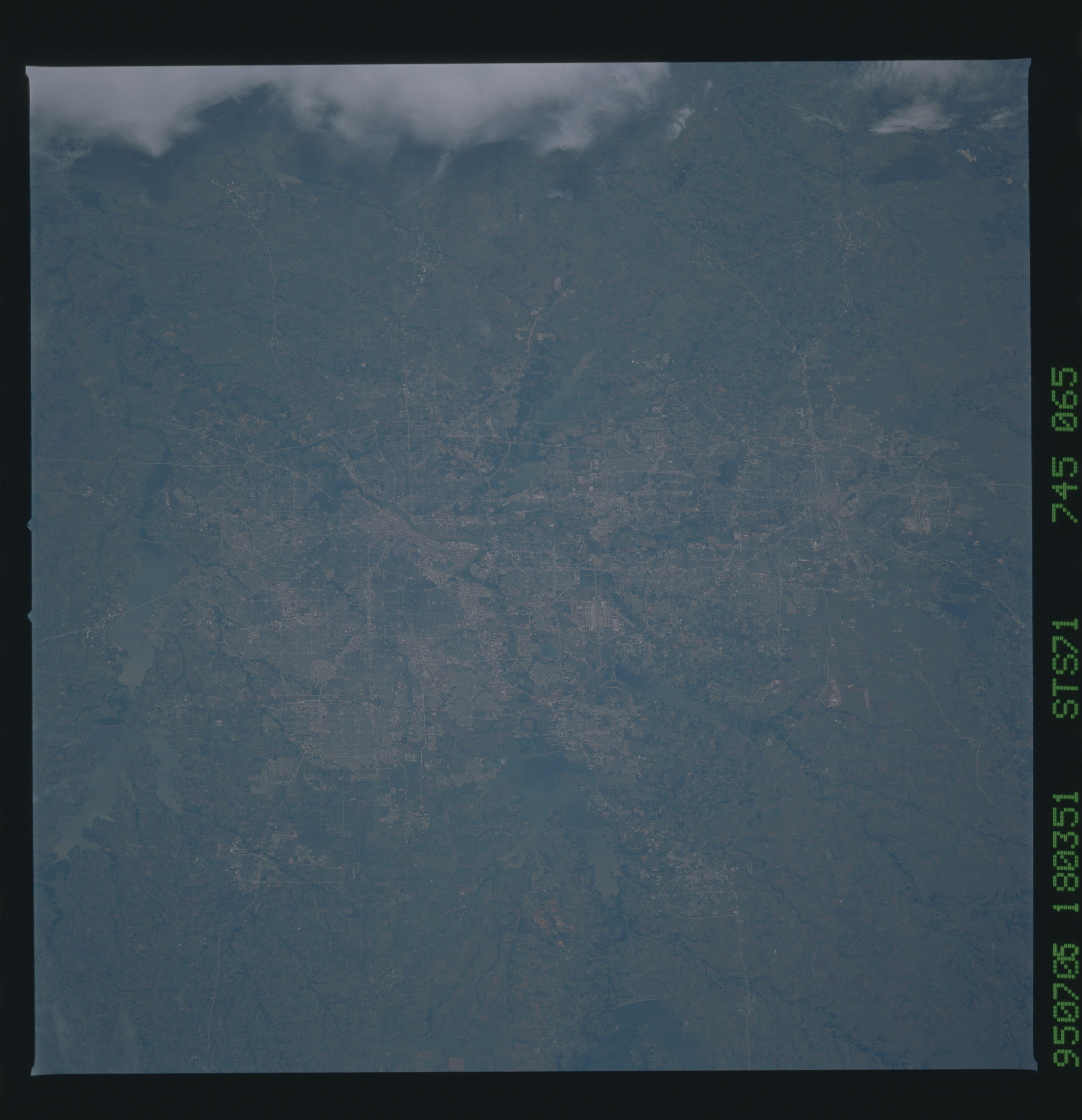
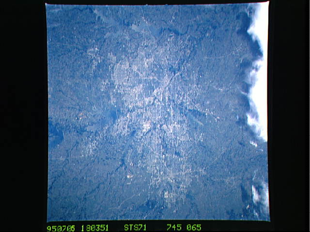
Image Caption: STS071-745-065 Dallas-Fort Worth Metroplex, Texas, U.S.A. July 1995
The coalescing of Dallas and Fort Worth is captured in this photograph. Except for the Trinity River and its numerous tributaries, no physical landform has impeded the rapid urban buildup on the relatively flat prairie of the Dallas-Fort Worth region. Discernible are the central business districts for each city and several highly reflective runways of the Dallas-Fort Worth International Airport. Viewing clockwise from the left side of the photograph are several large reservoirs bordering the metroplex--Lake Lavon, Lake Ray Hubbard, Joe Pool Lake, Grapevine Lake, Lake Lewisville, and Lake Ray Roberts (bottom center). Clouds are observed to the south.
The coalescing of Dallas and Fort Worth is captured in this photograph. Except for the Trinity River and its numerous tributaries, no physical landform has impeded the rapid urban buildup on the relatively flat prairie of the Dallas-Fort Worth region. Discernible are the central business districts for each city and several highly reflective runways of the Dallas-Fort Worth International Airport. Viewing clockwise from the left side of the photograph are several large reservoirs bordering the metroplex--Lake Lavon, Lake Ray Hubbard, Joe Pool Lake, Grapevine Lake, Lake Lewisville, and Lake Ray Roberts (bottom center). Clouds are observed to the south.
