STS069-733-100
| NASA Photo ID | STS069-733-100 |
| Focal Length | 250mm |
| Date taken | 1995.09.17 |
| Time taken | 17:42:59 GMT |
Cloud masks available for this image:
Spacecraft nadir point: 24.7° S, 53.2° W
Photo center point: 25.5° S, 54.5° W
Photo center point by machine learning:
Photo center point: 25.5° S, 54.5° W
Photo center point by machine learning:
Nadir to Photo Center: Southwest
Spacecraft Altitude: 185 nautical miles (343km)
Country or Geographic Name: | BRAZIL |
Features: | RESERVOIRS, RIVERS, FOREST |
| Features Found Using Machine Learning: | |
Cloud Cover Percentage: | 5 (1-10)% |
Sun Elevation Angle: | 48° |
Sun Azimuth: | 304° |
Camera: | Hasselblad |
Focal Length: | 250mm |
Camera Tilt: | 26 degrees |
Format: | 2443: Kodak Aerochrome 2443, color IR, thin base, EA-5 process thru June 1999, E-6 process afterward |
Film Exposure: | Normal |
| Additional Information | |
| Width | Height | Annotated | Cropped | Purpose | Links |
|---|---|---|---|---|---|
| 5700 pixels | 5900 pixels | No | No | Download Image | |
| 500 pixels | 518 pixels | No | No | Download Image | |
| 640 pixels | 480 pixels | No | No | Download Image |
Download Packaged File
Download a Google Earth KML for this Image
View photo footprint information
Download a GeoTIFF for this photo
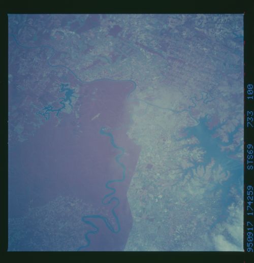
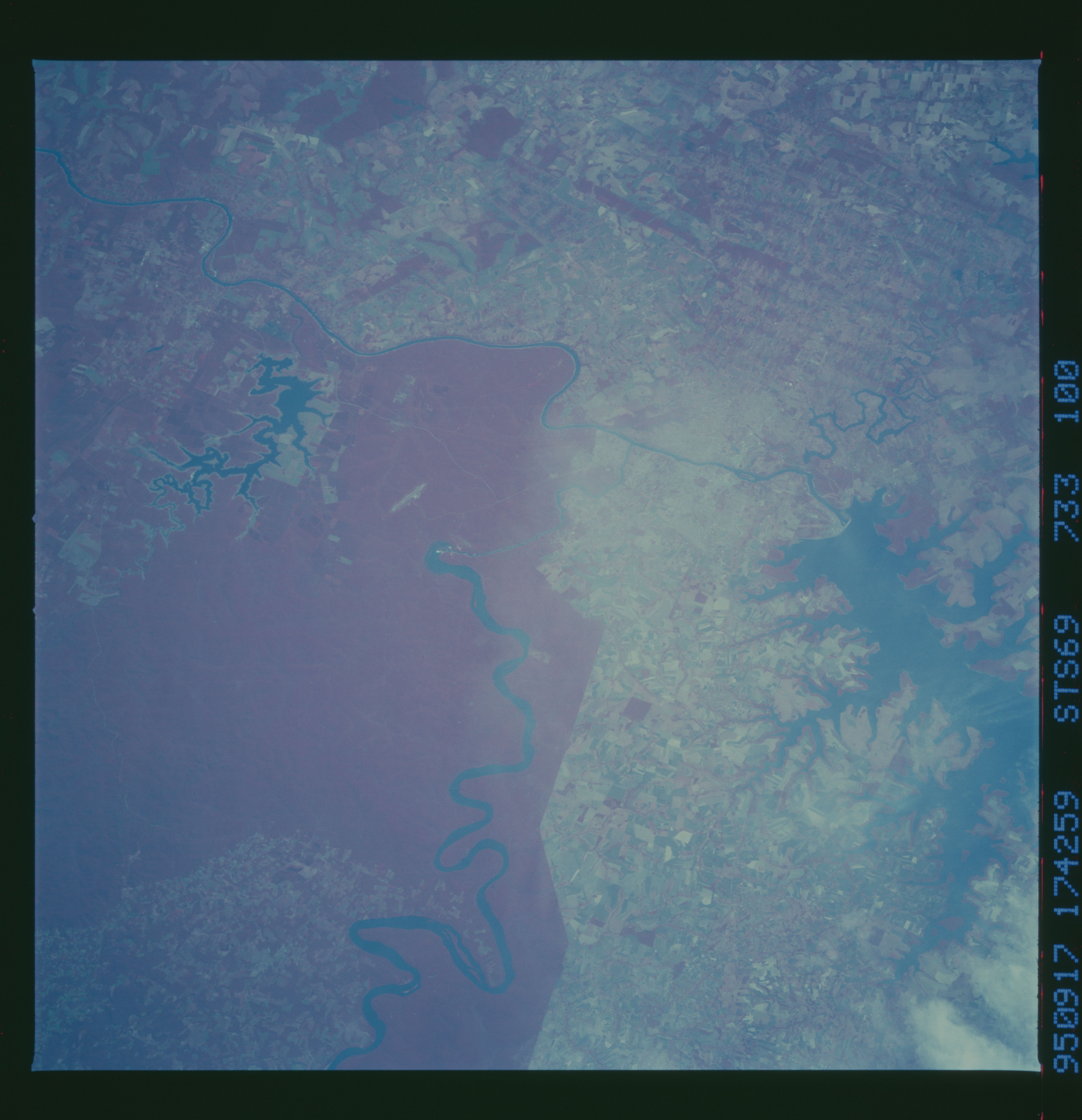
Image Caption: Igua'u River, Paran River, Itaipu Dam Forest preserve,
Southern Brazil/Argentina/Paraguay
This infrared nadir-looking view shows detail of the forest preserve
(red area) around one of South America's greatest tourist attractions,
the 200 foot Igua'u Falls (within the red forested area where the
river narrows abruptly). The large lake in S Brazil (right) is
impounded behind one of the largest damwalls in the world, the Itaip#
Dam
