STS069-717-73

| NASA Photo ID | STS069-717-73 |
| Focal Length | 250mm |
| Date taken | 1995.09.17 |
| Time taken | 17:38:57 GMT |
Cloud masks available for this image:
Spacecraft nadir point: 20.2° S, 67.3° W
Photo center point: 21.0° S, 67.0° W
Photo center point by machine learning:
Photo center point: 21.0° S, 67.0° W
Photo center point by machine learning:
Nadir to Photo Center: South
Spacecraft Altitude: 185 nautical miles (343km)
Country or Geographic Name: | BOLIVIA |
Features: | SALAR DE UYUNI, MTS., R. |
| Features Found Using Machine Learning: | |
Cloud Cover Percentage: | 0 (no clouds present) |
Sun Elevation Angle: | 61° |
Sun Azimuth: | 318° |
Camera: | Hasselblad |
Focal Length: | 250mm |
Camera Tilt: | 15 degrees |
Format: | 5046: Kodak, natural color positive, Lumiere 100/5046, ASA 100, standard base |
Film Exposure: | Normal |
| Additional Information | |
| Width | Height | Annotated | Cropped | Purpose | Links |
|---|---|---|---|---|---|
| 5700 pixels | 5900 pixels | No | No | Download Image | |
| 500 pixels | 518 pixels | No | No | Download Image | |
| 640 pixels | 480 pixels | No | No | Download Image |
Download Packaged File
Download a Google Earth KML for this Image
View photo footprint information
Download a GeoTIFF for this photo
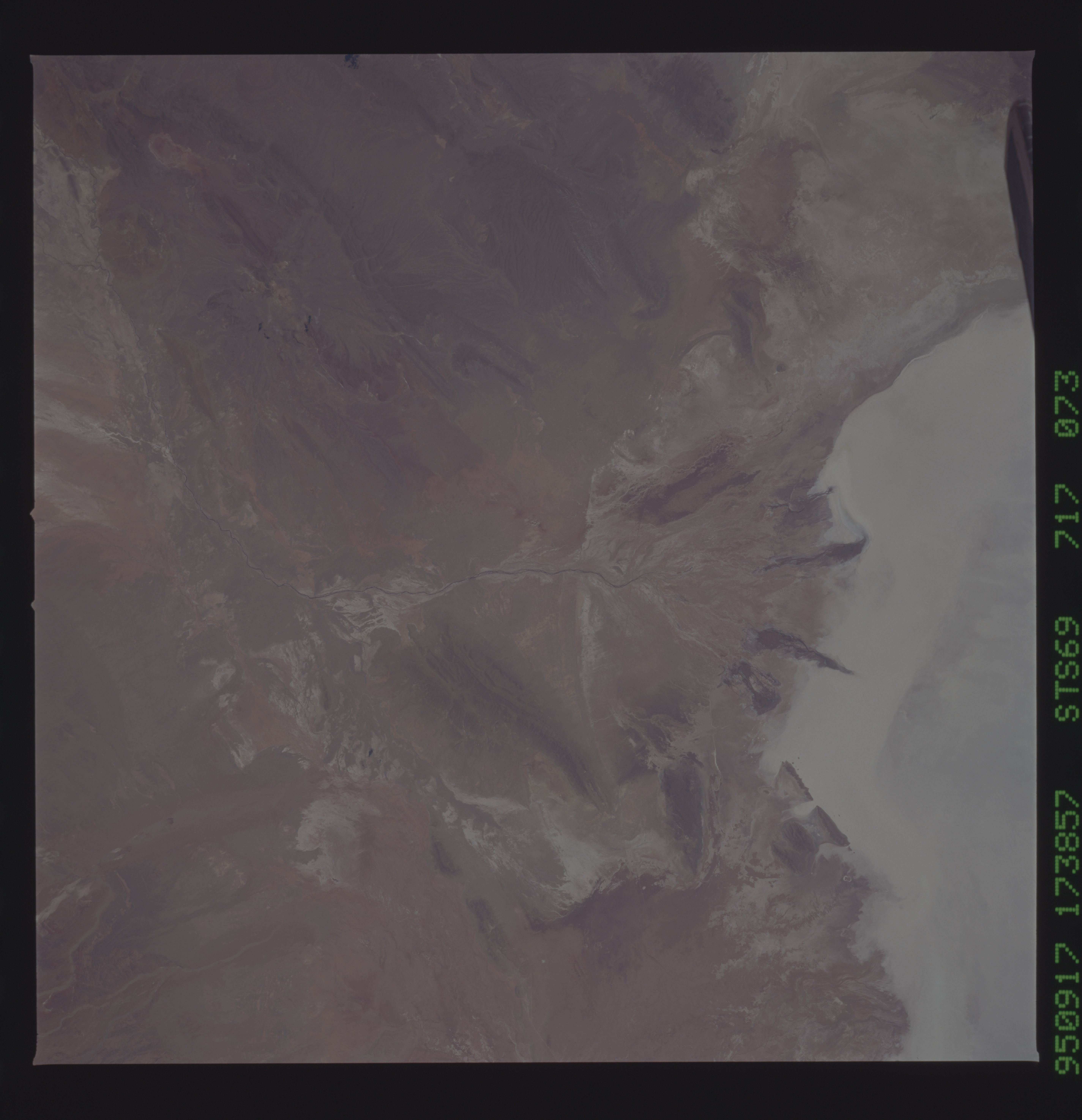
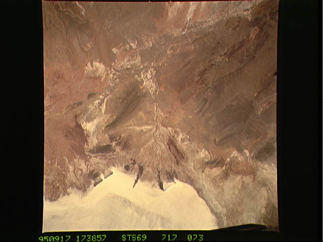
Image Caption: Dry delta of the Rio Grande de Lipez where the
intermittant
watercourse enters the Salar Uyuni, in southwestern Bolivia. Ancient
lake shorelines marked by beach ridges mark the head of the delta.
Dark streaks along deltaic distributaries suggest deep scours
reminiscent of the Warburton Groove in Lake Eyre, Australia.
intermittant
watercourse enters the Salar Uyuni, in southwestern Bolivia. Ancient
lake shorelines marked by beach ridges mark the head of the delta.
Dark streaks along deltaic distributaries suggest deep scours
reminiscent of the Warburton Groove in Lake Eyre, Australia.
