STS069-711-AG
| NASA Photo ID | STS069-711-AG |
| Focal Length | 100mm |
| Date taken | 1995.09.__ |
| Time taken | GMT |
Resolutions offered for this image:
5221 x 5274 pixels 633 x 640 pixels 5700 x 5900 pixels 500 x 518 pixels
5221 x 5274 pixels 633 x 640 pixels 5700 x 5900 pixels 500 x 518 pixels

Cloud masks available for this image:
Spacecraft nadir point:
Photo center point: 10.5° N, 51.0° E
Photo center point by machine learning:
Photo center point: 10.5° N, 51.0° E
Photo center point by machine learning:
Nadir to Photo Center:
Spacecraft Altitude: nautical miles (0km)
Camera: | Hasselblad |
Focal Length: | 100mm |
Camera Tilt: | Low Oblique |
Format: | 5046: Kodak, natural color positive, Lumiere 100/5046, ASA 100, standard base |
Film Exposure: | Normal |
| Additional Information | |
| Width | Height | Annotated | Cropped | Purpose | Links |
|---|---|---|---|---|---|
| 5221 pixels | 5274 pixels | No | No | Earth From Space collection | Download Image |
| 633 pixels | 640 pixels | No | No | Earth From Space collection | Download Image |
| 5700 pixels | 5900 pixels | No | No | Download Image | |
| 500 pixels | 518 pixels | No | No | Download Image |
Download Packaged File
Download a Google Earth KML for this Image
View photo footprint information
Download a GeoTIFF for this photo
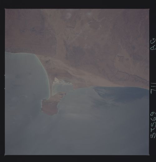
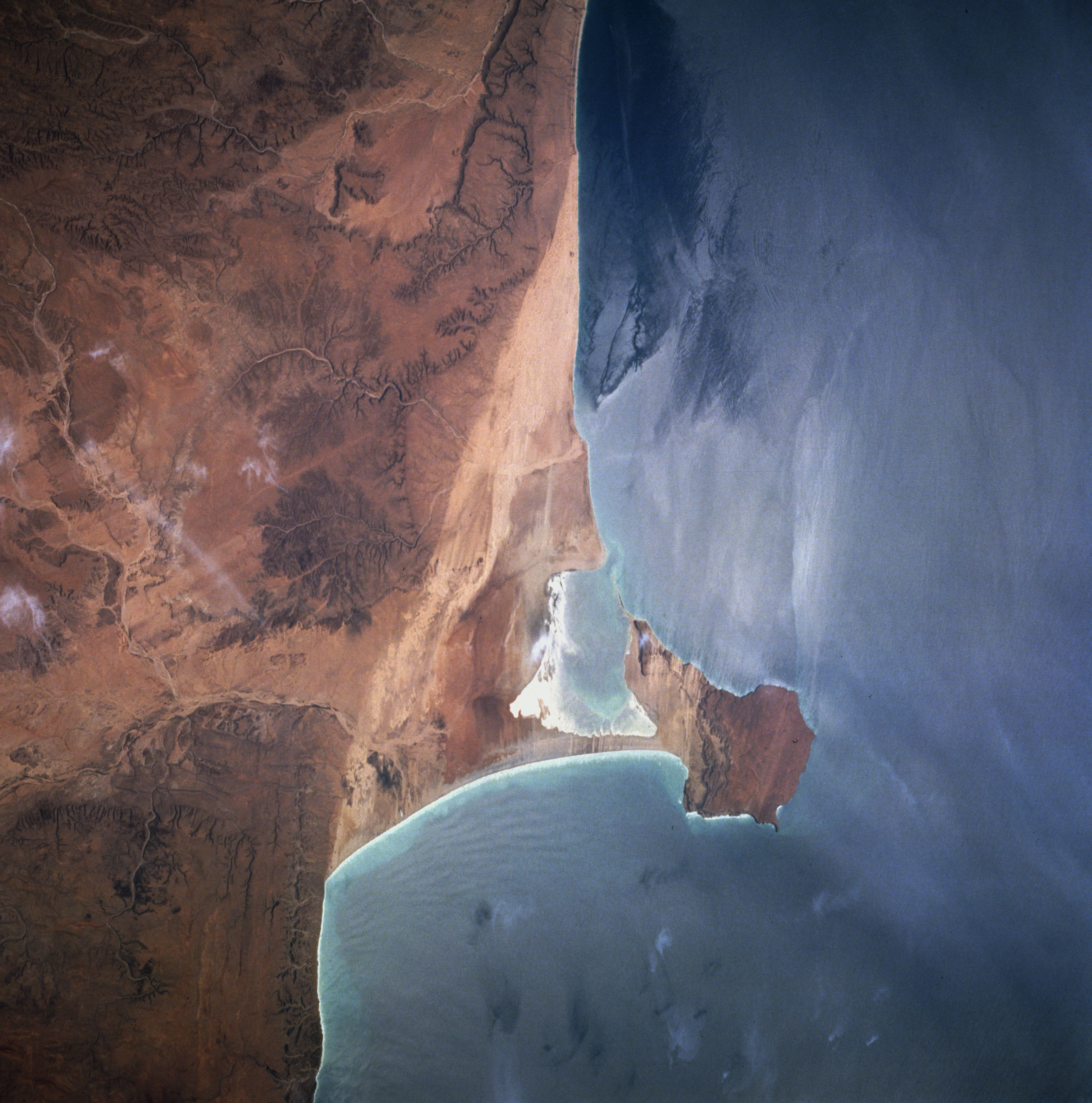
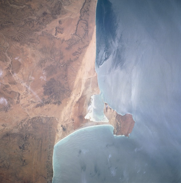
Image Caption: STS-069-711-0AG Hafun Peninsula, Northeast Somalia August 1995
The Hafun Peninsula along the northeast coast of Somalia is a tombolo -- a long, narrow accumulation of sand with one end attached to the mainland and the other end projecting to an offshore island or pillar of rocks. This part of Somalia is a hot desert with very little vegetation. Vivid drainage patterns are visible adjacent to the coastal sands. This natural color photograph and color infrared STS-049-087-035 may be compared--the color infrared photograph uses sunglint to show dynamic ocean patterns; however, this natural color picture also shows ocean dynamics as the warm, north-flowing current has produced an "island" wake effect on the north side of the peninsula. It is also interesting to compare the north-south-oriented lines of color change in the area immediately west of the tombolo, a change possibly resulting from the beach sands meeting a more resistant low escarpment that has different reflective properties.
The Hafun Peninsula along the northeast coast of Somalia is a tombolo -- a long, narrow accumulation of sand with one end attached to the mainland and the other end projecting to an offshore island or pillar of rocks. This part of Somalia is a hot desert with very little vegetation. Vivid drainage patterns are visible adjacent to the coastal sands. This natural color photograph and color infrared STS-049-087-035 may be compared--the color infrared photograph uses sunglint to show dynamic ocean patterns; however, this natural color picture also shows ocean dynamics as the warm, north-flowing current has produced an "island" wake effect on the north side of the peninsula. It is also interesting to compare the north-south-oriented lines of color change in the area immediately west of the tombolo, a change possibly resulting from the beach sands meeting a more resistant low escarpment that has different reflective properties.
