STS069-710-82

| NASA Photo ID | STS069-710-82 |
| Focal Length | 100mm |
| Date taken | 1995.09.08 |
| Time taken | 09:48:50 GMT |
Cloud masks available for this image:
Spacecraft nadir point: 16.3° N, 51.8° E
Photo center point: 16.5° N, 53.5° E
Photo center point by machine learning:
Photo center point: 16.5° N, 53.5° E
Photo center point by machine learning:
Nadir to Photo Center: East
Spacecraft Altitude: 200 nautical miles (370km)
Country or Geographic Name: | OMAN |
Features: | PLATEAU, VEGETATION |
| Features Found Using Machine Learning: | |
Cloud Cover Percentage: | 20 (11-25)% |
Sun Elevation Angle: | 68° |
Sun Azimuth: | 244° |
Camera: | Hasselblad |
Focal Length: | 100mm |
Camera Tilt: | 27 degrees |
Format: | 5046: Kodak, natural color positive, Lumiere 100/5046, ASA 100, standard base |
Film Exposure: | Normal |
| Additional Information | |
| Width | Height | Annotated | Cropped | Purpose | Links |
|---|---|---|---|---|---|
| 5700 pixels | 5900 pixels | No | No | Download Image | |
| 500 pixels | 518 pixels | No | No | Download Image | |
| 640 pixels | 480 pixels | No | No | Download Image |
Download Packaged File
Download a Google Earth KML for this Image
View photo footprint information
Download a GeoTIFF for this photo
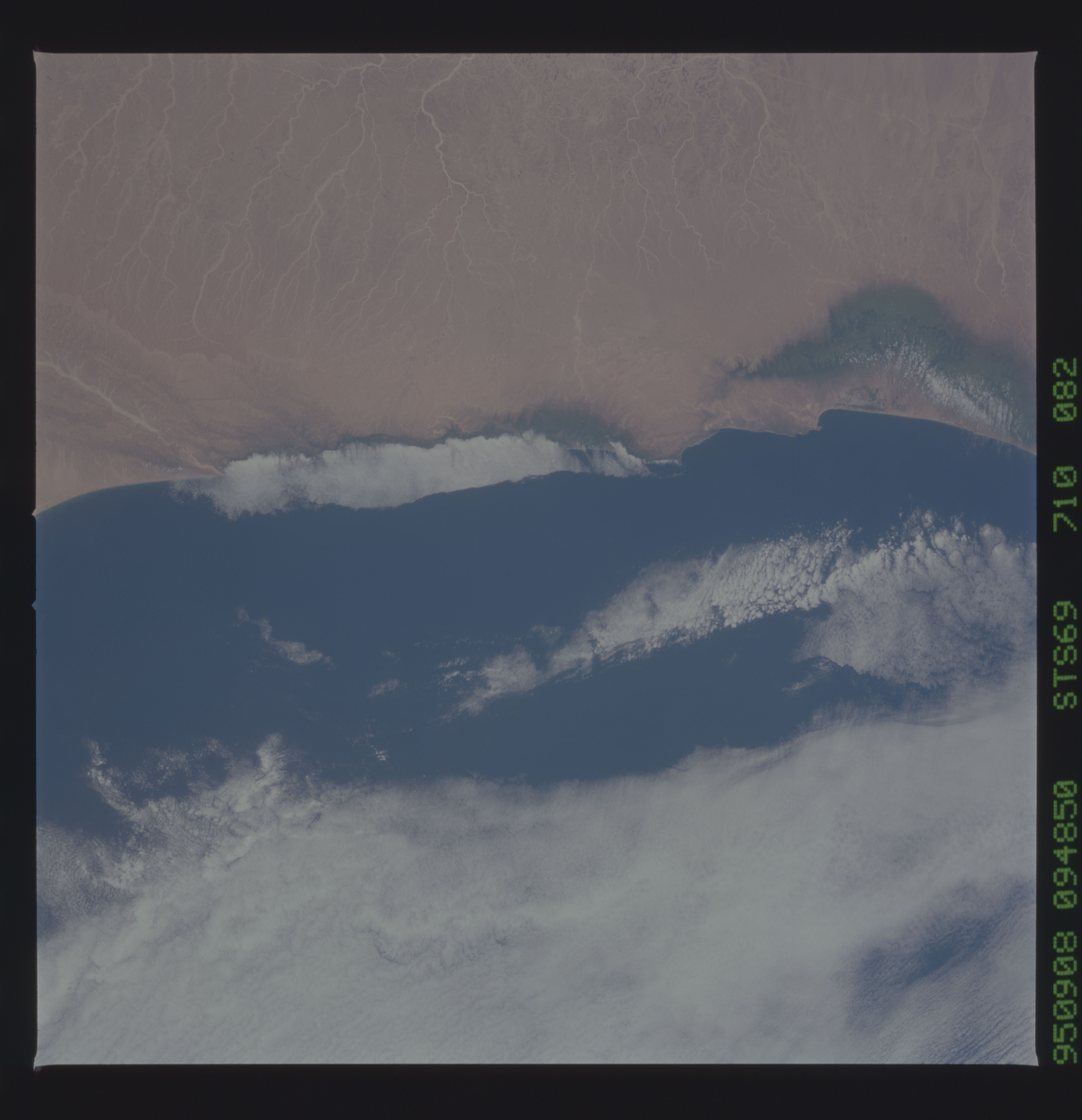
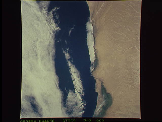
Image Caption: Coast of the People's Republic of Yemen, Arabian
Peninsula.
Now-dry watercourses head northward from the coastal range into the
Arabian Desert. Deep green vegetation surprises the eye in spots along
the coastal escarpment; vegetation thins out between 3500 and 4000
feet of elevation. The presence of coastal stratus in this photograph
suggests that the vegetation may be watered by fog and/or mist, rather
than rain.
