STS069-709-42

| NASA Photo ID | STS069-709-42 |
| Focal Length | 40mm |
| Date taken | 1995.09.09 |
| Time taken | 07:25:46 GMT |
Resolutions offered for this image:
5700 x 5900 pixels 500 x 518 pixels 640 x 480 pixels 2588 x 2570 pixels 2616 x 2582 pixels 909 x 1181 pixels 4800 x 4821 pixels 540 x 702 pixels
5700 x 5900 pixels 500 x 518 pixels 640 x 480 pixels 2588 x 2570 pixels 2616 x 2582 pixels 909 x 1181 pixels 4800 x 4821 pixels 540 x 702 pixels


Cloud masks available for this image:
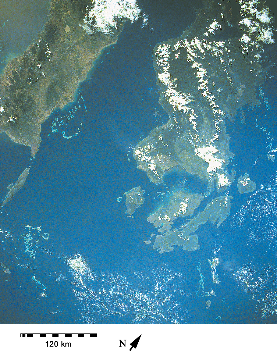
Spacecraft nadir point: 4.5° S, 120.9° E
Photo center point: 5.0° S, 121.0° E
Photo center point by machine learning:
Photo center point: 5.0° S, 121.0° E
Photo center point by machine learning:
Nadir to Photo Center: South
Spacecraft Altitude: 201 nautical miles (372km)
Country or Geographic Name: | INDONESIA-C |
Features: | ISLANDS, CORAL REEFS |
| Features Found Using Machine Learning: | |
Cloud Cover Percentage: | 10 (1-10)% |
Sun Elevation Angle: | 36° |
Sun Azimuth: | 280° |
Camera: | Hasselblad |
Focal Length: | 40mm |
Camera Tilt: | 9 degrees |
Format: | 5046: Kodak, natural color positive, Lumiere 100/5046, ASA 100, standard base |
Film Exposure: | Normal |
| Additional Information | |
| Width | Height | Annotated | Cropped | Purpose | Links |
|---|---|---|---|---|---|
| 5700 pixels | 5900 pixels | No | No | Download Image | |
| 500 pixels | 518 pixels | No | No | Download Image | |
| 640 pixels | 480 pixels | No | No | Download Image | |
| 2588 pixels | 2570 pixels | No | Yes | ReefBase 1 | Download Image |
| 2616 pixels | 2582 pixels | No | No | ReefBase 1 | Download Image |
| 909 pixels | 1181 pixels | Yes | Yes | Publisher Request | Download Image |
| 4800 pixels | 4821 pixels | No | No | Download Image | |
| 540 pixels | 702 pixels | Yes | Yes | Publisher Request | Download Image |
Download Packaged File
Download a Google Earth KML for this Image
View photo footprint information
Download a GeoTIFF for this photo
Image Caption: Celebes (Sulawesi), Indonesia. This SE-looking view shows the SE peninsula of the Celebes, with the island of Buton at the end.
