STS068-274-32

| NASA Photo ID | STS068-274-32 |
| Focal Length | 250mm |
| Date taken | 1994.10.03 |
| Time taken | 18:11:58 GMT |
Resolutions offered for this image:
4096 x 4096 pixels 790 x 785 pixels 3918 x 3955 pixels 634 x 640 pixels 5700 x 5900 pixels 4096 x 4096 pixels 500 x 518 pixels 640 x 480 pixels
4096 x 4096 pixels 790 x 785 pixels 3918 x 3955 pixels 634 x 640 pixels 5700 x 5900 pixels 4096 x 4096 pixels 500 x 518 pixels 640 x 480 pixels


Cloud masks available for this image:
Spacecraft nadir point: 43.2° N, 80.2° W
Photo center point: 43.0° N, 79.0° W
Photo center point by machine learning:
Photo center point: 43.0° N, 79.0° W
Photo center point by machine learning:
Nadir to Photo Center: East
Spacecraft Altitude: 117 nautical miles (217km)
Country or Geographic Name: | USA-NEW YORK |
Features: | NIAGARA FALLS, BUFFALO |
| Features Found Using Machine Learning: | |
Cloud Cover Percentage: | 0 (no clouds present) |
Sun Elevation Angle: | 41° |
Sun Azimuth: | 201° |
Camera: | Hasselblad |
Focal Length: | 250mm |
Camera Tilt: | Near Vertical |
Format: | 5046: Kodak, natural color positive, Lumiere 100/5046, ASA 100, standard base |
Film Exposure: | Normal |
| Additional Information | |
| Width | Height | Annotated | Cropped | Purpose | Links |
|---|---|---|---|---|---|
| 4096 pixels | 4096 pixels | Cities collection | Download Image | ||
| 790 pixels | 785 pixels | No | No | Cities collection | Download Image |
| 3918 pixels | 3955 pixels | No | No | Earth From Space collection | Download Image |
| 634 pixels | 640 pixels | No | No | Earth From Space collection | Download Image |
| 5700 pixels | 5900 pixels | No | No | Download Image | |
| 4096 pixels | 4096 pixels | No | No | Download Image | |
| 500 pixels | 518 pixels | No | No | Download Image | |
| 640 pixels | 480 pixels | No | No | Download Image |
Download Packaged File
Download a Google Earth KML for this Image
View photo footprint information
Download a GeoTIFF for this photo
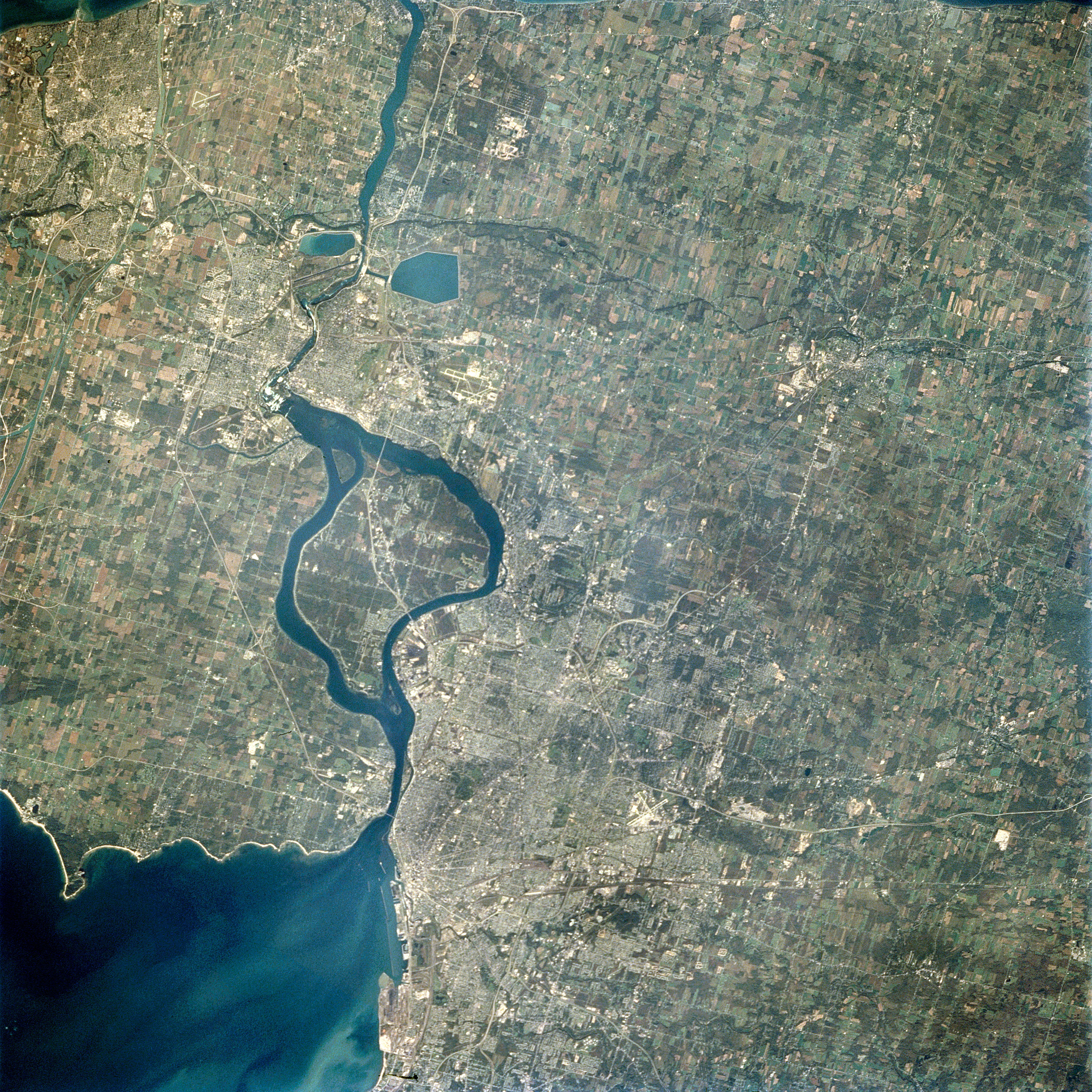
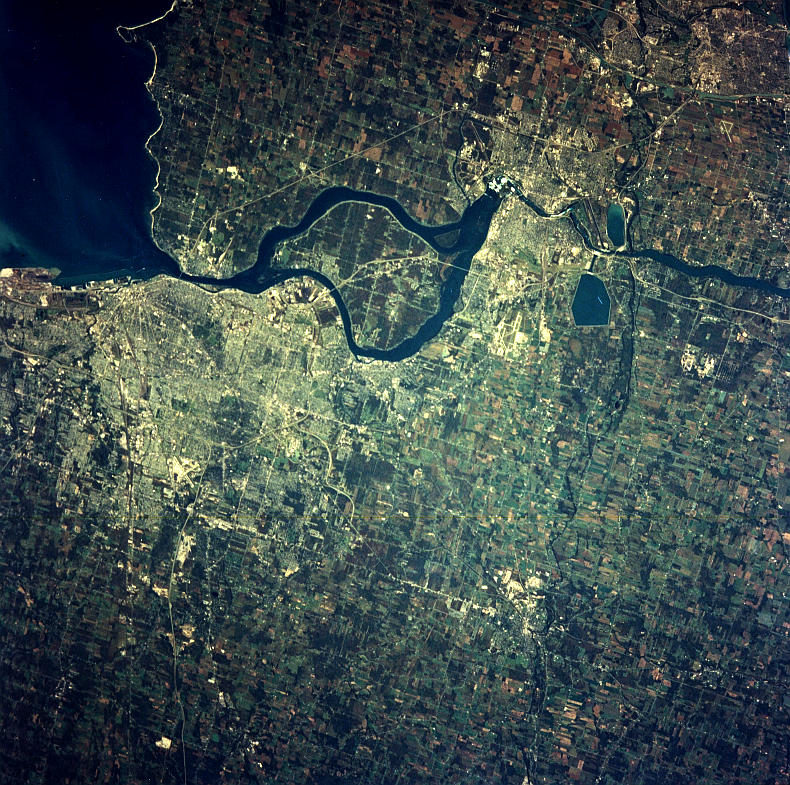
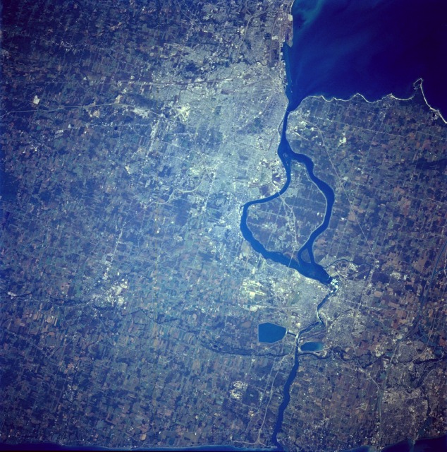
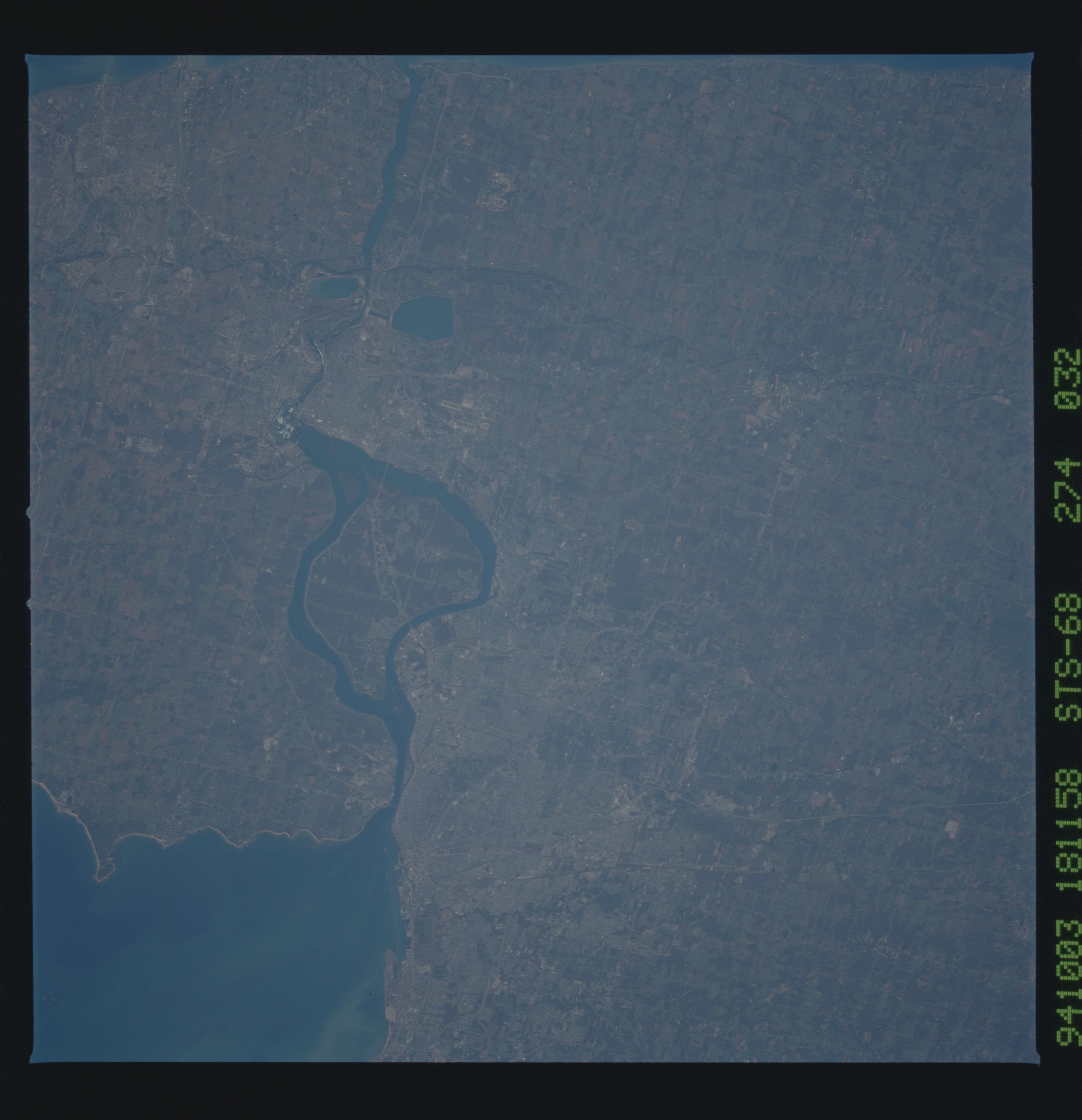
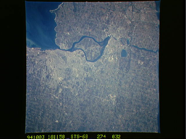
Image Caption: STS068-274-032 Niagara River, Canada and U.S.A. October 1994
The Niagara River forms part of the international boundary between the United States and Canada. Water exiting the eastern end of Lake Erie creates this north-flowing river, which eventually empties into the southwestern part of Lake Ontario (not shown in this photograph). The "white water" created by the waterflow over world-famous Niagara Falls is barely visible where the Niagara River narrows northwest of Grand Island, the large island that is completely encircled by the Niagara River on the U.S. side of the international border. Niagara Falls was formed approximately 10 000 years ago as the retreating glaciers of the last continental ice sheets exposed the Niagara escarpment, thus permitting the waters of Lake Erie to flow north, over the scarp, to Lake Ontario. The two cities adjacent to the Niagara Falls watercourse are Niagara Falls, New York (east of the river), and Niagara Falls, Ontario, Canada (west of the river). Each city has a population of more than 80 000. Two reservoirs are visible immediately north of these cities. The Welland Canal, approximately 7 miles (11 kilometers) west of the Niagara River, is part of the much larger Saint Lawrence Seaway that allows oceangoing vessels to travel between the Atlantic Ocean and the Great Lakes. This near-vertical photograph reveals much detail for Buffalo (south-central portion of the photograph), a major transshipment point for goods that are shipped by water through the Great Lakes. Some identifiable manmade features are major highways, street patterns, port facilities along Lake Erie, the Buffalo downtown district, and Greater Buffalo International Airport (east of downtown). Cultivated field patterns are visible on either side of the international border.
The Niagara River forms part of the international boundary between the United States and Canada. Water exiting the eastern end of Lake Erie creates this north-flowing river, which eventually empties into the southwestern part of Lake Ontario (not shown in this photograph). The "white water" created by the waterflow over world-famous Niagara Falls is barely visible where the Niagara River narrows northwest of Grand Island, the large island that is completely encircled by the Niagara River on the U.S. side of the international border. Niagara Falls was formed approximately 10 000 years ago as the retreating glaciers of the last continental ice sheets exposed the Niagara escarpment, thus permitting the waters of Lake Erie to flow north, over the scarp, to Lake Ontario. The two cities adjacent to the Niagara Falls watercourse are Niagara Falls, New York (east of the river), and Niagara Falls, Ontario, Canada (west of the river). Each city has a population of more than 80 000. Two reservoirs are visible immediately north of these cities. The Welland Canal, approximately 7 miles (11 kilometers) west of the Niagara River, is part of the much larger Saint Lawrence Seaway that allows oceangoing vessels to travel between the Atlantic Ocean and the Great Lakes. This near-vertical photograph reveals much detail for Buffalo (south-central portion of the photograph), a major transshipment point for goods that are shipped by water through the Great Lakes. Some identifiable manmade features are major highways, street patterns, port facilities along Lake Erie, the Buffalo downtown district, and Greater Buffalo International Airport (east of downtown). Cultivated field patterns are visible on either side of the international border.
