STS068-273-39
| NASA Photo ID | STS068-273-39 |
| Focal Length | 250mm |
| Date taken | 1994.10.03 |
| Time taken | 21:09:44 GMT |
Resolutions offered for this image:
3904 x 3904 pixels 639 x 639 pixels 5700 x 5900 pixels 500 x 518 pixels 640 x 480 pixels
3904 x 3904 pixels 639 x 639 pixels 5700 x 5900 pixels 500 x 518 pixels 640 x 480 pixels

Cloud masks available for this image:
Spacecraft nadir point: 42.8° N, 124.8° W
Photo center point: 42.0° N, 124.0° W
Photo center point by machine learning:
Photo center point: 42.0° N, 124.0° W
Photo center point by machine learning:
Nadir to Photo Center: Southeast
Spacecraft Altitude: 117 nautical miles (217km)
Country or Geographic Name: | USA-OREGON |
Features: | COAST NEAR CRESCENT CITY |
| Features Found Using Machine Learning: | |
Cloud Cover Percentage: | 0 (no clouds present) |
Sun Elevation Angle: | 41° |
Sun Azimuth: | 201° |
Camera: | Hasselblad |
Focal Length: | 250mm |
Camera Tilt: | 30 degrees |
Format: | 5046: Kodak, natural color positive, Lumiere 100/5046, ASA 100, standard base |
Film Exposure: | Normal |
| Additional Information | |
| Width | Height | Annotated | Cropped | Purpose | Links |
|---|---|---|---|---|---|
| 3904 pixels | 3904 pixels | No | No | Earth From Space collection | Download Image |
| 639 pixels | 639 pixels | No | No | Earth From Space collection | Download Image |
| 5700 pixels | 5900 pixels | No | No | Download Image | |
| 500 pixels | 518 pixels | No | No | Download Image | |
| 640 pixels | 480 pixels | No | No | Download Image |
Download Packaged File
Download a Google Earth KML for this Image
View photo footprint information
Download a GeoTIFF for this photo
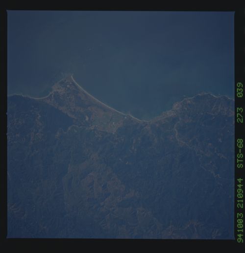
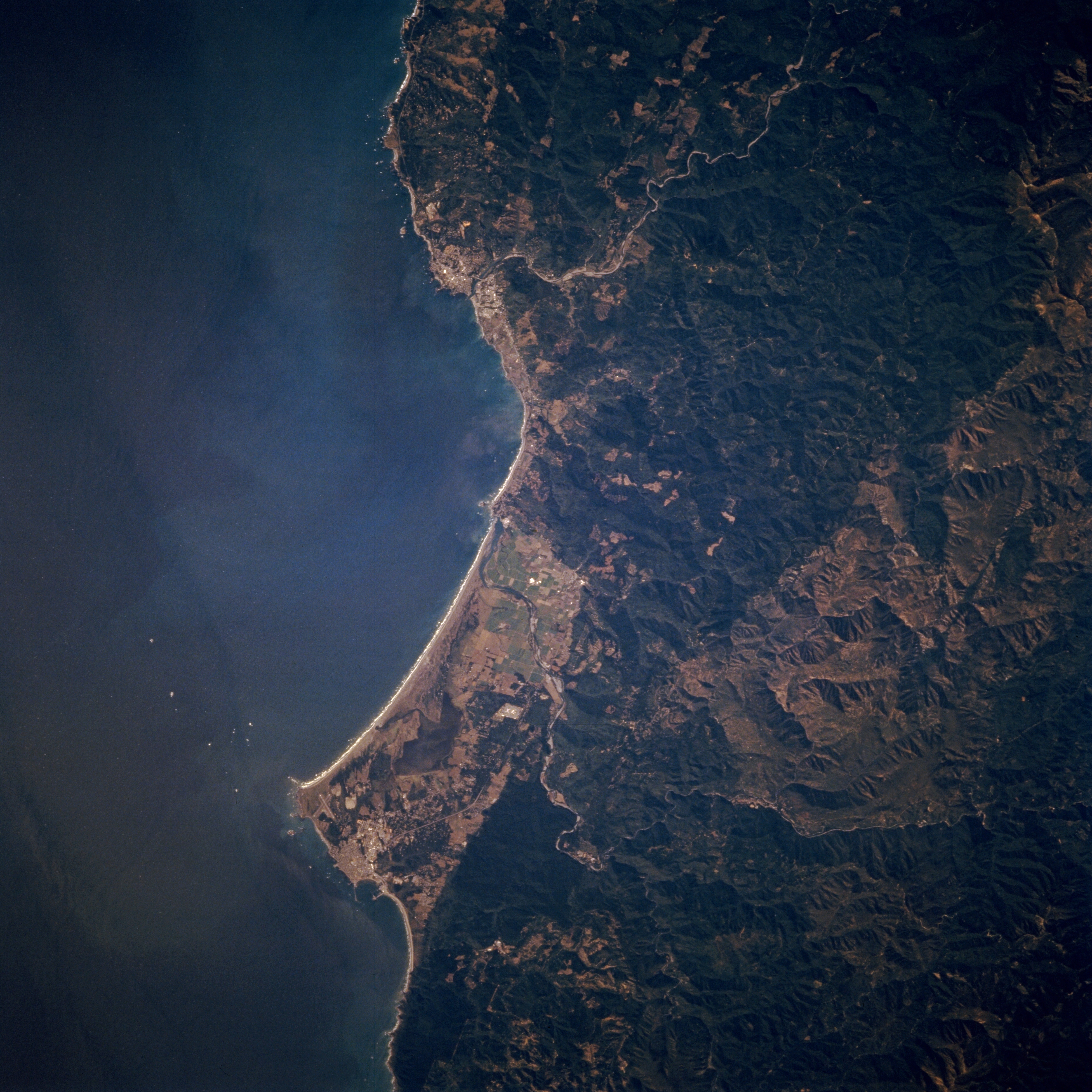
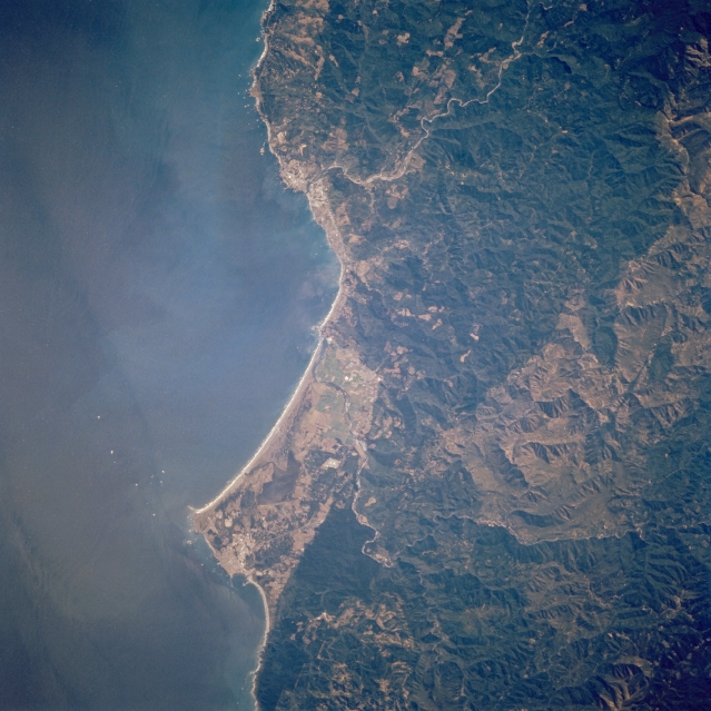
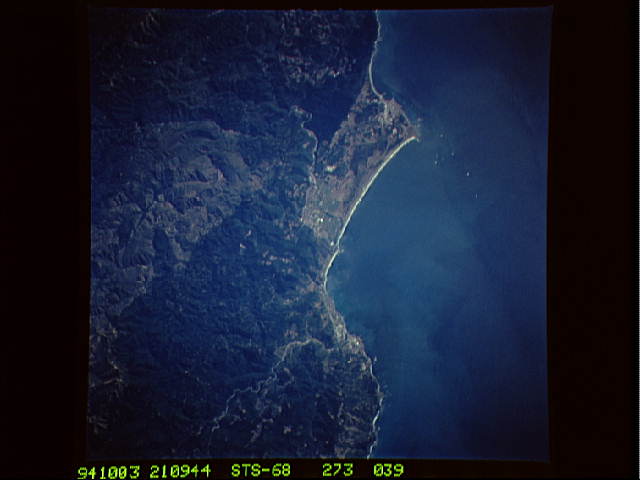
Image Caption: STS068-273-039 Crescent City and Smith River, California, U.S.A. October 1994
This near-vertical photograph shows the Smith River winding across a small coastal plain before emptying into the Pacific Ocean. Some clear-cutting is visible in the forested Klamath Mountains east of the Pacific Ocean. Along the coast and south of the Smith River mouth is Lake Earl. To the lake's south lie Point Saint George and to the southeast Crescent City. The green forested areas east and south of Crescent City are parts of Redwood National Park. The Chetco River winds its way southwestward to its mouth near Brookings, Oregon.
This near-vertical photograph shows the Smith River winding across a small coastal plain before emptying into the Pacific Ocean. Some clear-cutting is visible in the forested Klamath Mountains east of the Pacific Ocean. Along the coast and south of the Smith River mouth is Lake Earl. To the lake's south lie Point Saint George and to the southeast Crescent City. The green forested areas east and south of Crescent City are parts of Redwood National Park. The Chetco River winds its way southwestward to its mouth near Brookings, Oregon.
