STS068-264-53

| NASA Photo ID | STS068-264-53 |
| Focal Length | 100mm |
| Date taken | 1994.10.02 |
| Time taken | 21:28:41 GMT |
Resolutions offered for this image:
3904 x 3936 pixels 634 x 639 pixels 5700 x 5900 pixels 500 x 518 pixels 640 x 480 pixels
3904 x 3936 pixels 634 x 639 pixels 5700 x 5900 pixels 500 x 518 pixels 640 x 480 pixels

Cloud masks available for this image:
Spacecraft nadir point: 42.9° N, 124.0° W
Photo center point: 42.5° N, 123.0° W
Photo center point by machine learning:
Photo center point: 42.5° N, 123.0° W
Photo center point by machine learning:
Nadir to Photo Center: East
Spacecraft Altitude: 117 nautical miles (217km)
Country or Geographic Name: | USA-OREGON |
Features: | MEDFORD, UPPER KLAMATH L. |
| Features Found Using Machine Learning: | |
Cloud Cover Percentage: | 0 (no clouds present) |
Sun Elevation Angle: | 40° |
Sun Azimuth: | 208° |
Camera: | Hasselblad |
Focal Length: | 100mm |
Camera Tilt: | 29 degrees |
Format: | 5046: Kodak, natural color positive, Lumiere 100/5046, ASA 100, standard base |
Film Exposure: | Normal |
| Additional Information | |
| Width | Height | Annotated | Cropped | Purpose | Links |
|---|---|---|---|---|---|
| 3904 pixels | 3936 pixels | No | No | Earth From Space collection | Download Image |
| 634 pixels | 639 pixels | No | No | Earth From Space collection | Download Image |
| 5700 pixels | 5900 pixels | No | No | Download Image | |
| 500 pixels | 518 pixels | No | No | Download Image | |
| 640 pixels | 480 pixels | No | No | Download Image |
Download Packaged File
Download a Google Earth KML for this Image
View photo footprint information
Download a GeoTIFF for this photo
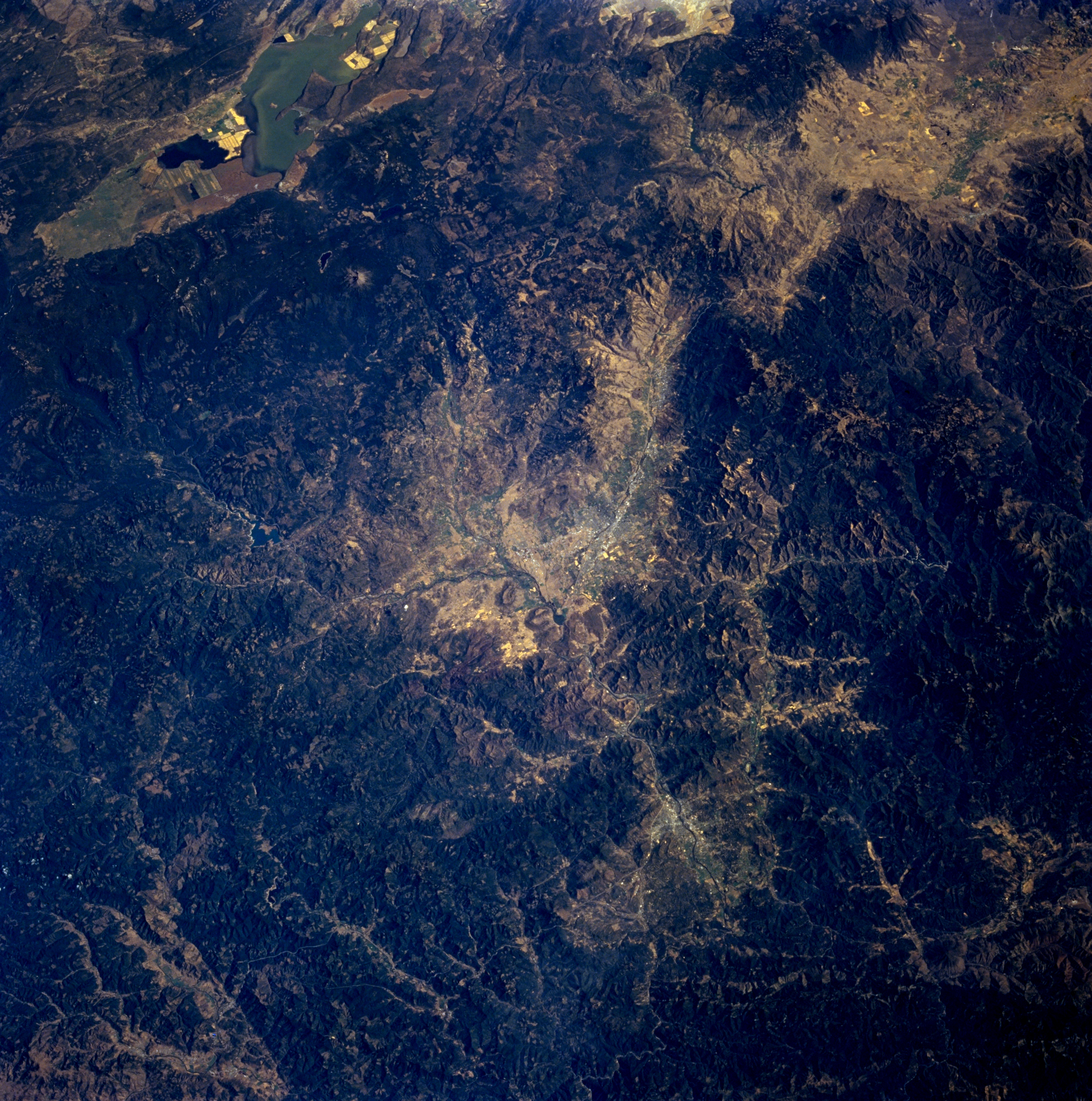
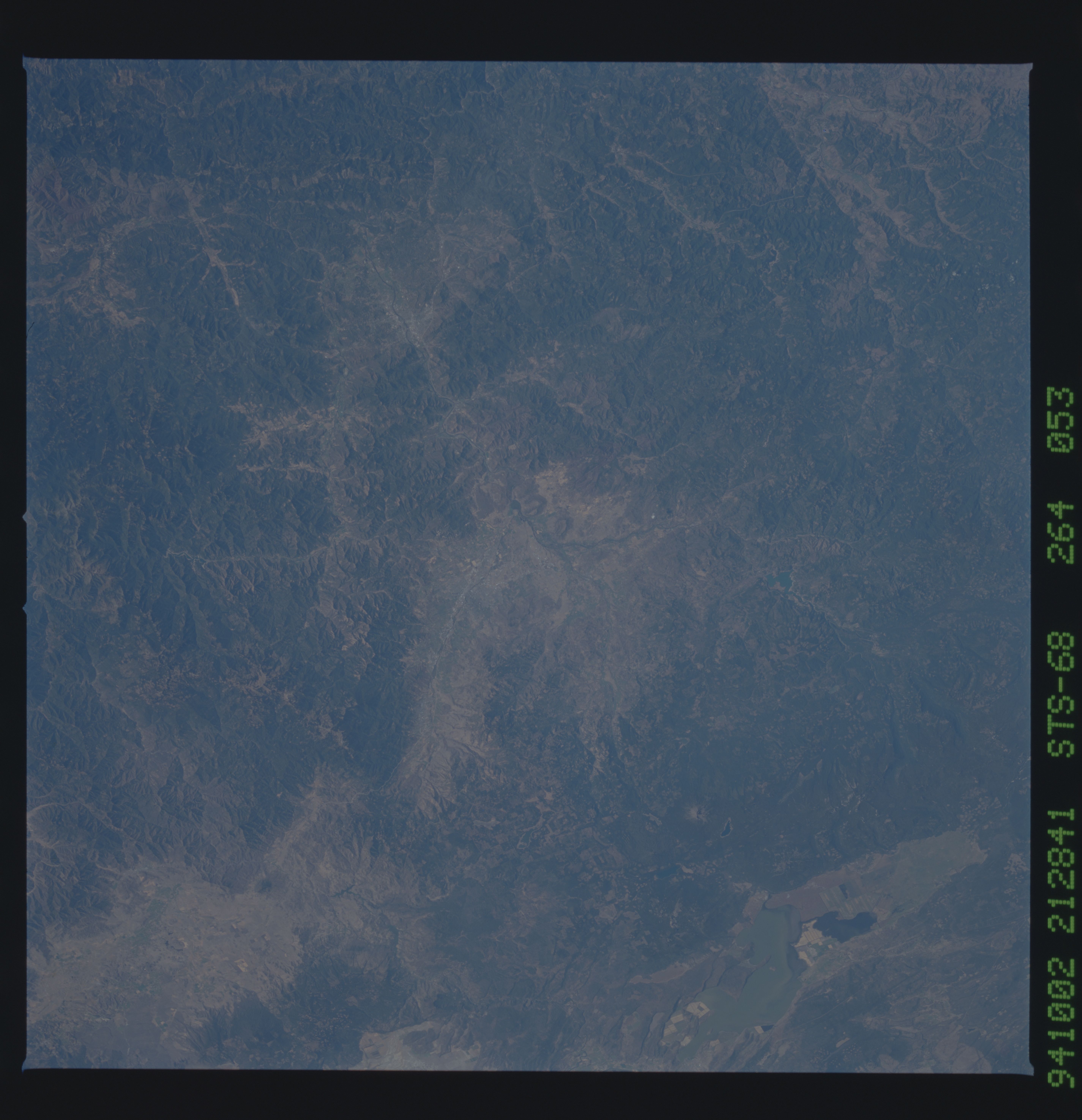
Image Caption: STS068-264-053 Medford and Grants Pass, Oregon, U.S.A. October 1994
Medford, a tourism, trade, shipping, and medical center in southwest Oregon, is visible at the center of this low-oblique, east-southeast-looking photograph. The city, the headquarters for Crater Lake National Park and the Rogue River National Forest, also has fruit-packing plants and lumber mills. Between 1836 and 1856, the area was the scene of numerous bloody conflicts between white settlers and the Rogue River Indians. Grants Pass, 25 miles (40 kilometers) west of Medford on the Rogue River in the heavily forested Klamath Mountains, has important lumber and agricultural enterprises. The area produces fruits, nuts, vegetables, and dairy products and is the commercial center of a large region that produces flower bulbs (especially gladioli). Other commercial interests include salmon fishing and mining. Upper Klamath Lake is visible near the upper left of the photograph, west of which is relatively young Mount McLoughlin Volcano.
Medford, a tourism, trade, shipping, and medical center in southwest Oregon, is visible at the center of this low-oblique, east-southeast-looking photograph. The city, the headquarters for Crater Lake National Park and the Rogue River National Forest, also has fruit-packing plants and lumber mills. Between 1836 and 1856, the area was the scene of numerous bloody conflicts between white settlers and the Rogue River Indians. Grants Pass, 25 miles (40 kilometers) west of Medford on the Rogue River in the heavily forested Klamath Mountains, has important lumber and agricultural enterprises. The area produces fruits, nuts, vegetables, and dairy products and is the commercial center of a large region that produces flower bulbs (especially gladioli). Other commercial interests include salmon fishing and mining. Upper Klamath Lake is visible near the upper left of the photograph, west of which is relatively young Mount McLoughlin Volcano.
