STS068-262-33
| NASA Photo ID | STS068-262-33 |
| Focal Length | 250mm |
| Date taken | 1994.10.02 |
| Time taken | 21:29:10 GMT |
Resolutions offered for this image:
3872 x 3840 pixels 639 x 634 pixels 5700 x 5900 pixels 500 x 518 pixels 640 x 480 pixels
3872 x 3840 pixels 639 x 634 pixels 5700 x 5900 pixels 500 x 518 pixels 640 x 480 pixels


Cloud masks available for this image:
Spacecraft nadir point: 41.6° N, 122.1° W
Photo center point: 43.5° N, 121.5° W
Photo center point by machine learning:
Photo center point: 43.5° N, 121.5° W
Photo center point by machine learning:
Nadir to Photo Center: North
Spacecraft Altitude: 117 nautical miles (217km)
Country or Geographic Name: | USA-OREGON |
Features: | MTS., LAKES, RESERVOIRS |
| Features Found Using Machine Learning: | |
Cloud Cover Percentage: | 0 (no clouds present) |
Sun Elevation Angle: | 40° |
Sun Azimuth: | 211° |
Camera: | Hasselblad |
Focal Length: | 250mm |
Camera Tilt: | 46 degrees |
Format: | 5046: Kodak, natural color positive, Lumiere 100/5046, ASA 100, standard base |
Film Exposure: | Normal |
| Additional Information | |
| Width | Height | Annotated | Cropped | Purpose | Links |
|---|---|---|---|---|---|
| 3872 pixels | 3840 pixels | No | No | Earth From Space collection | Download Image |
| 639 pixels | 634 pixels | No | No | Earth From Space collection | Download Image |
| 5700 pixels | 5900 pixels | No | No | Download Image | |
| 500 pixels | 518 pixels | No | No | Download Image | |
| 640 pixels | 480 pixels | No | No | Download Image |
Download Packaged File
Download a Google Earth KML for this Image
View photo footprint information
Download a GeoTIFF for this photo
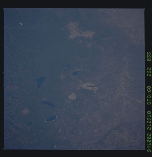
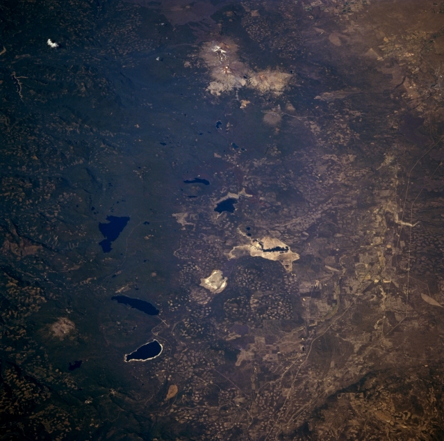
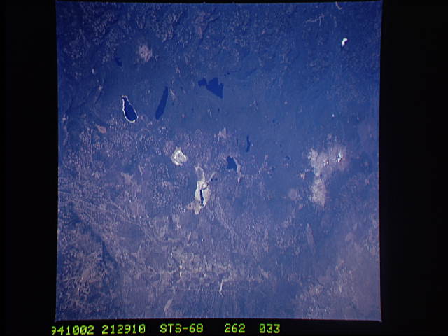
Image Caption: STS068-262-033 Central Oregon Cascades and Three Sisters Peaks, Oregon, U.S.A. October 1994
Visible in this low-oblique, north-looking photograph are the snowcapped peaks of the Three Sisters Volcanoes--North Sister, the oldest of the three, a stratovolcano 5 miles (8 kilometers) wide; Center Sister; and South Sister, the youngest and highest at 10 358 feet (3158 meters). The last major eruption of South Sister occurred nearly 1900 years ago. Mount Bachelor, a famous skiing attraction south of South Sister, is a monogentic volcano 9060 feet (2764 meters) high. Numerous lakes are apparent north to south--Lake Cultus, Crane Prairie Lake, Waldo Lake, Wickiup Reservoir, Davis Lake, Odell Lake, and Crescent Lake. West of Odell Lake and Crescent Lake is Diamond Peak, a shield volcano probably less than a 100 000 years old and the dominant landform in this region. Heavily forested Willamette National Forest and the clear-cutting patterns of lumber companies east of the lakes in the Deschutes National Forest are discernible.
Visible in this low-oblique, north-looking photograph are the snowcapped peaks of the Three Sisters Volcanoes--North Sister, the oldest of the three, a stratovolcano 5 miles (8 kilometers) wide; Center Sister; and South Sister, the youngest and highest at 10 358 feet (3158 meters). The last major eruption of South Sister occurred nearly 1900 years ago. Mount Bachelor, a famous skiing attraction south of South Sister, is a monogentic volcano 9060 feet (2764 meters) high. Numerous lakes are apparent north to south--Lake Cultus, Crane Prairie Lake, Waldo Lake, Wickiup Reservoir, Davis Lake, Odell Lake, and Crescent Lake. West of Odell Lake and Crescent Lake is Diamond Peak, a shield volcano probably less than a 100 000 years old and the dominant landform in this region. Heavily forested Willamette National Forest and the clear-cutting patterns of lumber companies east of the lakes in the Deschutes National Forest are discernible.
