STS068-262-32
| NASA Photo ID | STS068-262-32 |
| Focal Length | 250mm |
| Date taken | 1994.10.02 |
| Time taken | 21:29:06 GMT |
Resolutions offered for this image:
3808 x 3872 pixels 629 x 639 pixels 5700 x 5900 pixels 500 x 518 pixels 640 x 480 pixels
3808 x 3872 pixels 629 x 639 pixels 5700 x 5900 pixels 500 x 518 pixels 640 x 480 pixels

Cloud masks available for this image:
Spacecraft nadir point: 41.7° N, 122.3° W
Photo center point: 45.0° N, 121.5° W
Photo center point by machine learning:
Photo center point: 45.0° N, 121.5° W
Photo center point by machine learning:
Nadir to Photo Center: North
Spacecraft Altitude: 117 nautical miles (217km)
Country or Geographic Name: | USA-OREGON |
Features: | MT. JEFFERSON, MT. HOOD |
| Features Found Using Machine Learning: | |
Cloud Cover Percentage: | 5 (1-10)% |
Sun Elevation Angle: | 40° |
Sun Azimuth: | 210° |
Camera: | Hasselblad |
Focal Length: | 250mm |
Camera Tilt: | Low Oblique |
Format: | 5046: Kodak, natural color positive, Lumiere 100/5046, ASA 100, standard base |
Film Exposure: | Normal |
| Additional Information | |
| Width | Height | Annotated | Cropped | Purpose | Links |
|---|---|---|---|---|---|
| 3808 pixels | 3872 pixels | No | No | Earth From Space collection | Download Image |
| 629 pixels | 639 pixels | No | No | Earth From Space collection | Download Image |
| 5700 pixels | 5900 pixels | No | No | Download Image | |
| 500 pixels | 518 pixels | No | No | Download Image | |
| 640 pixels | 480 pixels | No | No | Download Image |
Download Packaged File
Download a Google Earth KML for this Image
View photo footprint information
Download a GeoTIFF for this photo
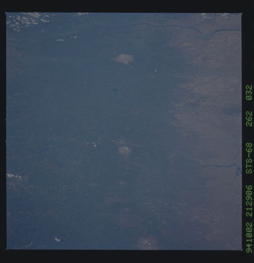
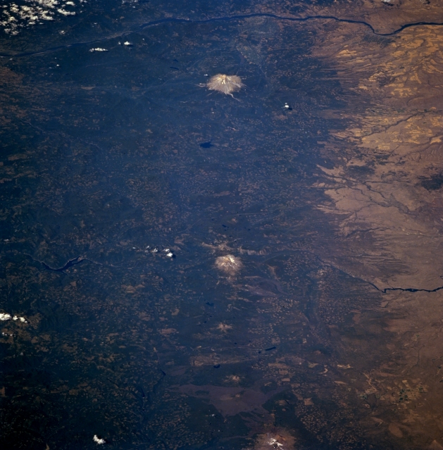
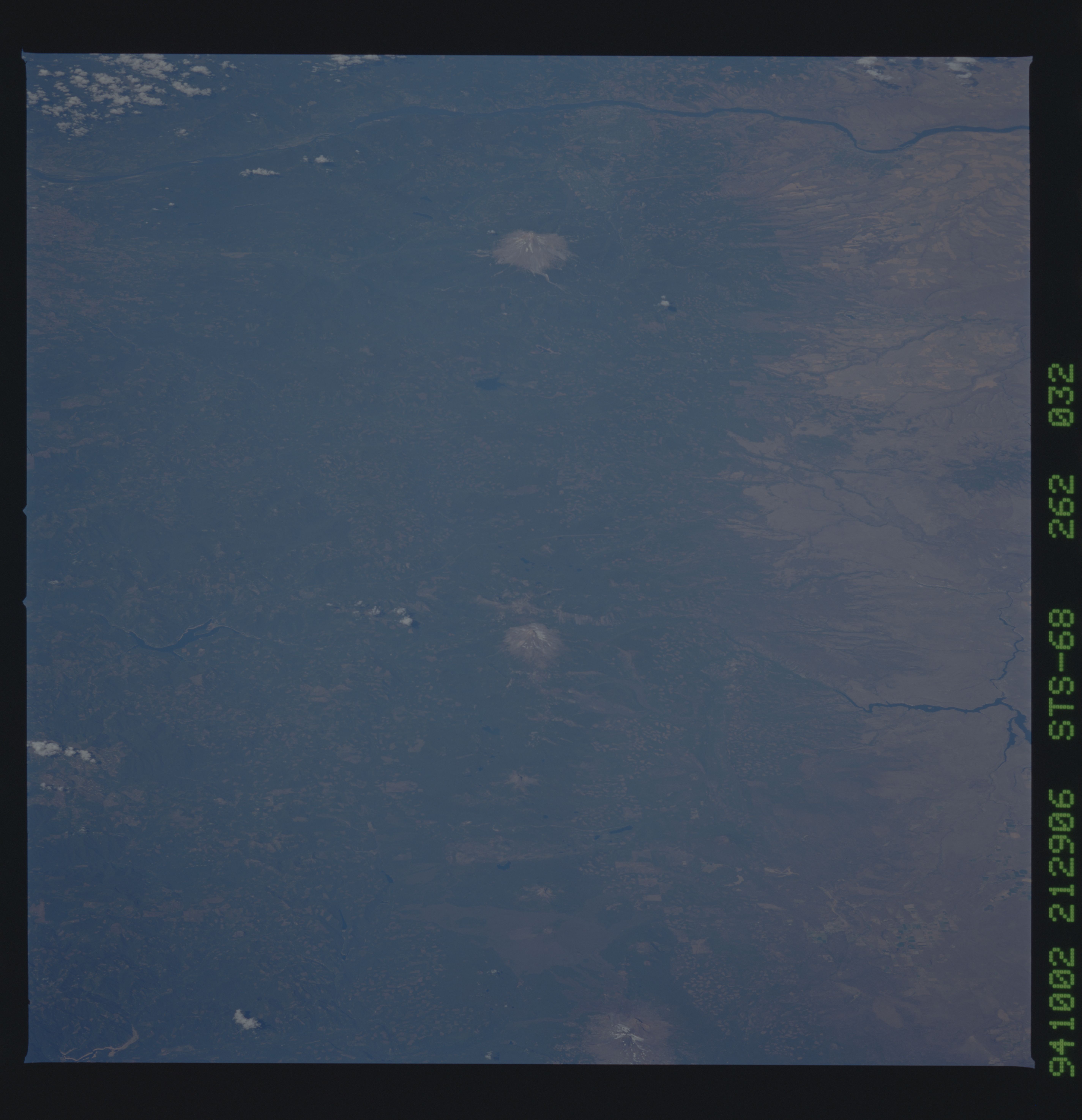
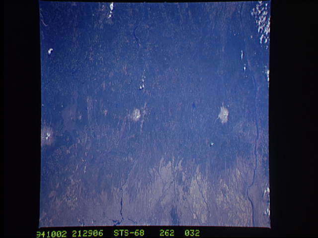
Image Caption: STS068-262-032 Cascade Range, Oregon, U.S.A. October 1994
This spectacular low-oblique, north-looking photograph features the Cascade Range of northern Oregon from North Sister Volcano at the bottom center to Mount Hood at the top center. Along the top portion of the photograph, the Columbia River is visible traversing east to west through the gorge it has cut. The Pacific Ocean shoreline was formed along the western edge of the mountain range, which began forming approximately 65 million years ago as rising magma boiled to the surface and built layer upon layer. Roughly 17 million years ago, the Cascade volcanoes became increasingly active, opening numerous fissures and pouring out lava. Approximately 2 million years later, dozens of the volcanoes erupted simultaneously, building the mountains in the Cascade Range to their present heights. Stratovolcanoes like Mount Hood, Mount Jefferson (the snow-covered peak near the center of the image), and North Sister are visible with less discernible shield volcanoes like Mount Washington and Three Fingered Jack located between North Sister and Mount Jefferson. Lava flows north of North Sister, mostly from Belknap Crater, a new, inactive, shield volcano, encompass areas around McKenzie Pass. Discernible east of Mount Jefferson (center right) are the Metolius River and Lake Chinook and west (left center) are the North Santiam River and Detroit Reservoir.
This spectacular low-oblique, north-looking photograph features the Cascade Range of northern Oregon from North Sister Volcano at the bottom center to Mount Hood at the top center. Along the top portion of the photograph, the Columbia River is visible traversing east to west through the gorge it has cut. The Pacific Ocean shoreline was formed along the western edge of the mountain range, which began forming approximately 65 million years ago as rising magma boiled to the surface and built layer upon layer. Roughly 17 million years ago, the Cascade volcanoes became increasingly active, opening numerous fissures and pouring out lava. Approximately 2 million years later, dozens of the volcanoes erupted simultaneously, building the mountains in the Cascade Range to their present heights. Stratovolcanoes like Mount Hood, Mount Jefferson (the snow-covered peak near the center of the image), and North Sister are visible with less discernible shield volcanoes like Mount Washington and Three Fingered Jack located between North Sister and Mount Jefferson. Lava flows north of North Sister, mostly from Belknap Crater, a new, inactive, shield volcano, encompass areas around McKenzie Pass. Discernible east of Mount Jefferson (center right) are the Metolius River and Lake Chinook and west (left center) are the North Santiam River and Detroit Reservoir.
