STS068-262-25
| NASA Photo ID | STS068-262-25 |
| Focal Length | 250mm |
| Date taken | 1994.10.02 |
| Time taken | 21:28:23 GMT |
Resolutions offered for this image:
3904 x 3904 pixels 639 x 639 pixels 5700 x 5900 pixels 500 x 518 pixels 640 x 480 pixels
3904 x 3904 pixels 639 x 639 pixels 5700 x 5900 pixels 500 x 518 pixels 640 x 480 pixels
Cloud masks available for this image:
Spacecraft nadir point: 43.7° N, 125.1° W
Photo center point: 46.0° N, 122.5° W
Photo center point by machine learning:
Photo center point: 46.0° N, 122.5° W
Photo center point by machine learning:
Nadir to Photo Center: Northeast
Spacecraft Altitude: 117 nautical miles (217km)
Country or Geographic Name: | USA-WASHINGTON |
Features: | COLUMBIA R., KELSO |
| Features Found Using Machine Learning: | |
Cloud Cover Percentage: | 10 (1-10)% |
Sun Elevation Angle: | 40° |
Sun Azimuth: | 206° |
Camera: | Hasselblad |
Focal Length: | 250mm |
Camera Tilt: | Low Oblique |
Format: | 5046: Kodak, natural color positive, Lumiere 100/5046, ASA 100, standard base |
Film Exposure: | Normal |
| Additional Information | |
| Width | Height | Annotated | Cropped | Purpose | Links |
|---|---|---|---|---|---|
| 3904 pixels | 3904 pixels | No | No | Earth From Space collection | Download Image |
| 639 pixels | 639 pixels | No | No | Earth From Space collection | Download Image |
| 5700 pixels | 5900 pixels | No | No | Download Image | |
| 500 pixels | 518 pixels | No | No | Download Image | |
| 640 pixels | 480 pixels | No | No | Download Image |
Download Packaged File
Download a Google Earth KML for this Image
View photo footprint information
Download a GeoTIFF for this photo
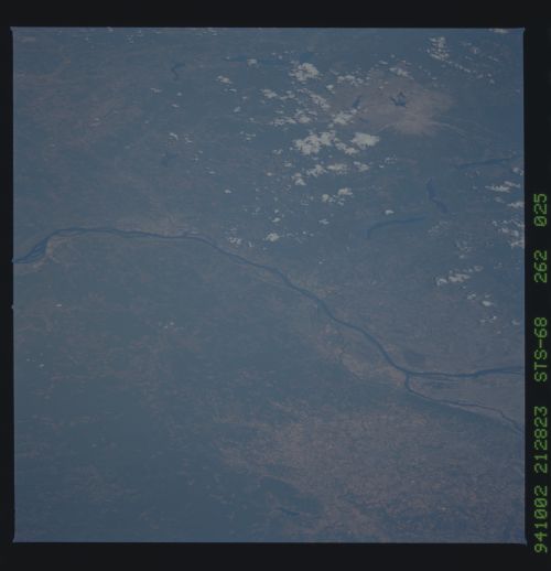
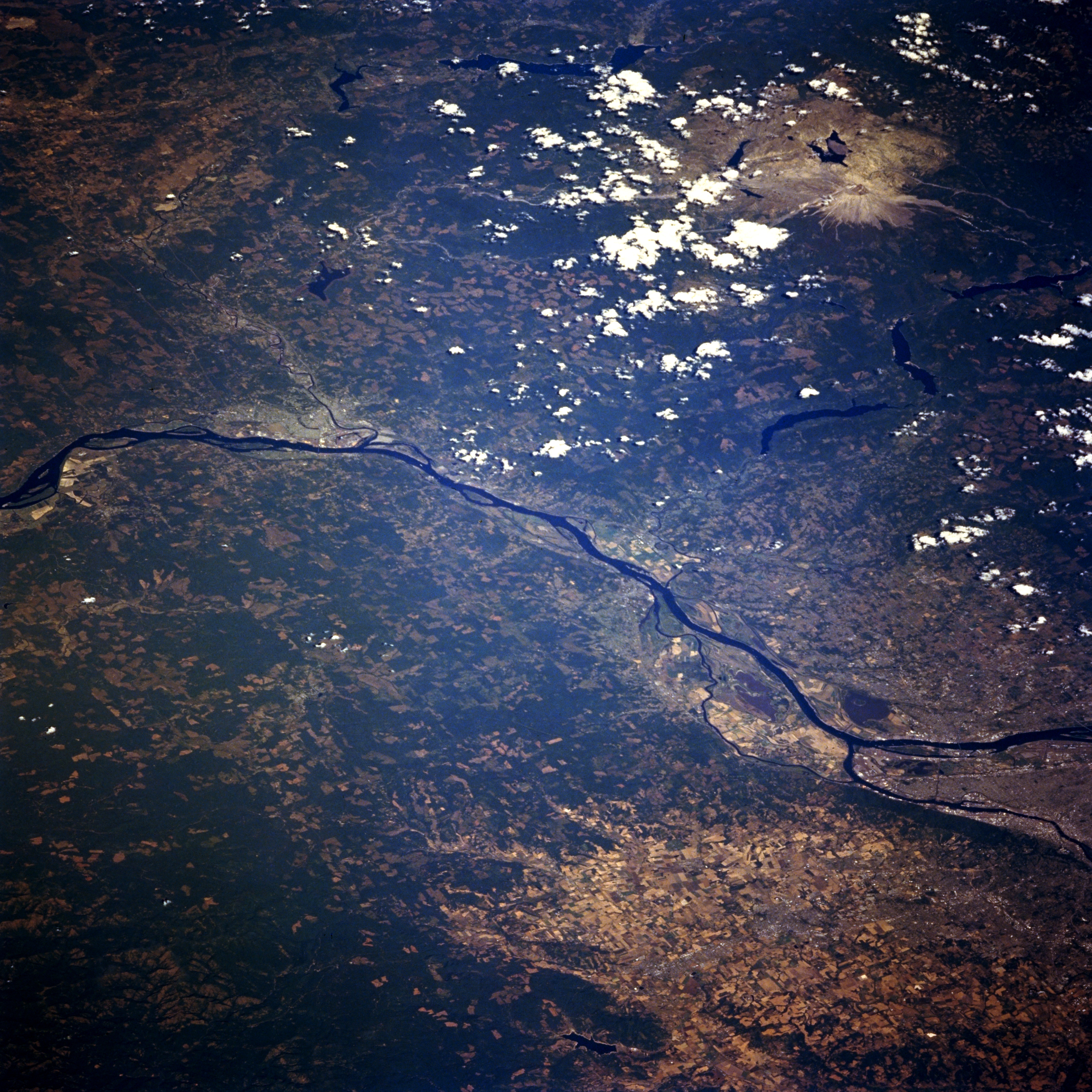
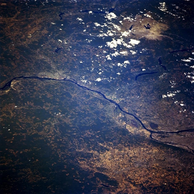
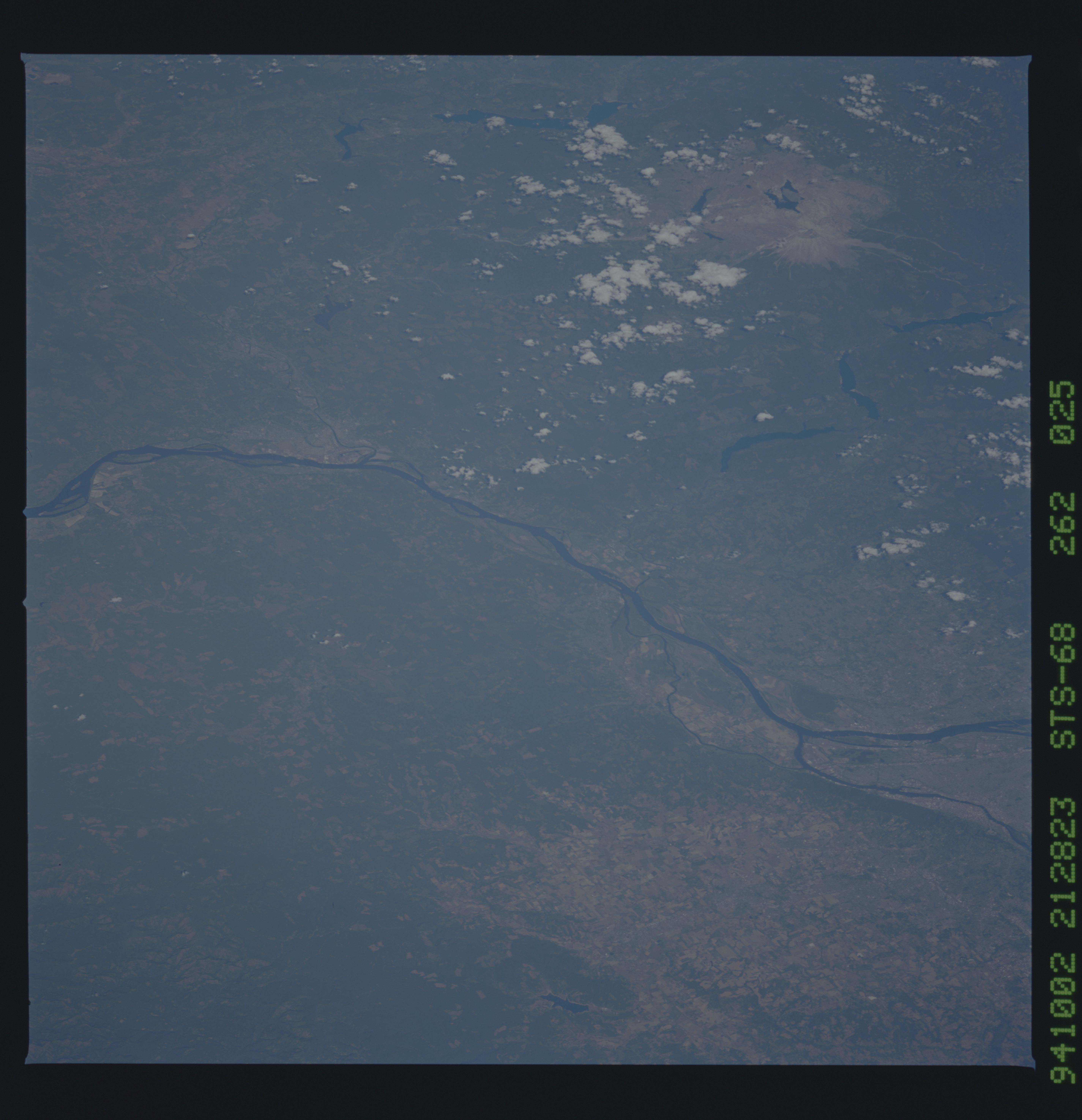
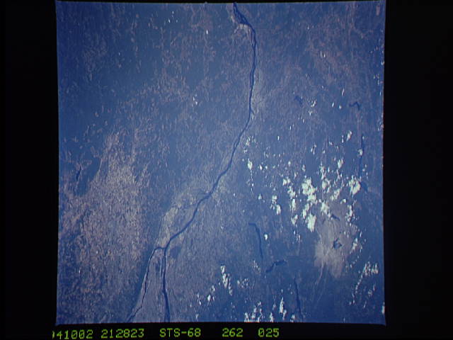
Image Caption: STS068-262-025 Columbia River, Oregon and Washington, U.S.A. October 1994
This north-northeast-looking, low-oblique photograph features the Columbia River crossing from Astoria (near the left center) to Portland, Oregon (just below the right center). After passing through the gorge, the Columbia River from Portland to its mouth can accommodate ocean-going vessels. West of Portland, numerous agricultural field patterns are visible. Mount Saint Helens Volcano and its blast zone from the May 1980 eruption appear light gray near the top right of the photograph. Longview and Kelso, Washington, are discernible near the left center of the photograph. The Coast Range is apparent at the left edge.
This north-northeast-looking, low-oblique photograph features the Columbia River crossing from Astoria (near the left center) to Portland, Oregon (just below the right center). After passing through the gorge, the Columbia River from Portland to its mouth can accommodate ocean-going vessels. West of Portland, numerous agricultural field patterns are visible. Mount Saint Helens Volcano and its blast zone from the May 1980 eruption appear light gray near the top right of the photograph. Longview and Kelso, Washington, are discernible near the left center of the photograph. The Coast Range is apparent at the left edge.
