STS068-262-2
| NASA Photo ID | STS068-262-2 |
| Focal Length | 250mm |
| Date taken | 1994.10.02 |
| Time taken | 20:02:13 GMT |
Resolutions offered for this image:
3904 x 3904 pixels 639 x 639 pixels 5700 x 5900 pixels 500 x 518 pixels 640 x 480 pixels
3904 x 3904 pixels 639 x 639 pixels 5700 x 5900 pixels 500 x 518 pixels 640 x 480 pixels
Cloud masks available for this image:
Spacecraft nadir point: 36.1° N, 93.2° W
Photo center point: 35.5° N, 94.5° W
Photo center point by machine learning:
Photo center point: 35.5° N, 94.5° W
Photo center point by machine learning:
Nadir to Photo Center: West
Spacecraft Altitude: 118 nautical miles (219km)
Country or Geographic Name: | USA-ARKANSAS |
Features: | FORT SMITH, ARKANSAS R. |
| Features Found Using Machine Learning: | |
Cloud Cover Percentage: | 10 (1-10)% |
Sun Elevation Angle: | 41° |
Sun Azimuth: | 222° |
Camera: | Hasselblad |
Focal Length: | 250mm |
Camera Tilt: | 36 degrees |
Format: | 5046: Kodak, natural color positive, Lumiere 100/5046, ASA 100, standard base |
Film Exposure: | Normal |
| Additional Information | |
| Width | Height | Annotated | Cropped | Purpose | Links |
|---|---|---|---|---|---|
| 3904 pixels | 3904 pixels | No | No | Earth From Space collection | Download Image |
| 639 pixels | 639 pixels | No | No | Earth From Space collection | Download Image |
| 5700 pixels | 5900 pixels | No | No | Download Image | |
| 500 pixels | 518 pixels | No | No | Download Image | |
| 640 pixels | 480 pixels | No | No | Download Image |
Download Packaged File
Download a Google Earth KML for this Image
View photo footprint information
Download a GeoTIFF for this photo
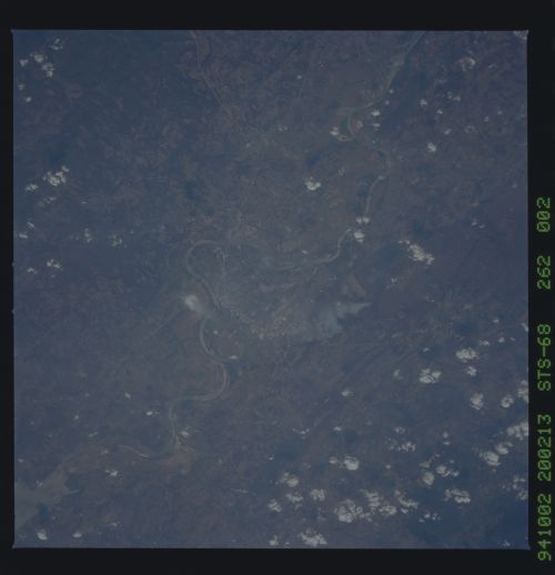
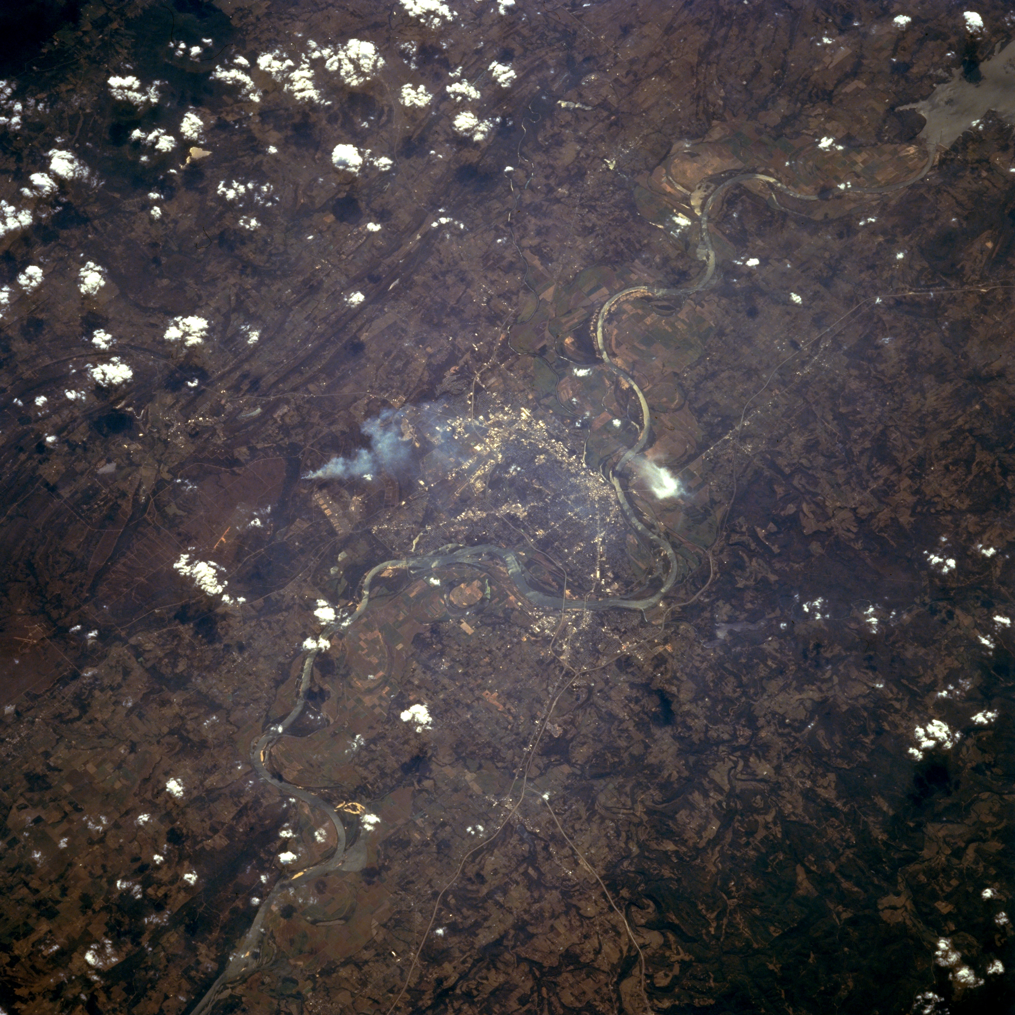
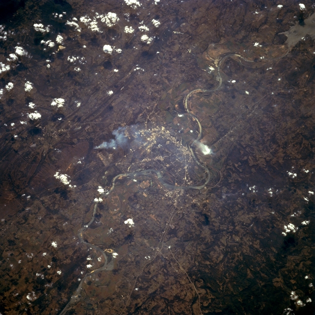
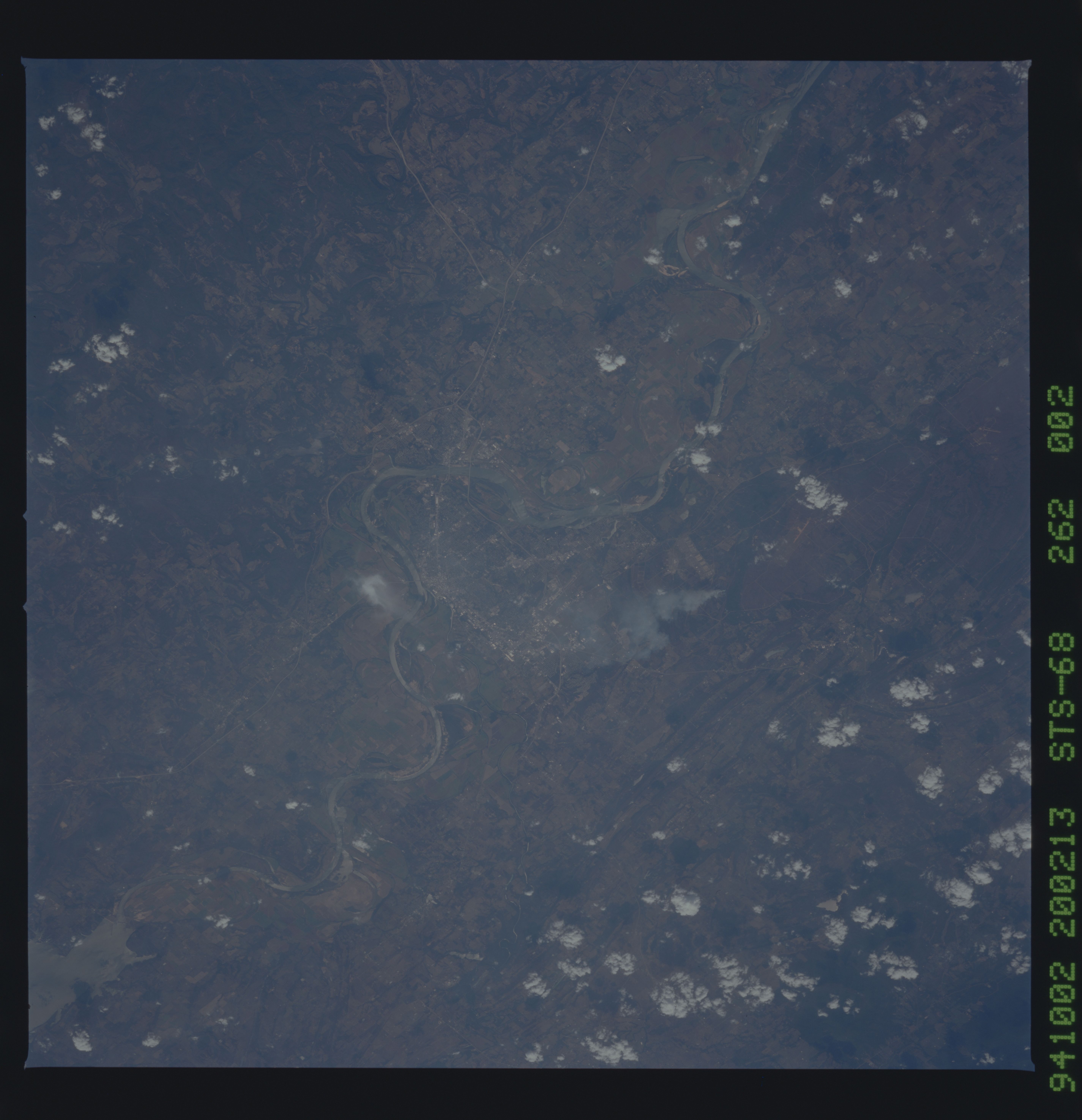
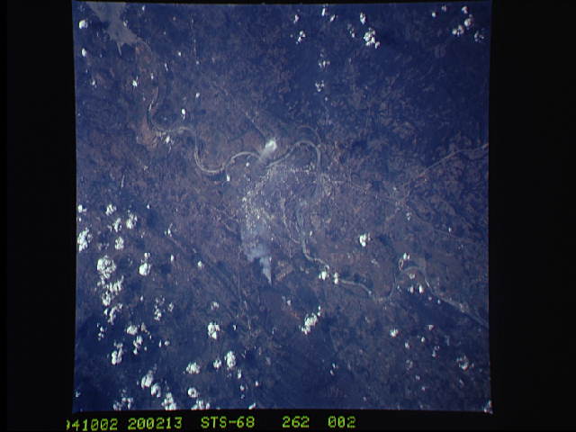
Image Caption: STS068-262-002 Fort Smith, Arkansas, U.S.A. October 1994
Apparent in this photograph are some haze and a single white smoke plume (left of center) that obscure some detail of historic Van Buren and Fort Smith, which are separated by the main channel of the winding Arkansas River. The commercial areas within these cities can be determined by the concentration of highly reflective surfaces. Visible are a segment of Interstate Highway 40 that passes Fort Smith on the north side of the Arkansas River and the eastern extent of Robert S. Kerr Reservoir to the west in Oklahoma (upper right corner). Most of west-central Arkansas consists of gently rolling hills; however, more rugged, wooded terrain is found north of Fort Smith and Van Buren.
Apparent in this photograph are some haze and a single white smoke plume (left of center) that obscure some detail of historic Van Buren and Fort Smith, which are separated by the main channel of the winding Arkansas River. The commercial areas within these cities can be determined by the concentration of highly reflective surfaces. Visible are a segment of Interstate Highway 40 that passes Fort Smith on the north side of the Arkansas River and the eastern extent of Robert S. Kerr Reservoir to the west in Oklahoma (upper right corner). Most of west-central Arkansas consists of gently rolling hills; however, more rugged, wooded terrain is found north of Fort Smith and Van Buren.
