STS068-260-31
| NASA Photo ID | STS068-260-31 |
| Focal Length | 250mm |
| Date taken | 1994.10.10 |
| Time taken | 18:44:54 GMT |
Resolutions offered for this image:
5248 x 5248 pixels 640 x 640 pixels 5700 x 5900 pixels 500 x 518 pixels 640 x 480 pixels
5248 x 5248 pixels 640 x 640 pixels 5700 x 5900 pixels 500 x 518 pixels 640 x 480 pixels

Cloud masks available for this image:
Spacecraft nadir point: 31.0° N, 114.9° W
Photo center point: 29.2° N, 114.6° W
Photo center point by machine learning:
Photo center point: 29.2° N, 114.6° W
Photo center point by machine learning:
Nadir to Photo Center: South
Spacecraft Altitude: 111 nautical miles (206km)
Country or Geographic Name: | MEXICO |
Features: | BAJA COAST, SGLINT, CURRENTS |
| Features Found Using Machine Learning: | |
Cloud Cover Percentage: | 10 (1-10)% |
Sun Elevation Angle: | 51° |
Sun Azimuth: | 163° |
Camera: | Hasselblad |
Focal Length: | 250mm |
Camera Tilt: | 45 degrees |
Format: | 5046: Kodak, natural color positive, Lumiere 100/5046, ASA 100, standard base |
Film Exposure: | Normal |
| Additional Information | |
| Width | Height | Annotated | Cropped | Purpose | Links |
|---|---|---|---|---|---|
| 5248 pixels | 5248 pixels | No | No | Earth From Space collection | Download Image |
| 640 pixels | 640 pixels | No | No | Earth From Space collection | Download Image |
| 5700 pixels | 5900 pixels | No | No | Download Image | |
| 500 pixels | 518 pixels | No | No | Download Image | |
| 640 pixels | 480 pixels | No | No | Download Image |
Download Packaged File
Download a Google Earth KML for this Image
View photo footprint information
Download a GeoTIFF for this photo
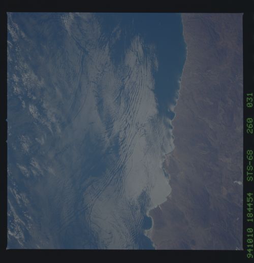
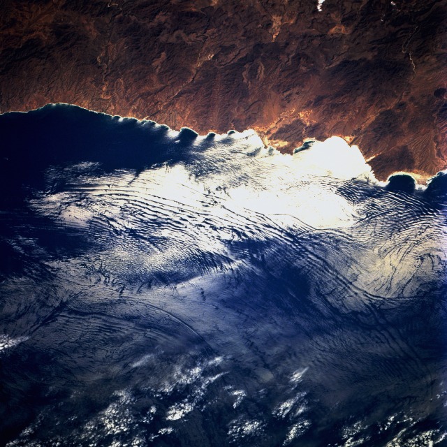
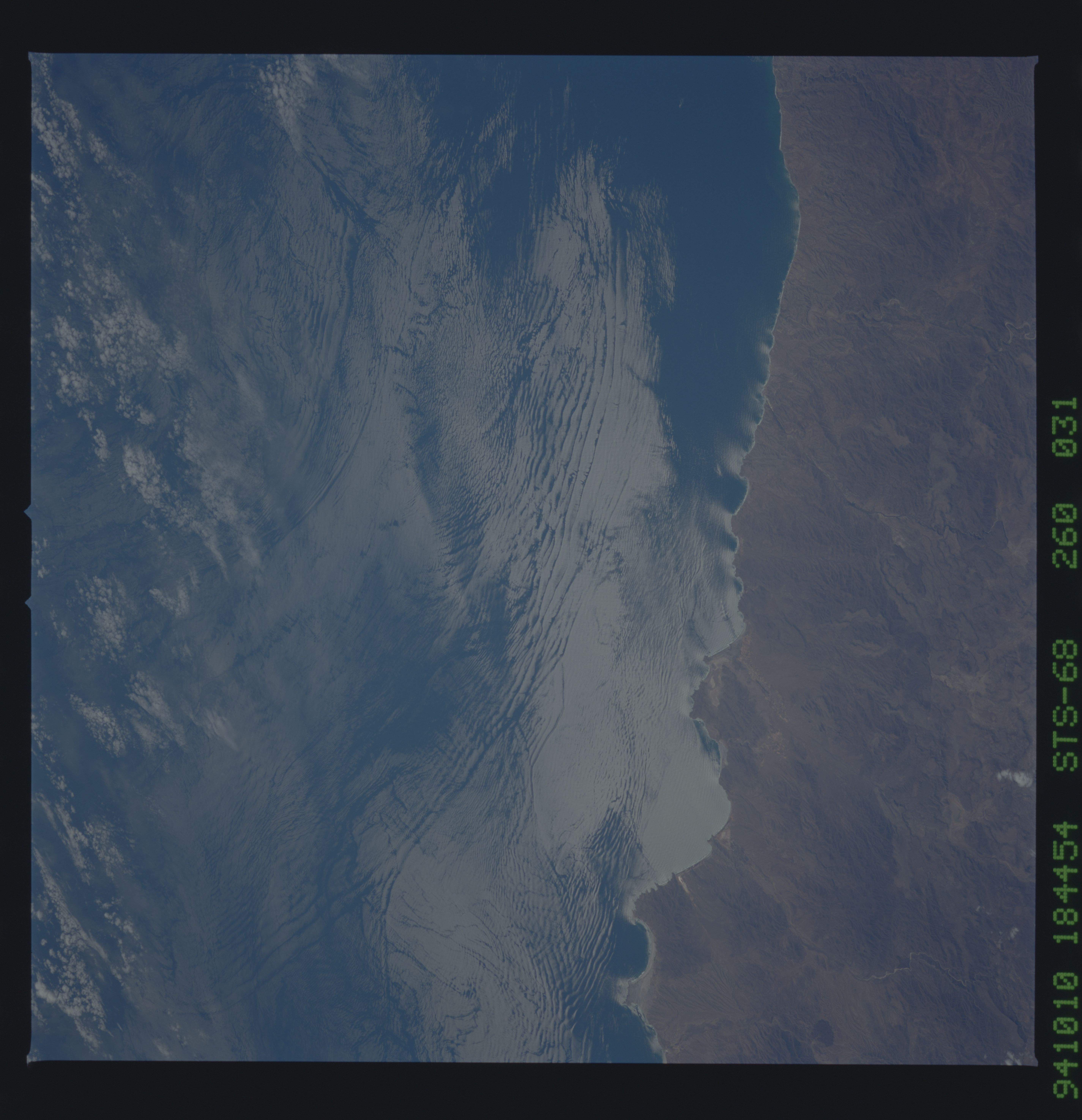
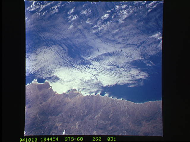
Image Caption: STS068-260-031 Internal Waves, Baja Peninsula, Mexico October 1994
In the sun-glint, bands of internal waves can be seen approaching the Baja Peninsula near Point Prieta in Mexico in this north-looking low-oblique view. The area of the band of internal waves is just to the north of the Bay of Sebastian Vizcaino. Internal Waves are located just below the sea surface from near 10 feet (3 meters) to over 300 feet (92 meters). They are most obvious at a density interface within the ocean, such as, the base of the upper mixed layer of thermocline. The spacing of these internal waves can vary from over 1 mile (1.6 km) to 5 miles (8 km) and they usually occur in packs of four to eight waves per packet. Oceanographers became aware of internal waves in 1975 when they were photographed in the Andaman Sea by astronauts on the Apollo-Soyuz Mission.
In the sun-glint, bands of internal waves can be seen approaching the Baja Peninsula near Point Prieta in Mexico in this north-looking low-oblique view. The area of the band of internal waves is just to the north of the Bay of Sebastian Vizcaino. Internal Waves are located just below the sea surface from near 10 feet (3 meters) to over 300 feet (92 meters). They are most obvious at a density interface within the ocean, such as, the base of the upper mixed layer of thermocline. The spacing of these internal waves can vary from over 1 mile (1.6 km) to 5 miles (8 km) and they usually occur in packs of four to eight waves per packet. Oceanographers became aware of internal waves in 1975 when they were photographed in the Andaman Sea by astronauts on the Apollo-Soyuz Mission.
