STS068-258-45
| NASA Photo ID | STS068-258-45 |
| Focal Length | 250mm |
| Date taken | 1994.10.09 |
| Time taken | 23:47:39 GMT |
Resolutions offered for this image:
5700 x 5900 pixels 500 x 518 pixels 640 x 480 pixels 2624 x 2558 pixels 5093 x 5112 pixels 2604 x 2578 pixels 1902 x 1181 pixels 4800 x 4824 pixels 540 x 335 pixels
5700 x 5900 pixels 500 x 518 pixels 640 x 480 pixels 2624 x 2558 pixels 5093 x 5112 pixels 2604 x 2578 pixels 1902 x 1181 pixels 4800 x 4824 pixels 540 x 335 pixels


Cloud masks available for this image:
Spacecraft nadir point: 16.0° S, 152.4° W
Photo center point: 16.5° S, 151.5° W
Photo center point by machine learning:
Photo center point: 16.5° S, 151.5° W
Photo center point by machine learning:
Nadir to Photo Center: Southeast
Spacecraft Altitude: 111 nautical miles (206km)
Country or Geographic Name: | SOCIETY ISLANDS |
Features: | UTUROA ISLAND |
| Features Found Using Machine Learning: | |
Cloud Cover Percentage: | 5 (1-10)% |
Sun Elevation Angle: | 61° |
Sun Azimuth: | 286° |
Camera: | Hasselblad |
Focal Length: | 250mm |
Camera Tilt: | 29 degrees |
Format: | 5046: Kodak, natural color positive, Lumiere 100/5046, ASA 100, standard base |
Film Exposure: | Normal |
| Additional Information | |
| Width | Height | Annotated | Cropped | Purpose | Links |
|---|---|---|---|---|---|
| 5700 pixels | 5900 pixels | No | No | Download Image | |
| 500 pixels | 518 pixels | No | No | Download Image | |
| 640 pixels | 480 pixels | No | No | Download Image | |
| 2624 pixels | 2558 pixels | No | Yes | ReefBase 1 | Download Image |
| 5093 pixels | 5112 pixels | Yes | Reef RS | Download Image | |
| 2604 pixels | 2578 pixels | No | No | ReefBase 1 | Download Image |
| 1902 pixels | 1181 pixels | Yes | Yes | Publisher Request | Download Image |
| 4800 pixels | 4824 pixels | No | No | Download Image | |
| 540 pixels | 335 pixels | Publisher Request | Download Image |
Download Packaged File
Download a Google Earth KML for this Image
View photo footprint information
Download a GeoTIFF for this photo
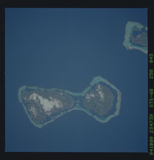
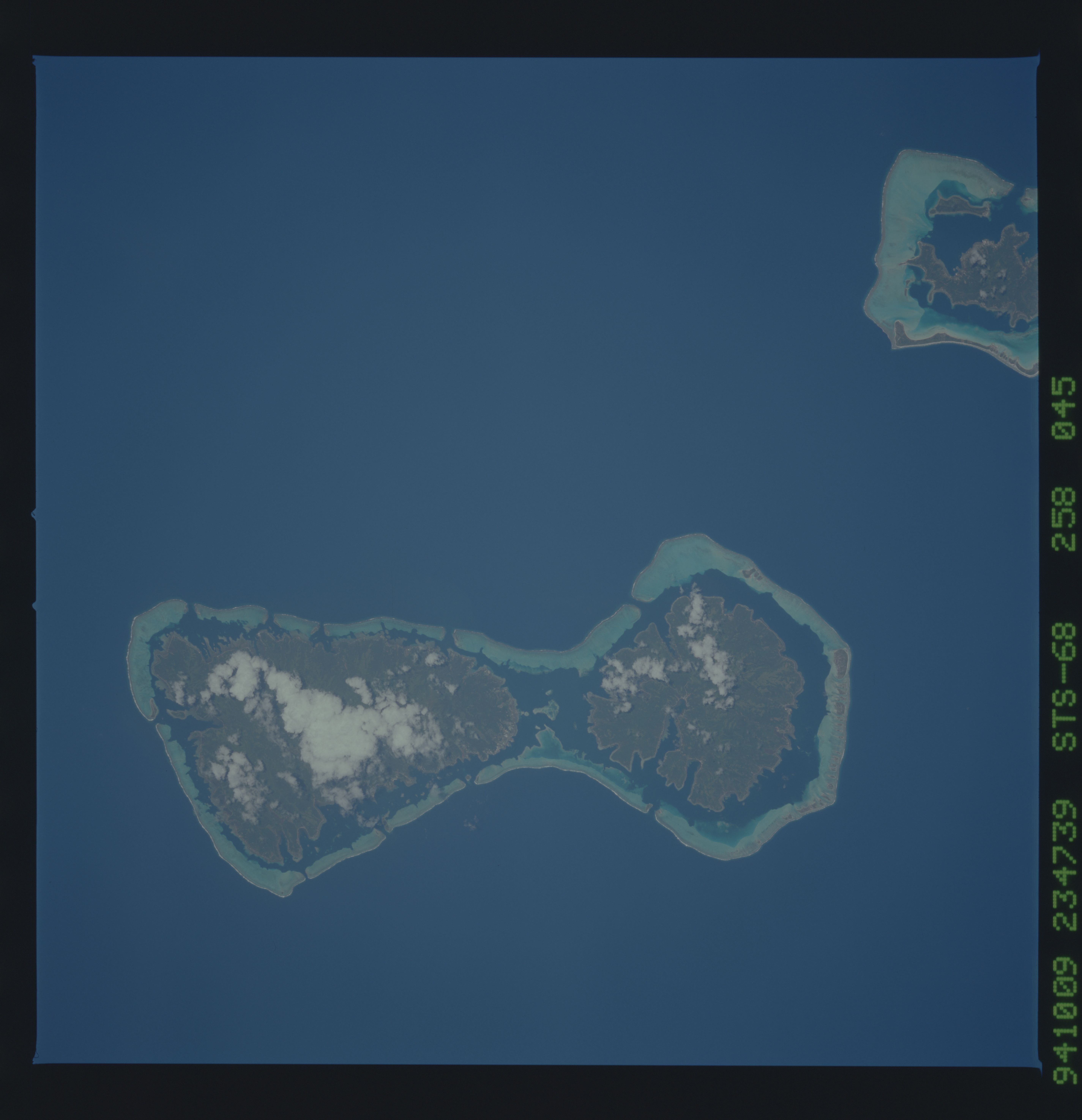
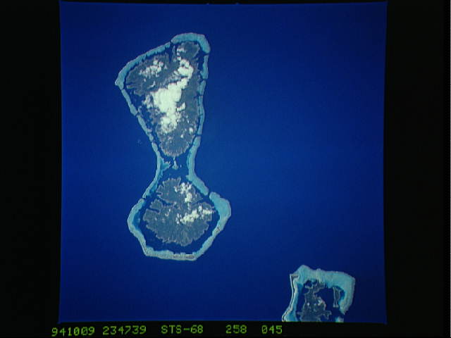
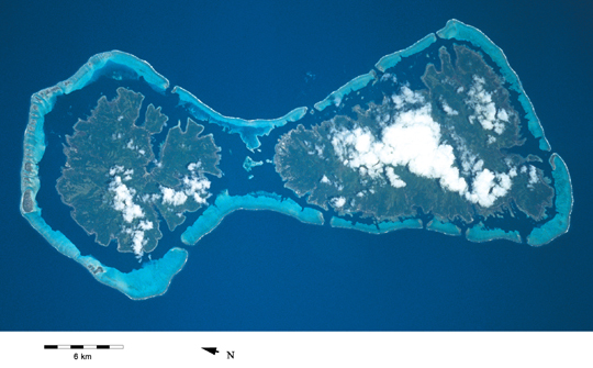
Image Caption: A barrier reef with broad reef flats has developed around Uturoa, Society Islands. Some of the channels through the barrier reef can be seen to correspond to inlets and river mouths of the adjacent island, a common occurence on some barrier reefs [STS068-258-45, 1994].
