STS068-257-43
| NASA Photo ID | STS068-257-43 |
| Focal Length | 100mm |
| Date taken | 1994.10.10 |
| Time taken | 17:14:12 GMT |
Resolutions offered for this image:
3901 x 3904 pixels 639 x 639 pixels 5700 x 5900 pixels 500 x 518 pixels 640 x 480 pixels
3901 x 3904 pixels 639 x 639 pixels 5700 x 5900 pixels 500 x 518 pixels 640 x 480 pixels

Cloud masks available for this image:
Spacecraft nadir point: 37.7° N, 99.0° W
Photo center point: 36.5° N, 98.5° W
Photo center point by machine learning:
Photo center point: 36.5° N, 98.5° W
Photo center point by machine learning:
Nadir to Photo Center: South
Spacecraft Altitude: 111 nautical miles (206km)
Country or Geographic Name: | USA-OKLAHOMA |
Features: | CIMARRON R, CANTON LAKE |
| Features Found Using Machine Learning: | |
Cloud Cover Percentage: | 0 (no clouds present) |
Sun Elevation Angle: | 43° |
Sun Azimuth: | 156° |
Camera: | Hasselblad |
Focal Length: | 100mm |
Camera Tilt: | 35 degrees |
Format: | 5046: Kodak, natural color positive, Lumiere 100/5046, ASA 100, standard base |
Film Exposure: | Normal |
| Additional Information | |
| Width | Height | Annotated | Cropped | Purpose | Links |
|---|---|---|---|---|---|
| 3901 pixels | 3904 pixels | No | No | Earth From Space collection | Download Image |
| 639 pixels | 639 pixels | No | No | Earth From Space collection | Download Image |
| 5700 pixels | 5900 pixels | No | No | Download Image | |
| 500 pixels | 518 pixels | No | No | Download Image | |
| 640 pixels | 480 pixels | No | No | Download Image |
Download Packaged File
Download a Google Earth KML for this Image
View photo footprint information
Download a GeoTIFF for this photo
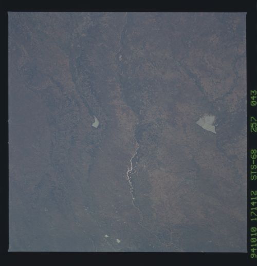
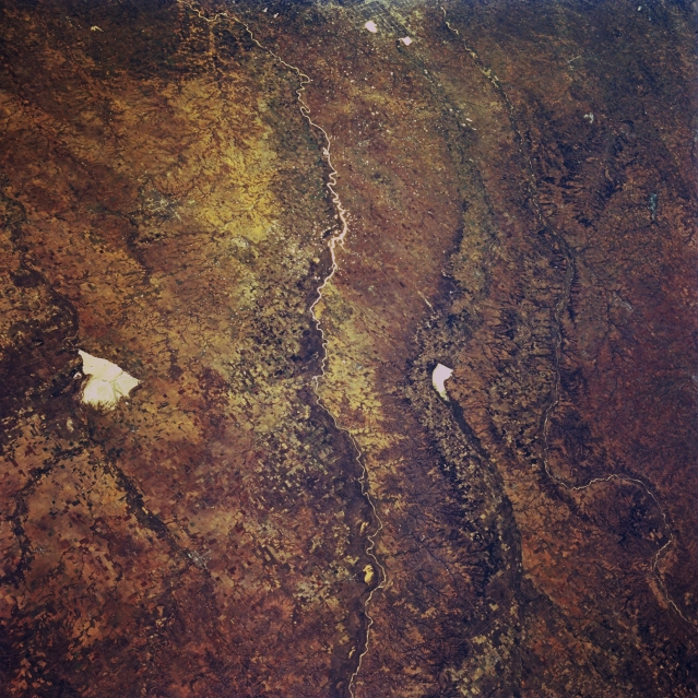
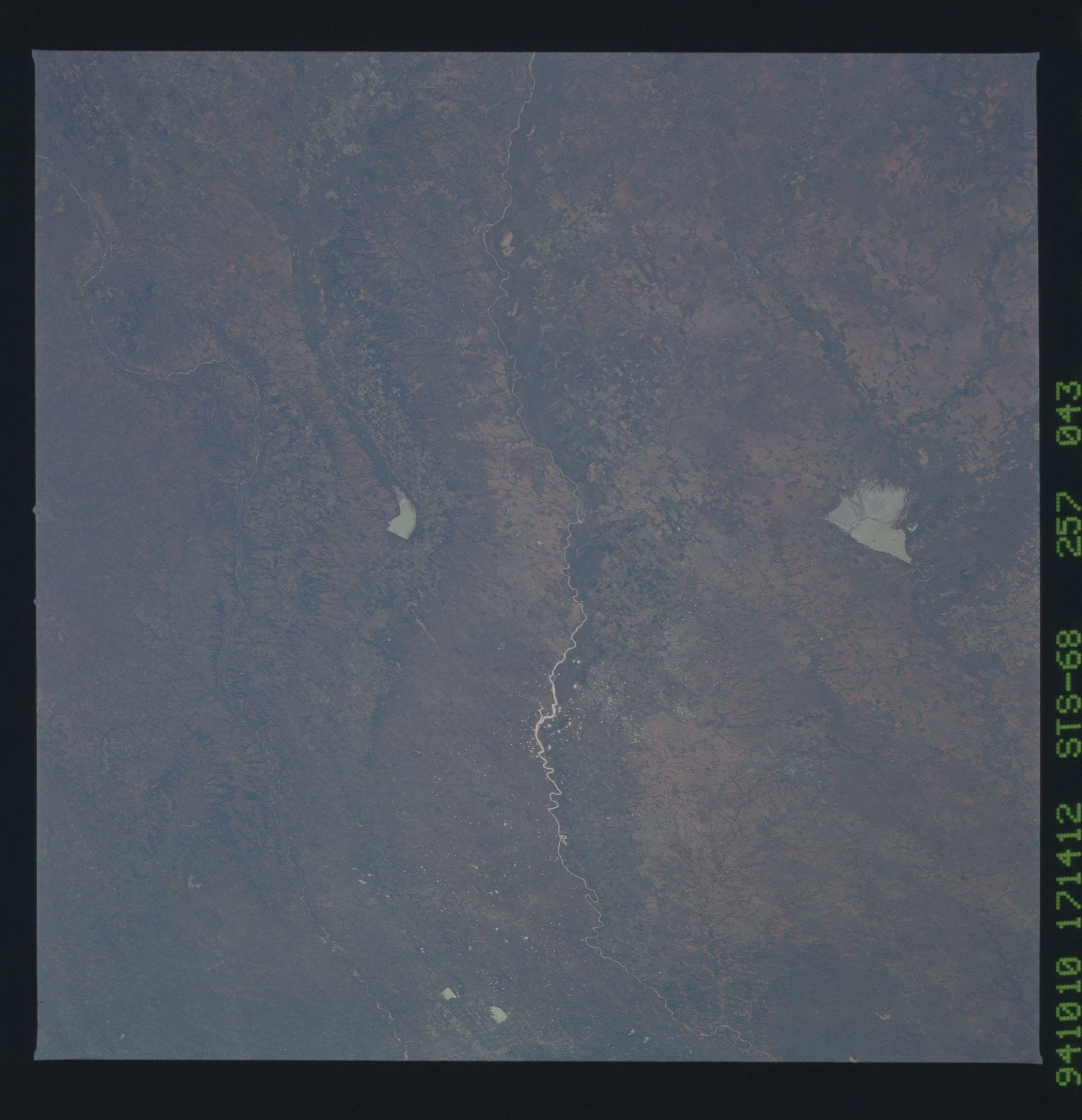
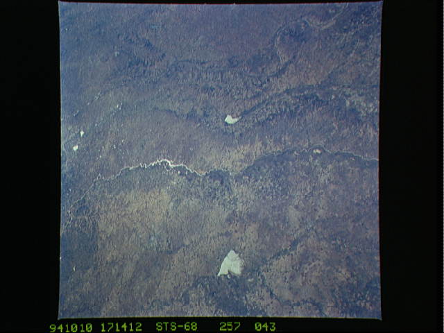
Image Caption: STS068-257-043 Great Salt Plains Lake, Cimarron River, and Canadian River, Oklahoma, U.S.A. October 1994
This southeast-looking, low-oblique, panoramic photograph of west-central Oklahoma shows three river systems that move generally west to east through the state--the Cimarron River; to its south the North Canadian River, which flows through Canton Lake (right of center) eastward into Oklahoma City; and farthest south, the South Canadian River, which flows generally southeastward. Situated on the Salt Fork of the Arkansas River, bright, white Great Salt Plains Lake [10 miles (16 kilometers) long], sometimes dry in the late summer and fall, is used for flood control and conservation.
This southeast-looking, low-oblique, panoramic photograph of west-central Oklahoma shows three river systems that move generally west to east through the state--the Cimarron River; to its south the North Canadian River, which flows through Canton Lake (right of center) eastward into Oklahoma City; and farthest south, the South Canadian River, which flows generally southeastward. Situated on the Salt Fork of the Arkansas River, bright, white Great Salt Plains Lake [10 miles (16 kilometers) long], sometimes dry in the late summer and fall, is used for flood control and conservation.
