STS068-248-92
| NASA Photo ID | STS068-248-92 |
| Focal Length | 250mm |
| Date taken | 1994.10.08 |
| Time taken | 17:59:06 GMT |
Resolutions offered for this image:
4096 x 4040 pixels 790 x 797 pixels 3904 x 3904 pixels 639 x 639 pixels 5700 x 5900 pixels 4040 x 4096 pixels 500 x 518 pixels 640 x 480 pixels 5213 x 5151 pixels
4096 x 4040 pixels 790 x 797 pixels 3904 x 3904 pixels 639 x 639 pixels 5700 x 5900 pixels 4040 x 4096 pixels 500 x 518 pixels 640 x 480 pixels 5213 x 5151 pixels

Cloud masks available for this image:
Spacecraft nadir point: 40.5° N, 102.2° W
Photo center point: 39.5° N, 105.0° W
Photo center point by machine learning:
Photo center point: 39.5° N, 105.0° W
Photo center point by machine learning:
Nadir to Photo Center: West
Spacecraft Altitude: 111 nautical miles (206km)
Country or Geographic Name: | USA-COLORADO |
Features: | DENVER AREA |
| Features Found Using Machine Learning: | |
Cloud Cover Percentage: | 5 (1-10)% |
Sun Elevation Angle: | 43° |
Sun Azimuth: | 167° |
Camera: | Hasselblad |
Focal Length: | 250mm |
Camera Tilt: | Low Oblique |
Format: | 5046: Kodak, natural color positive, Lumiere 100/5046, ASA 100, standard base |
Film Exposure: | Normal |
| Additional Information | |
| Width | Height | Annotated | Cropped | Purpose | Links |
|---|---|---|---|---|---|
| 4096 pixels | 4040 pixels | Cities collection | Download Image | ||
| 790 pixels | 797 pixels | No | No | Cities collection | Download Image |
| 3904 pixels | 3904 pixels | No | No | Earth From Space collection | Download Image |
| 639 pixels | 639 pixels | No | No | Earth From Space collection | Download Image |
| 5700 pixels | 5900 pixels | No | No | Download Image | |
| 4040 pixels | 4096 pixels | No | No | Download Image | |
| 500 pixels | 518 pixels | No | No | Download Image | |
| 640 pixels | 480 pixels | No | No | Download Image | |
| 5213 pixels | 5151 pixels | No | No | Download Image |
Download Packaged File
Download a Google Earth KML for this Image
View photo footprint information
Download a GeoTIFF for this photo
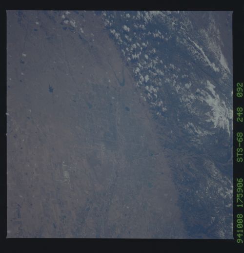
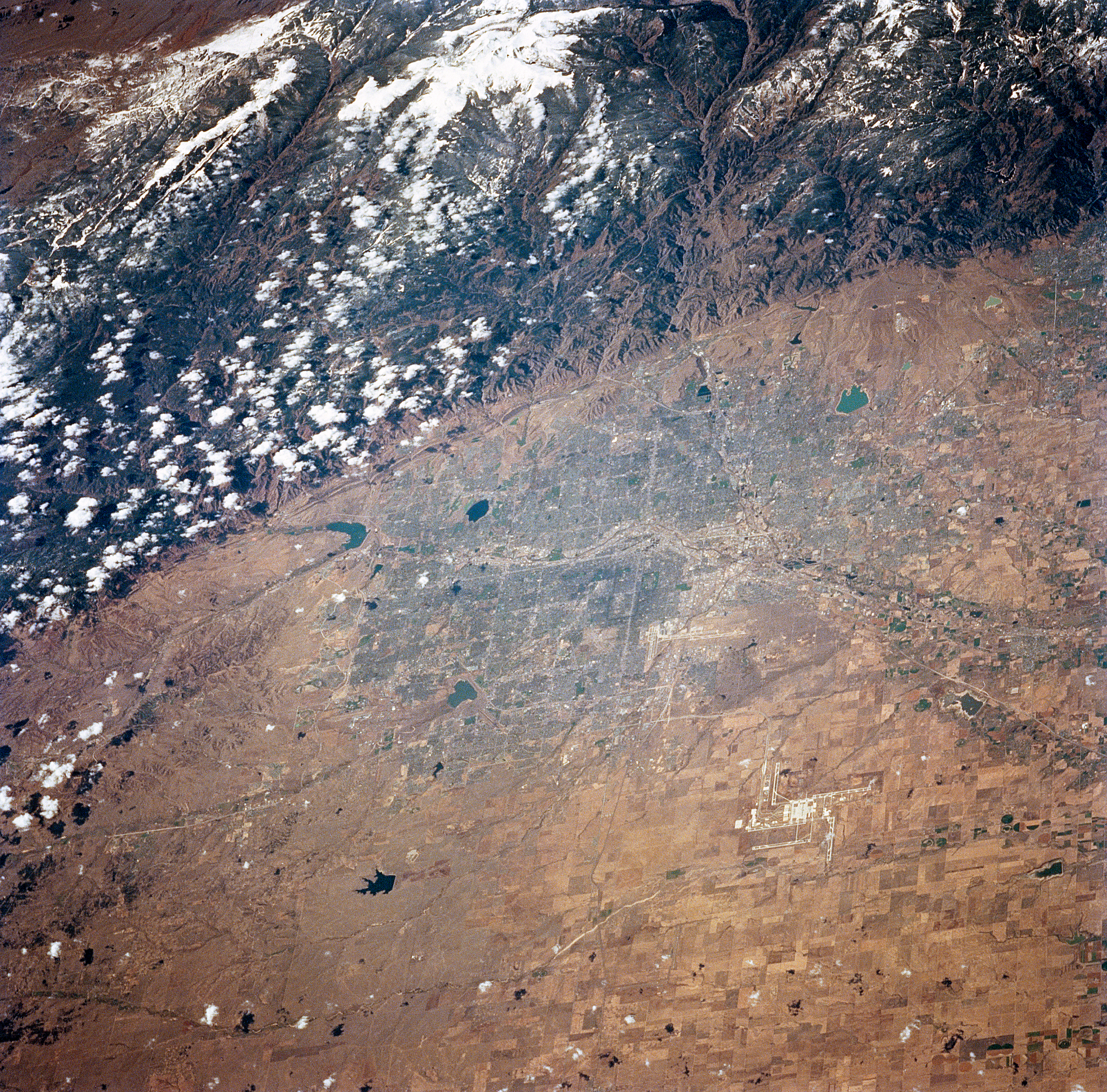
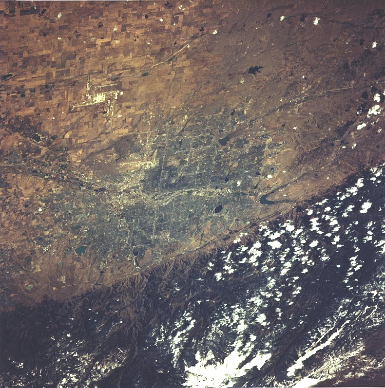
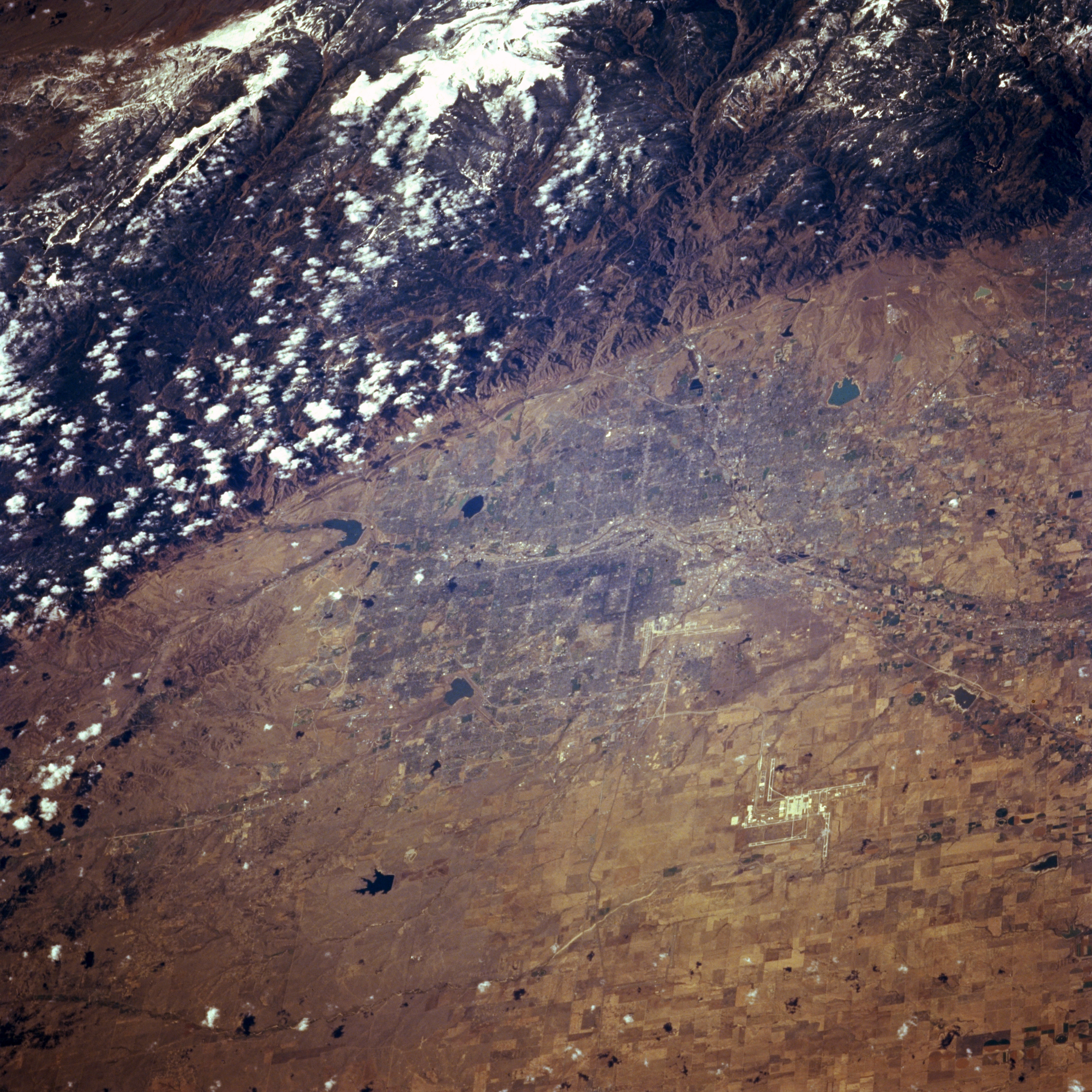
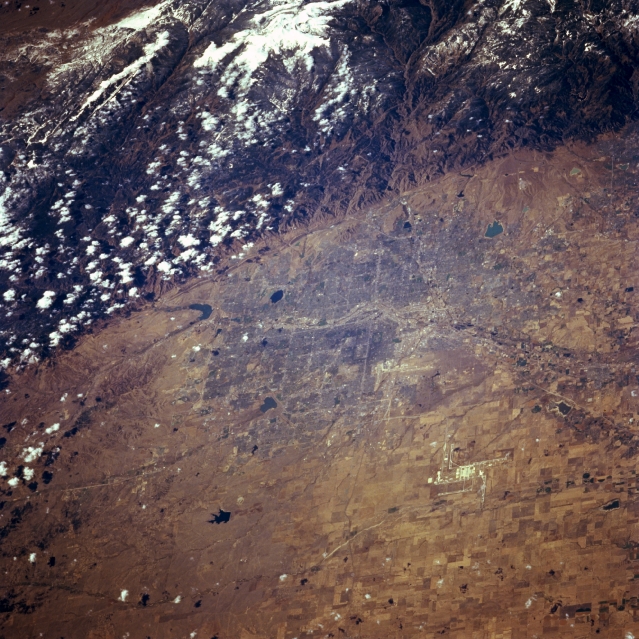
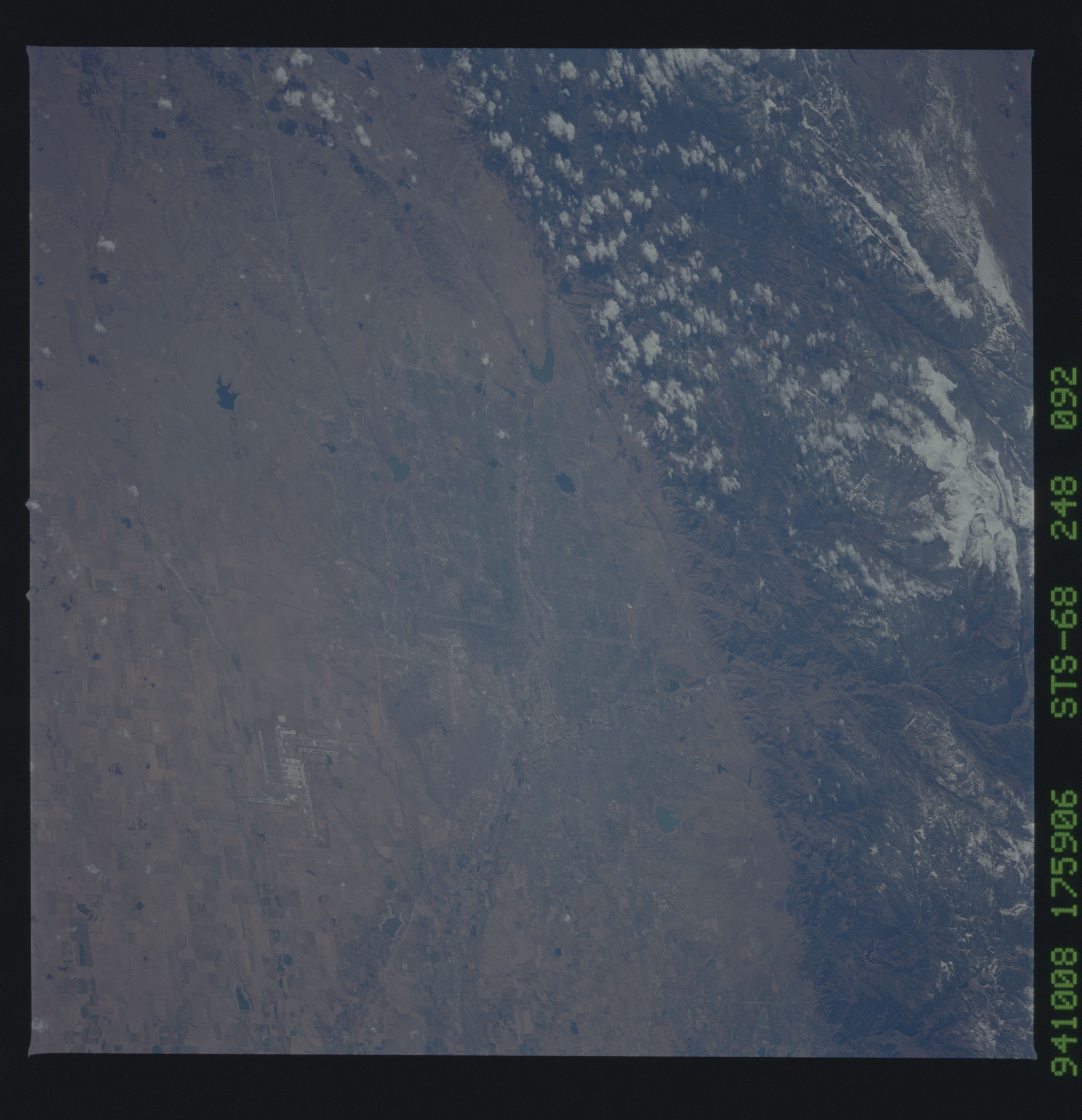
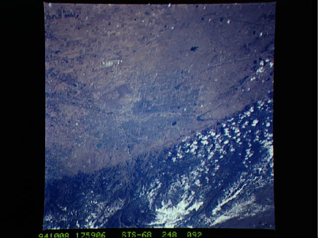
Image Caption: STS068-248-092 Denver Area, Colorado, U.S.A. October 1994
The Front Range of the Rocky Mountains provides a dramatic backdrop for metropolitan Denver, located on the western margin of the Great Plains. The landform change from the plains of the Colorado Piedmont to the faulted eastern slopes of the Rocky Mountains is abrupt. The north-flowing South Platte River, winding through the center of downtown Denver, and its floodplain are apparent. Visible are metropolitan street grid patterns; several lakes and reservoirs; and, to the northeast, runways of the new Denver International Airport surrounded by rectangular, cultivated fields to the east and northeast.
The Front Range of the Rocky Mountains provides a dramatic backdrop for metropolitan Denver, located on the western margin of the Great Plains. The landform change from the plains of the Colorado Piedmont to the faulted eastern slopes of the Rocky Mountains is abrupt. The north-flowing South Platte River, winding through the center of downtown Denver, and its floodplain are apparent. Visible are metropolitan street grid patterns; several lakes and reservoirs; and, to the northeast, runways of the new Denver International Airport surrounded by rectangular, cultivated fields to the east and northeast.
