STS068-246-98
| NASA Photo ID | STS068-246-98 |
| Focal Length | 250mm |
| Date taken | 1994.10.06 |
| Time taken | 11:16:55 GMT |
Resolutions offered for this image:
4056 x 4056 pixels 640 x 640 pixels 5700 x 5900 pixels 500 x 518 pixels 640 x 480 pixels
4056 x 4056 pixels 640 x 640 pixels 5700 x 5900 pixels 500 x 518 pixels 640 x 480 pixels

Cloud masks available for this image:
Spacecraft nadir point: 46.1° N, 2.8° E
Photo center point: 47.0° N, 3.0° E
Photo center point by machine learning:
Photo center point: 47.0° N, 3.0° E
Photo center point by machine learning:
Nadir to Photo Center: North
Spacecraft Altitude: 115 nautical miles (213km)
Country or Geographic Name: | FRANCE |
Features: | LOIRE R., CITIES, AGRICULTURE |
| Features Found Using Machine Learning: | |
Cloud Cover Percentage: | 0 (no clouds present) |
Sun Elevation Angle: | 39° |
Sun Azimuth: | 174° |
Camera: | Hasselblad |
Focal Length: | 250mm |
Camera Tilt: | 26 degrees |
Format: | 5046: Kodak, natural color positive, Lumiere 100/5046, ASA 100, standard base |
Film Exposure: | Normal |
| Additional Information | |
| Width | Height | Annotated | Cropped | Purpose | Links |
|---|---|---|---|---|---|
| 4056 pixels | 4056 pixels | No | No | Earth From Space collection | Download Image |
| 640 pixels | 640 pixels | No | No | Earth From Space collection | Download Image |
| 5700 pixels | 5900 pixels | No | No | Download Image | |
| 500 pixels | 518 pixels | No | No | Download Image | |
| 640 pixels | 480 pixels | No | No | Download Image |
Download Packaged File
Download a Google Earth KML for this Image
View photo footprint information
Download a GeoTIFF for this photo
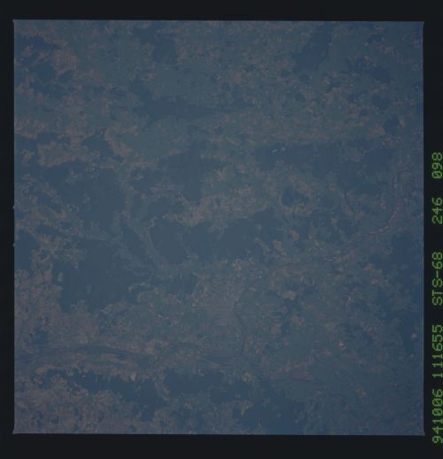
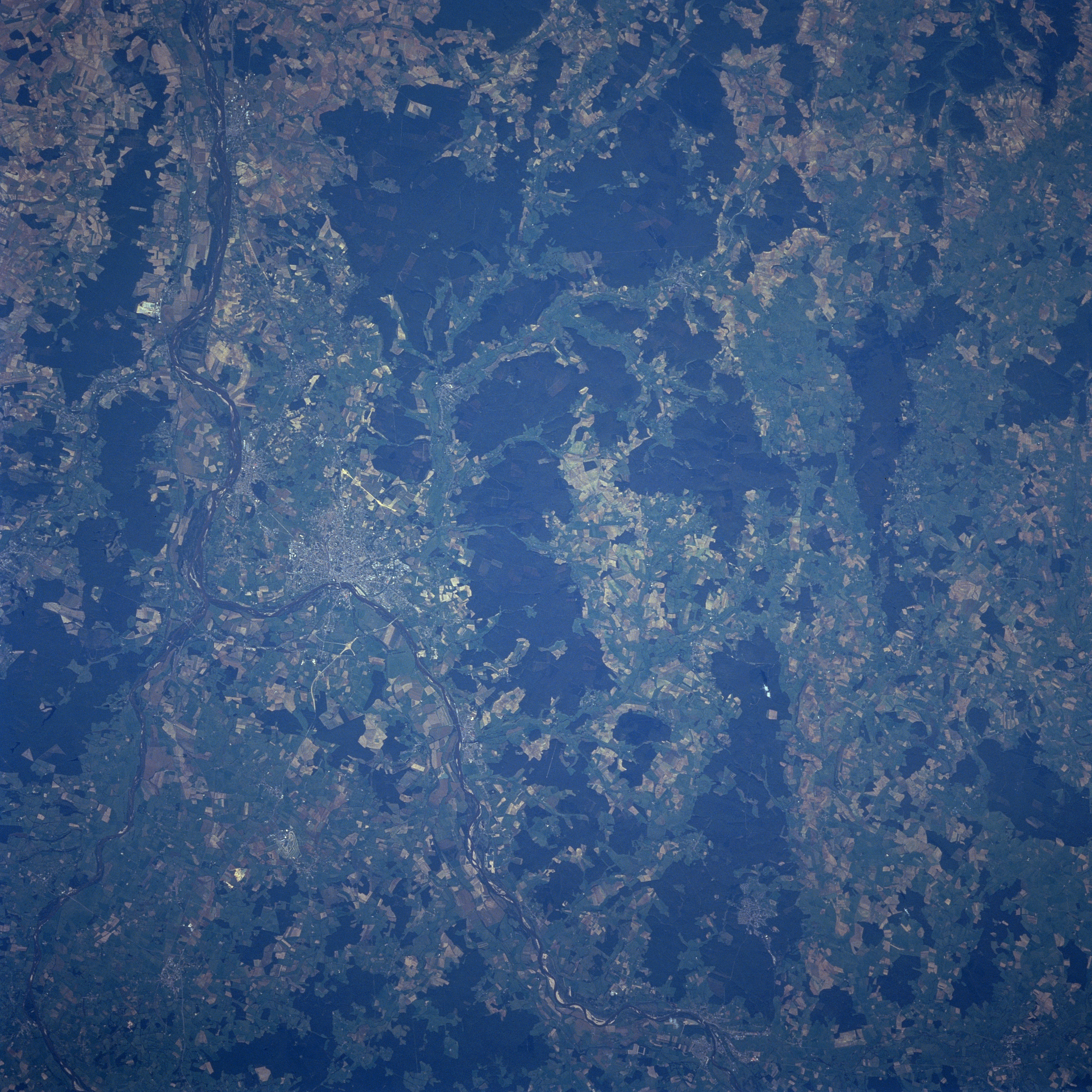
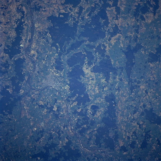
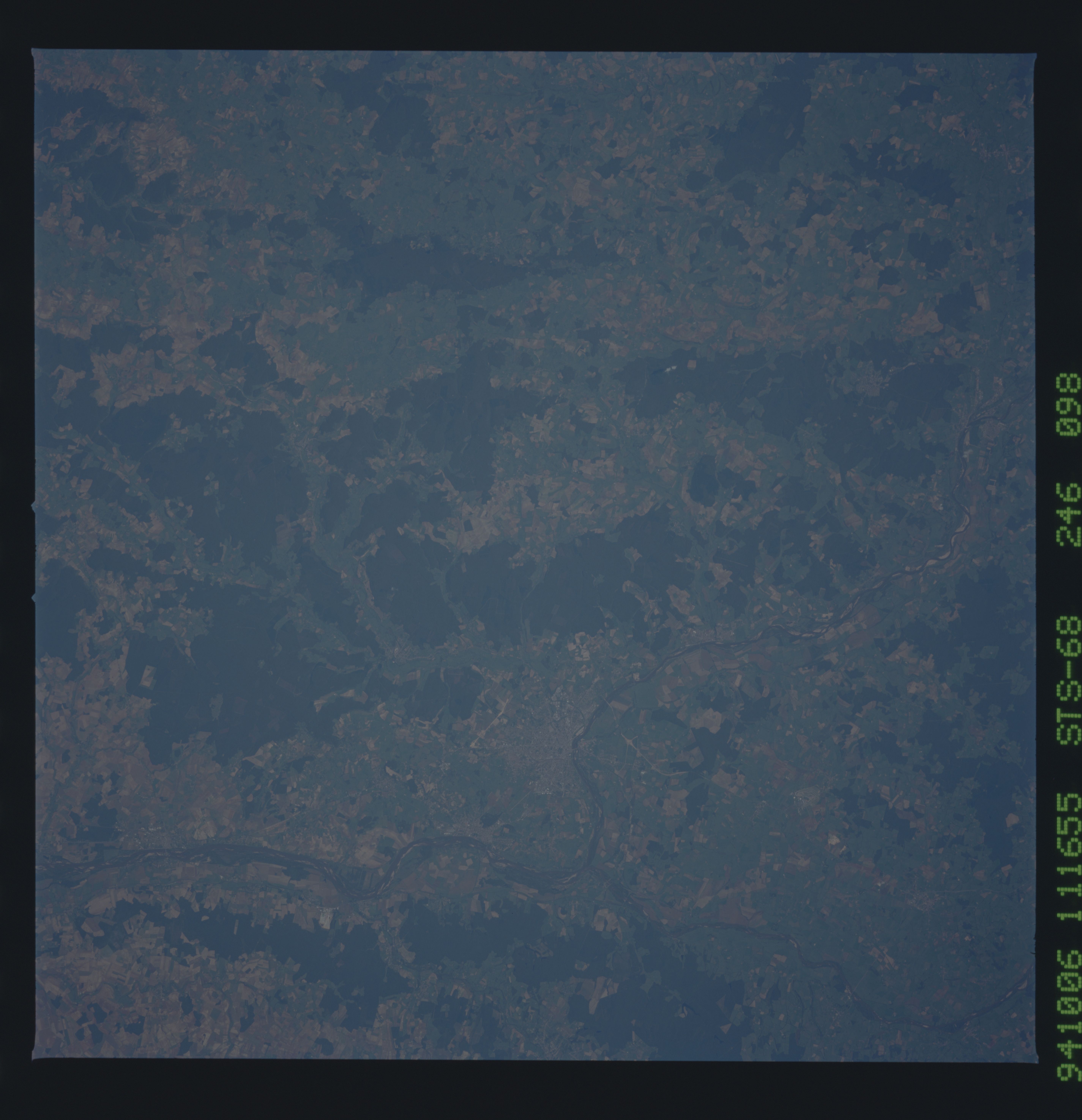
Image Caption: STS068-246-098 Loire and Allier Rivers, France October, 1994
Near the left center of the image, the Allier and the Loire River join in this near-nadir-looking view. The Allier River enters the scene at the bottom left corner of the image. The river is 255 miles (410 km) long and rises in the Cevennes Mountains of southeastern France. The Allier River is navigable for a good portion of its length. The Loire River enters the scene at the bottom center of the image and flows generally northwestward exiting the scene near the top left corner of the image. The Loire River is the longest river in France rising in the Cevennes Mountains and flowing 630 miles (1015 km) to the Bay of Biscay at Saint Nazaire. The industrial city of Nevers is located along the north bank of the Loire River immediately east of the confluence of these two rivers. The city is the center of an iron and steel district and also has important china and pottery industries. The forested uplands (irregular-shaped, dark pattern) of the Langres Plateau can be seen in the center of the image from the bottom center to the top center.
Near the left center of the image, the Allier and the Loire River join in this near-nadir-looking view. The Allier River enters the scene at the bottom left corner of the image. The river is 255 miles (410 km) long and rises in the Cevennes Mountains of southeastern France. The Allier River is navigable for a good portion of its length. The Loire River enters the scene at the bottom center of the image and flows generally northwestward exiting the scene near the top left corner of the image. The Loire River is the longest river in France rising in the Cevennes Mountains and flowing 630 miles (1015 km) to the Bay of Biscay at Saint Nazaire. The industrial city of Nevers is located along the north bank of the Loire River immediately east of the confluence of these two rivers. The city is the center of an iron and steel district and also has important china and pottery industries. The forested uplands (irregular-shaped, dark pattern) of the Langres Plateau can be seen in the center of the image from the bottom center to the top center.
