STS068-246-97
| NASA Photo ID | STS068-246-97 |
| Focal Length | 250mm |
| Date taken | 1994.10.06 |
| Time taken | 11:16:52 GMT |
Resolutions offered for this image:
4067 x 4067 pixels 639 x 639 pixels 5700 x 5900 pixels 500 x 518 pixels 640 x 480 pixels
4067 x 4067 pixels 639 x 639 pixels 5700 x 5900 pixels 500 x 518 pixels 640 x 480 pixels


Cloud masks available for this image:
Spacecraft nadir point: 46.3° N, 2.6° E
Photo center point: 47.5° N, 3.0° E
Photo center point by machine learning:
Photo center point: 47.5° N, 3.0° E
Photo center point by machine learning:
Nadir to Photo Center: North
Spacecraft Altitude: 115 nautical miles (213km)
Country or Geographic Name: | FRANCE |
Features: | LOIRE R., CITIES, AGRICULTURE |
| Features Found Using Machine Learning: | |
Cloud Cover Percentage: | 0 (no clouds present) |
Sun Elevation Angle: | 39° |
Sun Azimuth: | 173° |
Camera: | Hasselblad |
Focal Length: | 250mm |
Camera Tilt: | 33 degrees |
Format: | 5046: Kodak, natural color positive, Lumiere 100/5046, ASA 100, standard base |
Film Exposure: | Normal |
| Additional Information | |
| Width | Height | Annotated | Cropped | Purpose | Links |
|---|---|---|---|---|---|
| 4067 pixels | 4067 pixels | No | No | Earth From Space collection | Download Image |
| 639 pixels | 639 pixels | No | No | Earth From Space collection | Download Image |
| 5700 pixels | 5900 pixels | No | No | Download Image | |
| 500 pixels | 518 pixels | No | No | Download Image | |
| 640 pixels | 480 pixels | No | No | Download Image |
Download Packaged File
Download a Google Earth KML for this Image
View photo footprint information
Download a GeoTIFF for this photo
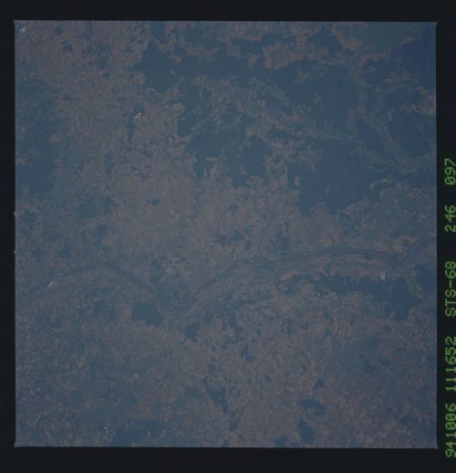
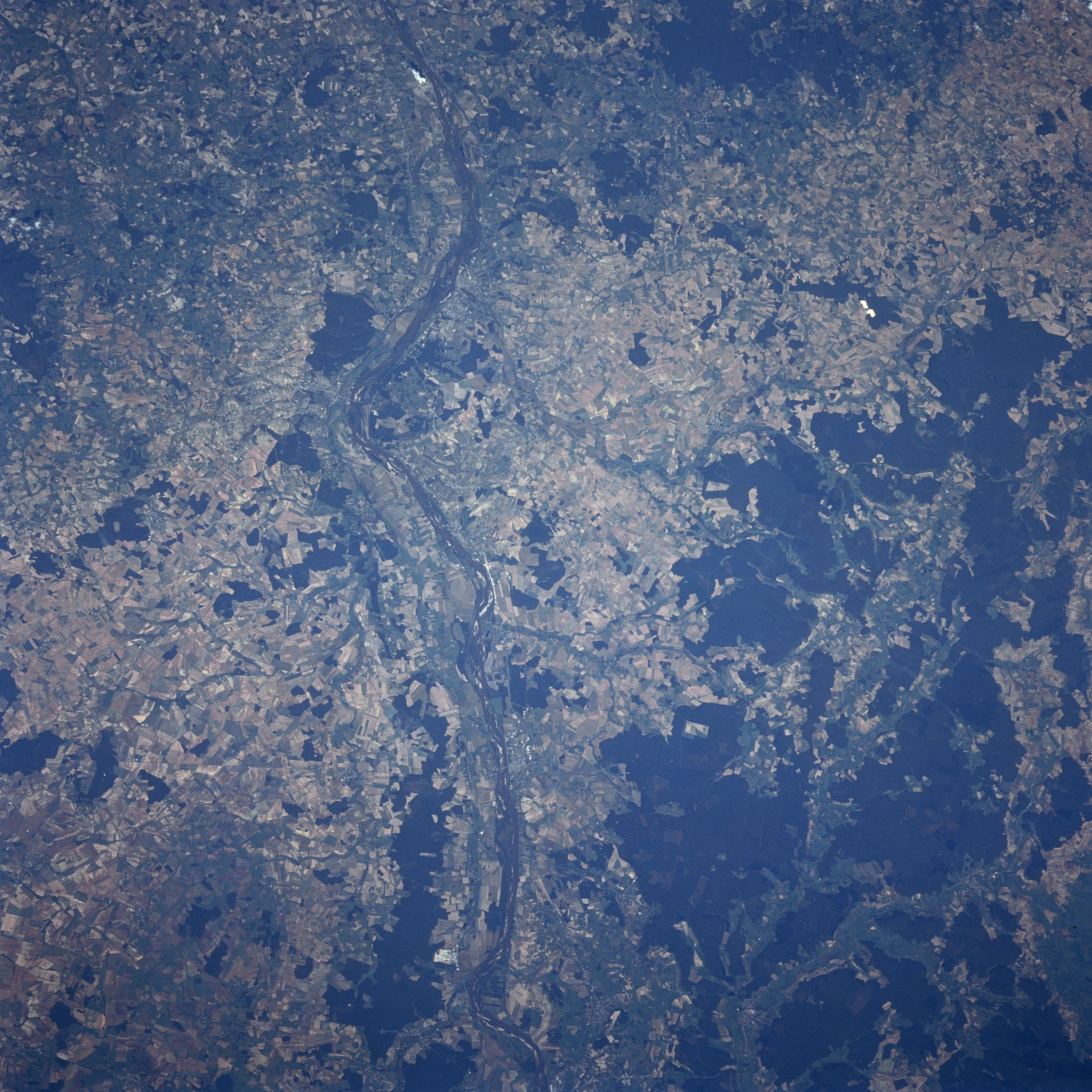
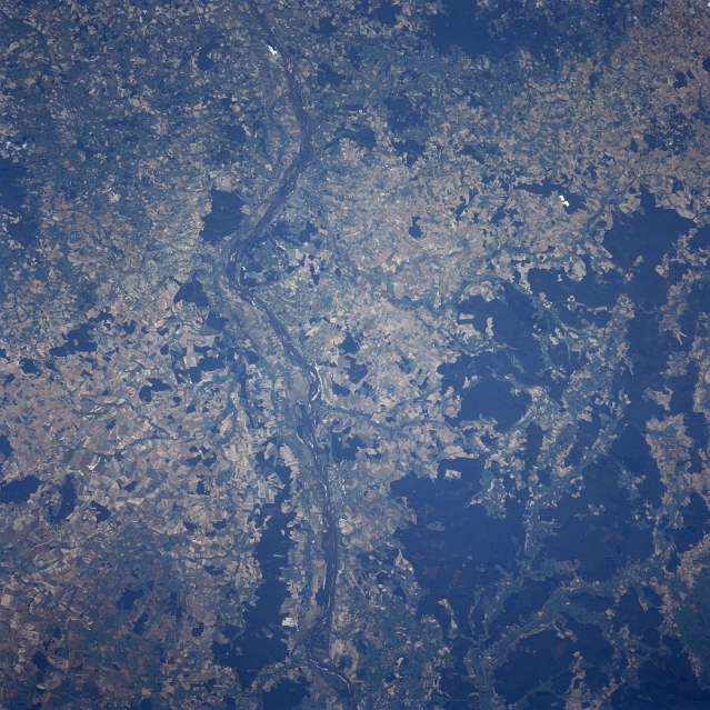
Image Caption: STS068-246-097 Loire River, France October, 1994
A section of the Loire River, the longest river in France, can be seen traversing the rural landscape of central France as it drains from southwest (bottom center) to northwest. The river is 630 miles (1015 km) long and rises in the Cevennes Mountains of southeastern France. The Allier River joins by the Loire River just off the bottom portion of the image. Silting, shallowness, and seasonal volume fluctuations limit the use of the Loire River for navigation. The darker forested areas to the right (east) of the Loire River are the western portions of the Langres Plateau.
A section of the Loire River, the longest river in France, can be seen traversing the rural landscape of central France as it drains from southwest (bottom center) to northwest. The river is 630 miles (1015 km) long and rises in the Cevennes Mountains of southeastern France. The Allier River joins by the Loire River just off the bottom portion of the image. Silting, shallowness, and seasonal volume fluctuations limit the use of the Loire River for navigation. The darker forested areas to the right (east) of the Loire River are the western portions of the Langres Plateau.
