STS068-246-100
| NASA Photo ID | STS068-246-100 |
| Focal Length | 250mm |
| Date taken | 1994.10.06 |
| Time taken | 11:17:04 GMT |
Resolutions offered for this image:
4073 x 4073 pixels 639 x 639 pixels 5700 x 5900 pixels 500 x 518 pixels 640 x 480 pixels 524 x 503 pixels
4073 x 4073 pixels 639 x 639 pixels 5700 x 5900 pixels 500 x 518 pixels 640 x 480 pixels 524 x 503 pixels
Cloud masks available for this image:
Spacecraft nadir point: 45.8° N, 3.5° E
Photo center point: 46.0° N, 3.5° E
Photo center point by machine learning:
Photo center point: 46.0° N, 3.5° E
Photo center point by machine learning:
Nadir to Photo Center: North
Spacecraft Altitude: 115 nautical miles (213km)
Country or Geographic Name: | FRANCE |
Features: | ALLIER R, CITIES, AGRICULTURE |
| Features Found Using Machine Learning: | |
Cloud Cover Percentage: | 0 (no clouds present) |
Sun Elevation Angle: | 39° |
Sun Azimuth: | 174° |
Camera: | Hasselblad |
Focal Length: | 250mm |
Camera Tilt: | 6 degrees |
Format: | 5046: Kodak, natural color positive, Lumiere 100/5046, ASA 100, standard base |
Film Exposure: | Normal |
| Additional Information | |
| Width | Height | Annotated | Cropped | Purpose | Links |
|---|---|---|---|---|---|
| 4073 pixels | 4073 pixels | No | No | Earth From Space collection | Download Image |
| 639 pixels | 639 pixels | No | No | Earth From Space collection | Download Image |
| 5700 pixels | 5900 pixels | No | No | Download Image | |
| 500 pixels | 518 pixels | No | No | Download Image | |
| 640 pixels | 480 pixels | No | No | Download Image | |
| 524 pixels | 503 pixels | No | No | Download Image |
Download Packaged File
Download a Google Earth KML for this Image
View photo footprint information
Download a GeoTIFF for this photo
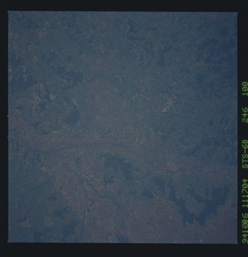
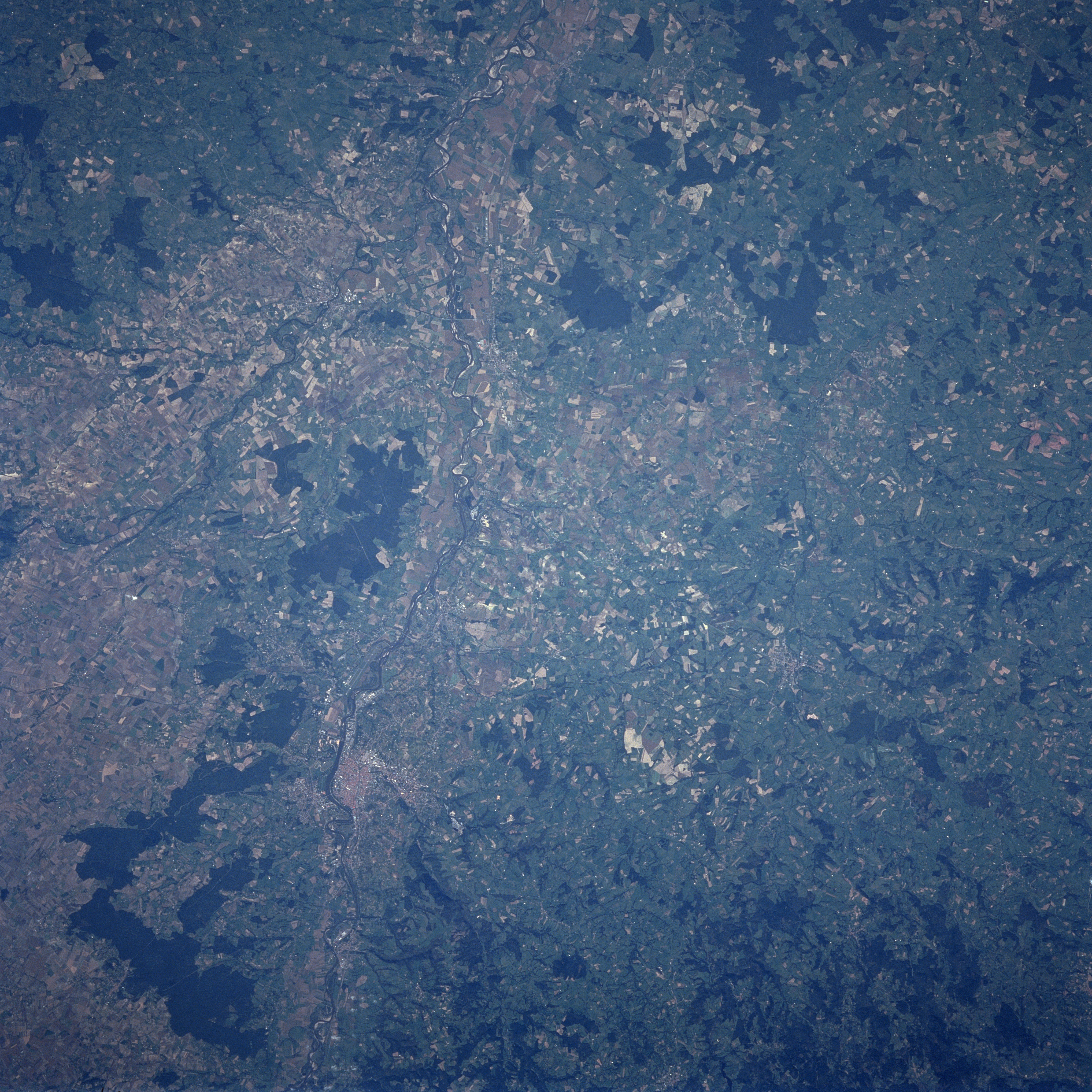
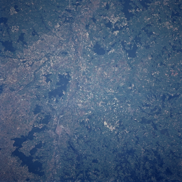
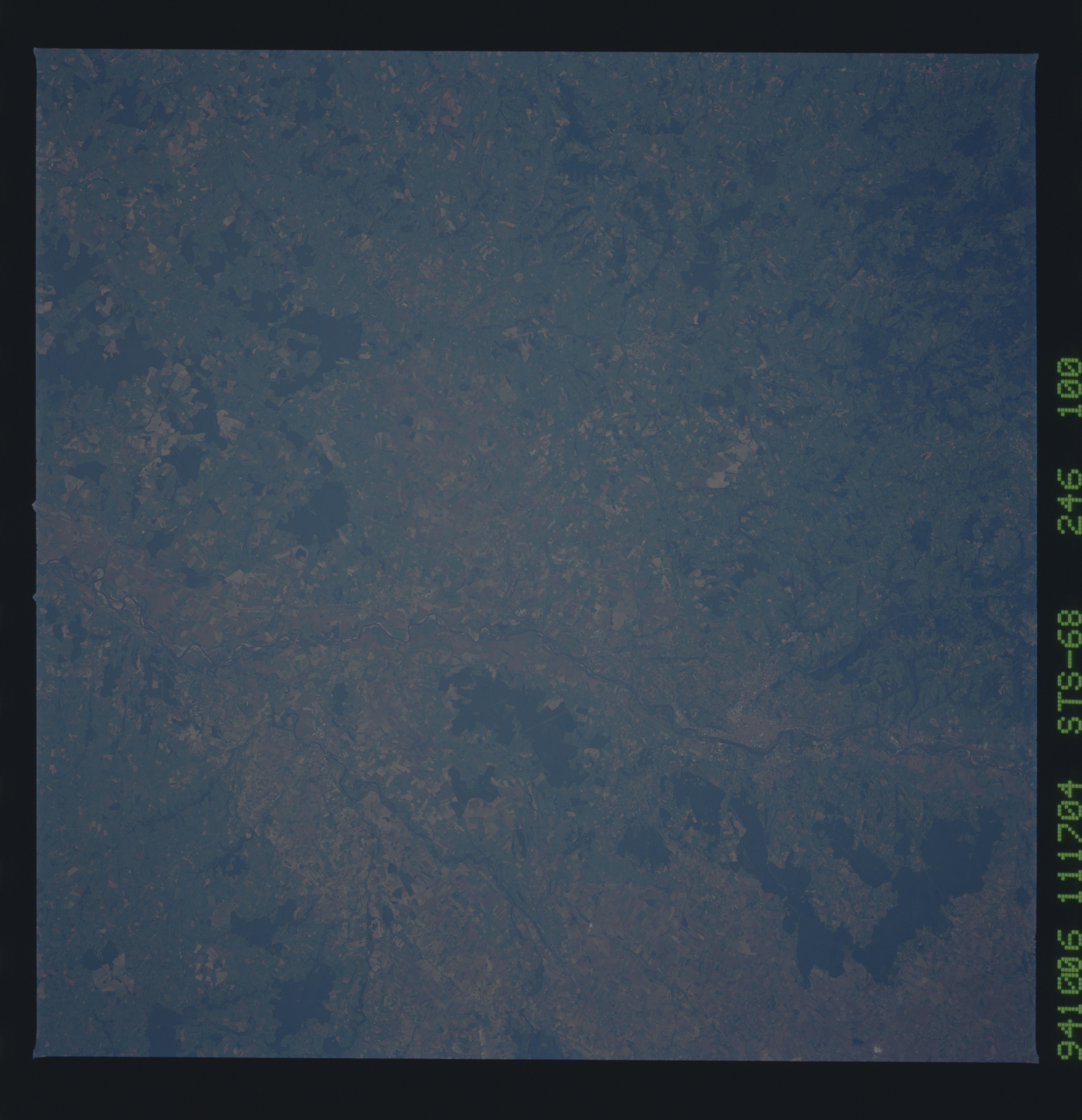
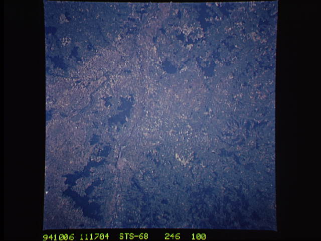
Image Caption: STS068-246-100 Allier River, Vichy, France October, 1994
The Allier River can be seen entering the scene midway between the bottom center and bottom left (south). The river traverses the scene in a generally northerly direction past the city of Vichy and exits the scene at the top center (north). The Allier River, navigable for a good portion of its length, rises in the Cevennes Mountains of southeastern France. The city of Vichy, located on the east bank of the Allier River, is located midway between the bottom center and center of the image. Vichy is a noted spa and health resort in Europe. Many of the thermal alkaline springs scattered throughout the city have been in use since Roman times. Vichy water and salts are exported in large quantities to countries all over the world.
The Allier River can be seen entering the scene midway between the bottom center and bottom left (south). The river traverses the scene in a generally northerly direction past the city of Vichy and exits the scene at the top center (north). The Allier River, navigable for a good portion of its length, rises in the Cevennes Mountains of southeastern France. The city of Vichy, located on the east bank of the Allier River, is located midway between the bottom center and center of the image. Vichy is a noted spa and health resort in Europe. Many of the thermal alkaline springs scattered throughout the city have been in use since Roman times. Vichy water and salts are exported in large quantities to countries all over the world.
