STS068-245-92
| NASA Photo ID | STS068-245-92 |
| Focal Length | 100mm |
| Date taken | 1994.10.11 |
| Time taken | 00:35:19 GMT |
Resolutions offered for this image:
4072 x 4072 pixels 639 x 639 pixels 5700 x 5900 pixels 500 x 518 pixels 640 x 480 pixels
4072 x 4072 pixels 639 x 639 pixels 5700 x 5900 pixels 500 x 518 pixels 640 x 480 pixels


Cloud masks available for this image:
Spacecraft nadir point: 42.7° N, 142.3° E
Photo center point: 43.5° N, 144.0° E
Photo center point by machine learning:
Photo center point: 43.5° N, 144.0° E
Photo center point by machine learning:
Nadir to Photo Center: East
Spacecraft Altitude: 111 nautical miles (206km)
Camera: | Hasselblad |
Focal Length: | 100mm |
Camera Tilt: | 46 degrees |
Format: | 5046: Kodak, natural color positive, Lumiere 100/5046, ASA 100, standard base |
Film Exposure: | Normal |
| Additional Information | |
| Width | Height | Annotated | Cropped | Purpose | Links |
|---|---|---|---|---|---|
| 4072 pixels | 4072 pixels | No | No | Earth From Space collection | Download Image |
| 639 pixels | 639 pixels | No | No | Earth From Space collection | Download Image |
| 5700 pixels | 5900 pixels | No | No | Download Image | |
| 500 pixels | 518 pixels | No | No | Download Image | |
| 640 pixels | 480 pixels | No | No | Download Image |
Download Packaged File
Download a Google Earth KML for this Image
View photo footprint information
Download a GeoTIFF for this photo
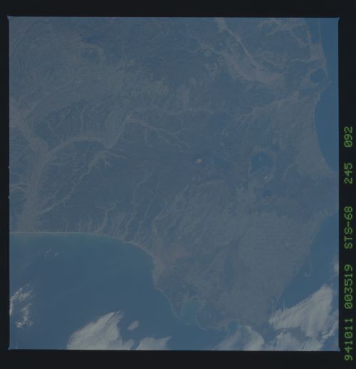
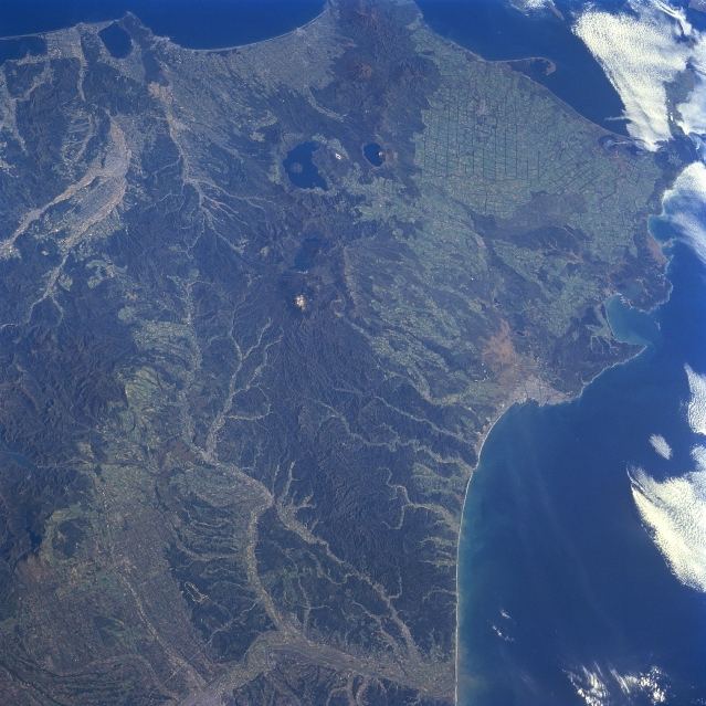
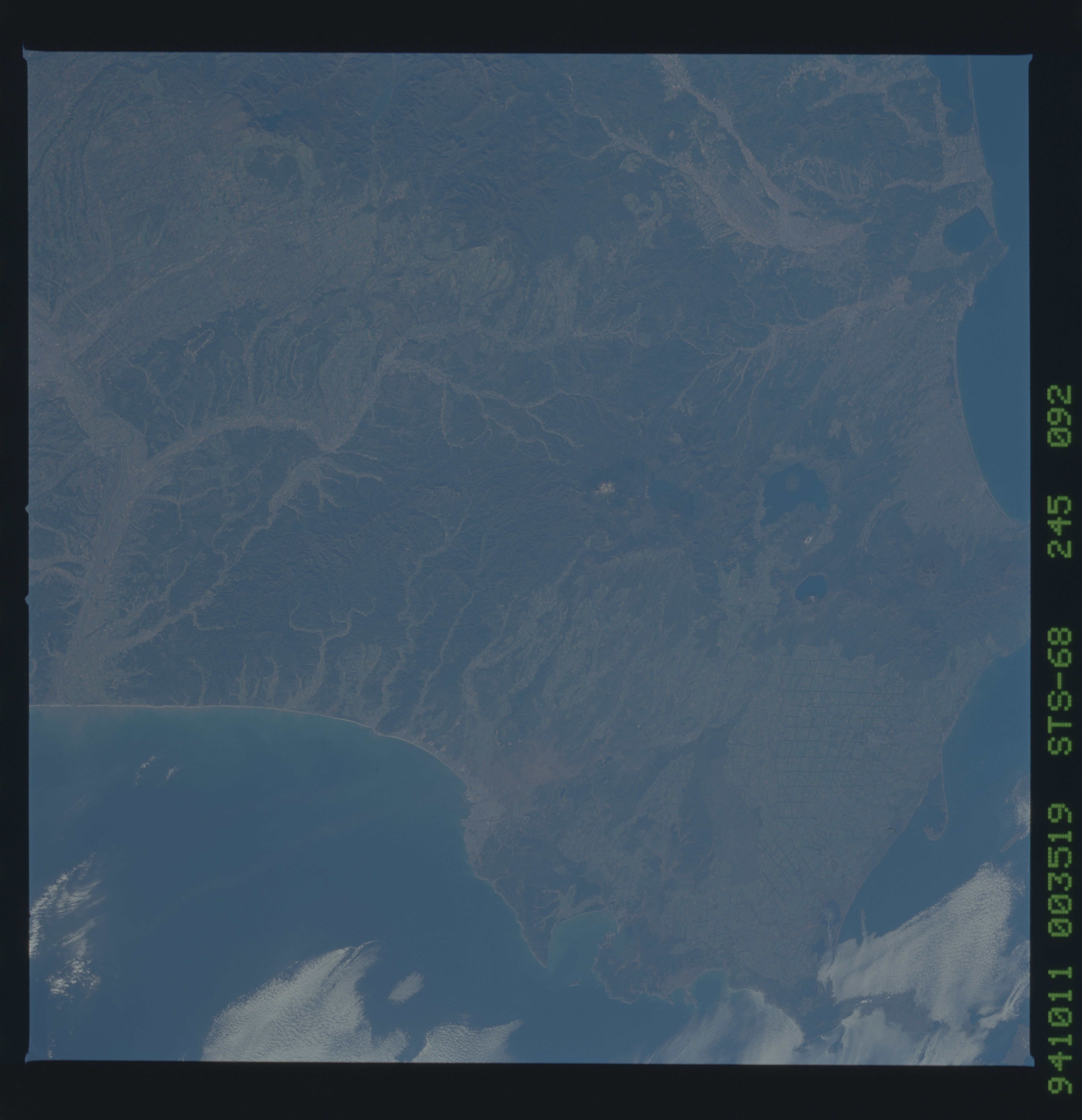
Image Caption: STS068-245-092 Eastern Hokkaido Island, Japan October 1994
A synoptic view of the eastern end of Hokkaido Island presents a diverse landscape of plains, drainage patterns, river valleys, lakes, peninsulas, and volcanic mountains. The features include the intensively cultivated Tokachi Plains (lower left) and the broad floodplains of the Obihiro and Tokachi Rivers (lighter-colored swaths bottom center); a northeast-southwest aligned belt of volcanic mountains (dark region extending vertically through the center of the image) with water filled calderas (dark features)- Lake Kutcharoko is the lighter lake and Lake Mashuko the smaller; an extensive gridded pattern near the eastern end of the island that is related to the forestry industry; and several coastal features that include peninsulas, estuaries, bays (Akkeshi Bay- middle right) and a sand spit along the east coast that extends into Nemuro Strait. A section of the Ishikari range of volcanic mountains (darker area left center) parallels the northwest margin of the Tokachi River Basin. The dark areas show regions of dense vegetative cover, mainly forested lands.
A synoptic view of the eastern end of Hokkaido Island presents a diverse landscape of plains, drainage patterns, river valleys, lakes, peninsulas, and volcanic mountains. The features include the intensively cultivated Tokachi Plains (lower left) and the broad floodplains of the Obihiro and Tokachi Rivers (lighter-colored swaths bottom center); a northeast-southwest aligned belt of volcanic mountains (dark region extending vertically through the center of the image) with water filled calderas (dark features)- Lake Kutcharoko is the lighter lake and Lake Mashuko the smaller; an extensive gridded pattern near the eastern end of the island that is related to the forestry industry; and several coastal features that include peninsulas, estuaries, bays (Akkeshi Bay- middle right) and a sand spit along the east coast that extends into Nemuro Strait. A section of the Ishikari range of volcanic mountains (darker area left center) parallels the northwest margin of the Tokachi River Basin. The dark areas show regions of dense vegetative cover, mainly forested lands.
