STS068-239-90
| NASA Photo ID | STS068-239-90 |
| Focal Length | 250mm |
| Date taken | 1994.10.02 |
| Time taken | 06:46:47 GMT |
Resolutions offered for this image:
4085 x 4091 pixels 639 x 640 pixels 5700 x 5900 pixels 500 x 518 pixels 640 x 480 pixels 2615 x 2384 pixels 2639 x 2518 pixels 527 x 516 pixels
4085 x 4091 pixels 639 x 640 pixels 5700 x 5900 pixels 500 x 518 pixels 640 x 480 pixels 2615 x 2384 pixels 2639 x 2518 pixels 527 x 516 pixels

Cloud masks available for this image:
Spacecraft nadir point: 23.3° N, 120.8° E
Photo center point: 25.0° N, 121.5° E
Photo center point by machine learning:
Photo center point: 25.0° N, 121.5° E
Photo center point by machine learning:
Nadir to Photo Center: North
Spacecraft Altitude: 118 nautical miles (219km)
Camera: | Hasselblad |
Focal Length: | 250mm |
Camera Tilt: | 43 degrees |
Format: | 5046: Kodak, natural color positive, Lumiere 100/5046, ASA 100, standard base |
Film Exposure: | Normal |
| Additional Information | |
| Width | Height | Annotated | Cropped | Purpose | Links |
|---|---|---|---|---|---|
| 4085 pixels | 4091 pixels | No | No | Earth From Space collection | Download Image |
| 639 pixels | 640 pixels | No | No | Earth From Space collection | Download Image |
| 5700 pixels | 5900 pixels | No | No | Download Image | |
| 500 pixels | 518 pixels | No | No | Download Image | |
| 640 pixels | 480 pixels | No | No | Download Image | |
| 2615 pixels | 2384 pixels | No | Yes | ReefBase 1 | Download Image |
| 2639 pixels | 2518 pixels | No | No | ReefBase 1 | Download Image |
| 527 pixels | 516 pixels | Download Image |
Download Packaged File
Download a Google Earth KML for this Image
View photo footprint information
Download a GeoTIFF for this photo
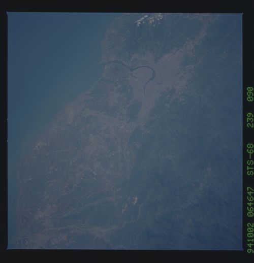
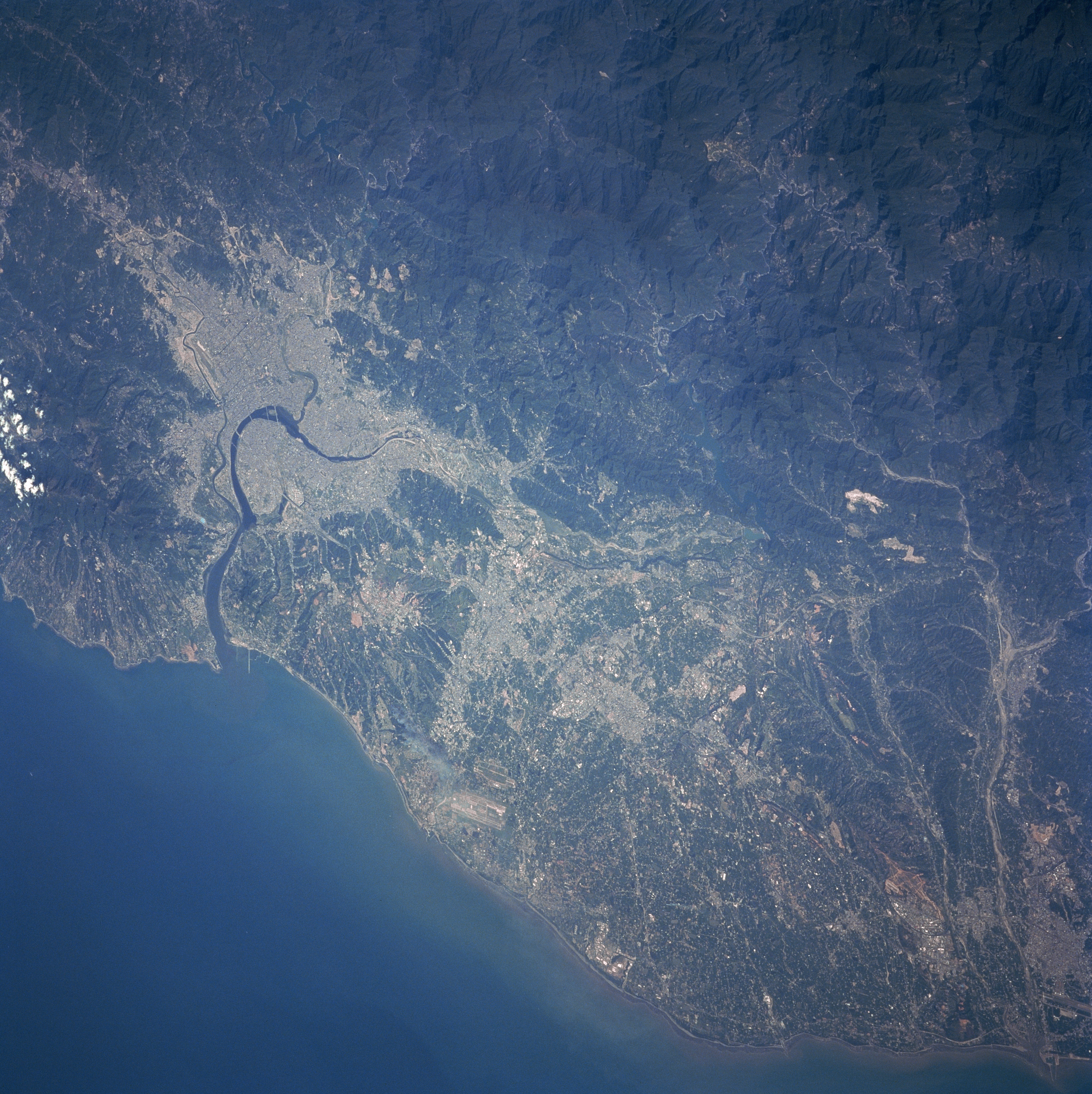
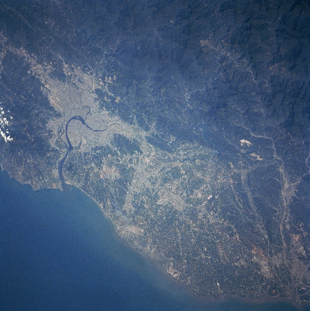
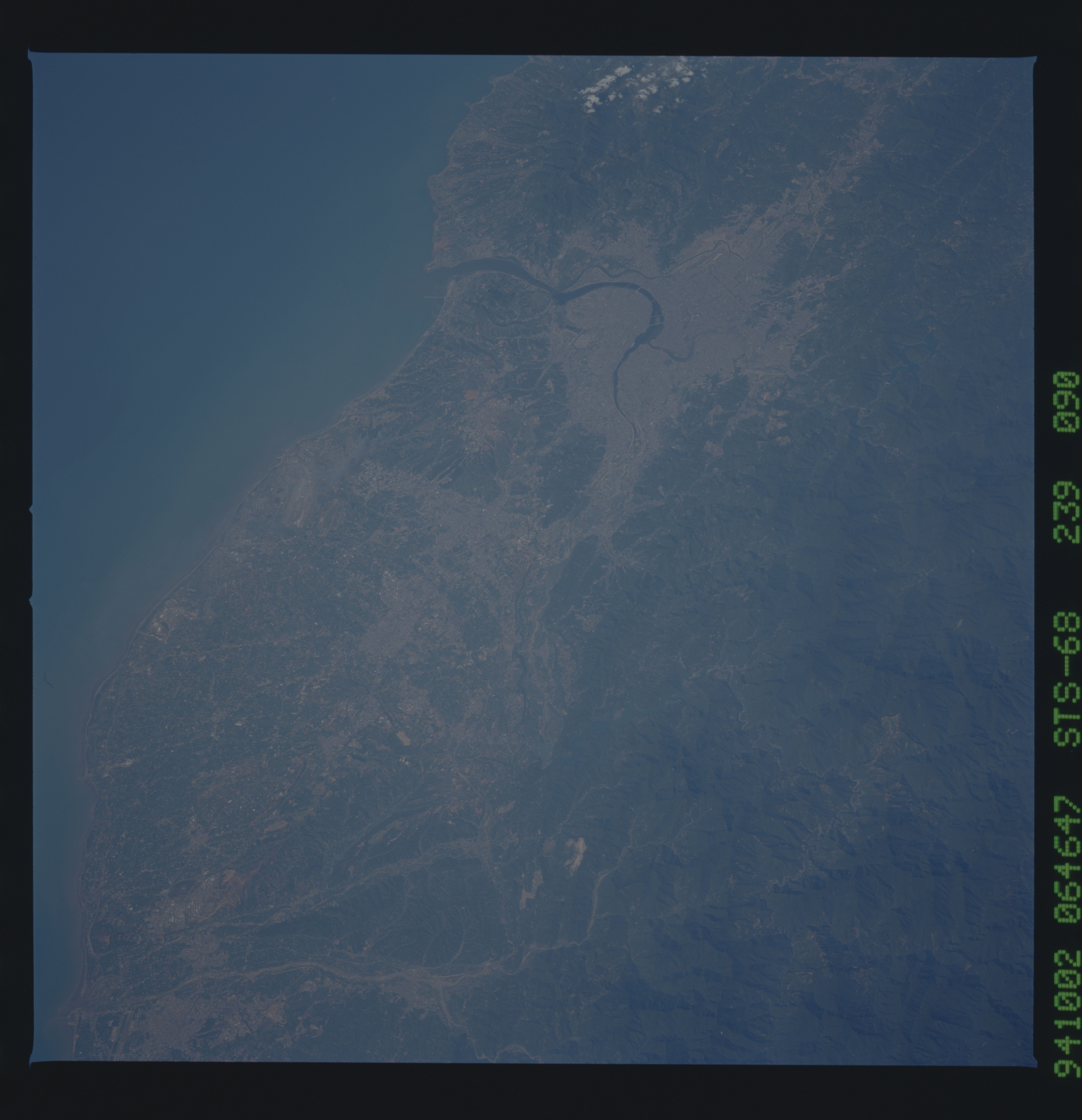
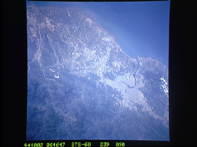
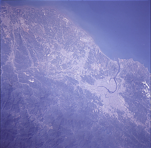
Image Caption: STS068-239-090 Taipei Area, Taiwan October 1994
Located at the northern end of the island, Taipei (light colored area) is Taiwan's capital and largest city (estimated 1997 population more than 2.6 million people). The Tanshui River (dark curving feature) flows through Taipei, eventually emptying into the Formosa Strait. Parallel runways (light-colored linear feature) of Chiang Kai Shek International Airport are visible west of Taipei near the coast. The Chungyang Mountains can be identified by the darker landscape, particularly in the lower right corner of the image. This mountain range extends northeast/southwest for the entire length of the island. The mountains tend to have steep slopes and are densely forested. The darker terrain along the west coast is vegetated hills, while the lighter colored terrain shows the distribution of urban areas and farmland.
Located at the northern end of the island, Taipei (light colored area) is Taiwan's capital and largest city (estimated 1997 population more than 2.6 million people). The Tanshui River (dark curving feature) flows through Taipei, eventually emptying into the Formosa Strait. Parallel runways (light-colored linear feature) of Chiang Kai Shek International Airport are visible west of Taipei near the coast. The Chungyang Mountains can be identified by the darker landscape, particularly in the lower right corner of the image. This mountain range extends northeast/southwest for the entire length of the island. The mountains tend to have steep slopes and are densely forested. The darker terrain along the west coast is vegetated hills, while the lighter colored terrain shows the distribution of urban areas and farmland.
