STS068-239-30
| NASA Photo ID | STS068-239-30 |
| Focal Length | 250mm |
| Date taken | 1994.10.02 |
| Time taken | 05:06:44 GMT |
Resolutions offered for this image:
4065 x 4065 pixels 639 x 639 pixels 5700 x 5900 pixels 500 x 518 pixels 640 x 480 pixels 523 x 503 pixels
4065 x 4065 pixels 639 x 639 pixels 5700 x 5900 pixels 500 x 518 pixels 640 x 480 pixels 523 x 503 pixels

Cloud masks available for this image:
Spacecraft nadir point: 53.7° N, 101.0° E
Photo center point: 54.5° N, 100.5° E
Photo center point by machine learning:
Photo center point: 54.5° N, 100.5° E
Photo center point by machine learning:
Nadir to Photo Center: Northwest
Spacecraft Altitude: 117 nautical miles (217km)
Camera: | Hasselblad |
Focal Length: | 250mm |
Camera Tilt: | 26 degrees |
Format: | 5046: Kodak, natural color positive, Lumiere 100/5046, ASA 100, standard base |
Film Exposure: | Normal |
| Additional Information | |
| Width | Height | Annotated | Cropped | Purpose | Links |
|---|---|---|---|---|---|
| 4065 pixels | 4065 pixels | No | No | Earth From Space collection | Download Image |
| 639 pixels | 639 pixels | No | No | Earth From Space collection | Download Image |
| 5700 pixels | 5900 pixels | No | No | Download Image | |
| 500 pixels | 518 pixels | No | No | Download Image | |
| 640 pixels | 480 pixels | No | No | Download Image | |
| 523 pixels | 503 pixels | No | No | Download Image |
Download Packaged File
Download a Google Earth KML for this Image
View photo footprint information
Download a GeoTIFF for this photo
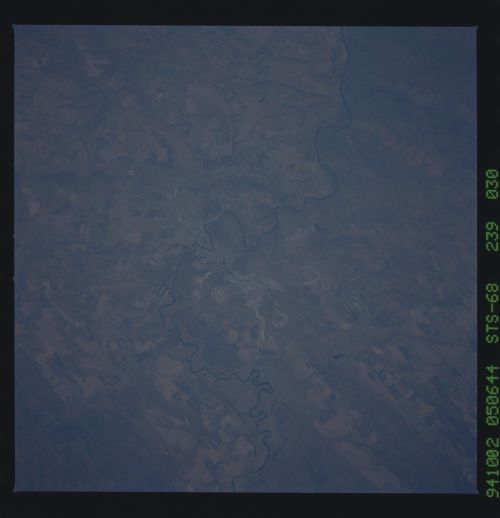
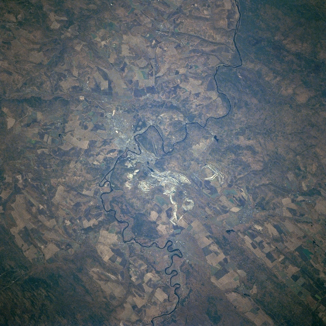
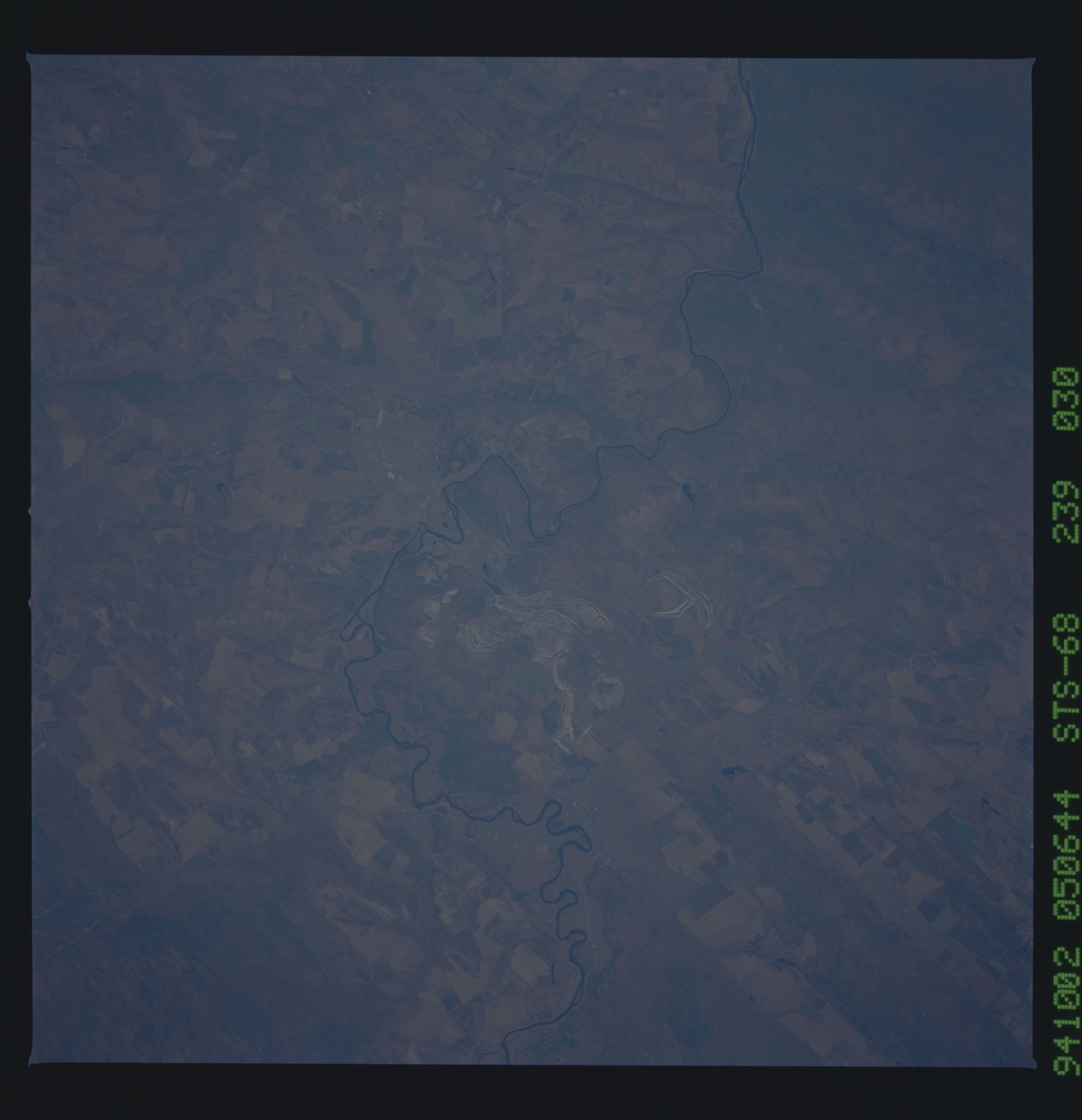
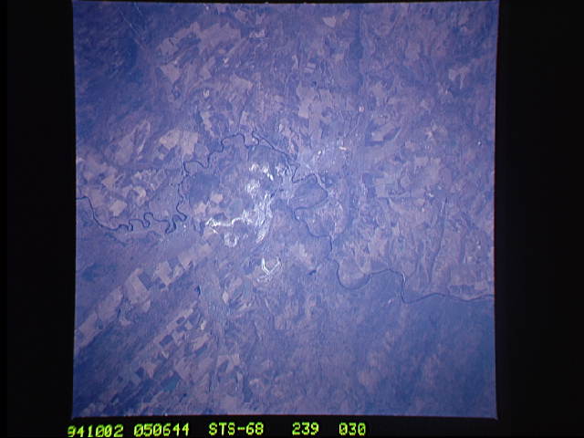
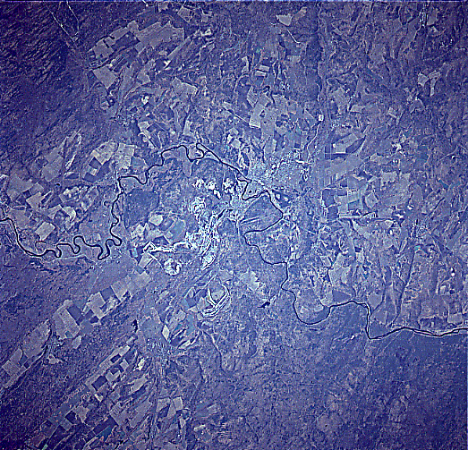
Image Caption: STS068-239-030 Iya River, Russia October 1994
The Russian city of Tulun (left center) is situated on the north flowing Iya River (meandering, thin dark lines that runs vertically through the middle of the picture). Sections of several manmade structures including a pipeline, a highway, a power line, and a railroad are located in an east-west corridor that can be traced across the landscape in the vicinity of Tulun. The railroad is especially significant since it is part of the Trans Siberian Railroad that connects Moscow with Vladivostok, a distance of 6000 miles (9655 km). The rural area around Tulun is agrarian, where the runoff from the mountains to the south brings alluvium to enrich the soil and provides sufficient water for irrigated farming (notice the large, angular-looking, multicolored field patterns). The lighter-colored area near the center of the image but east of the Iya River, are ground scars created by the surface mining activities.
The Russian city of Tulun (left center) is situated on the north flowing Iya River (meandering, thin dark lines that runs vertically through the middle of the picture). Sections of several manmade structures including a pipeline, a highway, a power line, and a railroad are located in an east-west corridor that can be traced across the landscape in the vicinity of Tulun. The railroad is especially significant since it is part of the Trans Siberian Railroad that connects Moscow with Vladivostok, a distance of 6000 miles (9655 km). The rural area around Tulun is agrarian, where the runoff from the mountains to the south brings alluvium to enrich the soil and provides sufficient water for irrigated farming (notice the large, angular-looking, multicolored field patterns). The lighter-colored area near the center of the image but east of the Iya River, are ground scars created by the surface mining activities.
