STS068-237-52
| NASA Photo ID | STS068-237-52 |
| Focal Length | 250mm |
| Date taken | 1994.10.06 |
| Time taken | 17:13:35 GMT |
Resolutions offered for this image:
3872 x 3872 pixels 639 x 639 pixels 5700 x 5900 pixels 500 x 518 pixels 640 x 480 pixels
3872 x 3872 pixels 639 x 639 pixels 5700 x 5900 pixels 500 x 518 pixels 640 x 480 pixels
Cloud masks available for this image:
Spacecraft nadir point: 41.5° N, 80.4° W
Photo center point: 41.5° N, 83.0° W
Photo center point by machine learning:
Photo center point: 41.5° N, 83.0° W
Photo center point by machine learning:
Nadir to Photo Center: West
Spacecraft Altitude: 116 nautical miles (215km)
Country or Geographic Name: | USA-OHIO |
Features: | SANDUSKY BAY, AGRICULTURE |
| Features Found Using Machine Learning: | |
Cloud Cover Percentage: | 0 (no clouds present) |
Sun Elevation Angle: | 43° |
Sun Azimuth: | 181° |
Camera: | Hasselblad |
Focal Length: | 250mm |
Camera Tilt: | 53 degrees |
Format: | 5046: Kodak, natural color positive, Lumiere 100/5046, ASA 100, standard base |
Film Exposure: | Normal |
| Additional Information | |
| Width | Height | Annotated | Cropped | Purpose | Links |
|---|---|---|---|---|---|
| 3872 pixels | 3872 pixels | No | No | Earth From Space collection | Download Image |
| 639 pixels | 639 pixels | No | No | Earth From Space collection | Download Image |
| 5700 pixels | 5900 pixels | No | No | Download Image | |
| 500 pixels | 518 pixels | No | No | Download Image | |
| 640 pixels | 480 pixels | No | No | Download Image |
Download Packaged File
Download a Google Earth KML for this Image
View photo footprint information
Download a GeoTIFF for this photo
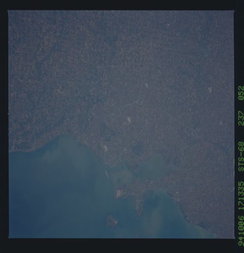
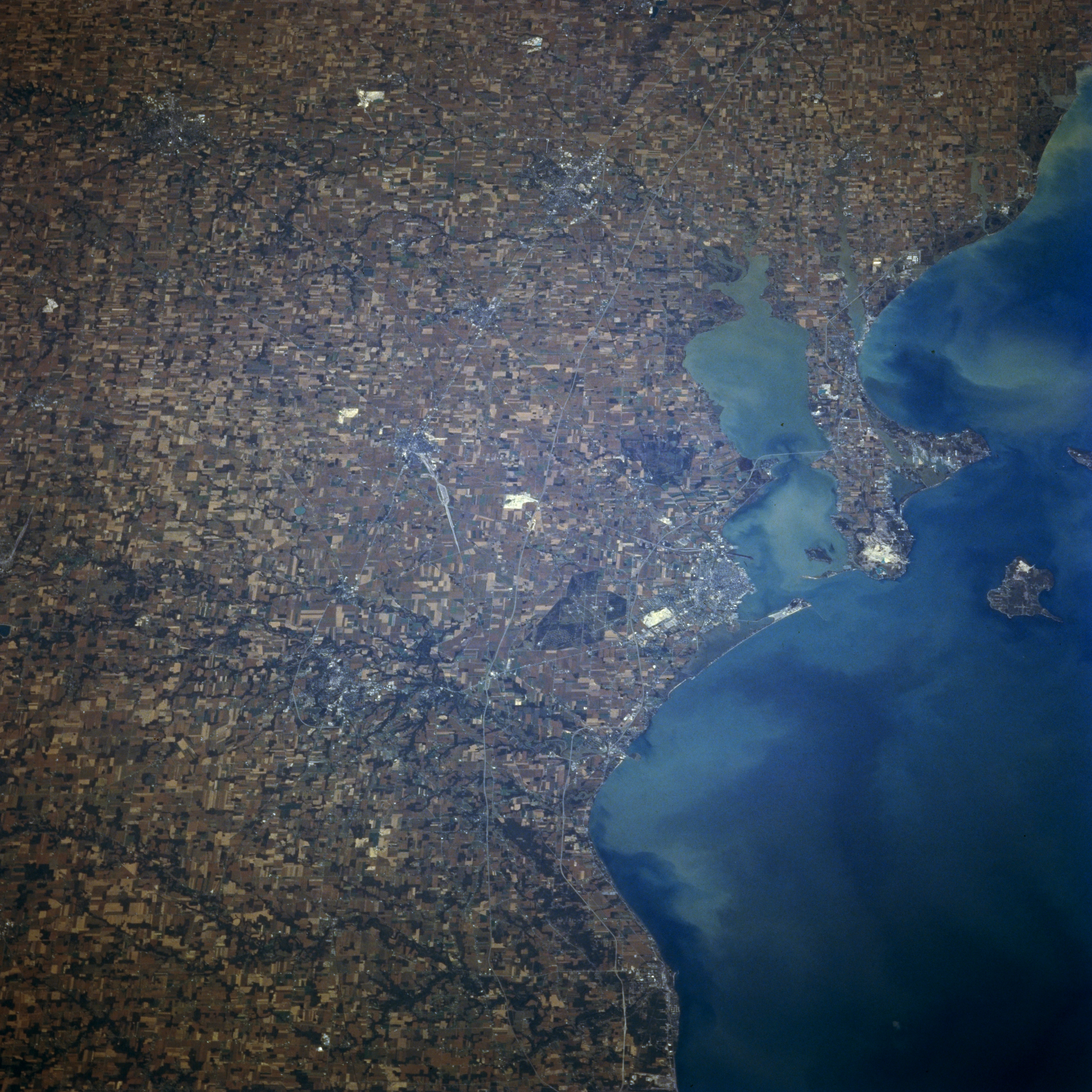
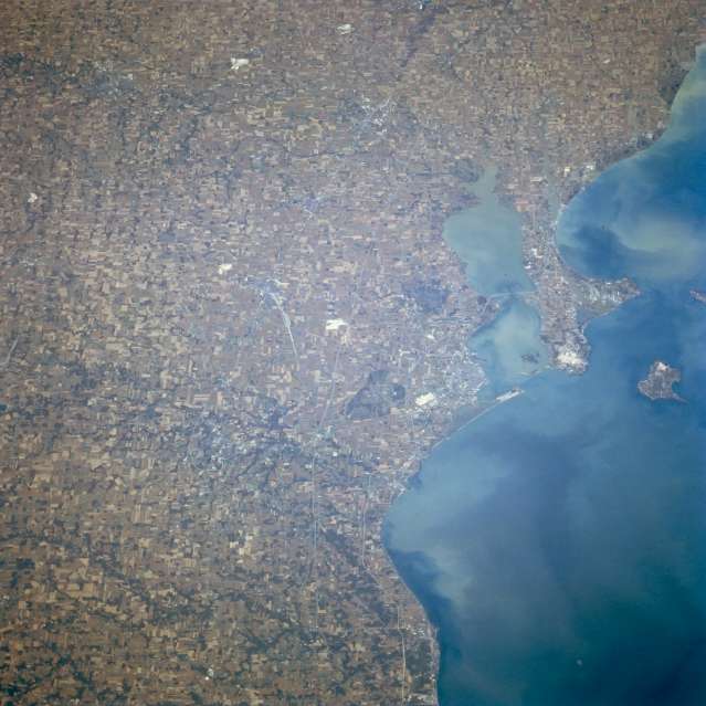
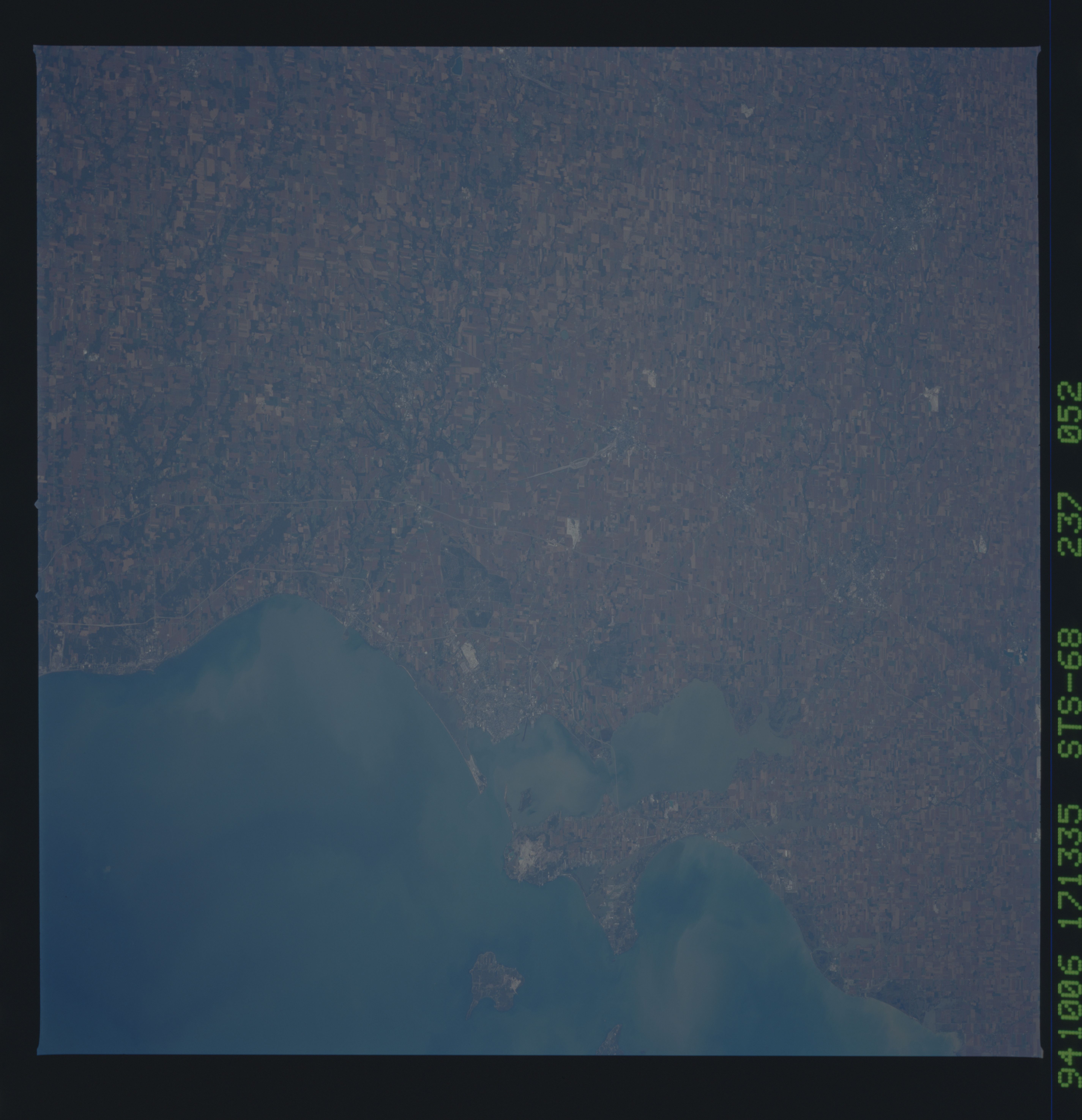
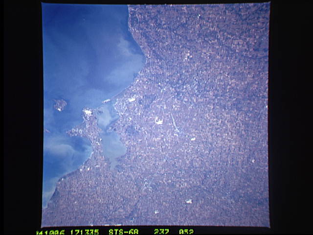
Image Caption: STS068-237-052 Sandusky Bay; Sandusky/Norwalk, Ohio October 1994
This west-looking view shows Sandusky Bay and the agricultural land use patterns of northwest Ohio. Lake Erie, with its numerous shoreline sediment patterns, covers most of the right quarter of the image. The highly reflected white areas that are visible scattered throughout the land scene are limestone quarries, as limestone is most prevalent in northwest Ohio. The small industrial city of Sandusky, located near the outlet of Sandusky Bay (to the right of the center of the image), is discernible. To the south-southeast of Sandusky, the small city of Norwalk is visible. Rubber products are the major industry of the city of Norwalk. Kelleys Island can be seen in lake Erie at the right center of the image.
This west-looking view shows Sandusky Bay and the agricultural land use patterns of northwest Ohio. Lake Erie, with its numerous shoreline sediment patterns, covers most of the right quarter of the image. The highly reflected white areas that are visible scattered throughout the land scene are limestone quarries, as limestone is most prevalent in northwest Ohio. The small industrial city of Sandusky, located near the outlet of Sandusky Bay (to the right of the center of the image), is discernible. To the south-southeast of Sandusky, the small city of Norwalk is visible. Rubber products are the major industry of the city of Norwalk. Kelleys Island can be seen in lake Erie at the right center of the image.
