STS068-232-43
| NASA Photo ID | STS068-232-43 |
| Focal Length | 100mm |
| Date taken | 1994.10.06 |
| Time taken | 18:45:13 GMT |
Resolutions offered for this image:
3840 x 3840 pixels 640 x 640 pixels 5700 x 5900 pixels 500 x 518 pixels 640 x 480 pixels 3180 x 3373 pixels
3840 x 3840 pixels 640 x 640 pixels 5700 x 5900 pixels 500 x 518 pixels 640 x 480 pixels 3180 x 3373 pixels

Cloud masks available for this image:
Spacecraft nadir point: 33.1° N, 93.7° W
Photo center point: 32.5° N, 92.5° W
Photo center point by machine learning:
Photo center point: 32.5° N, 92.5° W
Photo center point by machine learning:
Nadir to Photo Center: Southeast
Spacecraft Altitude: 116 nautical miles (215km)
Country or Geographic Name: | USA-MISSISSIPPI |
Features: | MONROE, OUACHITA R, AGRICULTURE |
| Features Found Using Machine Learning: | |
Cloud Cover Percentage: | 5 (1-10)% |
Sun Elevation Angle: | 51° |
Sun Azimuth: | 197° |
Camera: | Hasselblad |
Focal Length: | 100mm |
Camera Tilt: | Near Vertical |
Format: | 5046: Kodak, natural color positive, Lumiere 100/5046, ASA 100, standard base |
Film Exposure: | Normal |
| Additional Information | |
| Width | Height | Annotated | Cropped | Purpose | Links |
|---|---|---|---|---|---|
| 3840 pixels | 3840 pixels | No | No | Earth From Space collection | Download Image |
| 640 pixels | 640 pixels | No | No | Earth From Space collection | Download Image |
| 5700 pixels | 5900 pixels | No | No | Download Image | |
| 500 pixels | 518 pixels | No | No | Download Image | |
| 640 pixels | 480 pixels | No | No | Download Image | |
| 3180 pixels | 3373 pixels | Download Image |
Download Packaged File
Download a Google Earth KML for this Image
View photo footprint information
Download a GeoTIFF for this photo
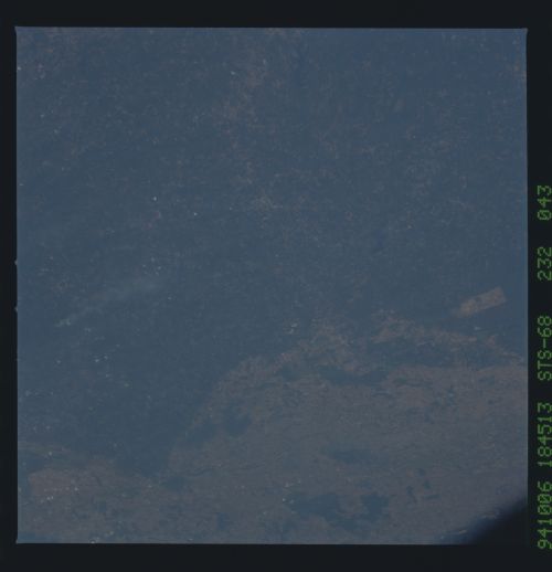
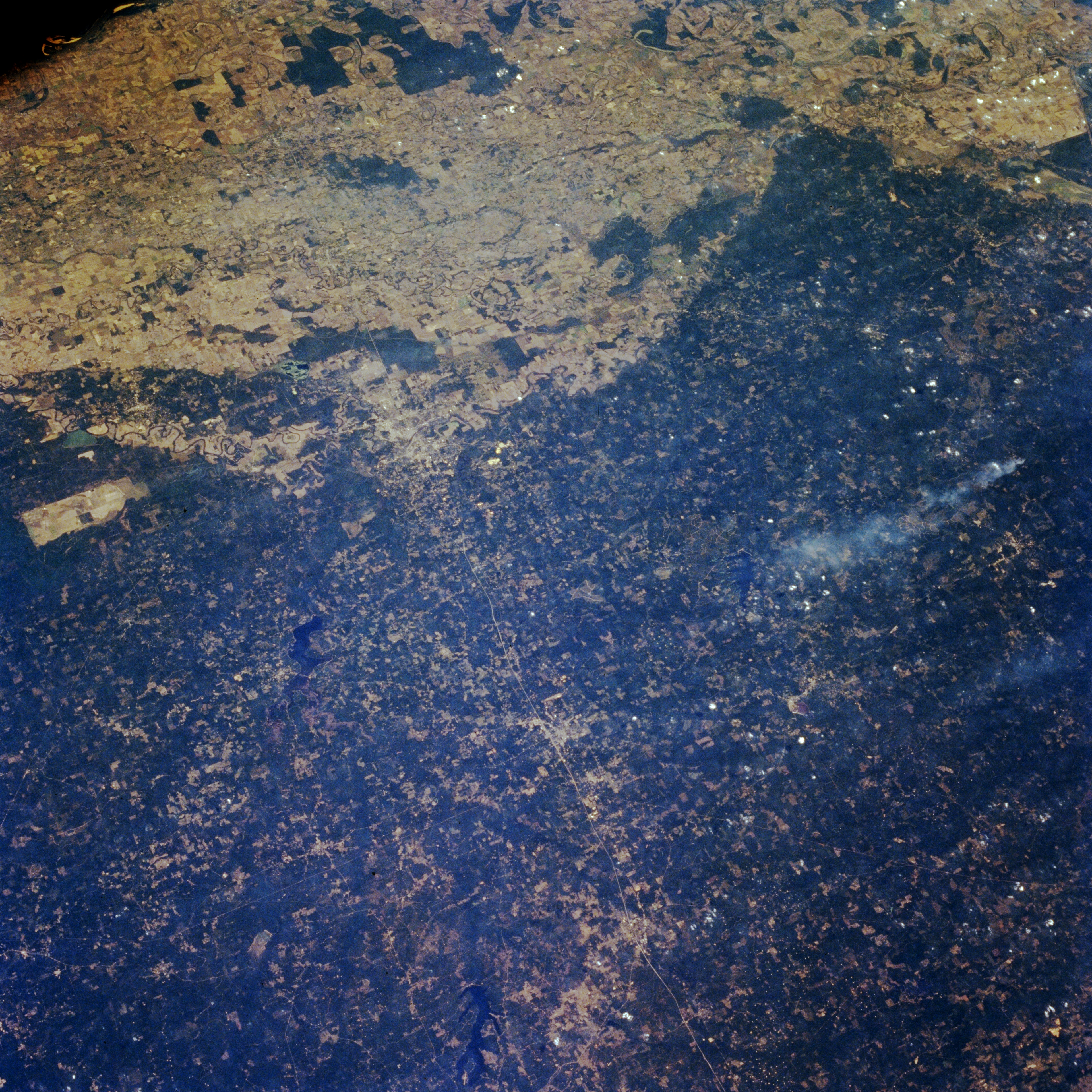
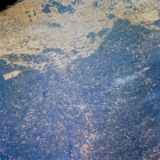
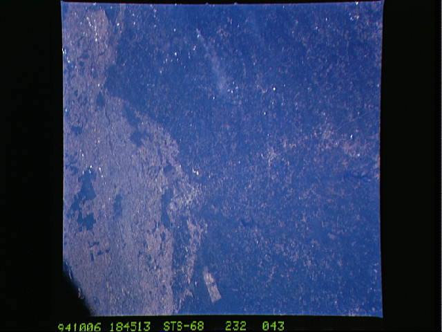
Image Caption: STS068-232-043 Northern Louisiana, U.S.A. October 1994
Interstate Highway 20 appears as a thin line connecting Arcadia in the west to Tallulah in the east in this east-looking, synoptic photograph of northern Louisiana. Visible north of Interstate Highway 20 are dark, irregular-shaped Lake Claiborne and Bayou d'Arbonne Lake farther east. Only the general locations of Ruston and Monroe, two of the larger cities in northern Louisiana, can be discerned. The dark greens of the rolling hills, known locally as the Prairie Complex, contrast dramatically with the lighter colors of the flat, intensely cultivated western Mississippi River floodplain. A single smoke plume appears south of Interstate Highway 20.
Interstate Highway 20 appears as a thin line connecting Arcadia in the west to Tallulah in the east in this east-looking, synoptic photograph of northern Louisiana. Visible north of Interstate Highway 20 are dark, irregular-shaped Lake Claiborne and Bayou d'Arbonne Lake farther east. Only the general locations of Ruston and Monroe, two of the larger cities in northern Louisiana, can be discerned. The dark greens of the rolling hills, known locally as the Prairie Complex, contrast dramatically with the lighter colors of the flat, intensely cultivated western Mississippi River floodplain. A single smoke plume appears south of Interstate Highway 20.
