STS068-232-26
| NASA Photo ID | STS068-232-26 |
| Focal Length | 100mm |
| Date taken | 1994.10.06 |
| Time taken | 17:13:44 GMT |
Resolutions offered for this image:
3808 x 3776 pixels 640 x 634 pixels 5700 x 5900 pixels 500 x 518 pixels 640 x 480 pixels
3808 x 3776 pixels 640 x 634 pixels 5700 x 5900 pixels 500 x 518 pixels 640 x 480 pixels
Cloud masks available for this image:
Spacecraft nadir point: 41.2° N, 80.0° W
Photo center point: 41.0° N, 81.5° W
Photo center point by machine learning:
Photo center point: 41.0° N, 81.5° W
Photo center point by machine learning:
Nadir to Photo Center: West
Spacecraft Altitude: 116 nautical miles (215km)
Country or Geographic Name: | USA-OHIO |
Features: | CLEVELAND, AKRON, AGRICULTURE |
| Features Found Using Machine Learning: | |
Cloud Cover Percentage: | 5 (1-10)% |
Sun Elevation Angle: | 44° |
Sun Azimuth: | 182° |
Camera: | Hasselblad |
Focal Length: | 100mm |
Camera Tilt: | 38 degrees |
Format: | 5046: Kodak, natural color positive, Lumiere 100/5046, ASA 100, standard base |
Film Exposure: | Normal |
| Additional Information | |
| Width | Height | Annotated | Cropped | Purpose | Links |
|---|---|---|---|---|---|
| 3808 pixels | 3776 pixels | No | No | Earth From Space collection | Download Image |
| 640 pixels | 634 pixels | No | No | Earth From Space collection | Download Image |
| 5700 pixels | 5900 pixels | No | No | Download Image | |
| 500 pixels | 518 pixels | No | No | Download Image | |
| 640 pixels | 480 pixels | No | No | Download Image |
Download Packaged File
Download a Google Earth KML for this Image
View photo footprint information
Download a GeoTIFF for this photo
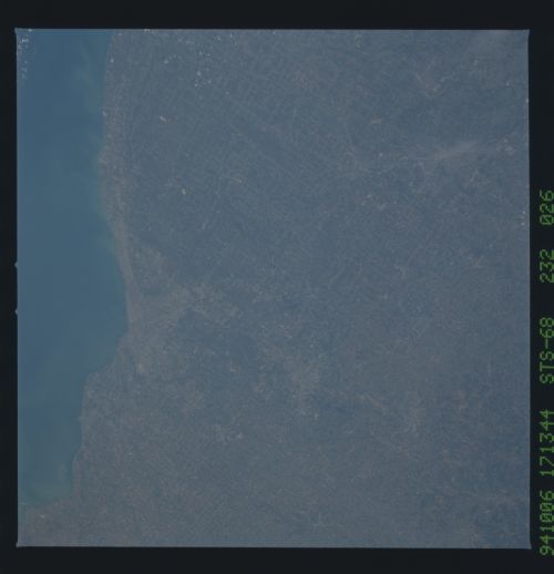
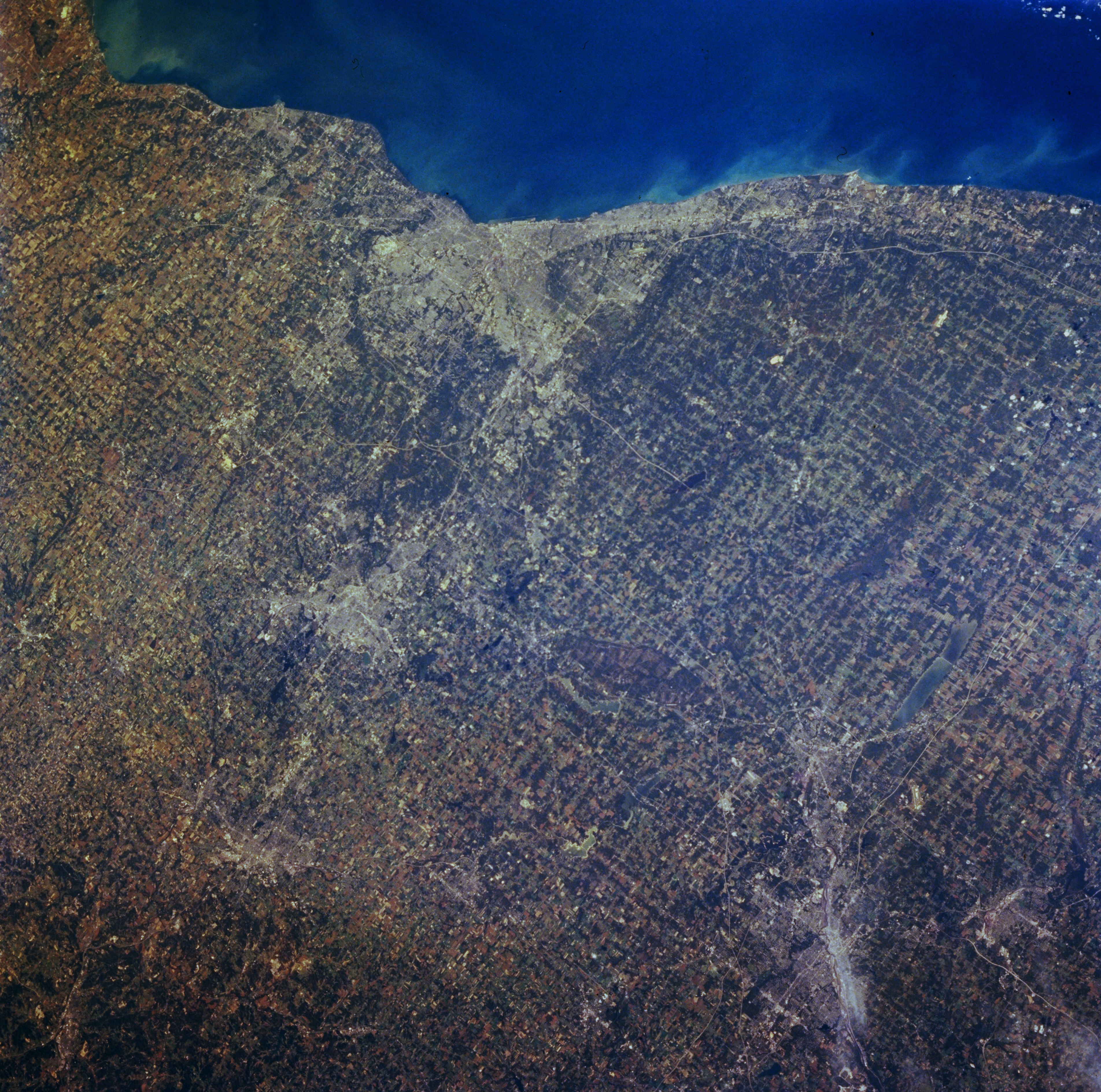
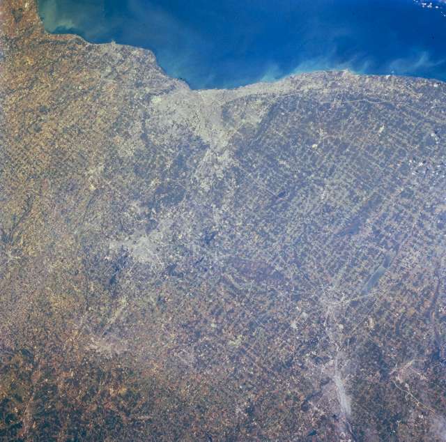
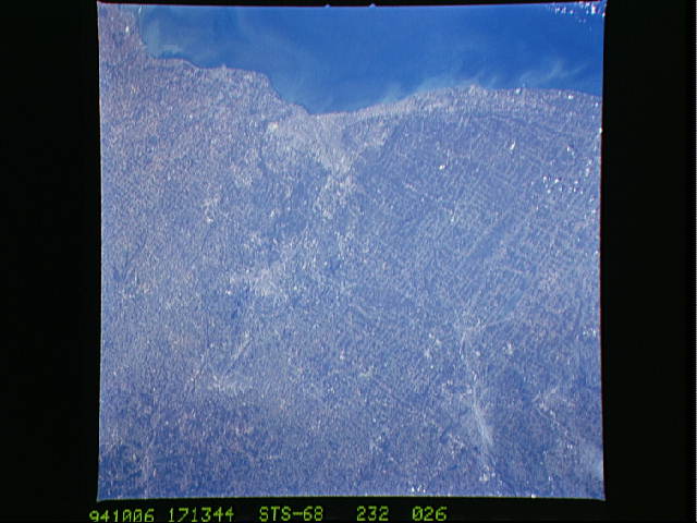
Image Caption: STS068-232-026 Cleveland, Akron, Canton, and Youngstown, Ohio, U.S.A. October 1994
Much of northeast Ohio is apparent in this north-northwest-looking, low-oblique photograph--Lake Erie from just east of Sandusky to near Geneva; metropolitan Cleveland; Akron, Massillon, and Canton south of Cleveland; and Warren and Youngstown (bottom right). The light blue waters of Mosquito Creek Lake are visible just north of Warren. The land patterns of northeast Ohio resemble those of the deforested regions of Rondonia in the upper Amazon River Basin of Brazil (reference photograph STS046-078-026).
Much of northeast Ohio is apparent in this north-northwest-looking, low-oblique photograph--Lake Erie from just east of Sandusky to near Geneva; metropolitan Cleveland; Akron, Massillon, and Canton south of Cleveland; and Warren and Youngstown (bottom right). The light blue waters of Mosquito Creek Lake are visible just north of Warren. The land patterns of northeast Ohio resemble those of the deforested regions of Rondonia in the upper Amazon River Basin of Brazil (reference photograph STS046-078-026).
