STS068-231-54
| NASA Photo ID | STS068-231-54 |
| Focal Length | 100mm |
| Date taken | 1994.10.05 |
| Time taken | 01:14:07 GMT |
Resolutions offered for this image:
5294 x 5294 pixels 640 x 640 pixels 5700 x 5900 pixels 500 x 518 pixels 640 x 480 pixels
5294 x 5294 pixels 640 x 640 pixels 5700 x 5900 pixels 500 x 518 pixels 640 x 480 pixels
Cloud masks available for this image:
Spacecraft nadir point: 49.4° N, 155.1° E
Photo center point: 49.5° N, 154.5° E
Photo center point by machine learning:
Photo center point: 49.5° N, 154.5° E
Photo center point by machine learning:
Nadir to Photo Center: West
Spacecraft Altitude: 116 nautical miles (215km)
Country or Geographic Name: | RUSSIAN FEDERATION |
Features: | KURIL IS., ONEKOTAN I. |
| Features Found Using Machine Learning: | |
Cloud Cover Percentage: | 5 (1-10)% |
Sun Elevation Angle: | 36° |
Sun Azimuth: | 176° |
Camera: | Hasselblad |
Focal Length: | 100mm |
Camera Tilt: | 18 degrees |
Format: | 5046: Kodak, natural color positive, Lumiere 100/5046, ASA 100, standard base |
Film Exposure: | Normal |
| Additional Information | |
| Width | Height | Annotated | Cropped | Purpose | Links |
|---|---|---|---|---|---|
| 5294 pixels | 5294 pixels | No | No | Earth From Space collection | Download Image |
| 640 pixels | 640 pixels | No | No | Earth From Space collection | Download Image |
| 5700 pixels | 5900 pixels | No | No | Download Image | |
| 500 pixels | 518 pixels | No | No | Download Image | |
| 640 pixels | 480 pixels | No | No | Download Image |
Download Packaged File
Download a Google Earth KML for this Image
View photo footprint information
Download a GeoTIFF for this photo
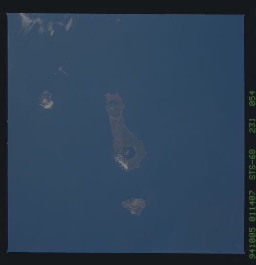
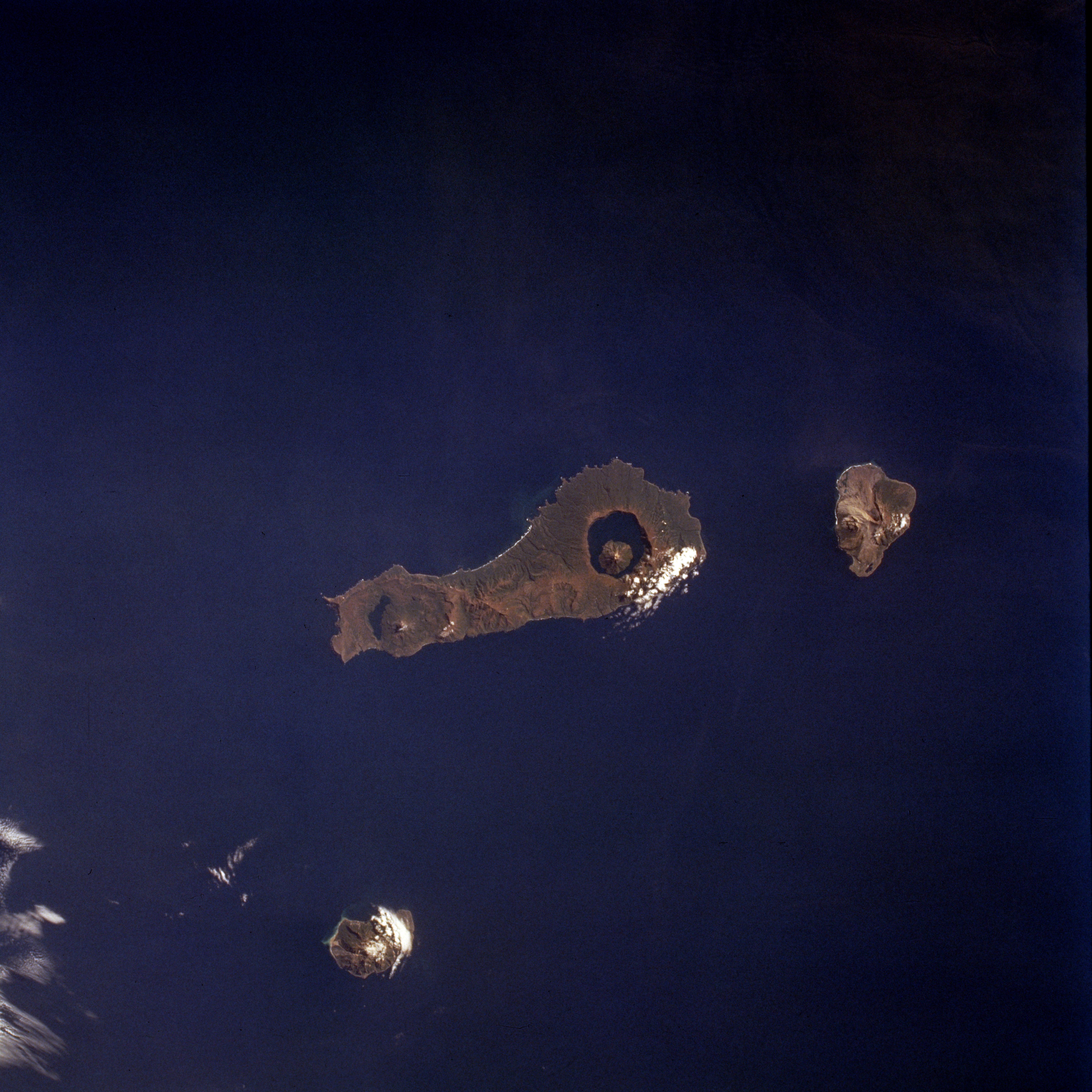
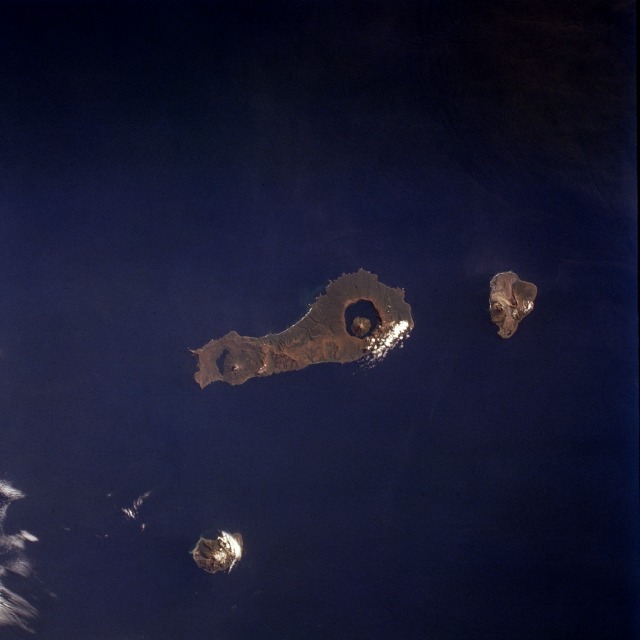
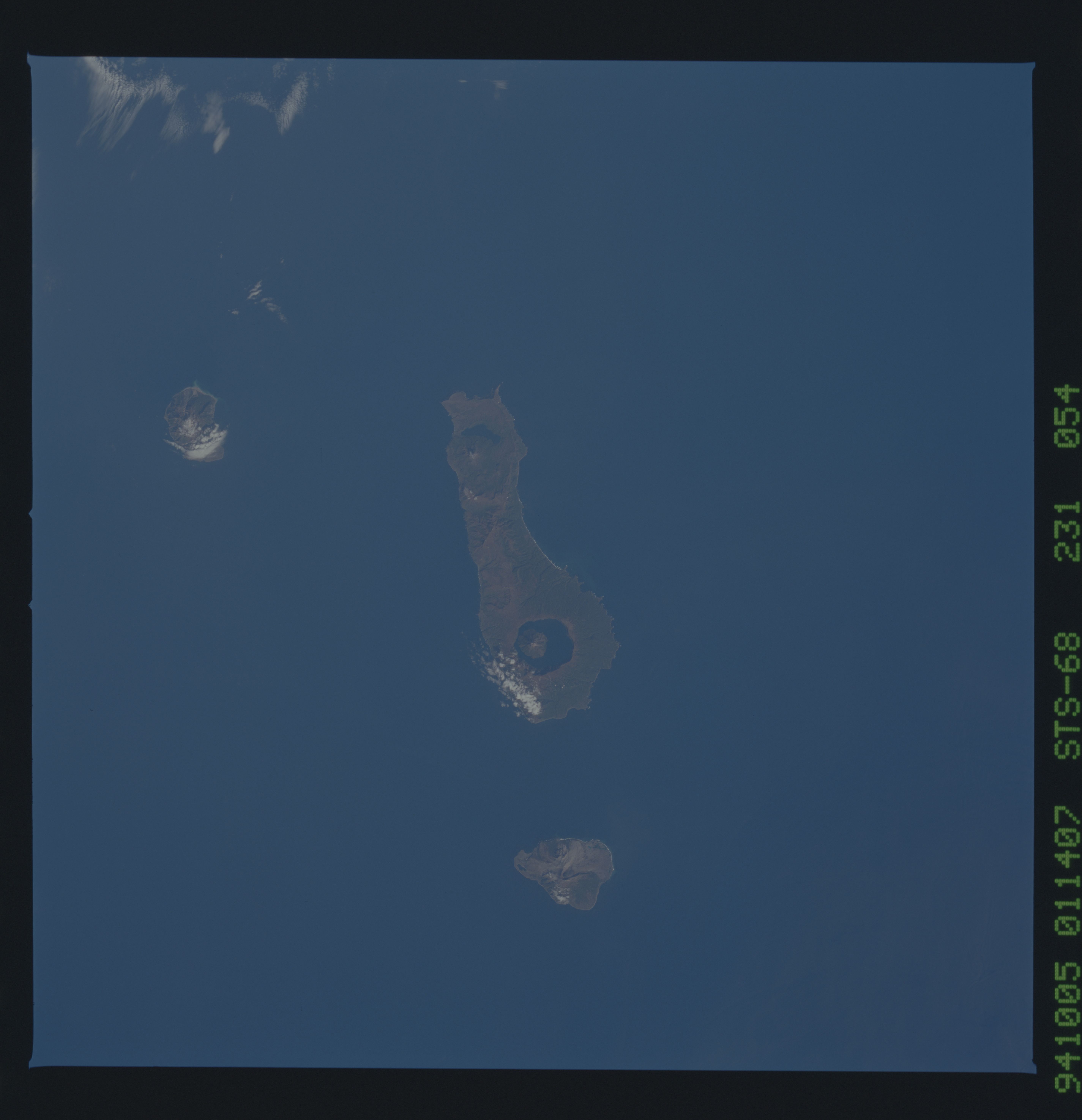
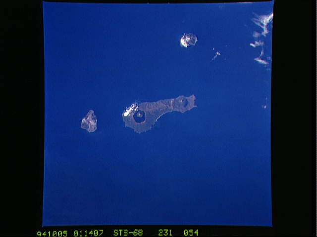
Image Caption: STS068-231-054 Onekotan Island, Kuril Islands, Russia October 1994
Located near the northern end of the Kuril Islands, Onekotan Island (center of photograph) is another volcanic island that is part of the "Ring of Fire" that encircles the Pacific Ocean. This island is unique because a water-filled caldera is evident at both the north and the south ends of the island. The highest elevation on Onekotan Island is the smaller peak, which is 4367 feet (1330 meters) above sea level, that lies within the southern caldera. More recent secondary volcanic cones have formed in both calderas; the northern caldera has almost been filled by the subsidiary cone. Two other smaller volcanic peaks are also visible on this photograph--Makanrushi Island, 3834 feet (11 170 meters), to the northwest of Onekotan Island and Kharimkotan Island, 3976 feet (1210 meters), to the south. (Refer to STS-047-075-082 for a view of Atlasova Island, another of the volcanic islands in the Kuril Island chain.)
Located near the northern end of the Kuril Islands, Onekotan Island (center of photograph) is another volcanic island that is part of the "Ring of Fire" that encircles the Pacific Ocean. This island is unique because a water-filled caldera is evident at both the north and the south ends of the island. The highest elevation on Onekotan Island is the smaller peak, which is 4367 feet (1330 meters) above sea level, that lies within the southern caldera. More recent secondary volcanic cones have formed in both calderas; the northern caldera has almost been filled by the subsidiary cone. Two other smaller volcanic peaks are also visible on this photograph--Makanrushi Island, 3834 feet (11 170 meters), to the northwest of Onekotan Island and Kharimkotan Island, 3976 feet (1210 meters), to the south. (Refer to STS-047-075-082 for a view of Atlasova Island, another of the volcanic islands in the Kuril Island chain.)
