STS068-230-94
| NASA Photo ID | STS068-230-94 |
| Focal Length | 250mm |
| Date taken | 1994.10.01 |
| Time taken | 19:03:19 GMT |
Resolutions offered for this image:
5294 x 5294 pixels 640 x 640 pixels 5700 x 5900 pixels 500 x 518 pixels 640 x 480 pixels
5294 x 5294 pixels 640 x 640 pixels 5700 x 5900 pixels 500 x 518 pixels 640 x 480 pixels


Cloud masks available for this image:
Spacecraft nadir point: 1.1° S, 43.6° W
Photo center point: 2.5° S, 42.5° W
Photo center point by machine learning:
Photo center point: 2.5° S, 42.5° W
Photo center point by machine learning:
Nadir to Photo Center: Southeast
Spacecraft Altitude: 119 nautical miles (220km)
Country or Geographic Name: | BRAZIL |
Features: | SAND DEPOSITS, PT. MANGUE |
| Features Found Using Machine Learning: | |
Cloud Cover Percentage: | 0 (no clouds present) |
Sun Elevation Angle: | 25° |
Sun Azimuth: | 267° |
Camera: | Hasselblad |
Focal Length: | 250mm |
Camera Tilt: | 42 degrees |
Format: | 5046: Kodak, natural color positive, Lumiere 100/5046, ASA 100, standard base |
Film Exposure: | Normal |
| Additional Information | |
| Width | Height | Annotated | Cropped | Purpose | Links |
|---|---|---|---|---|---|
| 5294 pixels | 5294 pixels | No | No | Earth From Space collection | Download Image |
| 640 pixels | 640 pixels | No | No | Earth From Space collection | Download Image |
| 5700 pixels | 5900 pixels | No | No | Download Image | |
| 500 pixels | 518 pixels | No | No | Download Image | |
| 640 pixels | 480 pixels | No | No | Download Image |
Download Packaged File
Download a Google Earth KML for this Image
View photo footprint information
Download a GeoTIFF for this photo
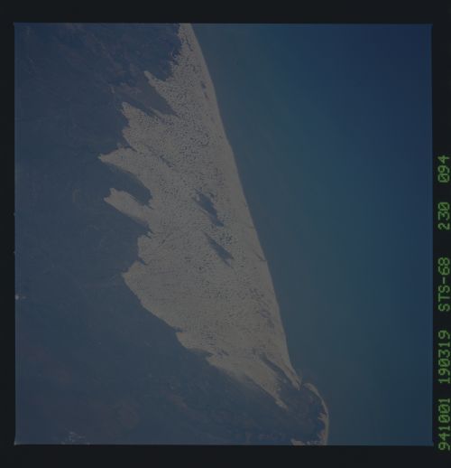
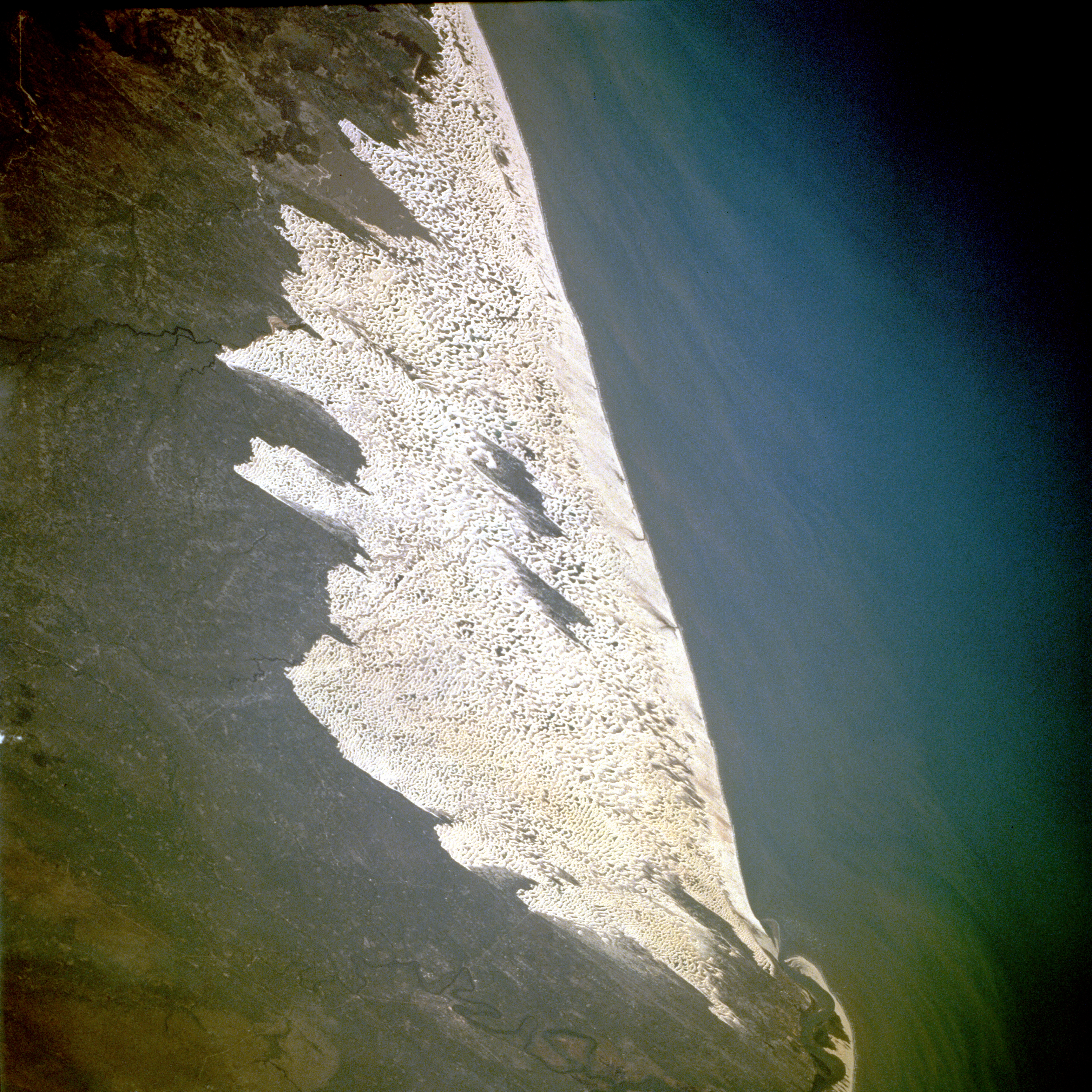
Image Caption: STS068-230-094 Sand Dunes, Maranhão State, Brazil October 1994
This extensive sand dune region along the northeast coast of Brazil in the state of Maranhão measures more than 40 miles (65 kilometers) in length. These dunes, classified as a parabolic or blowout dune formation, usually form adjacent to beaches that have a large supply of sand and strong prevailing onshore winds. The dunes are gradually encroaching westward because of the prevailing easterly winds. The small city of Barreirinhas is barely visible on the eastern side of the Rio Preguiças. A sand bar and its northwestward development at the mouth of the Rio Preguiças result from the warm south equatorial current flowing northwestward along the northeast coast of Brazil.
This extensive sand dune region along the northeast coast of Brazil in the state of Maranhão measures more than 40 miles (65 kilometers) in length. These dunes, classified as a parabolic or blowout dune formation, usually form adjacent to beaches that have a large supply of sand and strong prevailing onshore winds. The dunes are gradually encroaching westward because of the prevailing easterly winds. The small city of Barreirinhas is barely visible on the eastern side of the Rio Preguiças. A sand bar and its northwestward development at the mouth of the Rio Preguiças result from the warm south equatorial current flowing northwestward along the northeast coast of Brazil.
