STS068-230-83
| NASA Photo ID | STS068-230-83 |
| Focal Length | 250mm |
| Date taken | 1994.10.01 |
| Time taken | 18:47:07 GMT |
Resolutions offered for this image:
3869 x 3872 pixels 639 x 639 pixels 5700 x 5900 pixels 500 x 518 pixels 640 x 480 pixels
3869 x 3872 pixels 639 x 639 pixels 5700 x 5900 pixels 500 x 518 pixels 640 x 480 pixels

Cloud masks available for this image:
Spacecraft nadir point: 49.3° N, 88.8° W
Photo center point: 48.5° N, 89.5° W
Photo center point by machine learning:
Photo center point: 48.5° N, 89.5° W
Photo center point by machine learning:
Nadir to Photo Center: Southwest
Spacecraft Altitude: 117 nautical miles (217km)
Country or Geographic Name: | CANADA-O |
Features: | THUNDER BAY, MOUNTAINS |
| Features Found Using Machine Learning: | |
Cloud Cover Percentage: | 0 (no clouds present) |
Sun Elevation Angle: | 36° |
Sun Azimuth: | 199° |
Camera: | Hasselblad |
Focal Length: | 250mm |
Camera Tilt: | 29 degrees |
Format: | 5046: Kodak, natural color positive, Lumiere 100/5046, ASA 100, standard base |
Film Exposure: | Normal |
| Additional Information | |
| Width | Height | Annotated | Cropped | Purpose | Links |
|---|---|---|---|---|---|
| 3869 pixels | 3872 pixels | No | No | Earth From Space collection | Download Image |
| 639 pixels | 639 pixels | No | No | Earth From Space collection | Download Image |
| 5700 pixels | 5900 pixels | No | No | Download Image | |
| 500 pixels | 518 pixels | No | No | Download Image | |
| 640 pixels | 480 pixels | No | No | Download Image |
Download Packaged File
Download a Google Earth KML for this Image
View photo footprint information
Download a GeoTIFF for this photo
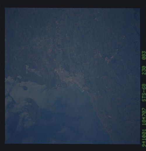
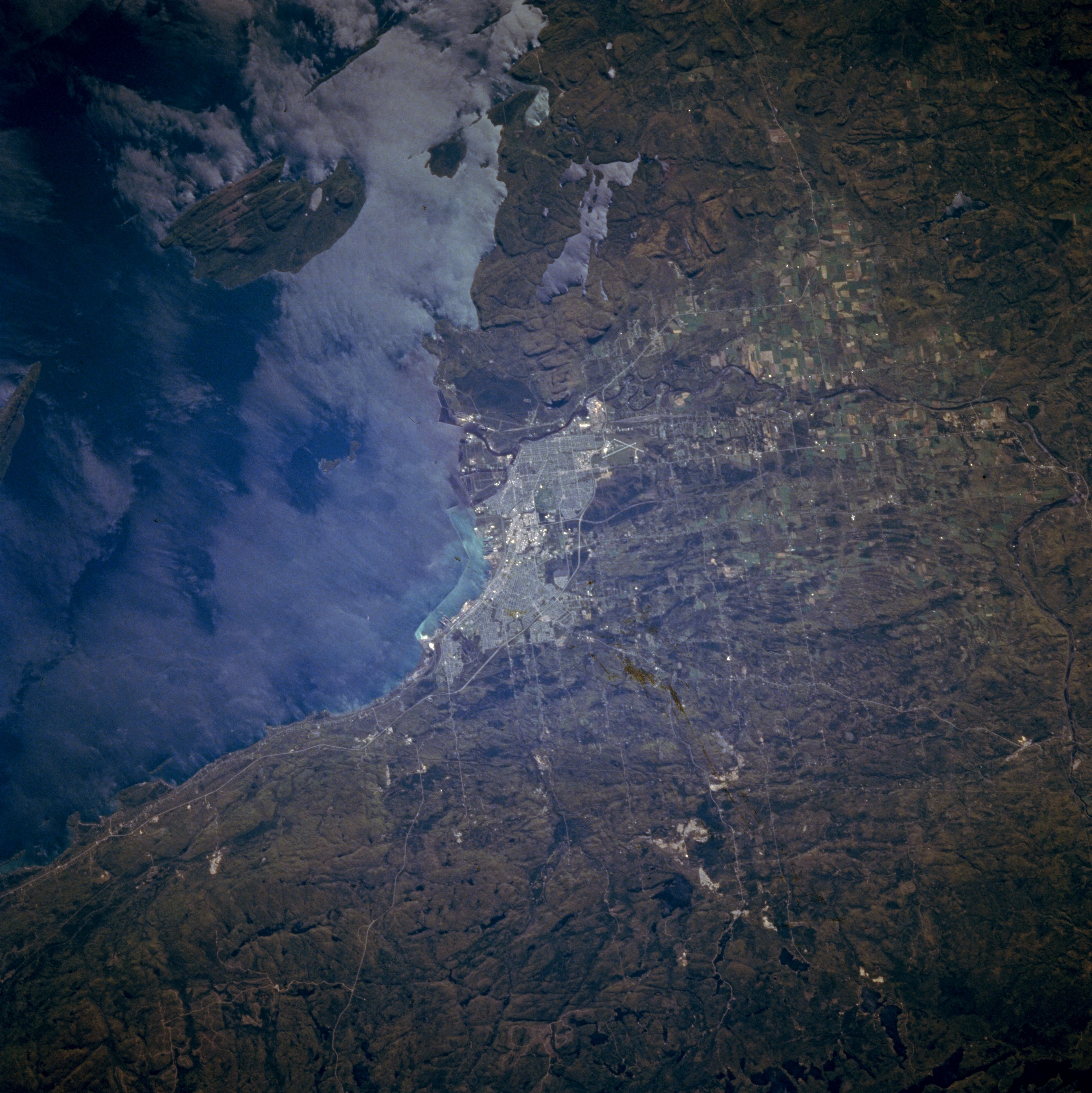
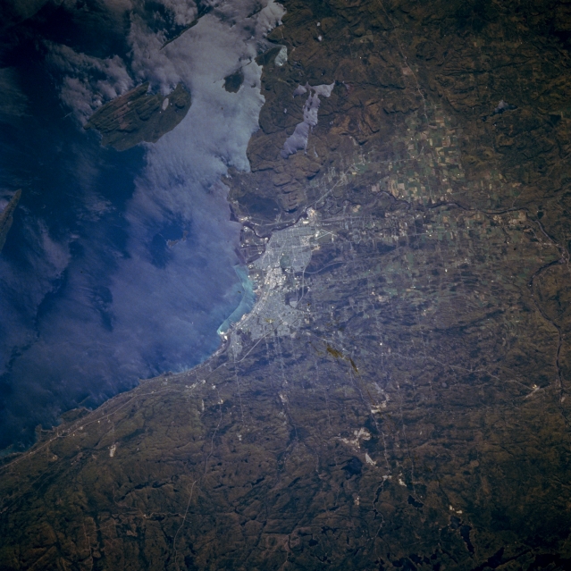
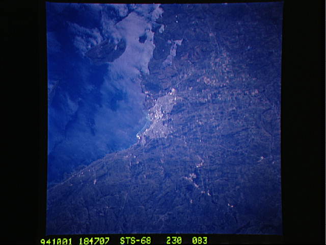
Image Caption: STS068-230-083 Thunder Bay, Ontario, Canada October 1994
Thunder Bay, a Canadian port city along the northwest shore of Lake Superior, is visible (center of image). This image also shows a rugged, glaciated landscape, especially south of the urban area where low escarpments can be seen. Even Pie Island, southeast of the city exhibits a rough surface terrain. Cultural features include the crossing runways of Thunder Bay International Airport (southwest of built-up area); Highways 11 and 17 as well as the Thunder Bay Expressway (around the north and west side of the city); and cultivated field patterns along the Kaministikwia River Valley (west of the city). The unusual pattern on the surface waters of Lake Superior may be the result of strong surface winds.
Thunder Bay, a Canadian port city along the northwest shore of Lake Superior, is visible (center of image). This image also shows a rugged, glaciated landscape, especially south of the urban area where low escarpments can be seen. Even Pie Island, southeast of the city exhibits a rough surface terrain. Cultural features include the crossing runways of Thunder Bay International Airport (southwest of built-up area); Highways 11 and 17 as well as the Thunder Bay Expressway (around the north and west side of the city); and cultivated field patterns along the Kaministikwia River Valley (west of the city). The unusual pattern on the surface waters of Lake Superior may be the result of strong surface winds.
