STS068-230-79
| NASA Photo ID | STS068-230-79 |
| Focal Length | 250mm |
| Date taken | 1994.10.01 |
| Time taken | 18:40:20 GMT |
Resolutions offered for this image:
3872 x 3904 pixels 634 x 639 pixels 5700 x 5900 pixels 500 x 518 pixels 640 x 480 pixels
3872 x 3904 pixels 634 x 639 pixels 5700 x 5900 pixels 500 x 518 pixels 640 x 480 pixels
Cloud masks available for this image:
Spacecraft nadir point: 57.1° N, 131.8° W
Photo center point:
Photo center point by machine learning:
Photo center point:
Photo center point by machine learning:
Nadir to Photo Center:
Spacecraft Altitude: 117 nautical miles (217km)
Country or Geographic Name: | CANADA-BC |
Features: | COAST MTS., GLACIERS |
| Features Found Using Machine Learning: | |
Cloud Cover Percentage: | 20 (11-25)% |
Sun Elevation Angle: | 25° |
Sun Azimuth: | 147° |
Camera: | Hasselblad |
Focal Length: | 250mm |
Camera Tilt: | Low Oblique |
Format: | 5046: Kodak, natural color positive, Lumiere 100/5046, ASA 100, standard base |
Film Exposure: | Normal |
| Additional Information | |
| Width | Height | Annotated | Cropped | Purpose | Links |
|---|---|---|---|---|---|
| 3872 pixels | 3904 pixels | No | No | Earth From Space collection | Download Image |
| 634 pixels | 639 pixels | No | No | Earth From Space collection | Download Image |
| 5700 pixels | 5900 pixels | No | No | Download Image | |
| 500 pixels | 518 pixels | No | No | Download Image | |
| 640 pixels | 480 pixels | No | No | Download Image |
Download Packaged File
Download a Google Earth KML for this Image
View photo footprint information
Download a GeoTIFF for this photo
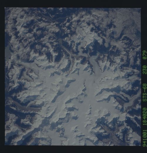
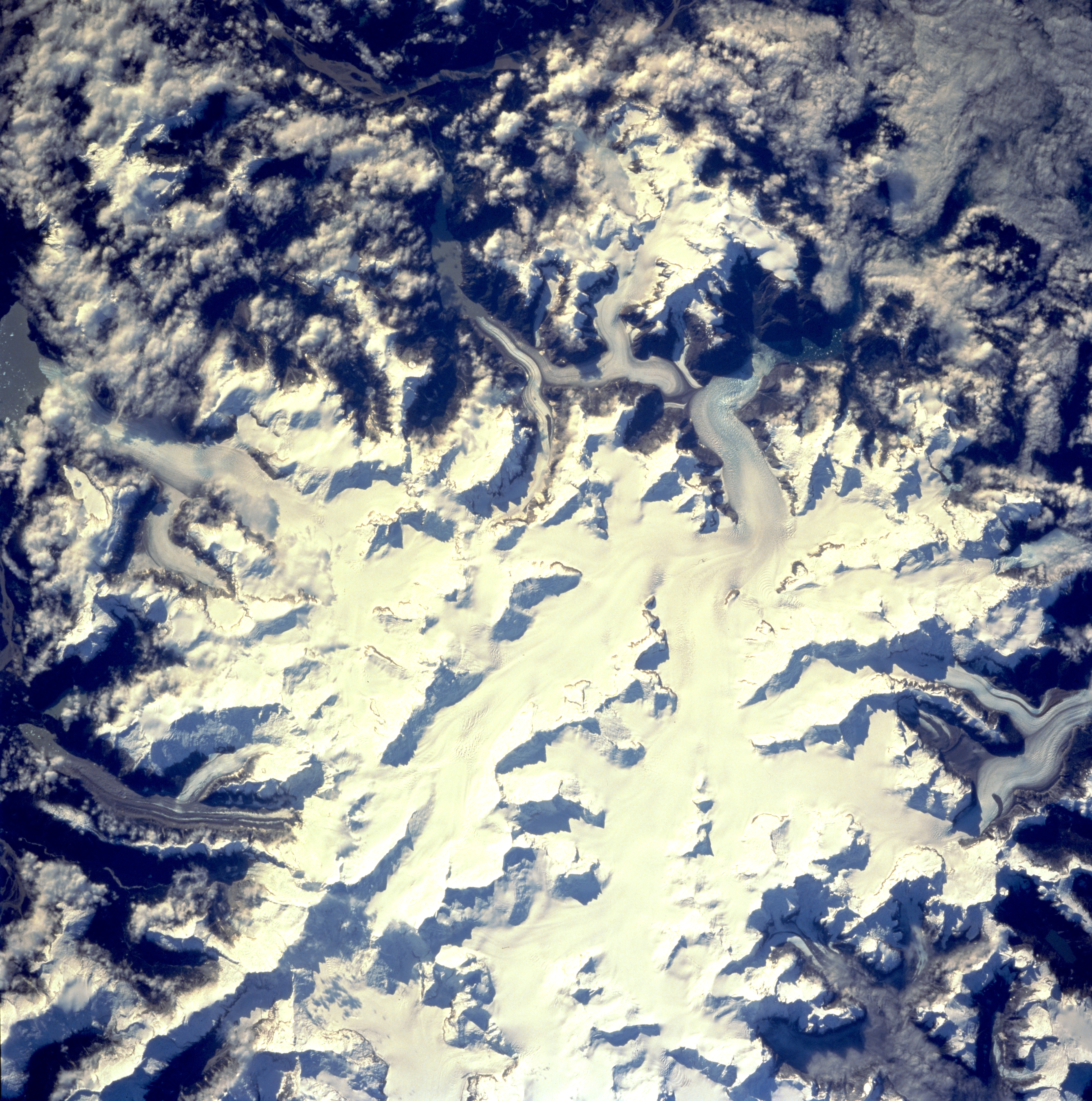
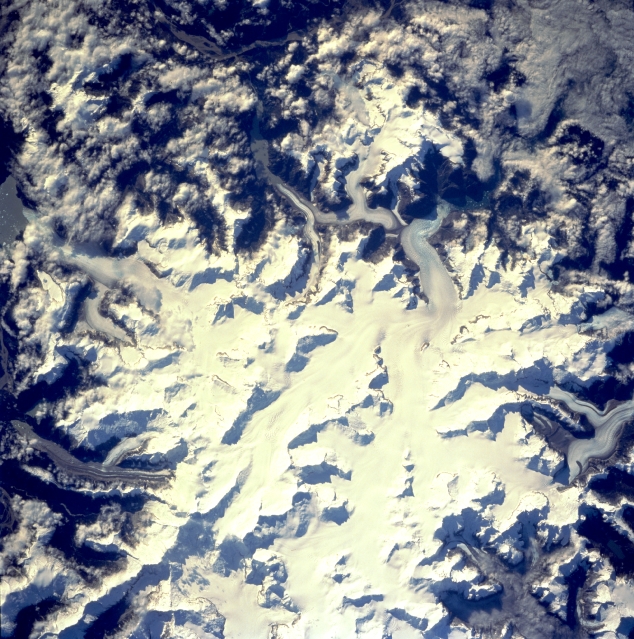
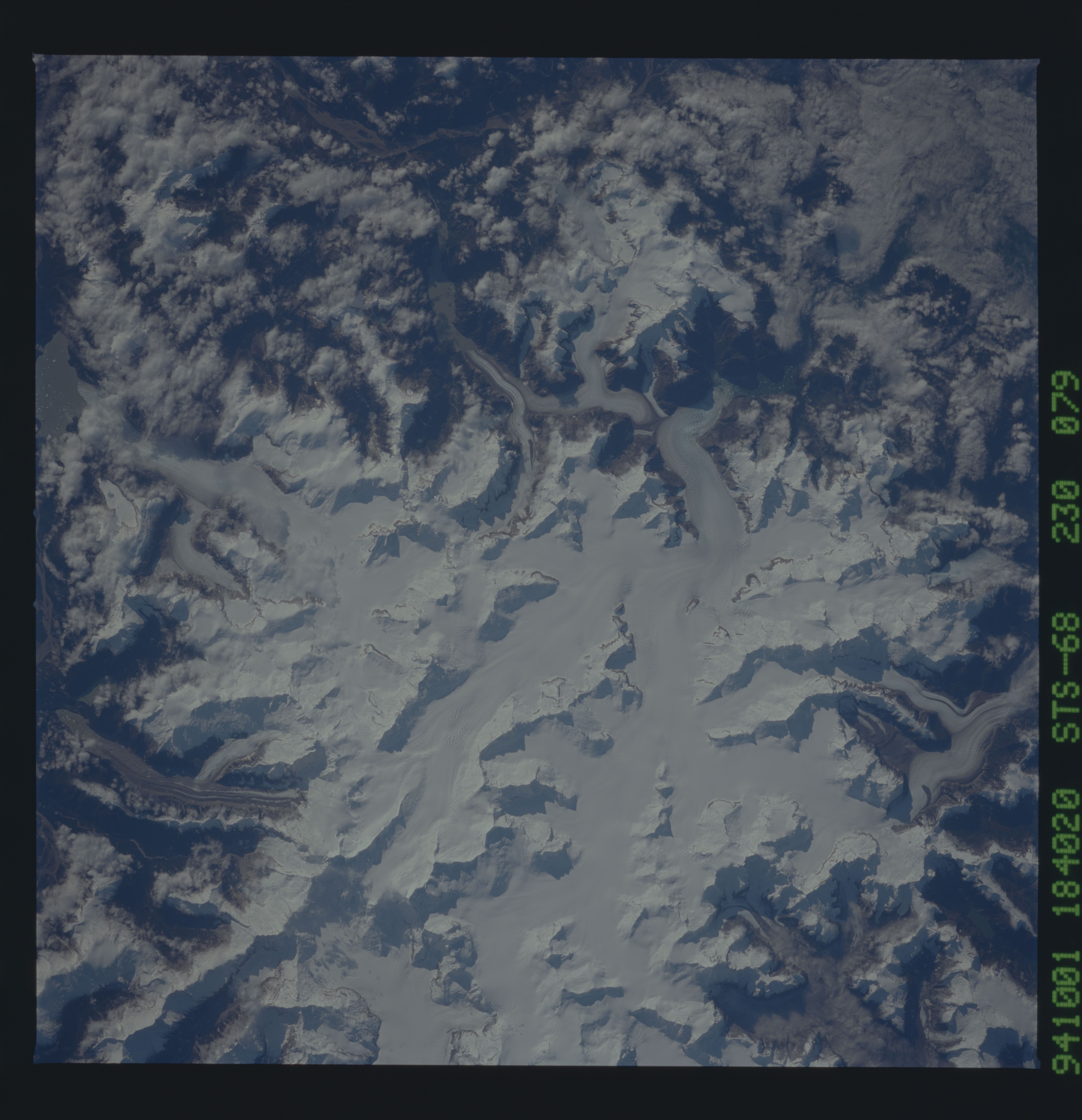
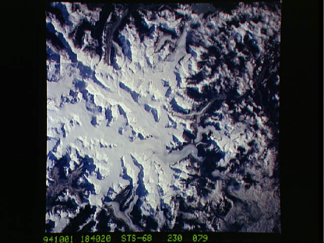
Image Caption: STS068-230-079 Coast Mountains, British Columbia, Canada October 1994
The margins of the large ice field (white area) in the center of the picture show many valley or alpine glaciers descending from the higher elevations of this section of the Coast Mountains (Canadian-U.S. Border). The ice field straddles the Canadian-U.S. border at 57 degrees north latitude. Mt. Burkett (9730 feet - 2966 meters) and Kate's Needle (10023 feet - 3055 meters) are just two of the many ice covered peaks, known as horns, that are observed in this image. Clouds obscure the Stikine River Valley on the east side of the ice field (top of picture).
The margins of the large ice field (white area) in the center of the picture show many valley or alpine glaciers descending from the higher elevations of this section of the Coast Mountains (Canadian-U.S. Border). The ice field straddles the Canadian-U.S. border at 57 degrees north latitude. Mt. Burkett (9730 feet - 2966 meters) and Kate's Needle (10023 feet - 3055 meters) are just two of the many ice covered peaks, known as horns, that are observed in this image. Clouds obscure the Stikine River Valley on the east side of the ice field (top of picture).
