STS068-227-7
| NASA Photo ID | STS068-227-7 |
| Focal Length | 250mm |
| Date taken | 1994.10.01 |
| Time taken | 20:16:36 GMT |
Resolutions offered for this image:
3904 x 3904 pixels 639 x 639 pixels 5700 x 5900 pixels 500 x 518 pixels 640 x 480 pixels
3904 x 3904 pixels 639 x 639 pixels 5700 x 5900 pixels 500 x 518 pixels 640 x 480 pixels
Cloud masks available for this image:
Spacecraft nadir point: 47.8° N, 108.4° W
Photo center point: 48.0° N, 106.5° W
Photo center point by machine learning:
Photo center point: 48.0° N, 106.5° W
Photo center point by machine learning:
Nadir to Photo Center: East
Spacecraft Altitude: 117 nautical miles (217km)
Country or Geographic Name: | USA-MONTANA |
Features: | FT. PECK LAKE, MISSOURI R |
| Features Found Using Machine Learning: | |
Cloud Cover Percentage: | 5 (1-10)% |
Sun Elevation Angle: | 37° |
Sun Azimuth: | 203° |
Camera: | Hasselblad |
Focal Length: | 250mm |
Camera Tilt: | 44 degrees |
Format: | 5046: Kodak, natural color positive, Lumiere 100/5046, ASA 100, standard base |
Film Exposure: | Normal |
| Additional Information | |
| Width | Height | Annotated | Cropped | Purpose | Links |
|---|---|---|---|---|---|
| 3904 pixels | 3904 pixels | No | No | Earth From Space collection | Download Image |
| 639 pixels | 639 pixels | No | No | Earth From Space collection | Download Image |
| 5700 pixels | 5900 pixels | No | No | Download Image | |
| 500 pixels | 518 pixels | No | No | Download Image | |
| 640 pixels | 480 pixels | No | No | Download Image |
Download Packaged File
Download a Google Earth KML for this Image
View photo footprint information
Download a GeoTIFF for this photo
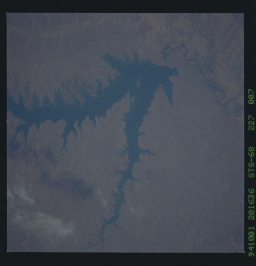
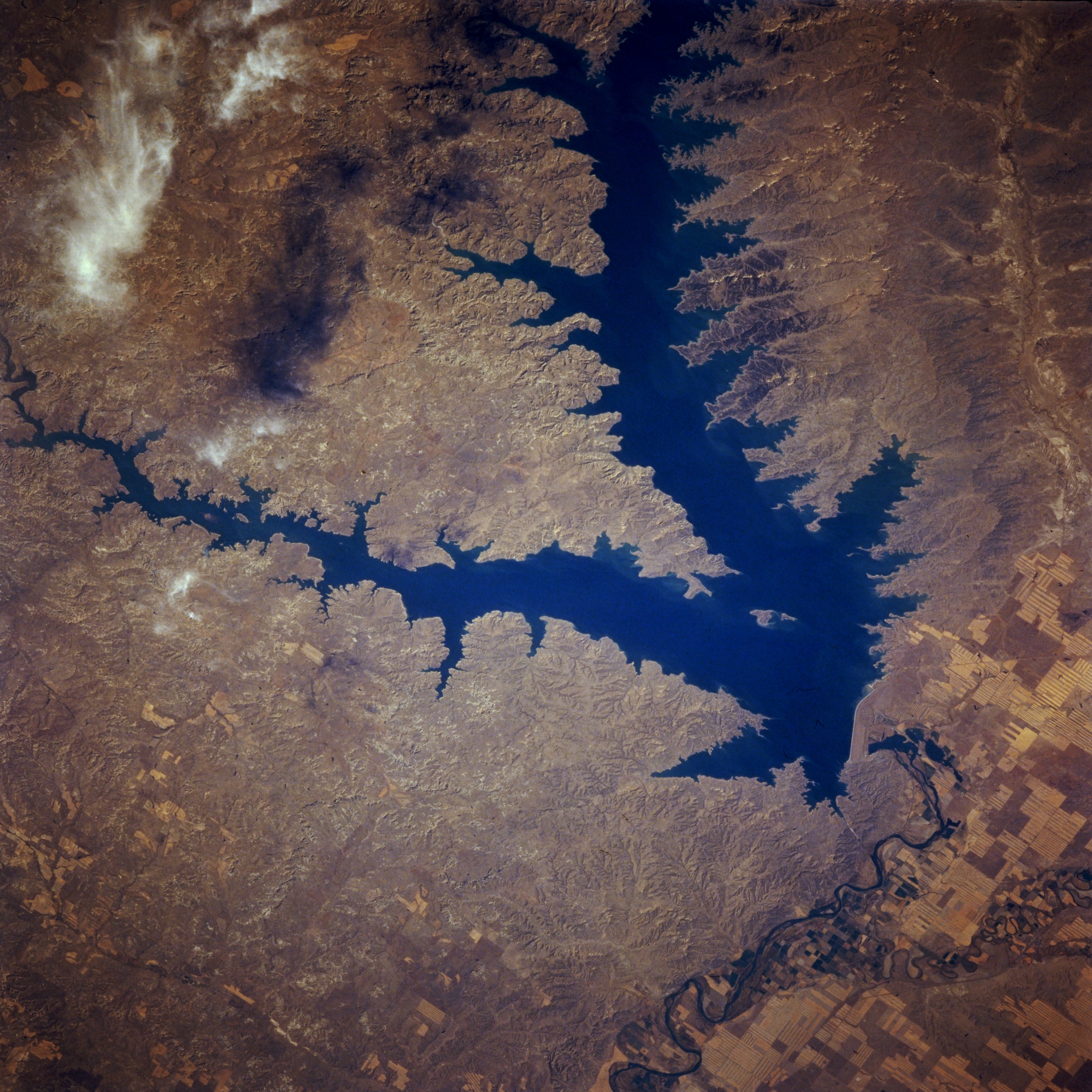
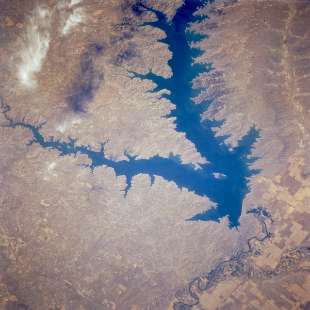
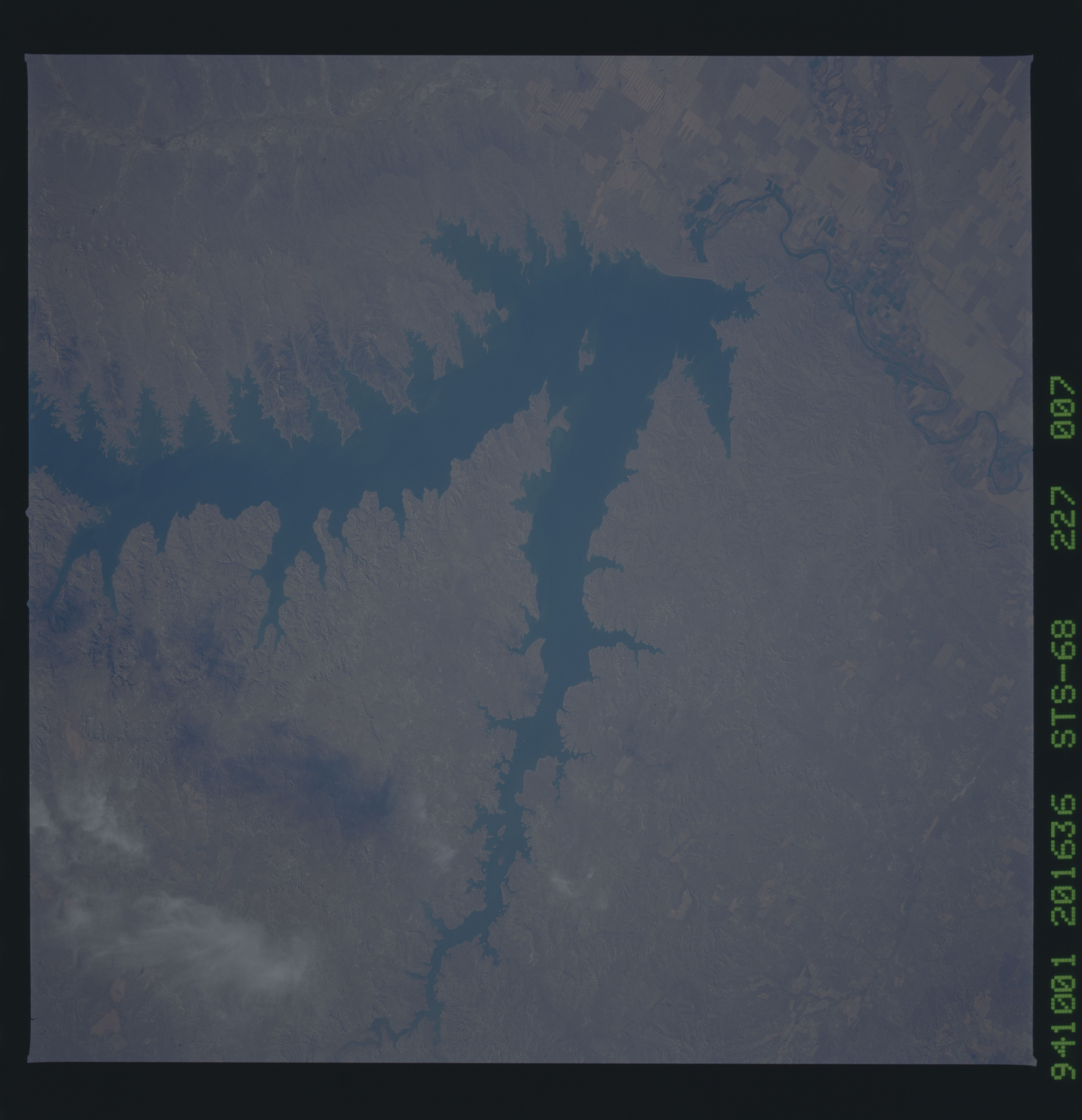
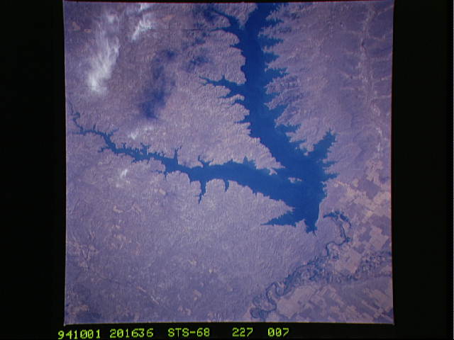
Image Caption: STS068-227-007 Fort Peck Reservoir, Montana, U.S.A. October 1994
Fort Peck Dam, one of the world's largest earth-filled dams, and Fort Peck Reservoir are featured in this west-southwest-looking, low-oblique photograph. Fort Peck Dam was completed in 1940 as one in a series of dams built in the 1930s, 1940s, and 1950s along the upper watershed of the Missouri River. Besides providing flood control, hydroelectric power, irrigation water, and recreation facilities, the dam serves to impound water for later use from spring rains and snowmelt that swell the Missouri River. Fort Peck Reservoir is approximately 135 miles (217 kilometers) long and a maximum of 16 miles (26 kilometers) wide. The broad valley of the Milk River (upper right) served as the course of the Missouri River before ice age glaciers changed the river to its present course further south. The Milk River is shown joining the Missouri River that meanders eastward toward North Dakota.
Fort Peck Dam, one of the world's largest earth-filled dams, and Fort Peck Reservoir are featured in this west-southwest-looking, low-oblique photograph. Fort Peck Dam was completed in 1940 as one in a series of dams built in the 1930s, 1940s, and 1950s along the upper watershed of the Missouri River. Besides providing flood control, hydroelectric power, irrigation water, and recreation facilities, the dam serves to impound water for later use from spring rains and snowmelt that swell the Missouri River. Fort Peck Reservoir is approximately 135 miles (217 kilometers) long and a maximum of 16 miles (26 kilometers) wide. The broad valley of the Milk River (upper right) served as the course of the Missouri River before ice age glaciers changed the river to its present course further south. The Milk River is shown joining the Missouri River that meanders eastward toward North Dakota.
