STS068-225-9
| NASA Photo ID | STS068-225-9 |
| Focal Length | 40mm |
| Date taken | 1994.10.02 |
| Time taken | 06:35:30 GMT |
Resolutions offered for this image:
5700 x 5900 pixels 500 x 518 pixels 640 x 480 pixels 451 x 453 pixels
5700 x 5900 pixels 500 x 518 pixels 640 x 480 pixels 451 x 453 pixels

Cloud masks available for this image:
Spacecraft nadir point: 53.8° N, 77.9° E
Photo center point: 52.5° N, 79.0° E
Photo center point by machine learning:
Photo center point: 52.5° N, 79.0° E
Photo center point by machine learning:
Nadir to Photo Center: Southeast
Spacecraft Altitude: 117 nautical miles (217km)
Country or Geographic Name: | RUSSIAN FEDERATION |
Features: | KULUNDINSKOYE L., AGRICULTURE |
| Features Found Using Machine Learning: | |
Cloud Cover Percentage: | 5 (1-10)% |
Sun Elevation Angle: | 33° |
Sun Azimuth: | 179° |
Camera: | Hasselblad |
Focal Length: | 40mm |
Camera Tilt: | 41 degrees |
Format: | 5046: Kodak, natural color positive, Lumiere 100/5046, ASA 100, standard base |
Film Exposure: | Normal |
| Additional Information | |
| Width | Height | Annotated | Cropped | Purpose | Links |
|---|---|---|---|---|---|
| 5700 pixels | 5900 pixels | No | No | Download Image | |
| 500 pixels | 518 pixels | No | No | Download Image | |
| 640 pixels | 480 pixels | No | No | Download Image | |
| 451 pixels | 453 pixels | Yes | No | Download Image |
Download Packaged File
Download a Google Earth KML for this Image
View photo footprint information
Download a GeoTIFF for this photo
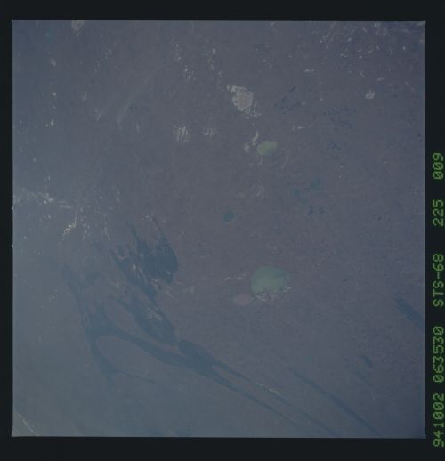
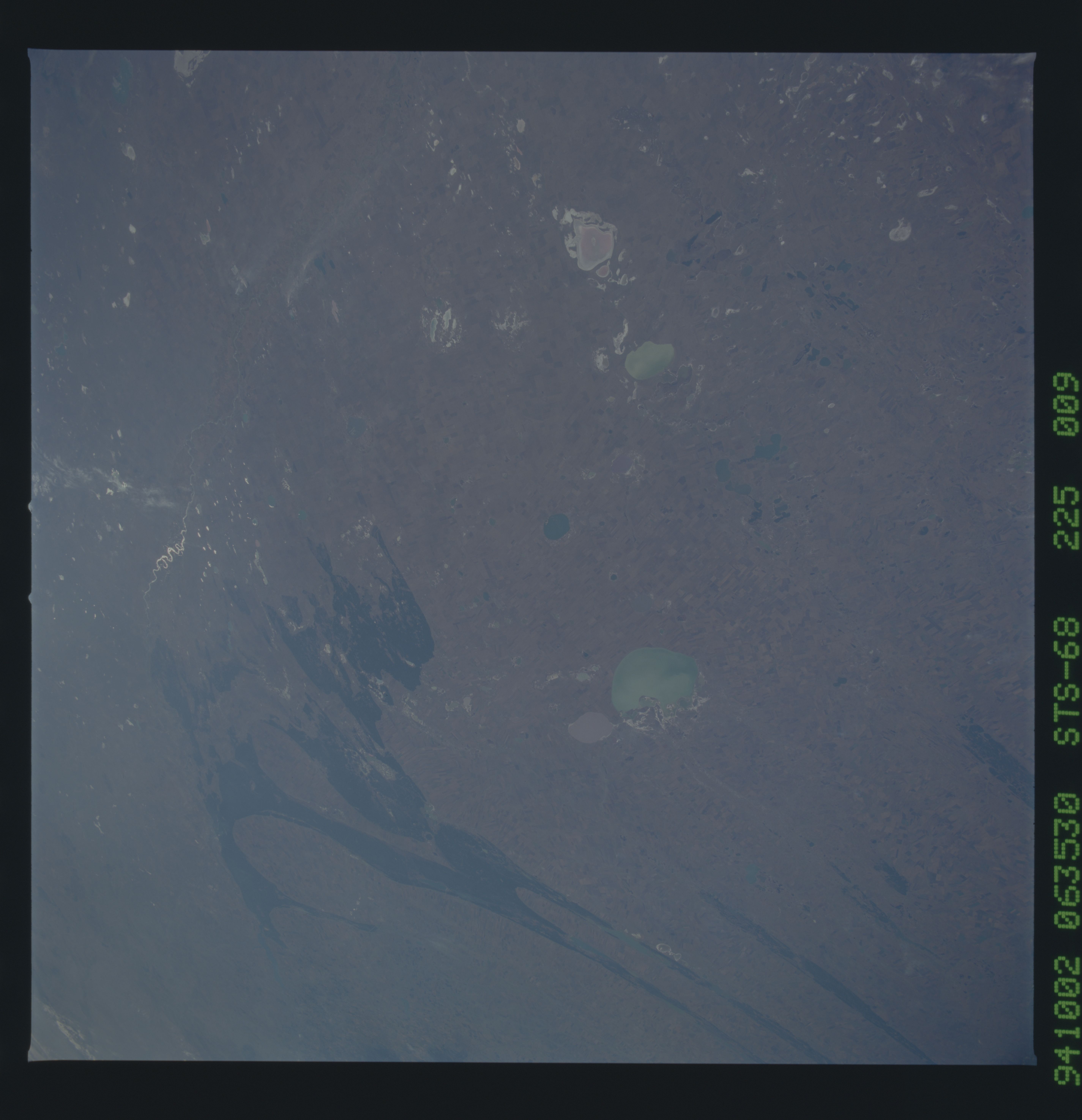
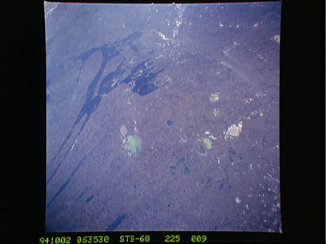
Image Caption: This west-looking view shows the Kulunda Steppe, a
region in Siberia between the Ob' and Irtysh Rivers dominated by a
geological pattern of a series of parallel ridges and valleys. The
Irtysh crosses the top of the view. Semipalatinsk lies on the Irtysh
top left. Salt lakes dot the region. The largest green lake is
Kulundinskoye Lake.
region in Siberia between the Ob' and Irtysh Rivers dominated by a
geological pattern of a series of parallel ridges and valleys. The
Irtysh crosses the top of the view. Semipalatinsk lies on the Irtysh
top left. Salt lakes dot the region. The largest green lake is
Kulundinskoye Lake.
