STS068-209-76

| NASA Photo ID | STS068-209-76 |
| Focal Length | 250mm |
| Date taken | 1994.10.06 |
| Time taken | 18:38:33 GMT |
Resolutions offered for this image:
3904 x 3904 pixels 639 x 639 pixels 5700 x 5900 pixels 500 x 518 pixels 640 x 480 pixels
3904 x 3904 pixels 639 x 639 pixels 5700 x 5900 pixels 500 x 518 pixels 640 x 480 pixels
Cloud masks available for this image:
Spacecraft nadir point: 51.0° N, 120.0° W
Photo center point: 48.0° N, 120.5° W
Photo center point by machine learning:
Photo center point: 48.0° N, 120.5° W
Photo center point by machine learning:
Nadir to Photo Center: South
Spacecraft Altitude: 115 nautical miles (213km)
Country or Geographic Name: | USA-WASHINGTON |
Features: | L. CHELAN, COLUMBIA R, MTS |
| Features Found Using Machine Learning: | |
Cloud Cover Percentage: | 5 (1-10)% |
Sun Elevation Angle: | 32° |
Sun Azimuth: | 159° |
Camera: | Hasselblad |
Focal Length: | 250mm |
Camera Tilt: | Low Oblique |
Format: | 2443: Kodak Aerochrome 2443, color IR, thin base, EA-5 process thru June 1999, E-6 process afterward |
Film Exposure: | Normal |
| Additional Information | |
| Width | Height | Annotated | Cropped | Purpose | Links |
|---|---|---|---|---|---|
| 3904 pixels | 3904 pixels | No | No | Earth From Space collection | Download Image |
| 639 pixels | 639 pixels | No | No | Earth From Space collection | Download Image |
| 5700 pixels | 5900 pixels | No | No | Download Image | |
| 500 pixels | 518 pixels | No | No | Download Image | |
| 640 pixels | 480 pixels | No | No | Download Image |
Download Packaged File
Download a Google Earth KML for this Image
View photo footprint information
Download a GeoTIFF for this photo
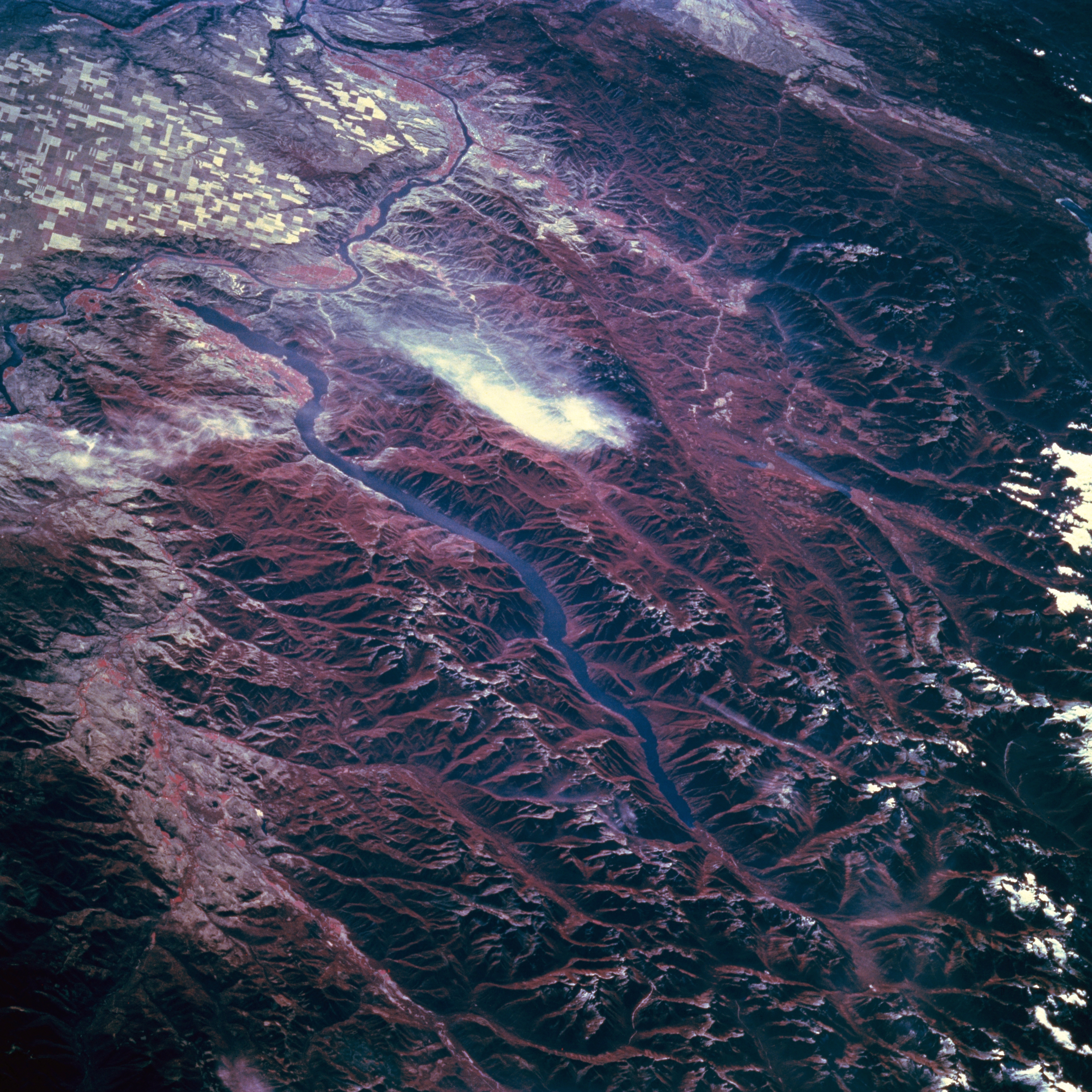
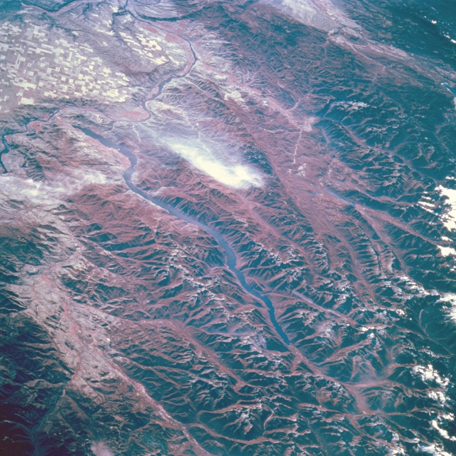
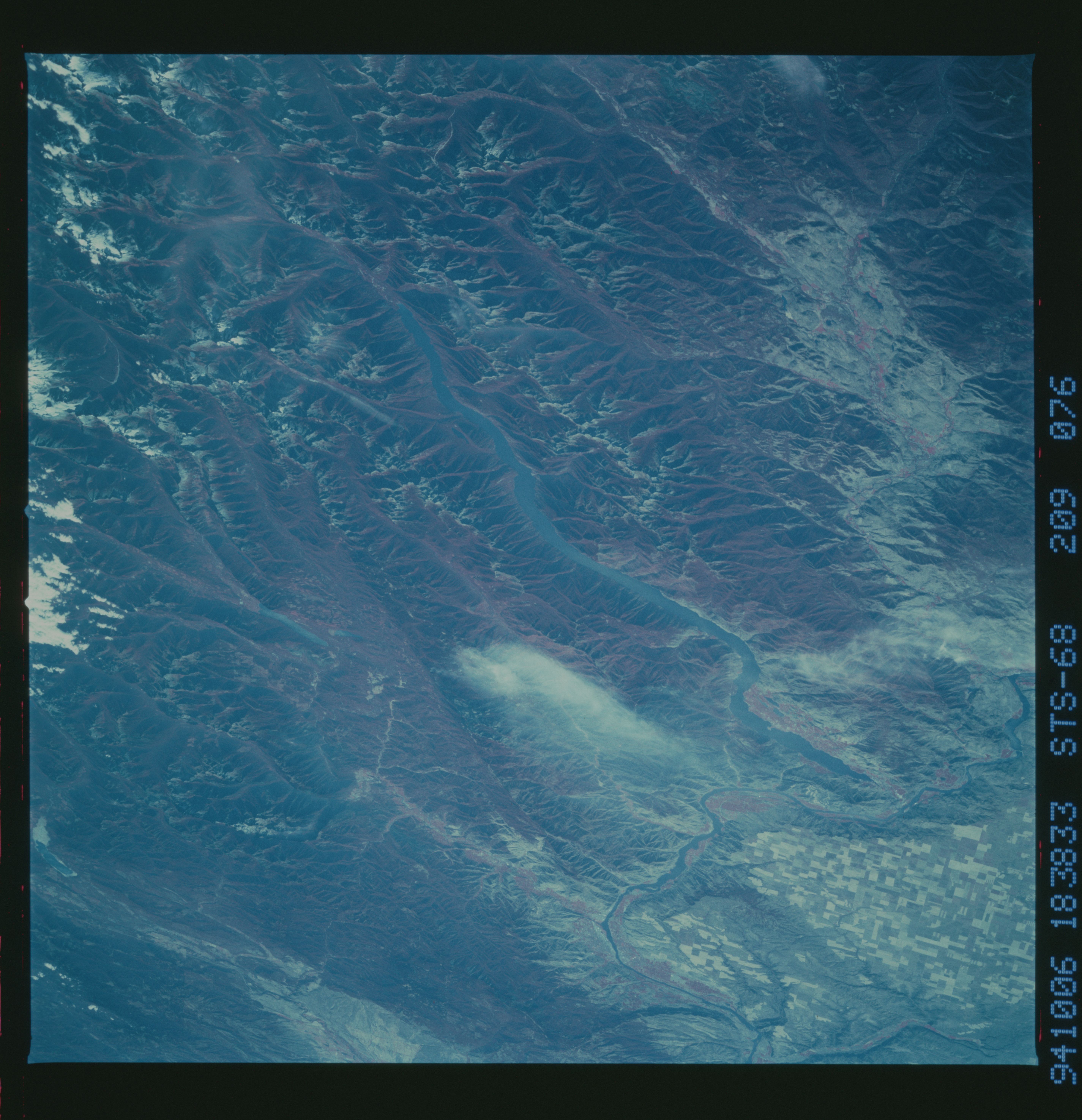
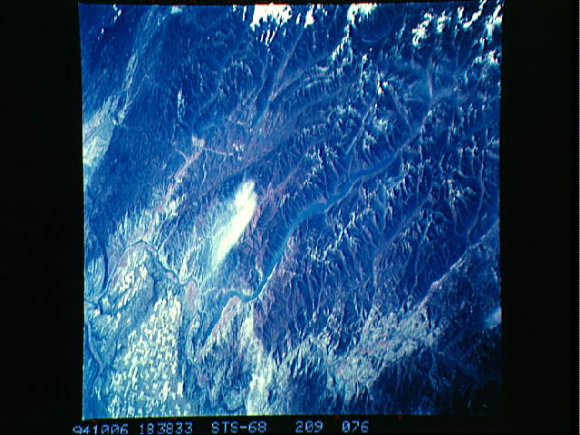
Image Caption: STS068-209-076 Lake Chelan, Washington, U.S.A. October 1994
Lake Chelan in the northeastern Cascades is featured in this south-looking, low-oblique, infrared photograph. Lake Chelan is the third deepest lake in the United States [1486 feet (453 meters)]--only Crater Lake and Lake Tahoe are deeper. Carved by ice-age glaciers that dammed the basin that holds it, Lake Chelan is 55 miles (88 kilometers) long and approximately 1 to 2 miles (1 to 3 kilometers) wide. Its northern end is part of Lake Chelan National Recreational Area, and national forest lands extend over almost the entire length of the lake (Okanogan National Forest to its north, and Wenatchee National Forest to its south). Agricultural field patterns and the Columbia River are visible in the upper-left portion of the photograph.
Lake Chelan in the northeastern Cascades is featured in this south-looking, low-oblique, infrared photograph. Lake Chelan is the third deepest lake in the United States [1486 feet (453 meters)]--only Crater Lake and Lake Tahoe are deeper. Carved by ice-age glaciers that dammed the basin that holds it, Lake Chelan is 55 miles (88 kilometers) long and approximately 1 to 2 miles (1 to 3 kilometers) wide. Its northern end is part of Lake Chelan National Recreational Area, and national forest lands extend over almost the entire length of the lake (Okanogan National Forest to its north, and Wenatchee National Forest to its south). Agricultural field patterns and the Columbia River are visible in the upper-left portion of the photograph.
