STS068-209-74
| NASA Photo ID | STS068-209-74 |
| Focal Length | 250mm |
| Date taken | 1994.10.06 |
| Time taken | 17:14:47 GMT |
Resolutions offered for this image:
3904 x 3904 pixels 639 x 639 pixels 5700 x 5900 pixels 500 x 518 pixels 640 x 480 pixels
3904 x 3904 pixels 639 x 639 pixels 5700 x 5900 pixels 500 x 518 pixels 640 x 480 pixels


Cloud masks available for this image:
Spacecraft nadir point: 38.3° N, 76.5° W
Photo center point: 38.5° N, 76.5° W
Photo center point by machine learning:
Photo center point: 38.5° N, 76.5° W
Photo center point by machine learning:
Nadir to Photo Center: North
Spacecraft Altitude: 116 nautical miles (215km)
Country or Geographic Name: | USA-MARYLAND |
Features: | CHEASPEAKE B., POTOMAC R. |
| Features Found Using Machine Learning: | |
Cloud Cover Percentage: | 5 (1-10)% |
Sun Elevation Angle: | 46° |
Sun Azimuth: | 187° |
Camera: | Hasselblad |
Focal Length: | 250mm |
Camera Tilt: | 6 degrees |
Format: | 2443: Kodak Aerochrome 2443, color IR, thin base, EA-5 process thru June 1999, E-6 process afterward |
Film Exposure: | Normal |
| Additional Information | |
| Width | Height | Annotated | Cropped | Purpose | Links |
|---|---|---|---|---|---|
| 3904 pixels | 3904 pixels | No | No | Earth From Space collection | Download Image |
| 639 pixels | 639 pixels | No | No | Earth From Space collection | Download Image |
| 5700 pixels | 5900 pixels | No | No | Download Image | |
| 500 pixels | 518 pixels | No | No | Download Image | |
| 640 pixels | 480 pixels | No | No | Download Image |
Download Packaged File
Download a Google Earth KML for this Image
View photo footprint information
Download a GeoTIFF for this photo
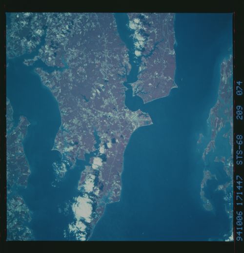
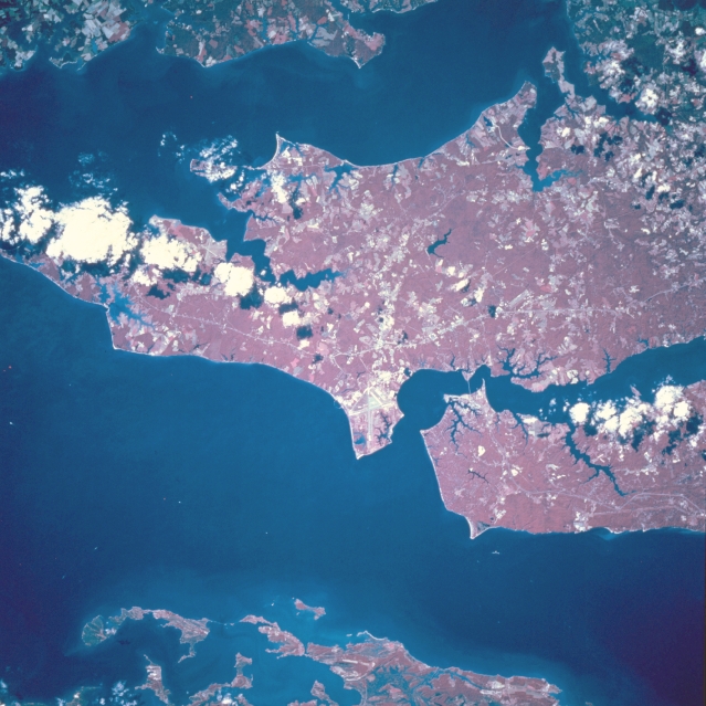
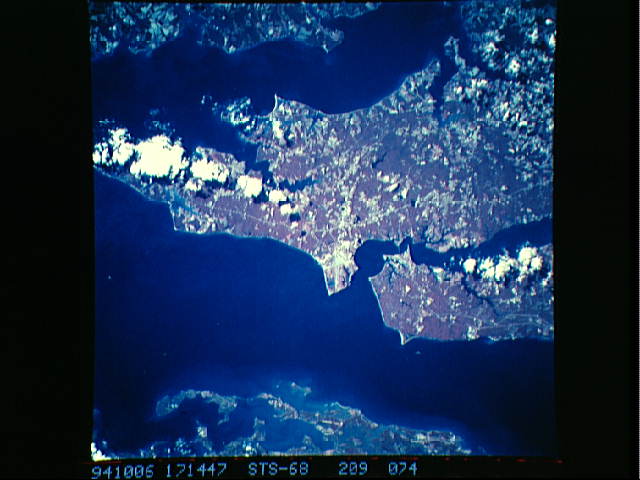
Image Caption: STS068-209-074 Patuxent Naval Air Station, Maryland, U.S.A. October 1994
The forested, gently rolling region of southeastern Maryland is visible in this color-infrared, south-southwest-looking, low-oblique view. The runways of the Patuxent Naval Air Center are visible near the center of the image. The Air Center is home to numerous squadrons of the U. S. Navy's Atlantic Command and is also a testing center for new and modified aircraft. Chesapeake Bay, the largest estuary in the United States, covers the bottom portion of the image. To the right (northeast) of the naval air station is the Patuxent River, which exits the scene at the right center of the image. Covering most of the upper portion of the scene is the Potomac River. The extreme upper portion of the image shows the shoreline of the state of Virginia.
The forested, gently rolling region of southeastern Maryland is visible in this color-infrared, south-southwest-looking, low-oblique view. The runways of the Patuxent Naval Air Center are visible near the center of the image. The Air Center is home to numerous squadrons of the U. S. Navy's Atlantic Command and is also a testing center for new and modified aircraft. Chesapeake Bay, the largest estuary in the United States, covers the bottom portion of the image. To the right (northeast) of the naval air station is the Patuxent River, which exits the scene at the right center of the image. Covering most of the upper portion of the scene is the Potomac River. The extreme upper portion of the image shows the shoreline of the state of Virginia.
