STS068-209-70
| NASA Photo ID | STS068-209-70 |
| Focal Length | 250mm |
| Date taken | 1994.10.06 |
| Time taken | 17:13:24 GMT |
Resolutions offered for this image:
3904 x 3840 pixels 639 x 629 pixels 5700 x 5900 pixels 500 x 518 pixels 640 x 480 pixels
3904 x 3840 pixels 639 x 629 pixels 5700 x 5900 pixels 500 x 518 pixels 640 x 480 pixels

Cloud masks available for this image:
Spacecraft nadir point: 42.3° N, 81.4° W
Photo center point: 41.5° N, 81.5° W
Photo center point by machine learning:
Photo center point: 41.5° N, 81.5° W
Photo center point by machine learning:
Nadir to Photo Center: South
Spacecraft Altitude: 116 nautical miles (215km)
Camera: | Hasselblad |
Focal Length: | 250mm |
Camera Tilt: | 23 degrees |
Format: | 2443: Kodak Aerochrome 2443, color IR, thin base, EA-5 process thru June 1999, E-6 process afterward |
Film Exposure: | Normal |
| Additional Information | |
| Width | Height | Annotated | Cropped | Purpose | Links |
|---|---|---|---|---|---|
| 3904 pixels | 3840 pixels | No | No | Earth From Space collection | Download Image |
| 639 pixels | 629 pixels | No | No | Earth From Space collection | Download Image |
| 5700 pixels | 5900 pixels | No | No | Download Image | |
| 500 pixels | 518 pixels | No | No | Download Image | |
| 640 pixels | 480 pixels | No | No | Download Image |
Download Packaged File
Download a Google Earth KML for this Image
View photo footprint information
Download a GeoTIFF for this photo
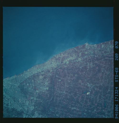
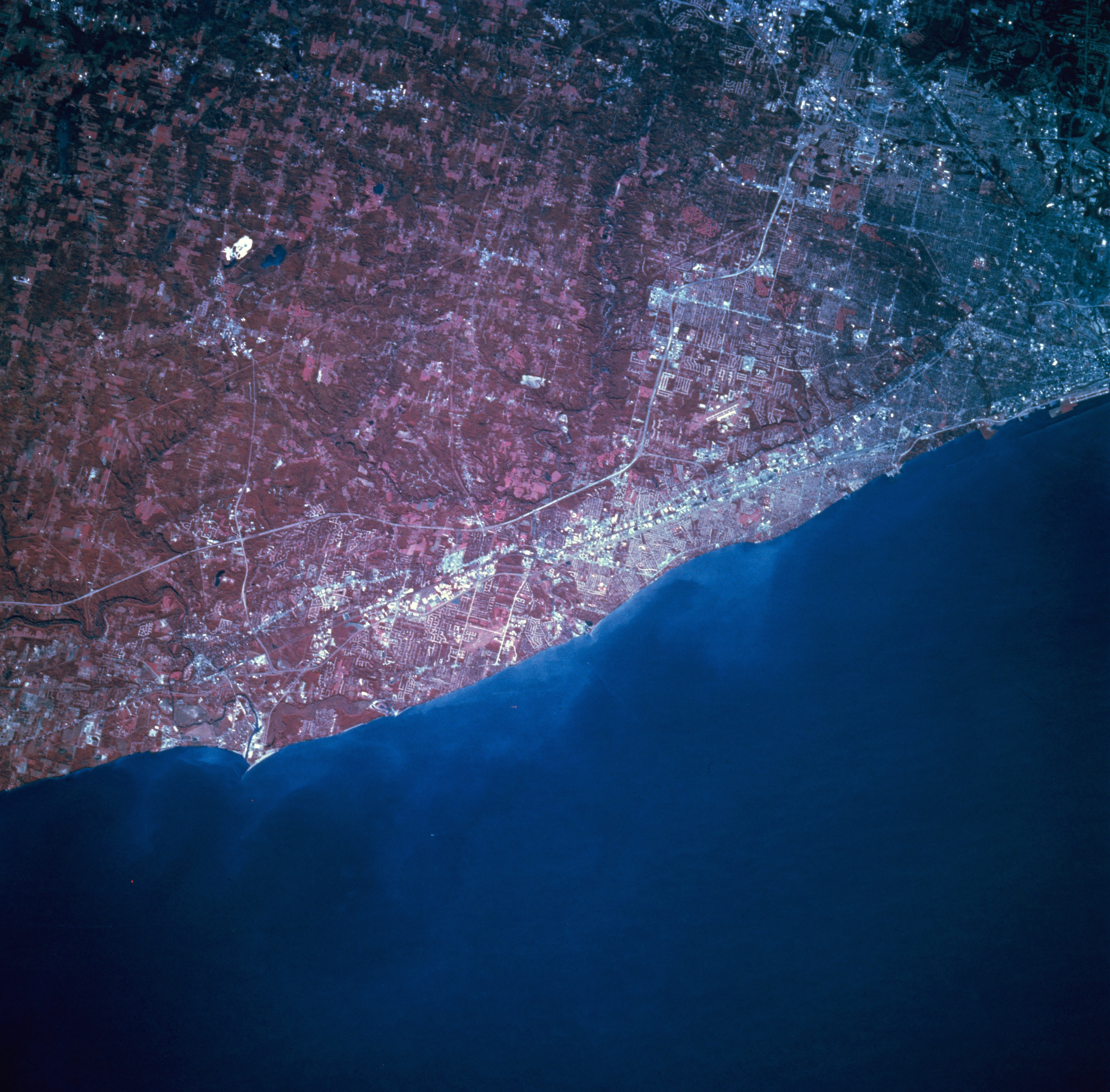
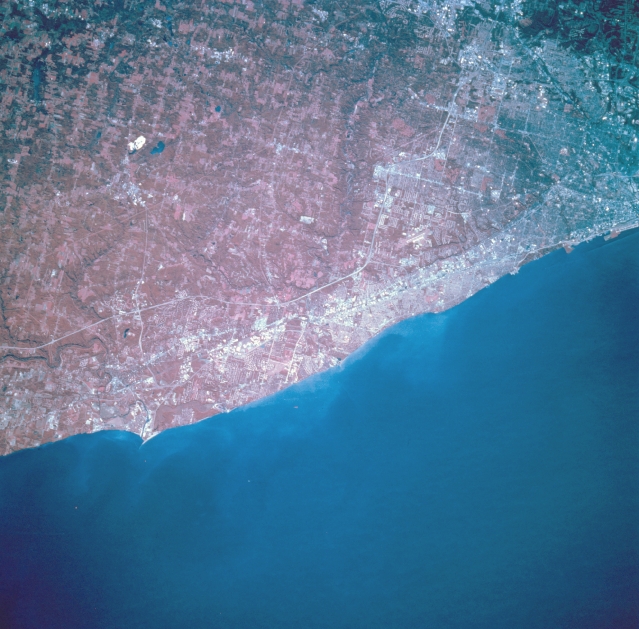
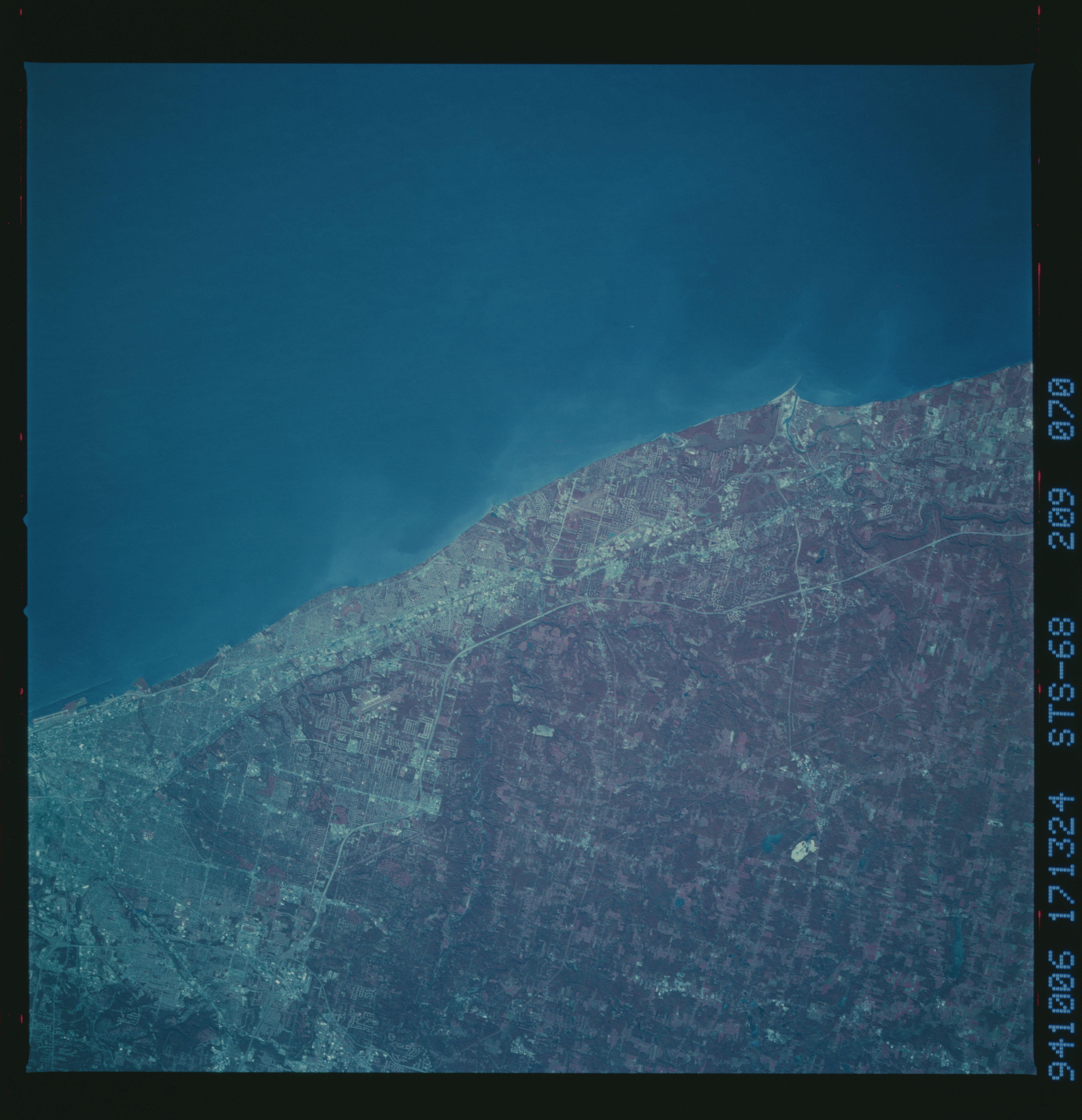
Image Caption: STS068-209-070 Lake Erie, Ohio, U.S.A. October 1994
Lake Erie, the shallowest of the Great Lakes, is apparent in this south-looking, low-oblique, color infrared photograph. Discernible are eastern Cleveland (upper right); small communities with summer homes overlooking Lake Erie eastward from Cleveland to Painesville; and Interstate Highway 90 paralleling the lake. Much of the land south of Interstate Highway 90 resembles patterns in the deforested regions of Rondonia in the upper Amazon River Basin of Brazil (reference photograph STS046-078-026). Shoreline property values have improved during the last two decades as a result of the cleanup of Lake Erie.
Lake Erie, the shallowest of the Great Lakes, is apparent in this south-looking, low-oblique, color infrared photograph. Discernible are eastern Cleveland (upper right); small communities with summer homes overlooking Lake Erie eastward from Cleveland to Painesville; and Interstate Highway 90 paralleling the lake. Much of the land south of Interstate Highway 90 resembles patterns in the deforested regions of Rondonia in the upper Amazon River Basin of Brazil (reference photograph STS046-078-026). Shoreline property values have improved during the last two decades as a result of the cleanup of Lake Erie.
