STS068-205-20
| NASA Photo ID | STS068-205-20 |
| Focal Length | 250mm |
| Date taken | 1994.10.10 |
| Time taken | 17:16:21 GMT |
Resolutions offered for this image:
3904 x 3904 pixels 639 x 639 pixels 5700 x 5900 pixels 500 x 518 pixels 640 x 480 pixels
3904 x 3904 pixels 639 x 639 pixels 5700 x 5900 pixels 500 x 518 pixels 640 x 480 pixels
Cloud masks available for this image:
Spacecraft nadir point: 31.2° N, 92.6° W
Photo center point: 30.0° N, 95.5° W
Photo center point by machine learning:
Photo center point: 30.0° N, 95.5° W
Photo center point by machine learning:
Nadir to Photo Center: West
Spacecraft Altitude: 111 nautical miles (206km)
Country or Geographic Name: | USA-TEXAS |
Features: | HOUSTON AREA |
| Features Found Using Machine Learning: | |
Cloud Cover Percentage: | 0 (no clouds present) |
Sun Elevation Angle: | 51° |
Sun Azimuth: | 164° |
Camera: | Hasselblad |
Focal Length: | 250mm |
Camera Tilt: | Low Oblique |
Format: | 2443: Kodak Aerochrome 2443, color IR, thin base, EA-5 process thru June 1999, E-6 process afterward |
Film Exposure: | Normal |
| Additional Information | |
| Width | Height | Annotated | Cropped | Purpose | Links |
|---|---|---|---|---|---|
| 3904 pixels | 3904 pixels | No | No | Earth From Space collection | Download Image |
| 639 pixels | 639 pixels | No | No | Earth From Space collection | Download Image |
| 5700 pixels | 5900 pixels | No | No | Download Image | |
| 500 pixels | 518 pixels | No | No | Download Image | |
| 640 pixels | 480 pixels | No | No | Download Image |
Download Packaged File
Download a Google Earth KML for this Image
View photo footprint information
Download a GeoTIFF for this photo
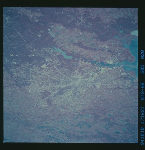
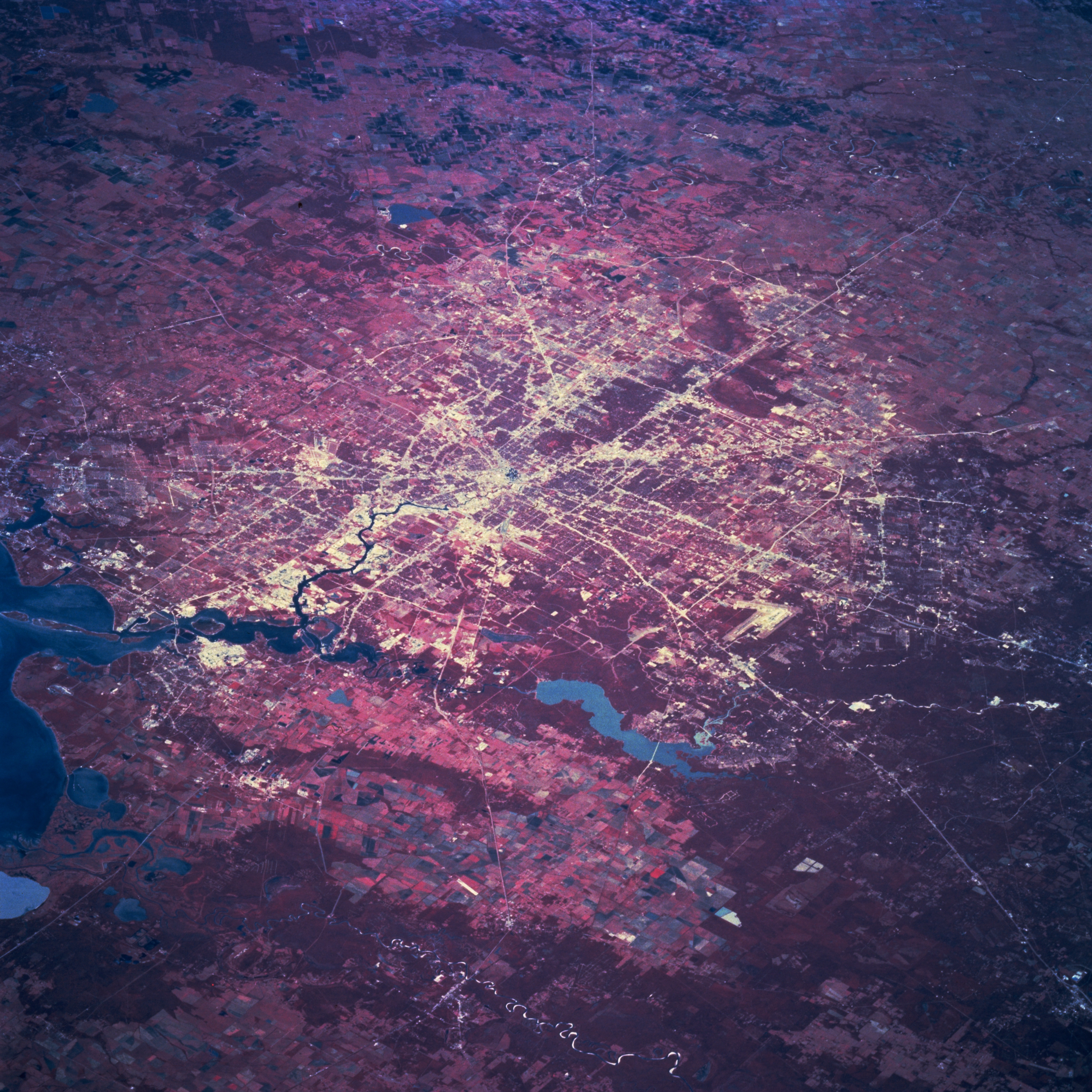
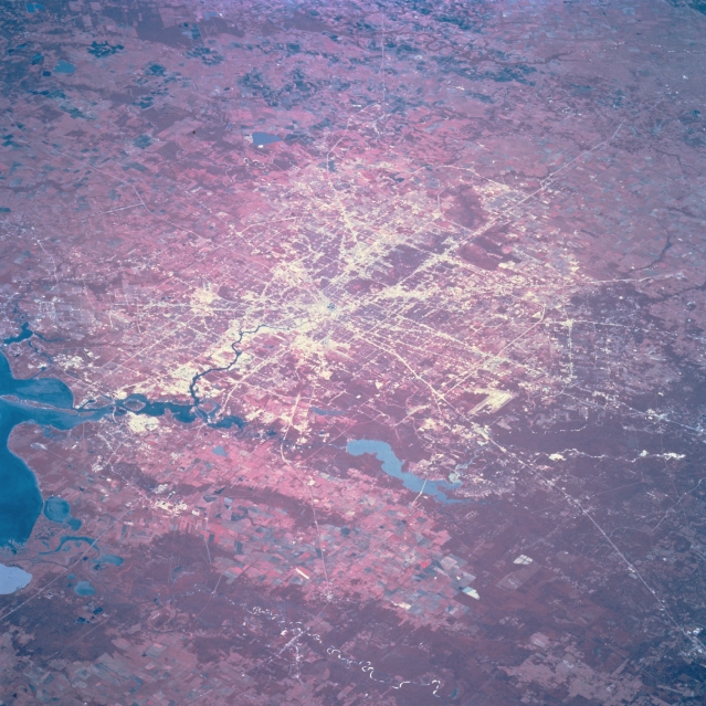
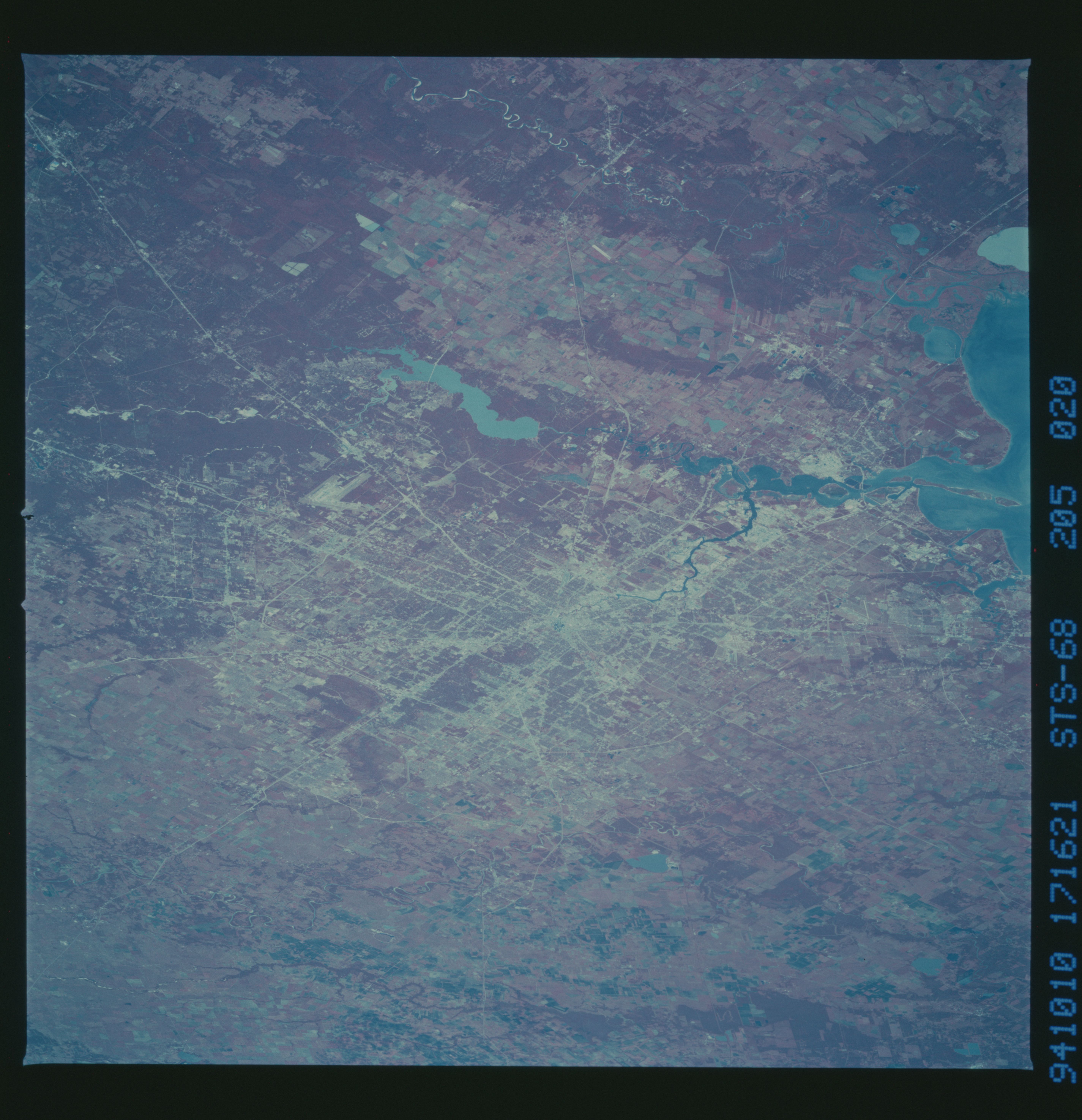
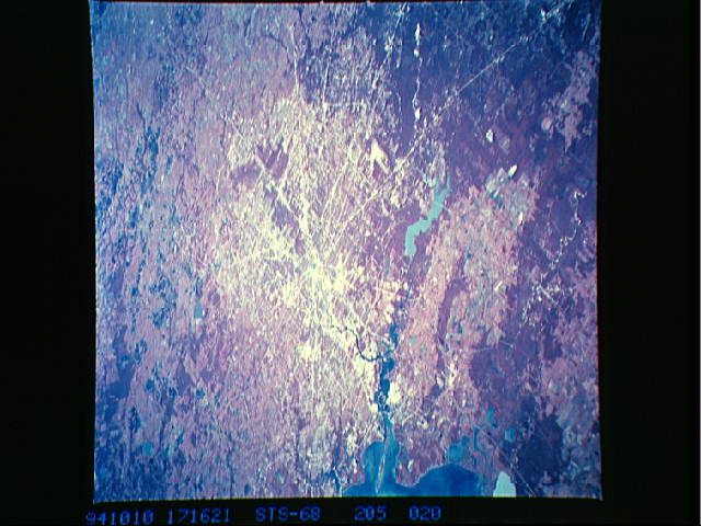
Image Caption: STS068-205-020 Houston, Texas, U.S.A. October 1994
Highways radiate outward from the central business district of Houston, which lies on the flat, coastal plain of southeast Texas. Dense woodlands, primarily north and east of the city, are shown as deep reds with color infrared film. Blue Lake Houston (actually muddy brown) is part of the San Jacinto River that eventually flows into the northwest corner of Galveston Bay. Visible east of the San Jacinto River and its floodplain are slightly elevated cultivated fields that separate the San Jacinto watershed from the much broader floodplain and delta of the Trinity River drainage basin (near the bottom left corner). Lighter areas show larger concentrations of commercial and industrial activities.
Highways radiate outward from the central business district of Houston, which lies on the flat, coastal plain of southeast Texas. Dense woodlands, primarily north and east of the city, are shown as deep reds with color infrared film. Blue Lake Houston (actually muddy brown) is part of the San Jacinto River that eventually flows into the northwest corner of Galveston Bay. Visible east of the San Jacinto River and its floodplain are slightly elevated cultivated fields that separate the San Jacinto watershed from the much broader floodplain and delta of the Trinity River drainage basin (near the bottom left corner). Lighter areas show larger concentrations of commercial and industrial activities.
